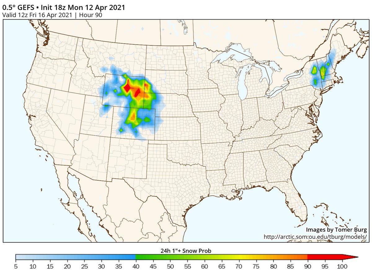
Confidence is increasing in a high elevation snow event in the Northeast this week, which isn& #39;t unusual but still noteworthy for mid-April.
What I& #39;m more intrigued by, however, is some deterministic & ensembles showing accumulating snow even down to the Hudson Valley... (thread)
What I& #39;m more intrigued by, however, is some deterministic & ensembles showing accumulating snow even down to the Hudson Valley... (thread)
First let& #39;s review the synoptic evolution - this event is driven by a vigorous cutoff ULL with strong DCVA inducing surface cyclogenesis as its associated circulation infringes on the coastal baroclinic zone. The cyclone quickly becomes occluded & stalls near SNE.
Zooming out a bit more, we see there& #39;s a decaying block over eastern Canada with above-normal heights across much of Canada. Accordingly, there& #39;s anomalously weak westerly flow across the northern US with a slow meandering cutoff low & just enough cold air aloft to support snow.
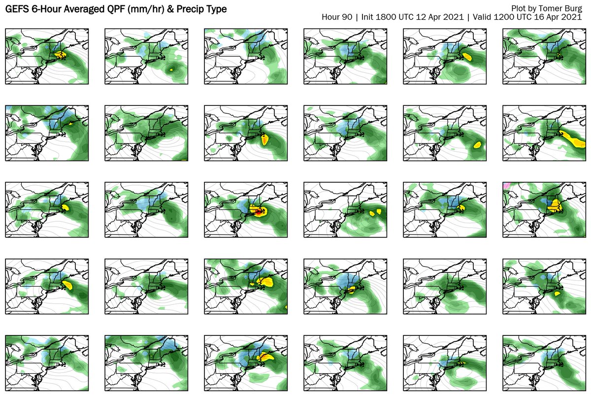
One might imagine predicting a slow-moving cutoff low & induced coastal cyclogenesis is a tough spot for models, and indeed we see a fairly large spread in GEFS ensemble solutions, for both intensity and placement of the surface low & accordingly precip intensity & type inland.
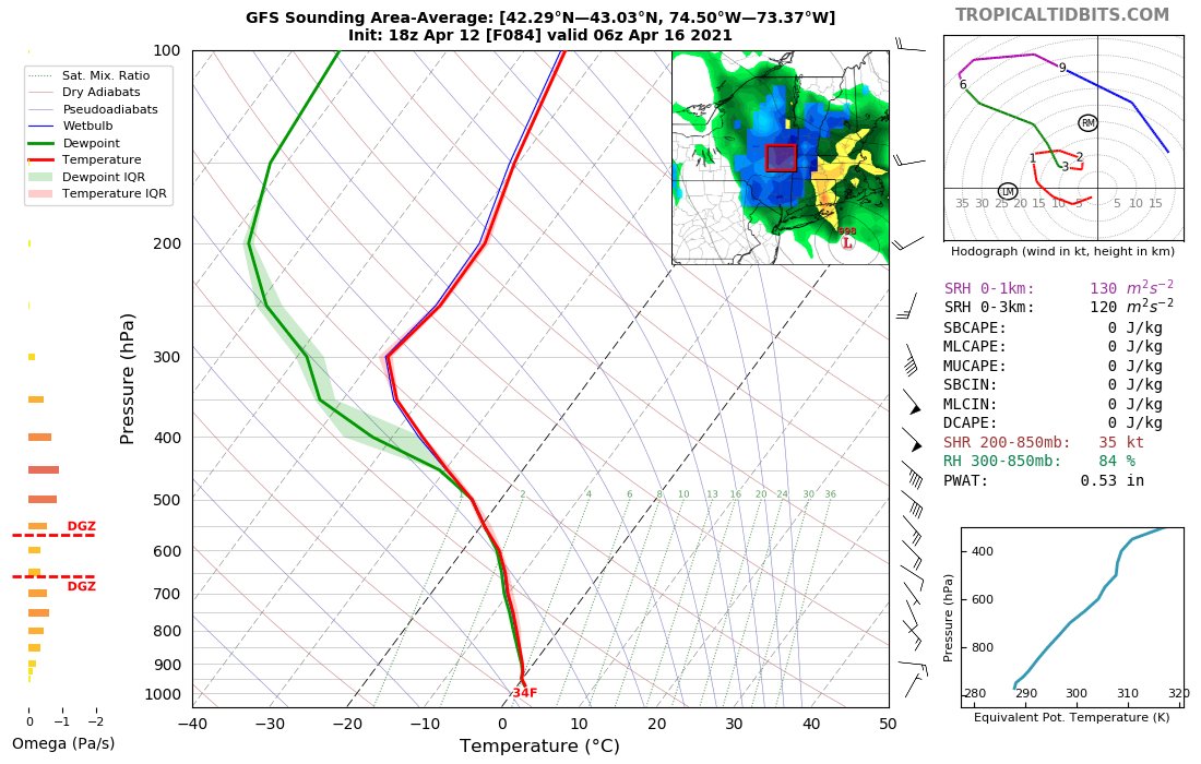
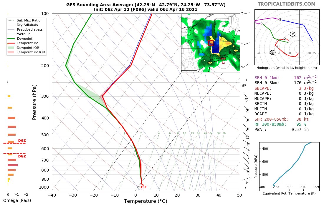
The operational GFS is fairly bullish in depicting a more intense low closer to the coast, and thus stronger forcing for ascent & stratiform precip inland. Its temp profile verbatim is marginally favorable for snow in the valley with adiabatic cooling associated w/ strong ascent.
At least per the GFS ptype algorithm, one can get the sense the ptype in the Hudson Valley is going to be very marginally close to snow - a very slightly drier/warmer solution is enough to differentiate between snow and rain.
Essentially, a lot has to go right for snow in the Hudson Valley. This includes:
- continued cooling trend w/ cold pool currently in N US
- strong synoptic+meso forcing in central NY for heavy precip rates & ascent
- synoptic evolution not differing too much from OP GFS
- continued cooling trend w/ cold pool currently in N US
- strong synoptic+meso forcing in central NY for heavy precip rates & ascent
- synoptic evolution not differing too much from OP GFS

 Read on Twitter


