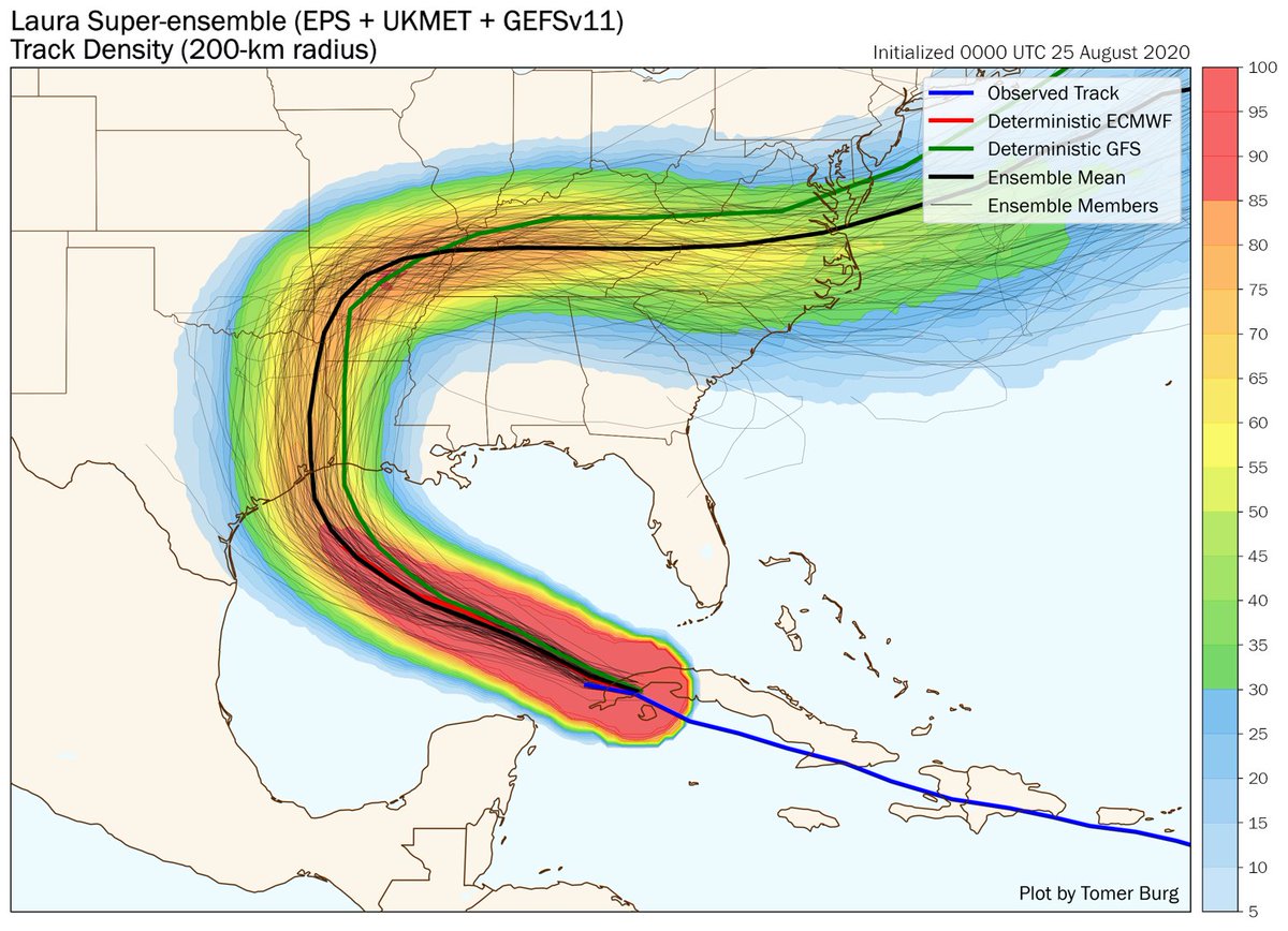
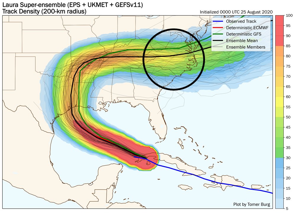
This graphic garnered quite a bit of discussion - since not everyone is overly familiar with ensembles, this thread will focus on interpreting this data and what it means for impacts from Laura.
For those that don& #39;t know what model ensembles are, I wrote a thread a couple days ago briefly highlighting what an ensemble is, and some limitations of using ensembles for forecasting: https://twitter.com/burgwx/status/1296529326741979136">https://twitter.com/burgwx/st...
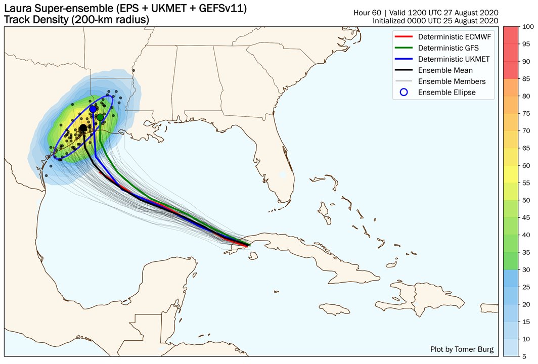
Back to Laura - combining the EPS, UKMET & GEFSv11 ensembles gives a multi-model 108 member ensemble. Looking at early Thurs AM, or around when Laura makes landfall, most members show a landfall just east of Houston, but with a range from Corpus Christi, TX to Baton Rouge, LA.
These dots show where each ensemble member is forecasting Laura to be, but this doesn& #39;t account for Laura& #39;s size.
This is an imperfect assumption, but applying NHC& #39;s forecast of a 35 mile radius of hurricane force wind, this is what probability of hurricane impact looks like:
This is an imperfect assumption, but applying NHC& #39;s forecast of a 35 mile radius of hurricane force wind, this is what probability of hurricane impact looks like:
Hurricane force winds are confined close to a hurricane& #39;s center, but heavy rain can extend farther out.
Hurricane Harvey, having struck TX 3 years ago today, had a narrow axis of strong wind, but the heaviest rain was far from the center, near Houston. https://twitter.com/burgwx/status/1296989930837757952">https://twitter.com/burgwx/st...
Hurricane Harvey, having struck TX 3 years ago today, had a narrow axis of strong wind, but the heaviest rain was far from the center, near Houston. https://twitter.com/burgwx/status/1296989930837757952">https://twitter.com/burgwx/st...
A large concern with hurricanes is storm surge. This can extend well beyond the center - NWS is currently forecasting a storm surge as large as 9-13 feet, with impacts extending far to the east of the landfall location. https://twitter.com/NWS/status/1298280241010548737">https://twitter.com/NWS/statu...
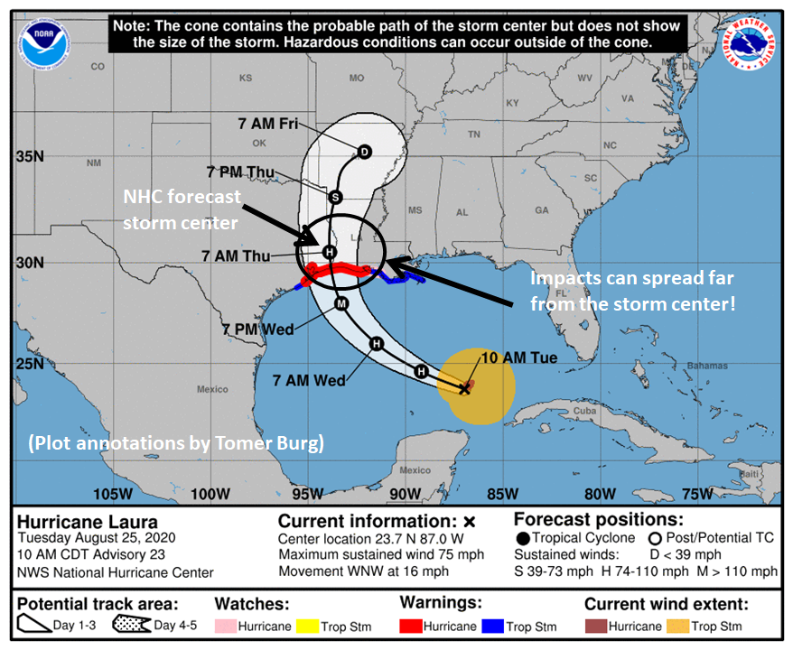
The takeaway point with this? Don& #39;t focus too much on that specific "H" dot on the official forecast graphics, or an exact line in an ensemble plot.
Besides that the exact landfall location is still subject to change, impacts will spread far from the center.
Besides that the exact landfall location is still subject to change, impacts will spread far from the center.

 Read on Twitter


