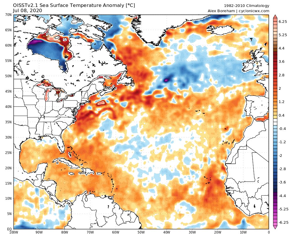
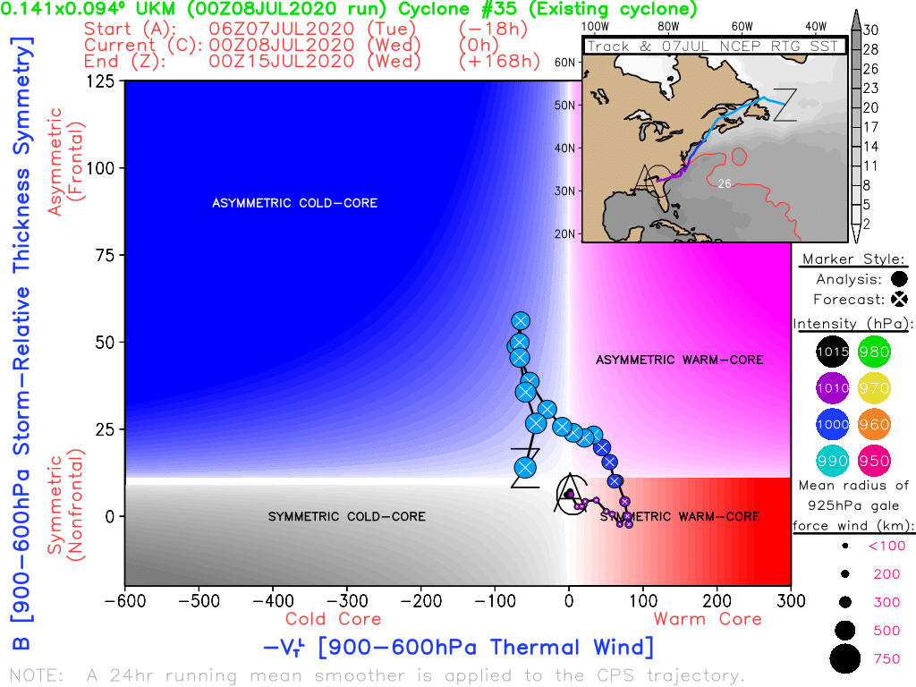
Some observations for 98L& #39;s tropical prospects - as many have noted, SSTs are anomalously warm along the Mid Atlantic coast, and given ongoing convection off the SC coast, it& #39;s possible a new circulation may develop farther offshore, keeping 98L& #39;s eventual track over water.
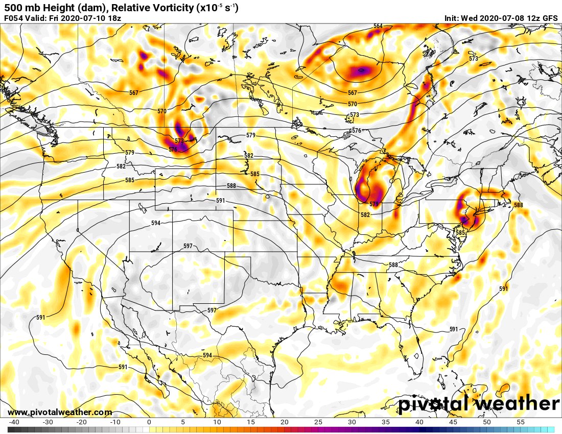
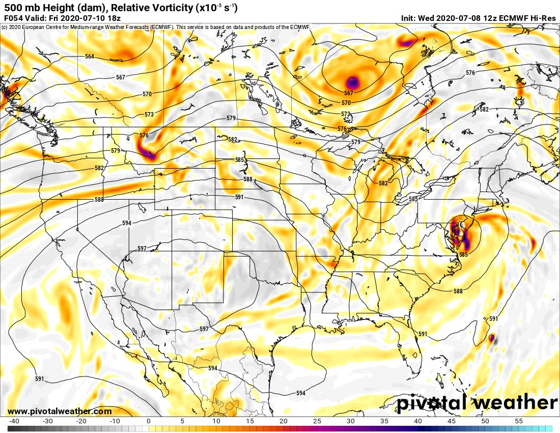
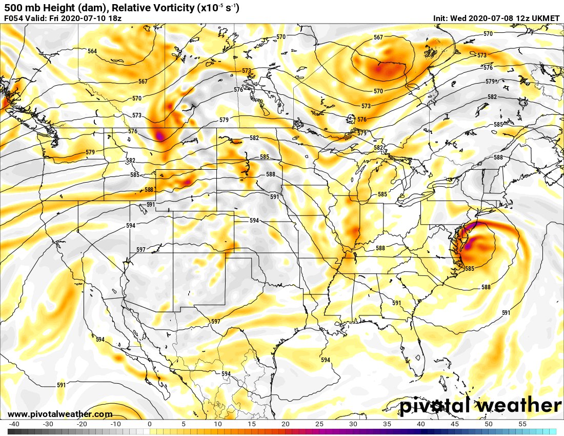
Another factor influencing 98L& #39;s track is its short term evolution (GFS faster vs. ECM & UKM slower), and amplitude of upstream trough (GFS deeper, latter weaker). GFS scenario has quick N track inland, latter leads to slow & farther east track over water increasing % of TC/STC.

 Read on Twitter