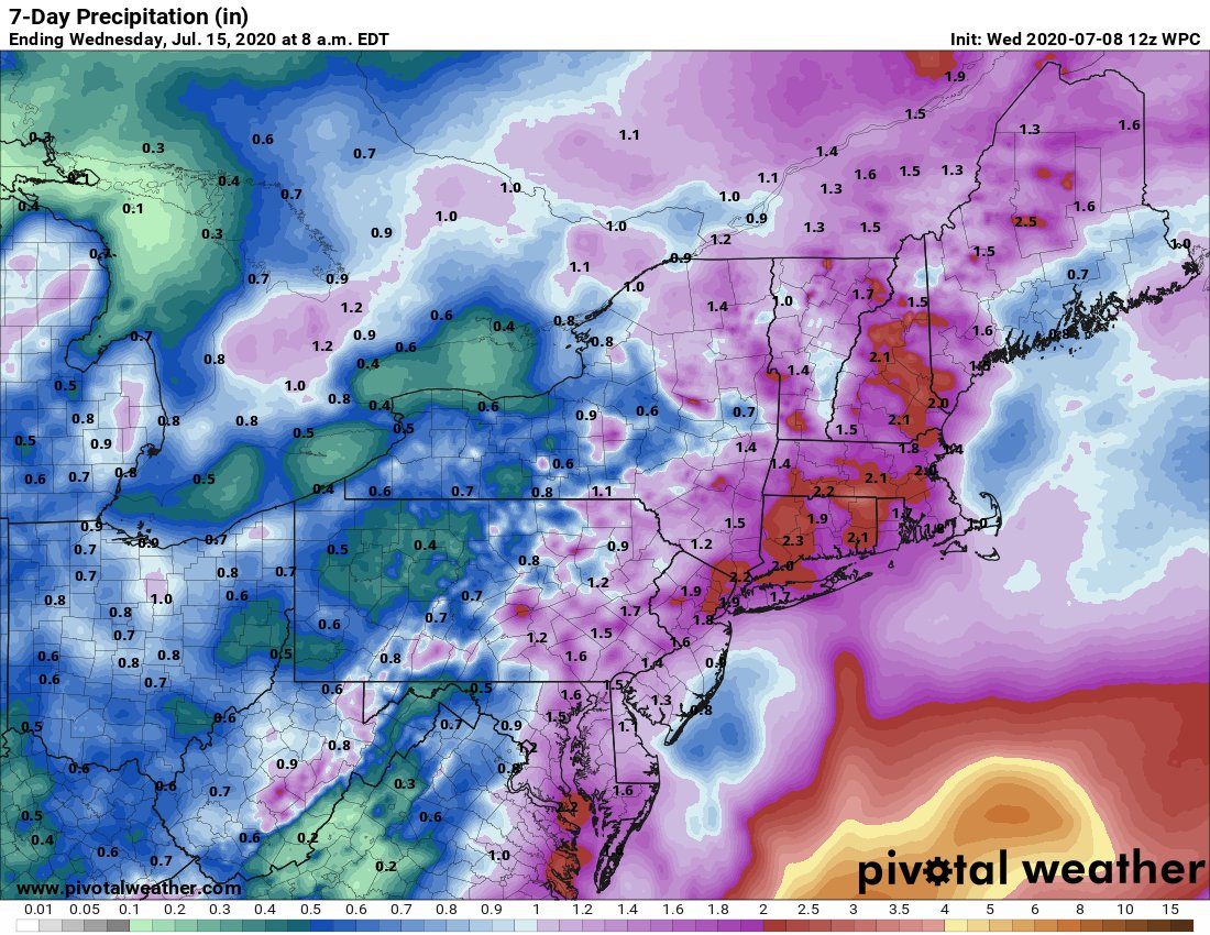
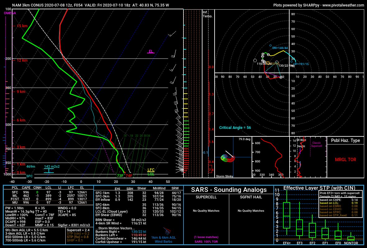
Concerned about significant mesoscale flash flooding & wind damage on Friday w/ Invest #98L. I& #39;m primarily concerned about 2 areas, depending on 98L& #39;s tropical evolution:
1. Near/east of I-95 through Mid Atlantic
2. Long Island/coastal SNE
1. Near/east of I-95 through Mid Atlantic
2. Long Island/coastal SNE
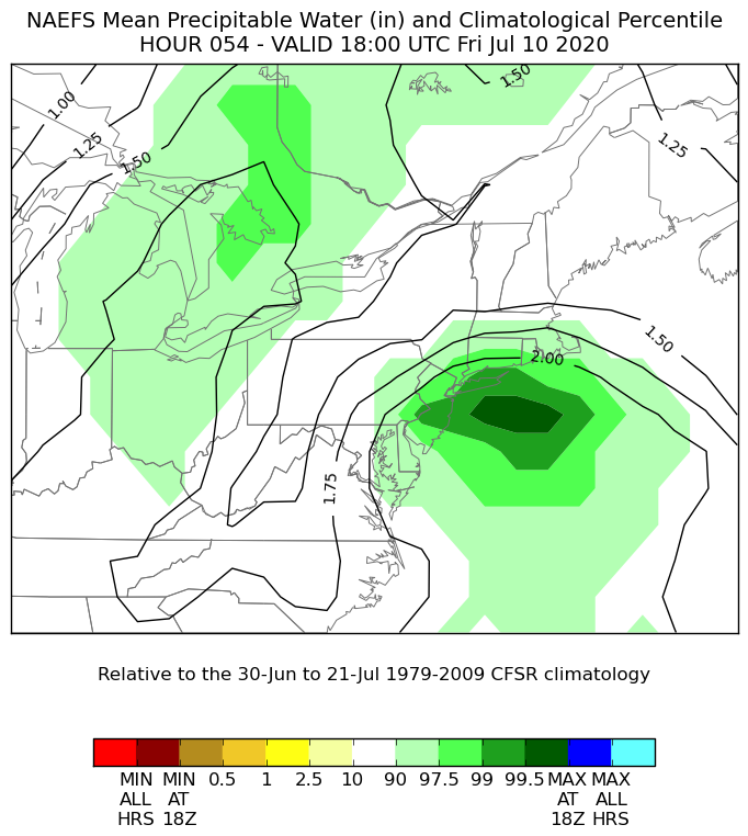
1. High PWATs are expected near the 99th percentile along the Mid Atlantic coast into southern New England. Depending on the track & intensity of 98L, organized rainbands on its west side associated w/ mid-level frontogenesis may favor an axis of >2-4" of rain.
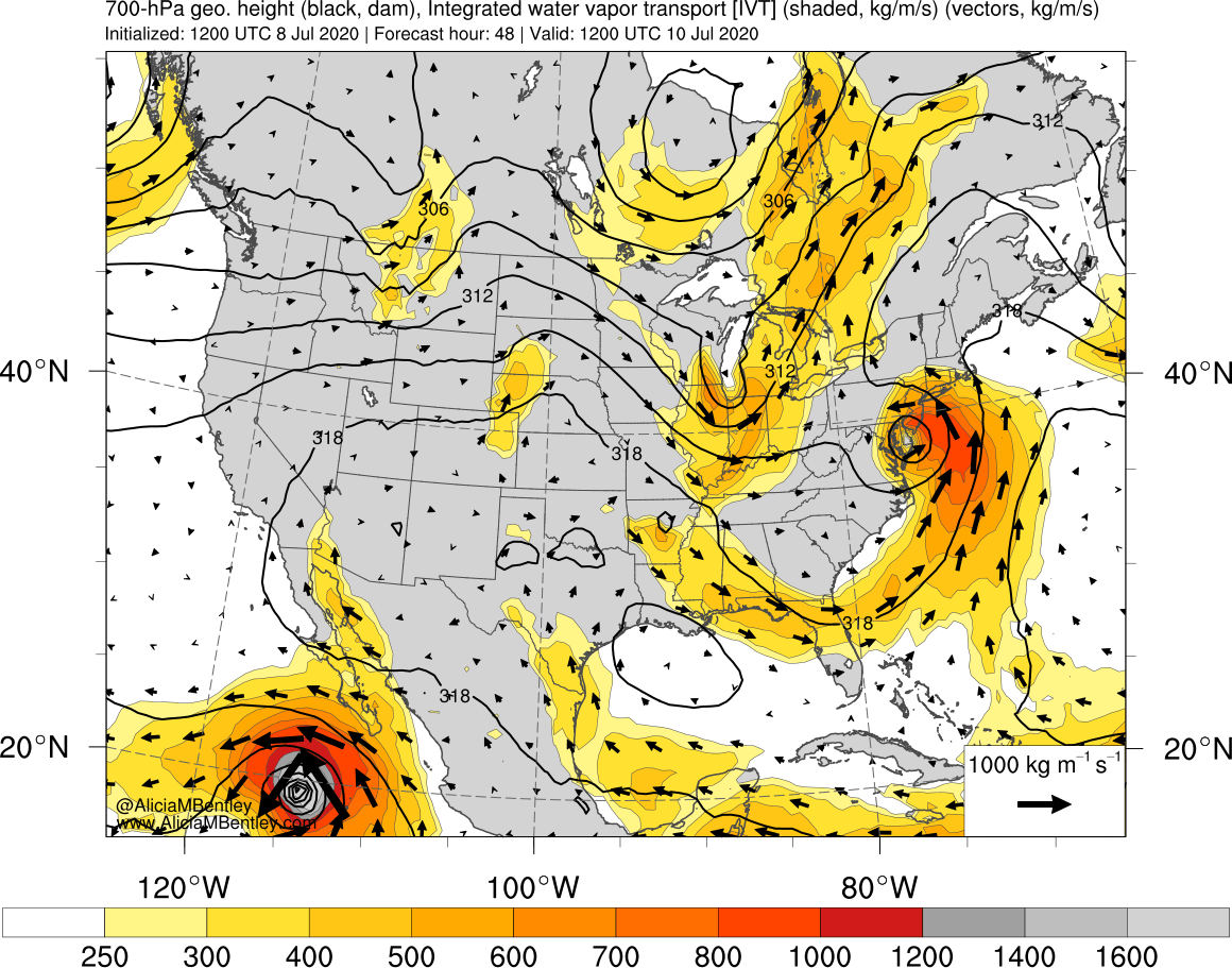
2. Strong LLJ will transport an anomalously moist airmass to NJ/SNE. Strong synoptic IVT convergence & coastal fgen via frictional convergence may support heavy rain bands. Low predictability & high impact scenario if rainbands train -> potential for >3-4" rain locally.
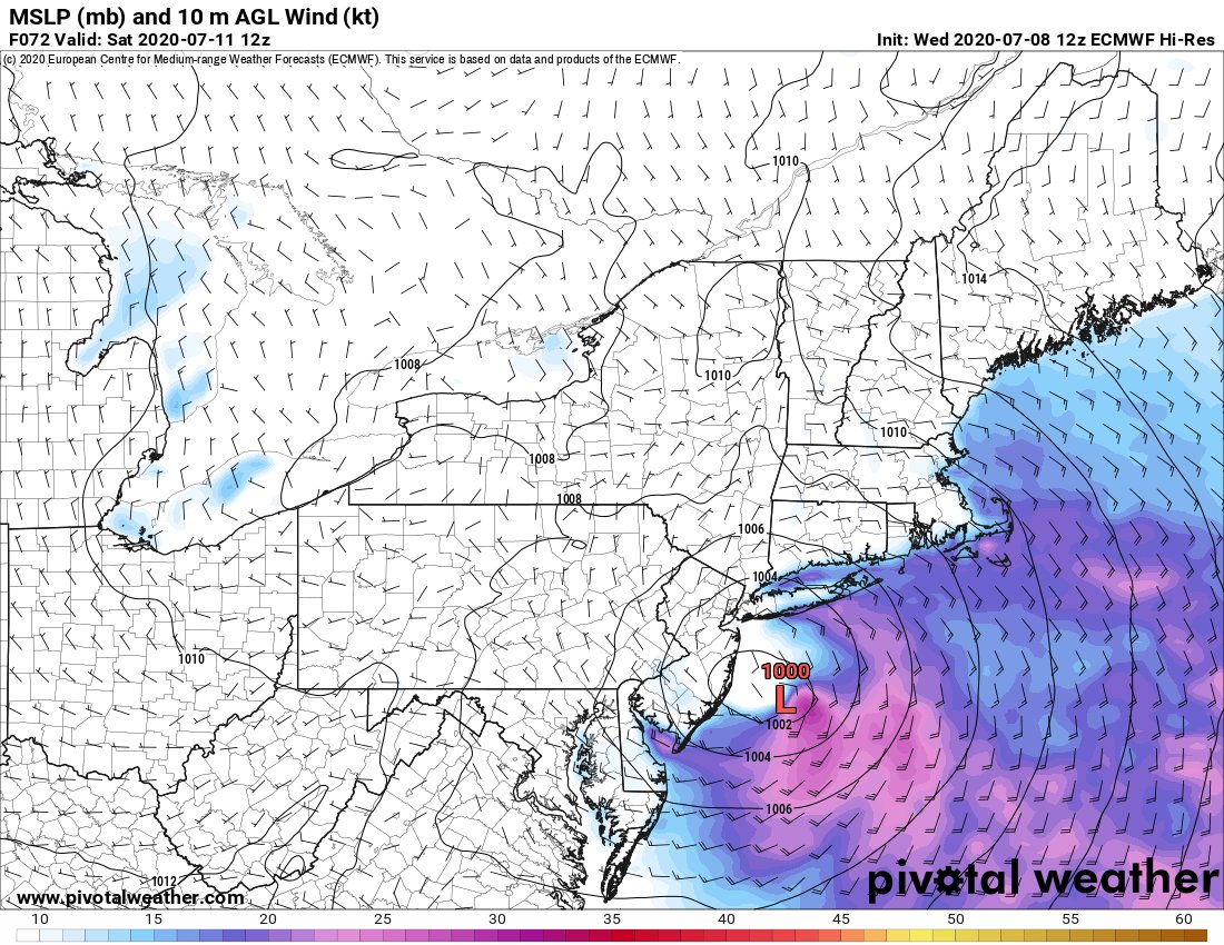
With a >=40kt LLJ near the New England coast, strong wind gusts could mix down to the surface with convective cells east of 98L& #39;s center on Friday. Wouldn& #39;t completely rule out an isolated tornado or two with a curved low-level hodograph.
Caution on this last tweet - I used the 3km NAM for the environmental parameters on the outer rainbands, but would urge caution with using the 3km NAM for this. It has a known bias to significantly exaggerate TC development and intensification, and is a strong & west outlier.

 Read on Twitter