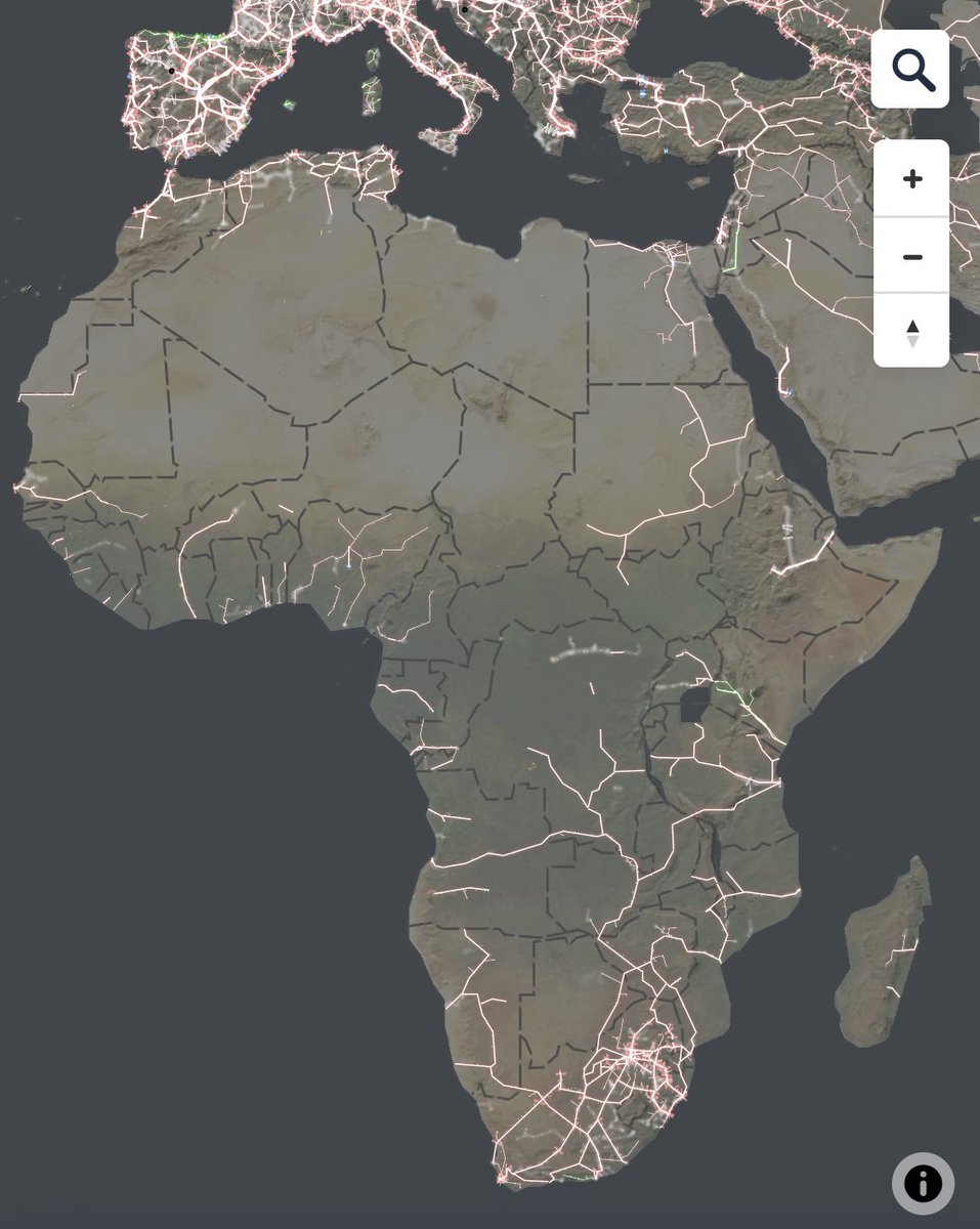
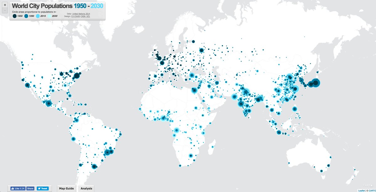
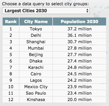
I think about maps a lot, and I& #39;m underwhelmed and unimpressed by a lot of them. Here& #39;s one I quite like – world city populations, by luminocity3d. It& #39;s always interesting to me to pay attention to the white areas – western China, the Sahara, etc.
(Also – upcoming cities)
(Also – upcoming cities)
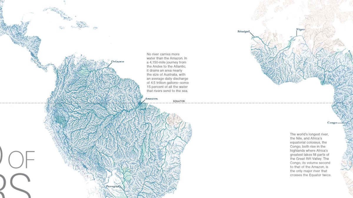
I& #39;d be curious to overlay this map of cities with the worldmap of rivers:
https://twitter.com/terriblemaps/status/994336826218467330?s=21">https://twitter.com/terriblem...
https://twitter.com/biologypartners/status/995315526883721216?s=21">https://twitter.com/biologypa...
https://twitter.com/simongerman600/status/996142615841124352">https://twitter.com/simongerm...
https://twitter.com/visakanv/status/988020573878927360">https://twitter.com/visakanv/...
https://twitter.com/visakanv/status/921441279510114304">https://twitter.com/visakanv/...
our world in 250,000,000 years – if our descendants are still around, geopolitics will be very different https://twitter.com/simongerman600/status/1004020023357304832">https://twitter.com/simongerm...
https://twitter.com/terriblemaps/status/1009198177810075649?s=21">https://twitter.com/terriblem...
https://twitter.com/visakanv/status/996272715232198657?s=21">https://twitter.com/visakanv/...
https://twitter.com/sasha_trub/status/1000891076931215360?s=21">https://twitter.com/sasha_tru...
Topography https://twitter.com/devonzuegel/status/1012159191081934848?s=21">https://twitter.com/devonzueg...
https://twitter.com/simongerman600/status/1012352437259300864?s=21">https://twitter.com/simongerm...
Kinda spooky (h/t @seculartaoist) https://twitter.com/geoviews/status/1015219086622588928?s=21">https://twitter.com/geoviews/...
Geography, politics, religion and school lunches https://twitter.com/misraudit/status/1015863613070958592?s=21">https://twitter.com/misraudit...
Thx @a_xenop for sharing https://twitter.com/factsbalkan/status/845692675068248066?s=21">https://twitter.com/factsbalk...
https://twitter.com/devonzuegel/status/1017182086778613760?s=21">https://twitter.com/devonzueg...
Parking in NYC https://twitter.com/devonzuegel/status/1019352015913213952?s=21">https://twitter.com/devonzueg...
I’d love a Google Maps plugin or mode that allows you to toggle 90s CGI https://twitter.com/ageofnapoleon/status/1020466546974646273?s=21">https://twitter.com/ageofnapo...
cool thread about the history of New York https://twitter.com/chazhutton/status/1020295040864833536">https://twitter.com/chazhutto...
Land use https://twitter.com/juliagalef/status/1024918230433845249?s=21">https://twitter.com/juliagale...
the sweet potato odyssey https://twitter.com/Botanygeek/status/1025073011437838338">https://twitter.com/Botanygee...
UK musical artists https://twitter.com/brilliantmaps/status/1027158303212752896?s=21">https://twitter.com/brilliant...
Various past empires in Asia https://twitter.com/visakanv/status/1026383605239406593?s=21">https://twitter.com/visakanv/...
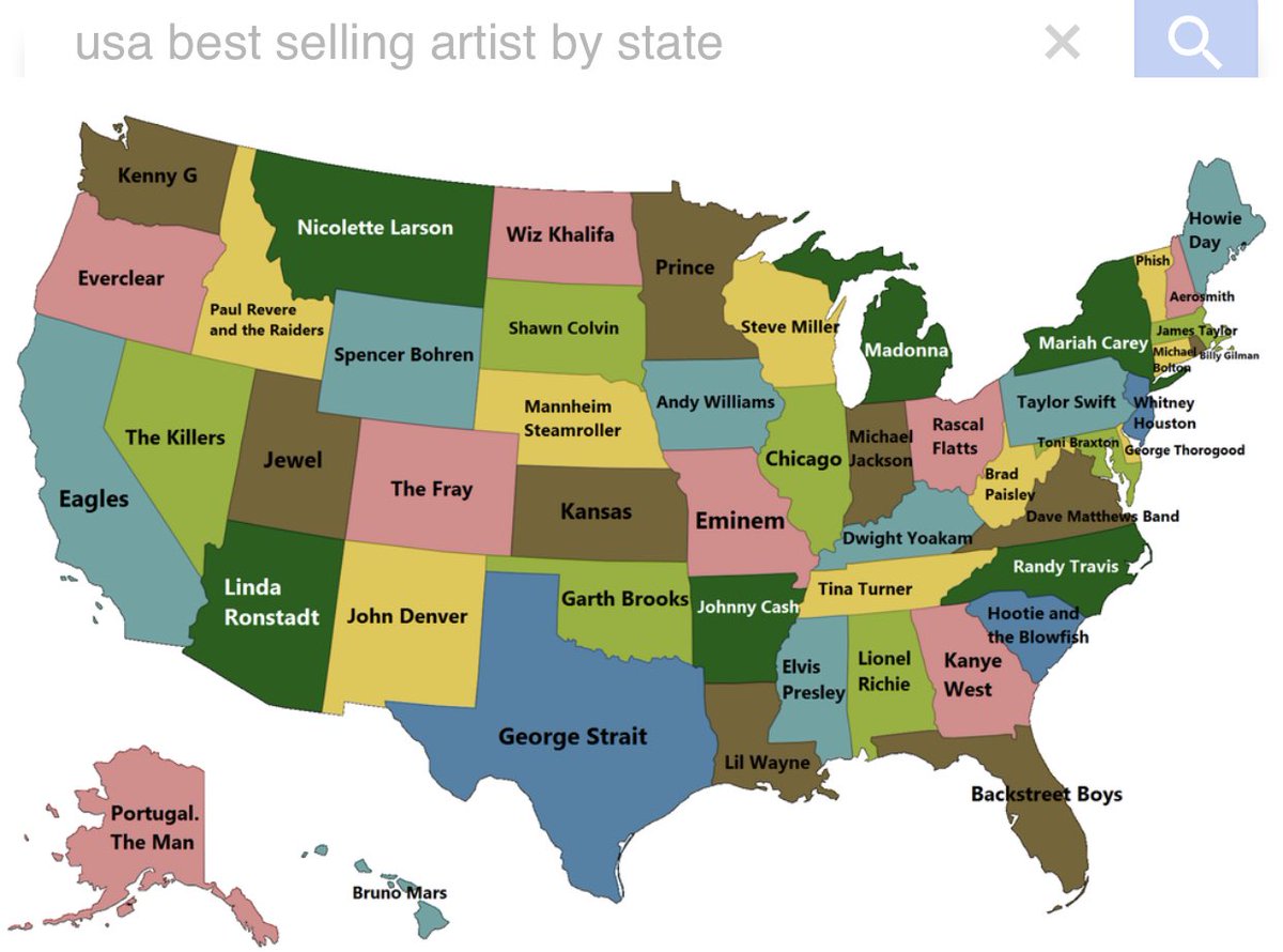
Supposed US equivalent of best selling artists by state of birth. Feels a bit confusing because people don’t buy records these days the way they used to... I don’t recognise some of these artists. Linda? Nicolette? Spencer? Dwight? Brad? Mannheim?
sobering https://twitter.com/simongerman600/status/1029104063135330304">https://twitter.com/simongerm...
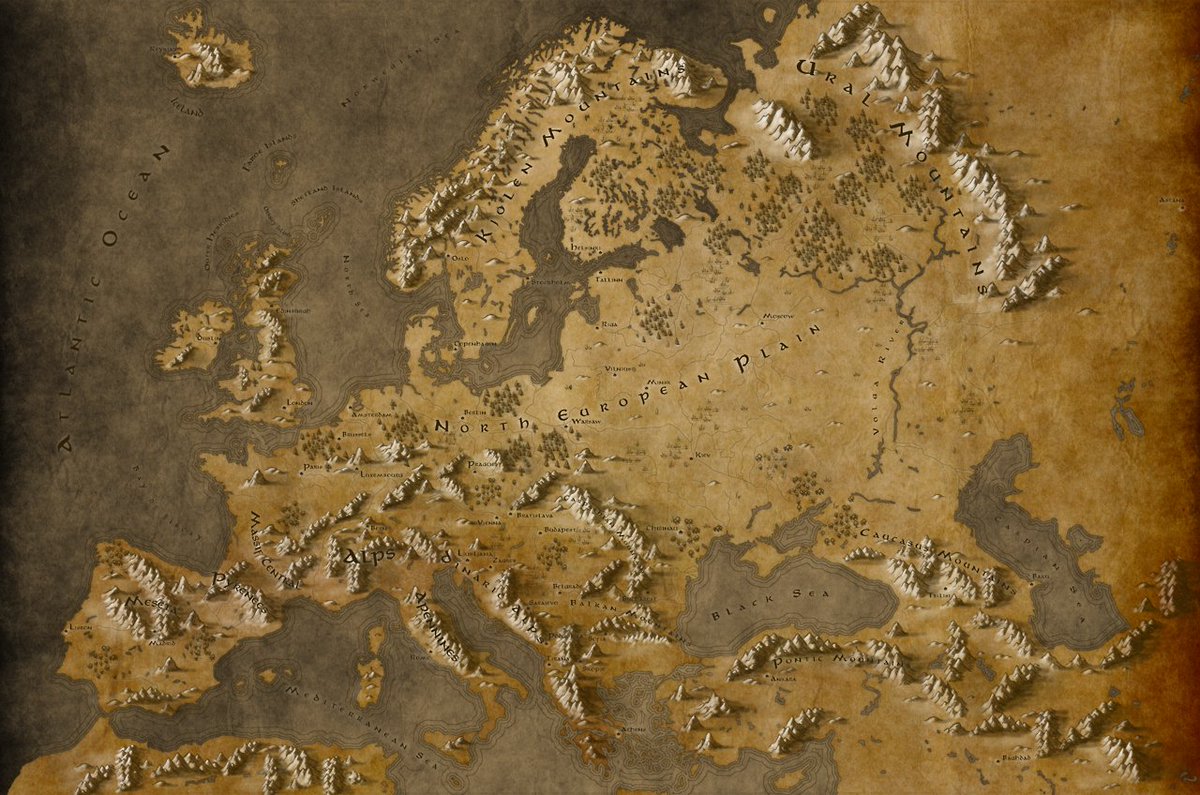
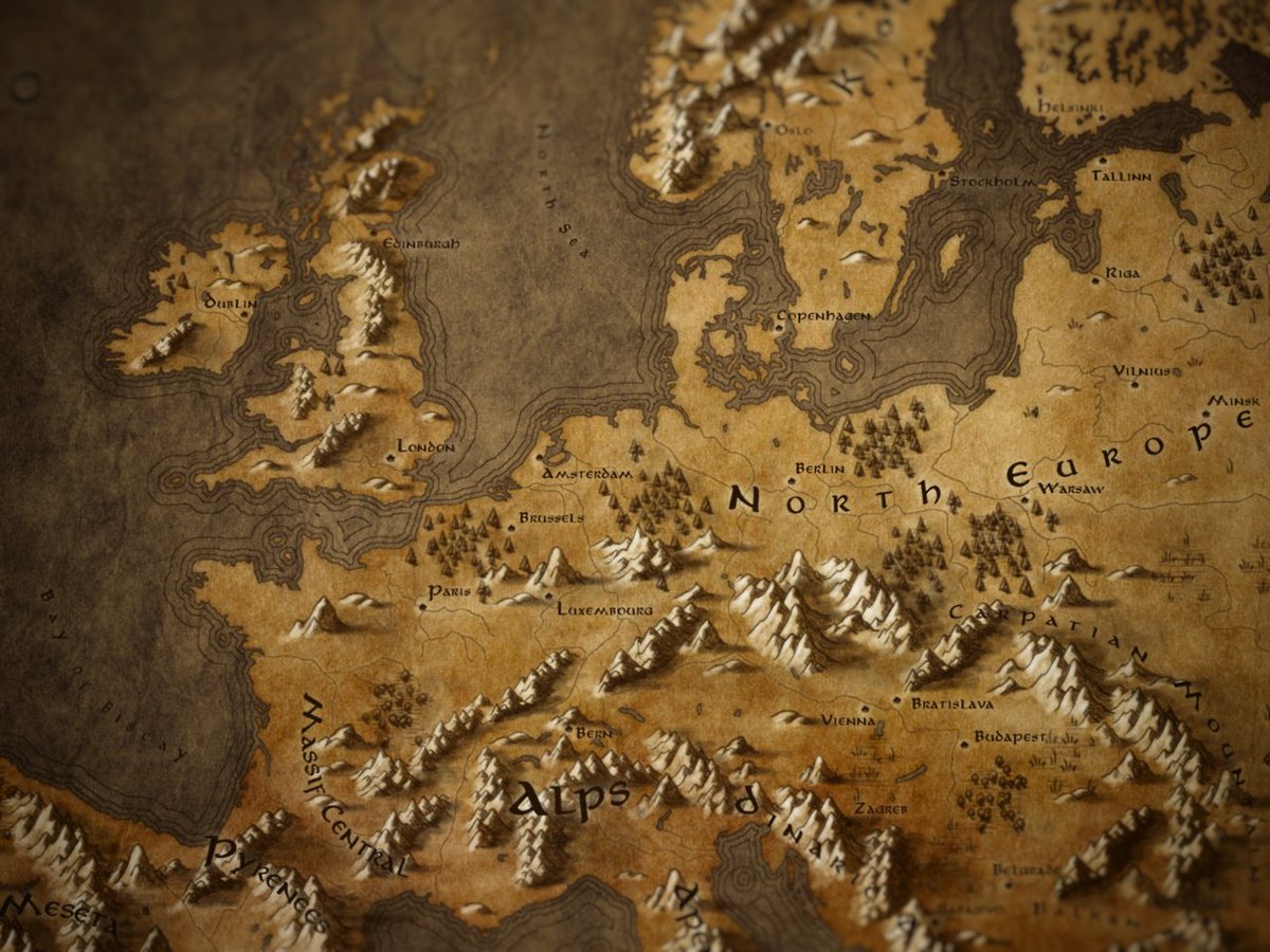
Tolkien-style maps of Europe, by Callum Ogden https://old.reddit.com/r/europe/comments/6rb6dd/fantasy_europe_in_a_tolkien_sort_of_style/">https://old.reddit.com/r/europe/...
https://twitter.com/seshatdatabank/status/1030718709592141824?s=21">https://twitter.com/seshatdat...
https://twitter.com/simongerman600/status/992026048404606978?s=21">https://twitter.com/simongerm...
Interactive voronoi globe of the world’s airports https://twitter.com/yutakashino/status/1034583760845643776?s=21">https://twitter.com/yutakashi...
If Germany had been broken up according to the Roosevelt plan https://twitter.com/simongerman600/status/1038873457252098050?s=21">https://twitter.com/simongerm...
If Europe had to be depicted with Tetris blocks https://twitter.com/whyvert/status/1039354779082866689">https://twitter.com/whyvert/s...
35. https://twitter.com/simongerman600/status/1040190108782215170?s=21">https://twitter.com/simongerm...
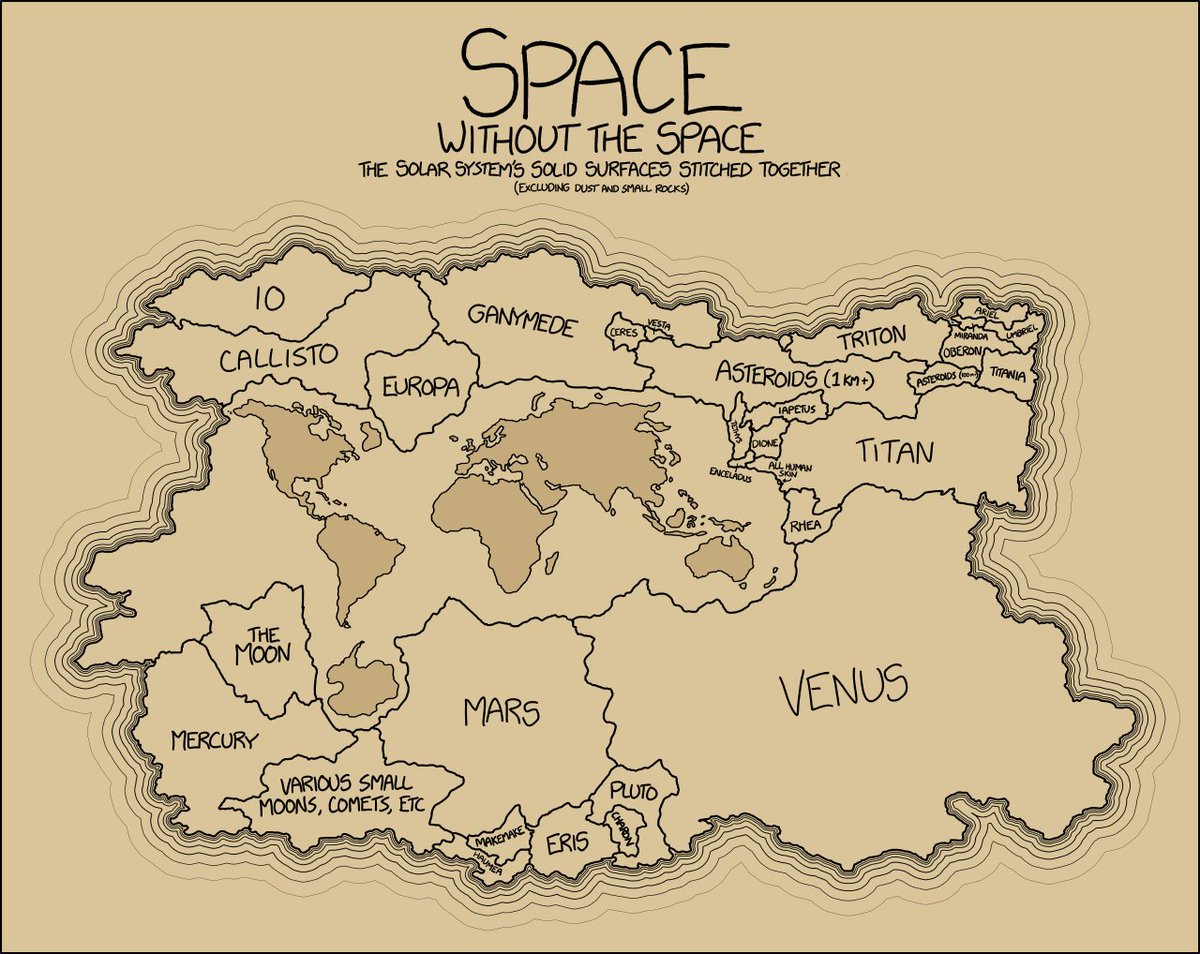
36. the solar system& #39;s solid surfaces stitched together, excluding dust and small rocks (but including "all human skin") http://xkcd.com/1389/ ">https://xkcd.com/1389/&quo...
37. oceans https://twitter.com/simongerman600/status/1040984848947666950?s=21">https://twitter.com/simongerm...
38. planetary urban modelling https://twitter.com/sevamoo/status/1046147812252143617">https://twitter.com/sevamoo/s...
40. Byzantine Empire in 1265 https://twitter.com/romebyzantium/status/1047209623281913857">https://twitter.com/romebyzan...
41. very stylish https://twitter.com/simongerman600/status/988799758780325889">https://twitter.com/simongerm...
42. https://twitter.com/ohoncharuk/status/1048991792098684928?s=21">https://twitter.com/ohoncharu...
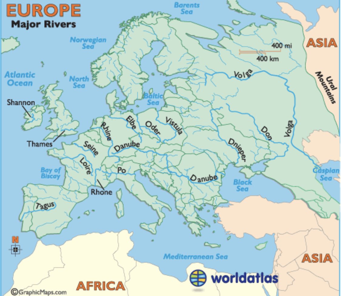
43. Rivers https://twitter.com/simongerman600/status/1003260034292346880?s=21">https://twitter.com/simongerm...
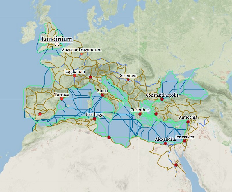
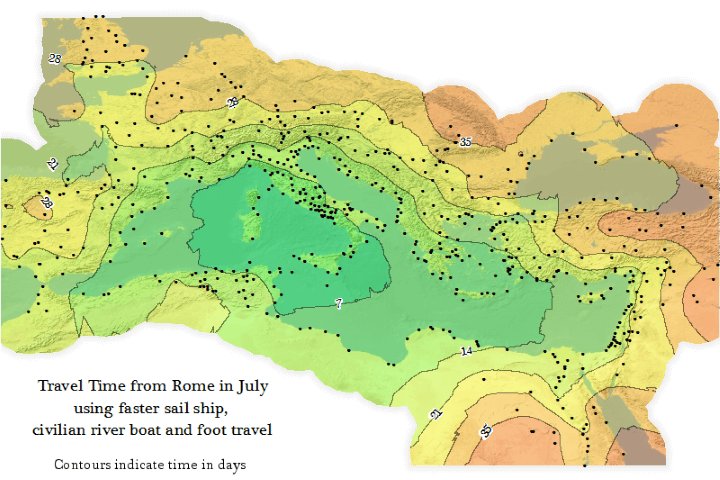
46. Oh this is fascinating! A team at Stanford made a "geospatial network model of the Roman world" – you can play around and check out the travel times! and really cool just to see the old names in a modern interface h/t @simongerman600 for sharing http://orbis.stanford.edu/ ">https://orbis.stanford.edu/">...
47. World population, visualized! This is beautiful and illuminating https://twitter.com/puddingviz/status/1055505311585497090">https://twitter.com/puddingvi...
48. travel time in the 1880s https://twitter.com/devonzuegel/status/1056544476494209025">https://twitter.com/devonzueg...
49. gulls https://twitter.com/brookejarvis/status/1028814989681807360?s=21">https://twitter.com/brookejar...
50. My favourite thing about this map is that you can’t see the national boundaries. I would further remove the nation’s names and maybe put cities down instead https://twitter.com/openculture/status/1069169553186410496?s=21">https://twitter.com/opencultu...
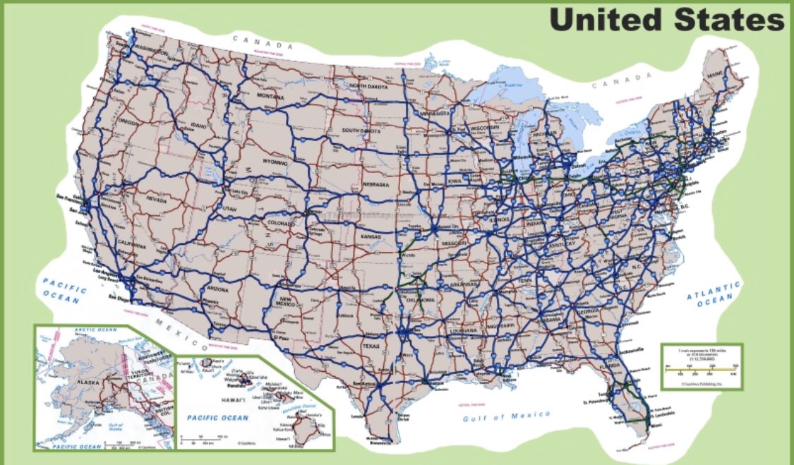
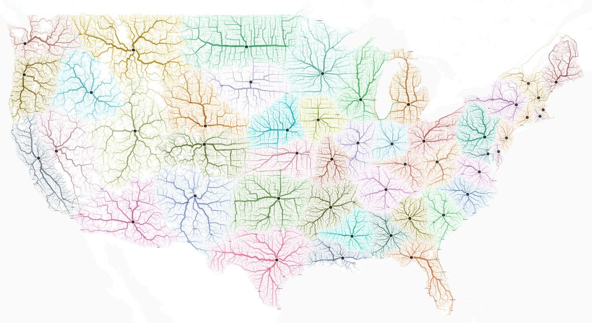
51. the roads leading to each US state& #39;s capital
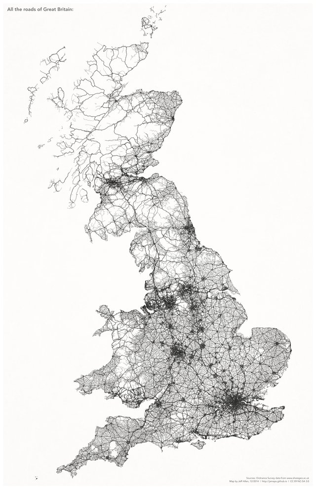
52. Roads in Great Britain, by /u/jamaps (discovered via @simongerman600)
somebody please make this for an entire continent, *without* national boundaries!
https://www.reddit.com/r/dataisbeautiful/comments/8mylc9/only_the_roads_of_great_britain_oc/">https://www.reddit.com/r/dataisb...
somebody please make this for an entire continent, *without* national boundaries!
https://www.reddit.com/r/dataisbeautiful/comments/8mylc9/only_the_roads_of_great_britain_oc/">https://www.reddit.com/r/dataisb...
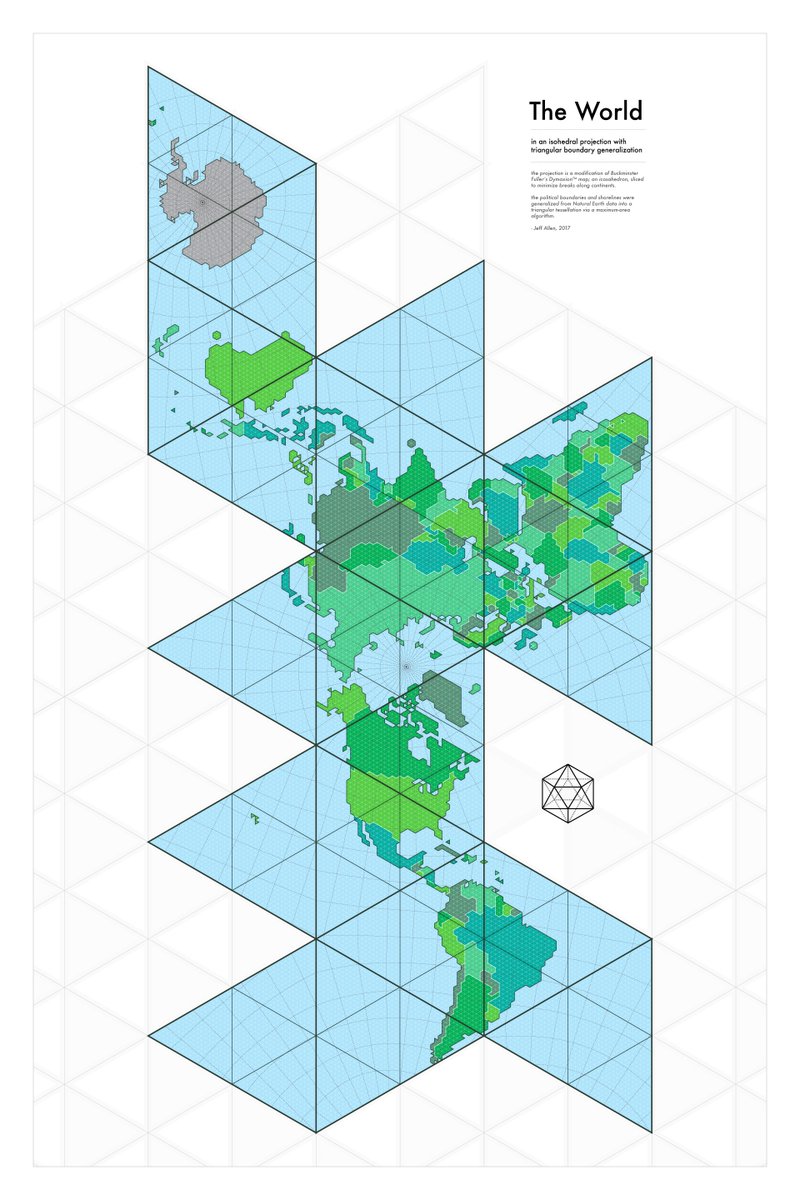
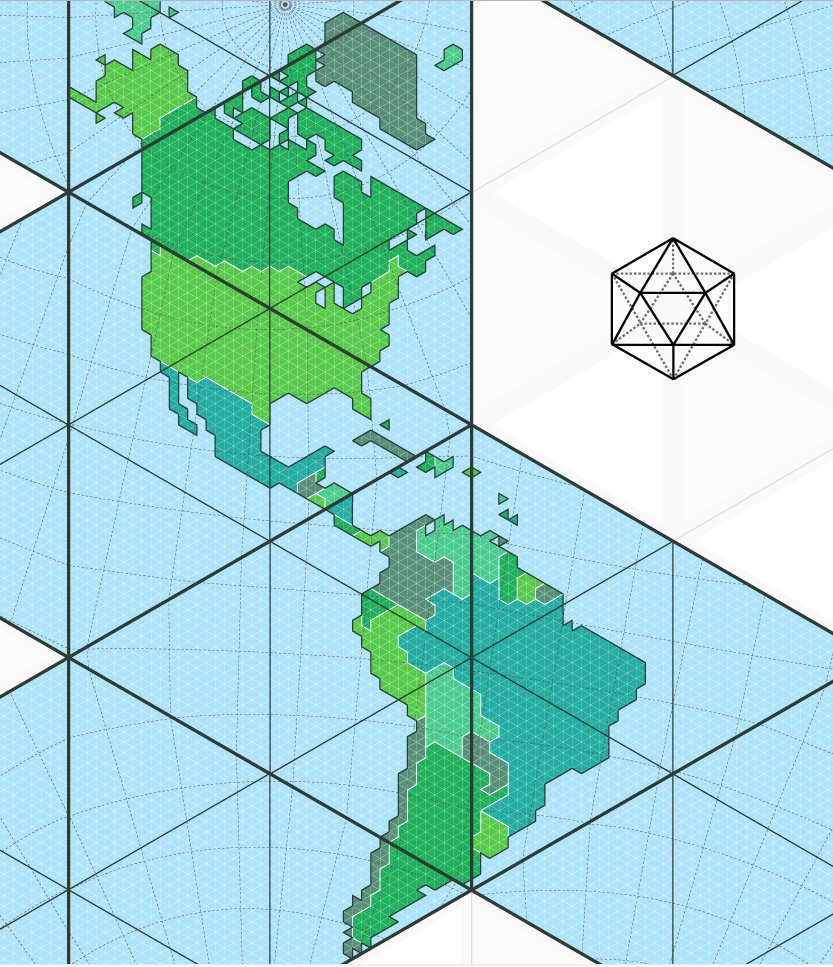
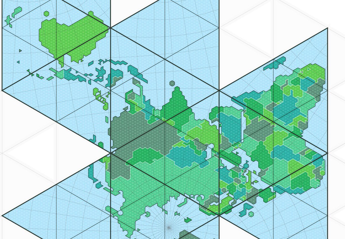
53. also by /u/jamaps – "the world in an isohedral projection with triangular boundary generalization" – a modification of Buckminister Fuller& #39;s Dymaxion map http://jamaps.github.io/maps.html ">https://jamaps.github.io/maps.html...
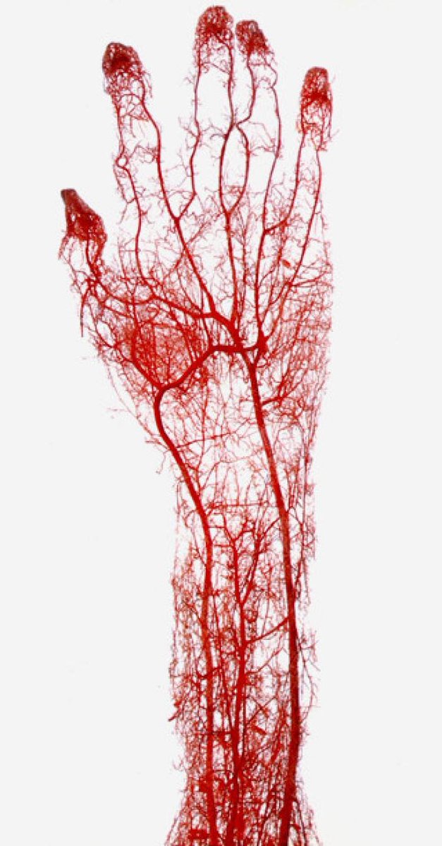
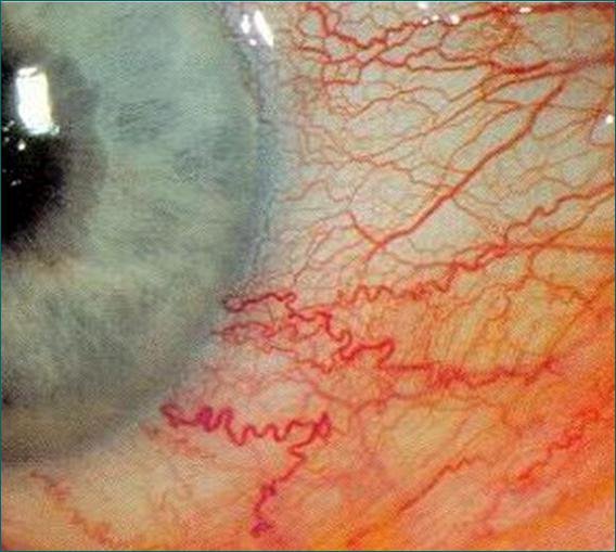
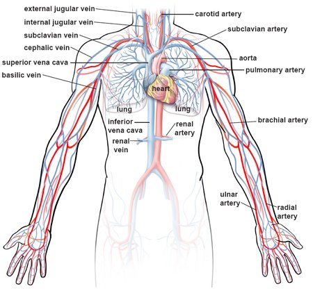
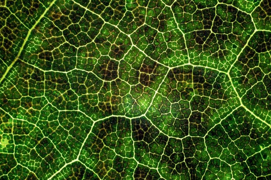
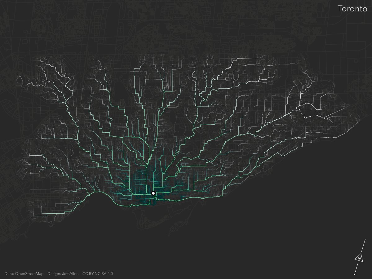
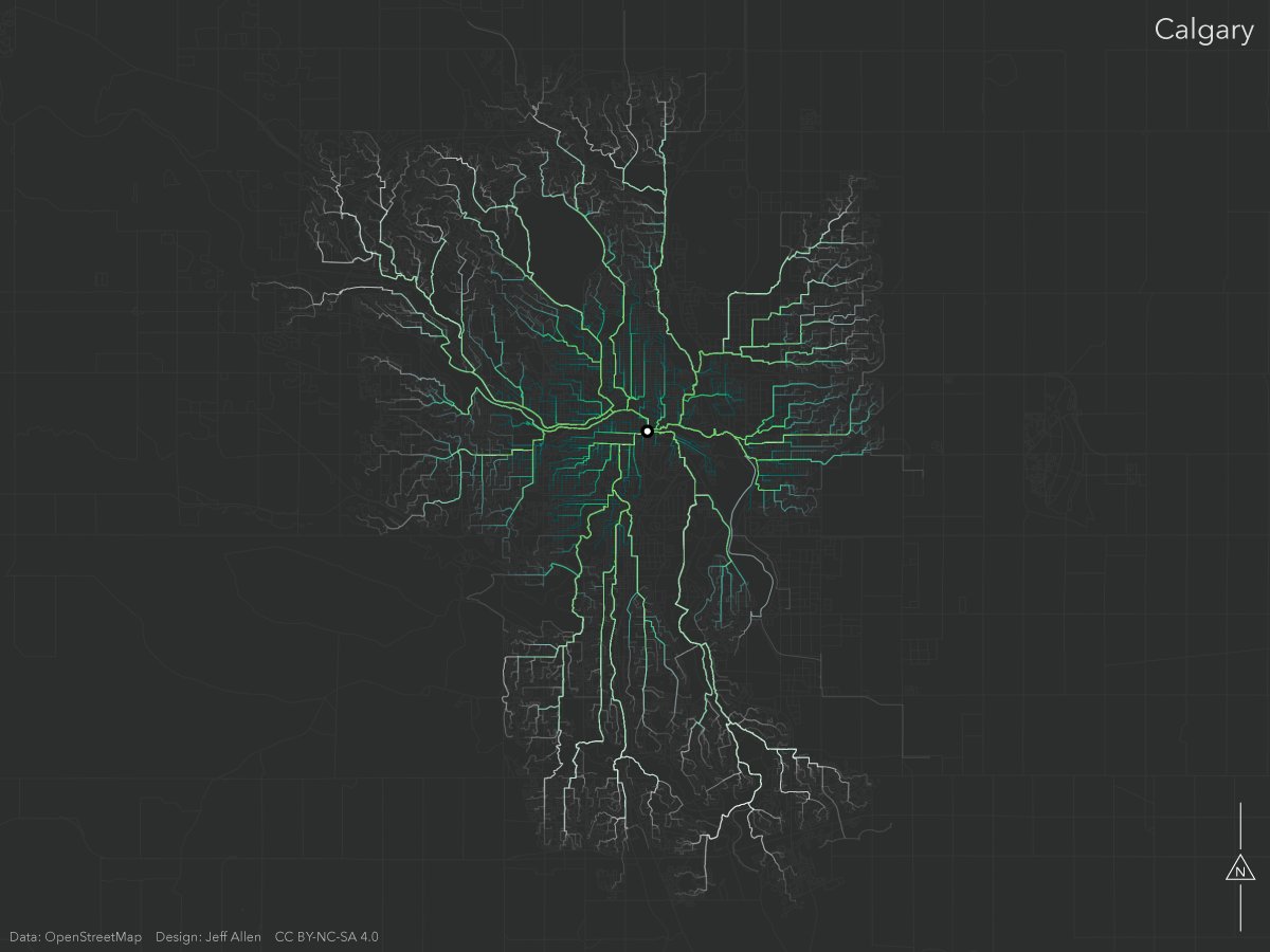
54. more from /u/jamaps – he calls these "fractal commuting trees" – I believe the color intensity represents how much people travel on these routes? You really see how human movement through terrain forms a sort of pulsing tree structure, like lightning, neurons, capillaries
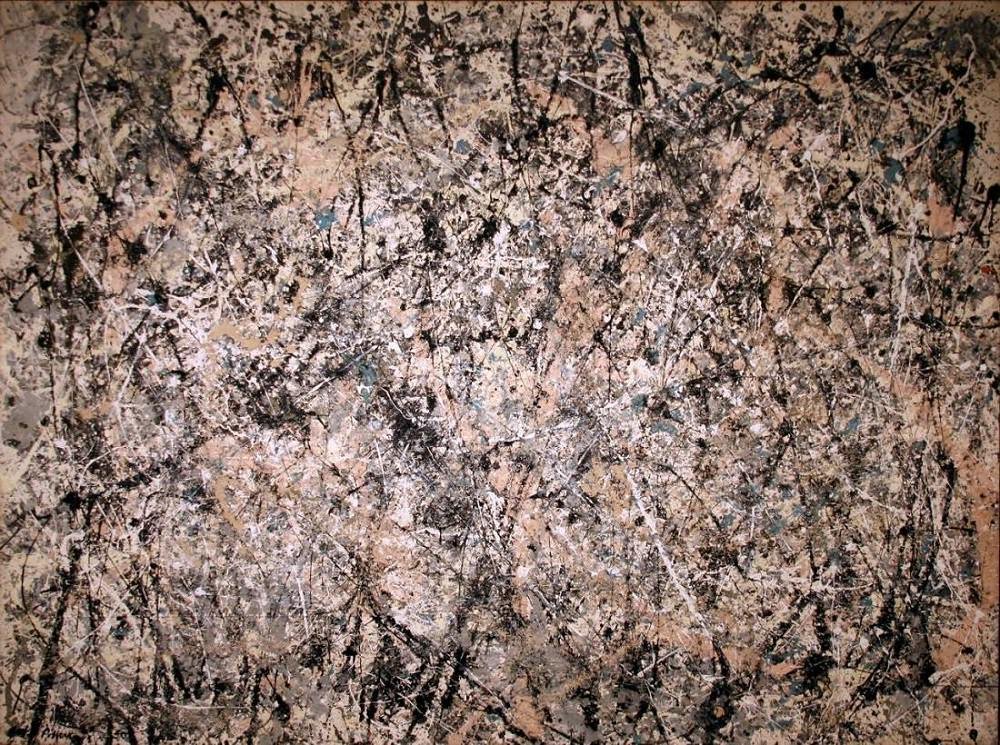
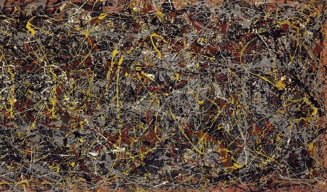
55. Jackson Pollock paintings. These are maps to me  https://abs.twimg.com/emoji/v2/... draggable="false" alt="😂" title="Gesicht mit Freudentränen" aria-label="Emoji: Gesicht mit Freudentränen"> https://www.jackson-pollock.org/jackson-pollock-paintings.jsp">https://www.jackson-pollock.org/jackson-p...
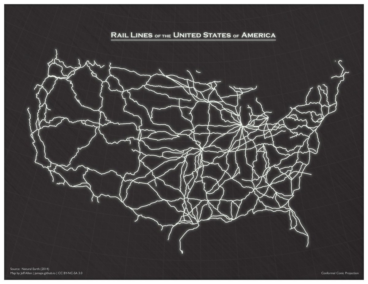
57. /u/jamaps again – railways of the USA
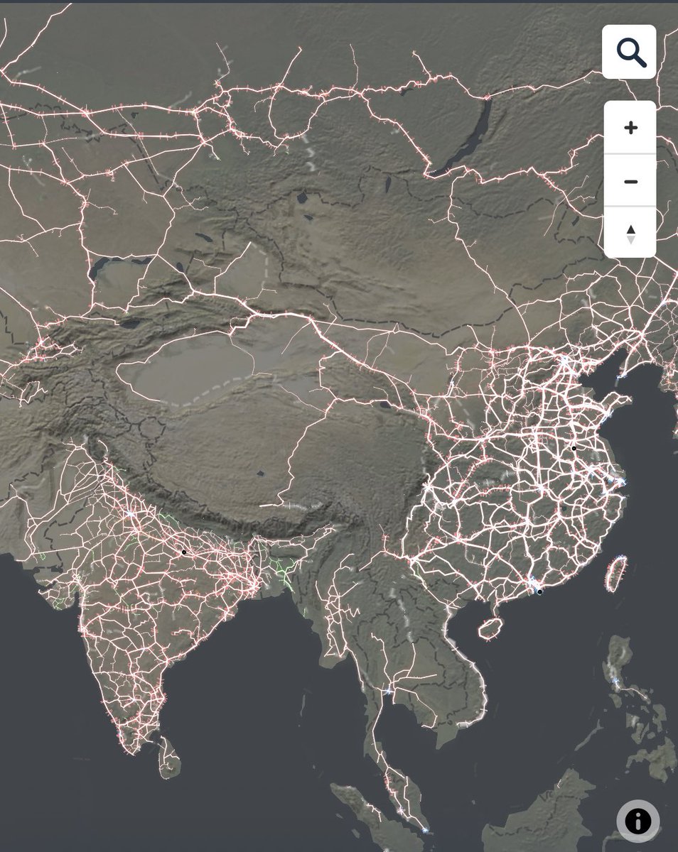
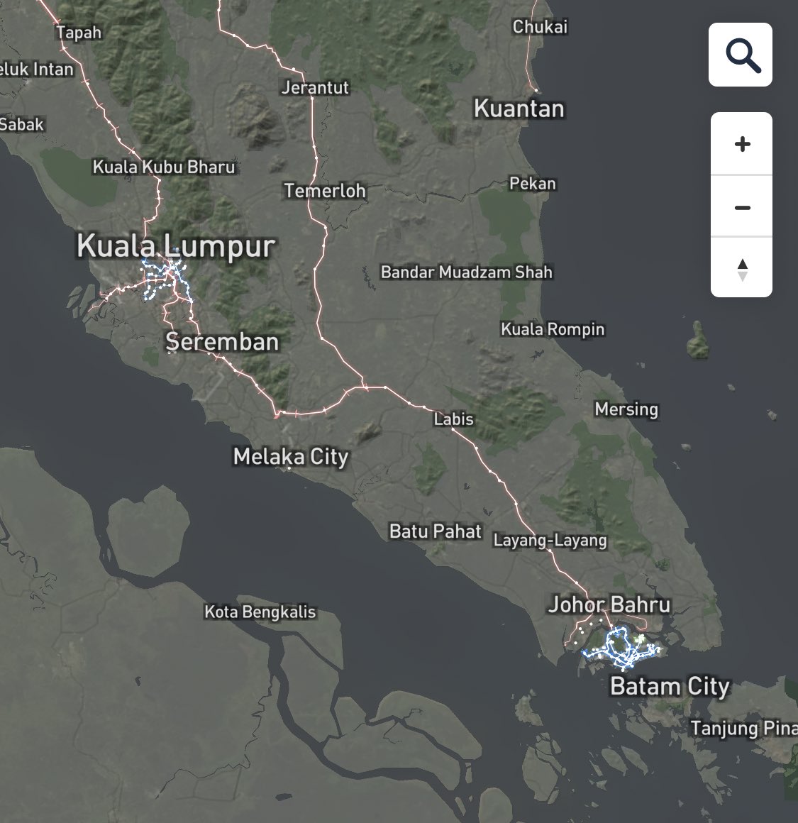
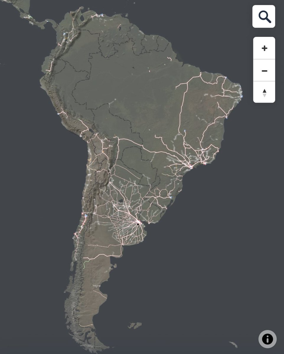
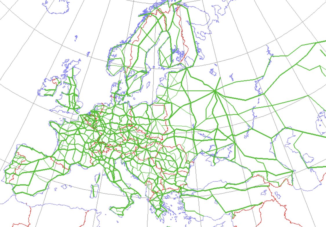
world railway maps without national boundaries, pls, somebody
world railway maps without national boundaries, pls, somebody
59. The art of cartography https://twitter.com/weirdlandtales/status/1086755431911964674?s=21">https://twitter.com/weirdland...
60. US numbered highway system in numerical order, by /u/tns22x on /r/MapPorn
https://www.reddit.com/r/MapPorn/comments/al3kiy/the_us_numbered_highway_system_in_numerical_order/">https://www.reddit.com/r/MapPorn...
https://www.reddit.com/r/MapPorn/comments/al3kiy/the_us_numbered_highway_system_in_numerical_order/">https://www.reddit.com/r/MapPorn...
61. New Orleans is unrealistic https://twitter.com/jameslsutter/status/975550946884268032">https://twitter.com/jameslsut...
62. At last! I’ve been looking for this for years!! https://twitter.com/onlmaps/status/1154192058766073858?s=21">https://twitter.com/onlmaps/s...
63. US railroads, color-coded by companies https://twitter.com/380kmh/status/1147164647449137152">https://twitter.com/380kmh/st...
64. latitudes https://twitter.com/380kmh/status/1177293386816118787?s=21">https://twitter.com/380kmh/st...
65. rail maps https://twitter.com/tjl/status/1241071678651805705?s=21">https://twitter.com/tjl/statu... https://twitter.com/tjl/status/1241071678651805705">https://twitter.com/tjl/statu...

 Read on Twitter
 https://www.jackson-pollock.org/jackson-p..." title="55. Jackson Pollock paintings. These are maps to me https://abs.twimg.com/emoji/v2/... draggable="false" alt="😂" title="Gesicht mit Freudentränen" aria-label="Emoji: Gesicht mit Freudentränen"> https://www.jackson-pollock.org/jackson-p...">
 https://www.jackson-pollock.org/jackson-p..." title="55. Jackson Pollock paintings. These are maps to me https://abs.twimg.com/emoji/v2/... draggable="false" alt="😂" title="Gesicht mit Freudentränen" aria-label="Emoji: Gesicht mit Freudentränen"> https://www.jackson-pollock.org/jackson-p...">
 https://www.jackson-pollock.org/jackson-p..." title="55. Jackson Pollock paintings. These are maps to me https://abs.twimg.com/emoji/v2/... draggable="false" alt="😂" title="Gesicht mit Freudentränen" aria-label="Emoji: Gesicht mit Freudentränen"> https://www.jackson-pollock.org/jackson-p...">
 https://www.jackson-pollock.org/jackson-p..." title="55. Jackson Pollock paintings. These are maps to me https://abs.twimg.com/emoji/v2/... draggable="false" alt="😂" title="Gesicht mit Freudentränen" aria-label="Emoji: Gesicht mit Freudentränen"> https://www.jackson-pollock.org/jackson-p...">

