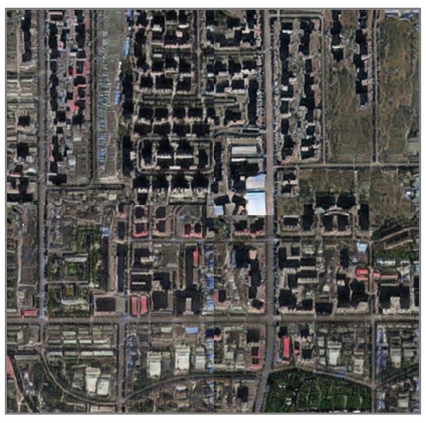
What may appear to be an image of Tacoma, US, it is, in fact, a simulated one. Welcome to the brand new world of deepfake satellite images. https://www.washington.edu/news/2021/04/21/a-growing-problem-of-deepfake-geography-how-ai-falsifies-satellite-images/">https://www.washington.edu/news/2021...
“This isn’t just Photoshopping things. It’s making data look uncannily realistic,” said Bo Zhao, assistant professor of geography at the UW and lead author of the study (2/...)
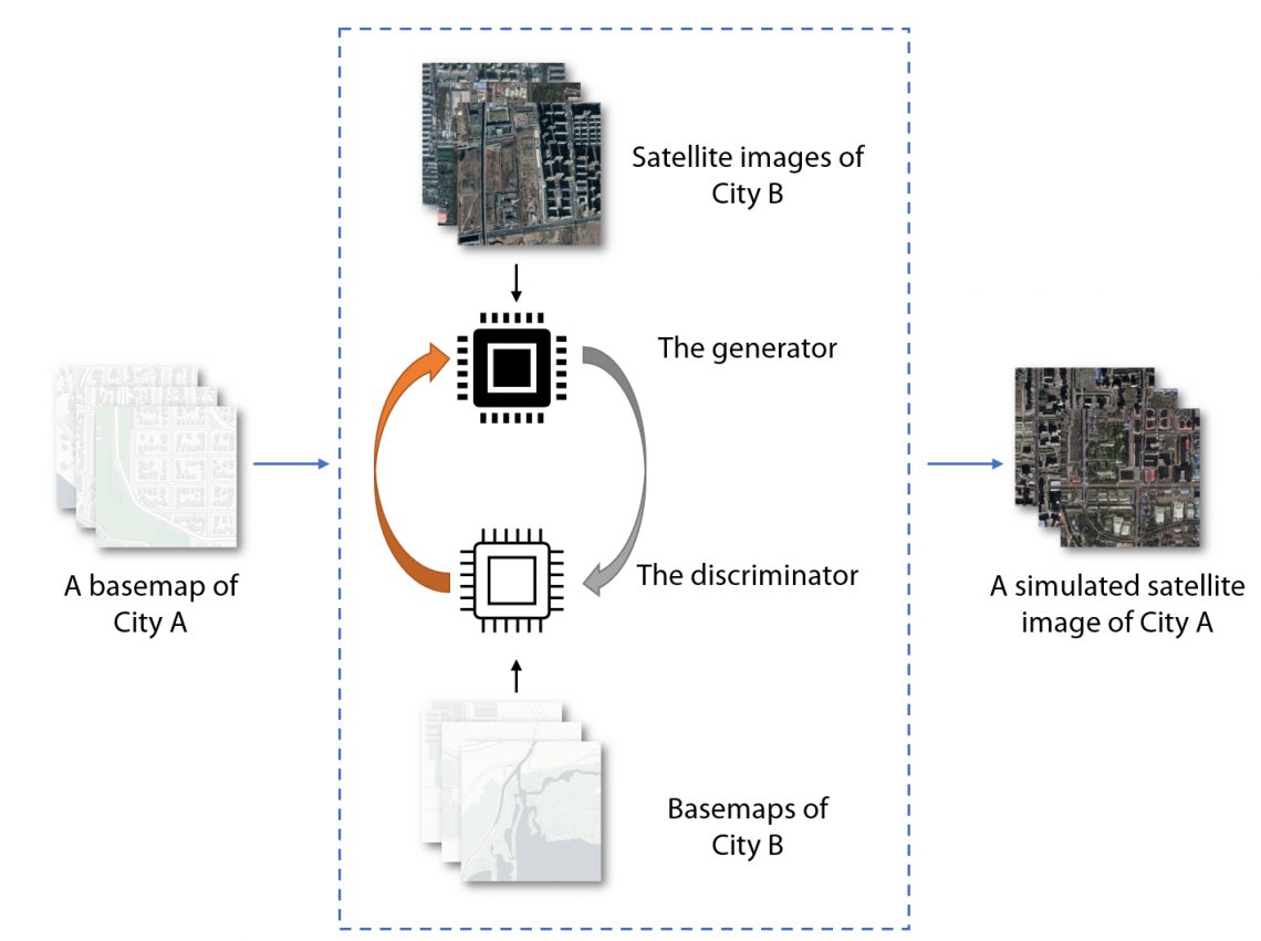
This simplified illustration shows how a simulated satellite image (right) can be generated by putting a base map (City A) into a deepfake satellite image model. This model is created by distinguish a group of base map and satellite image pairs from a second city (City B). (3/..)
Experts already warned for years that deep fakes images of Earth could be used to trick military analysts into seeing objects that aren& #39;t really there https://www.dailymail.co.uk/sciencetech/article-6882893/Deep-fakes-images-Earth-used-trick-military-analysts-experts-say.html">https://www.dailymail.co.uk/sciencete...
Satellite Image Spoofing was mentioned in this 2018 study https://drops.dagstuhl.de/opus/volltexte/2018/9395/pdf/LIPIcs-GISCIENCE-2018-67.pdf(4....)">https://drops.dagstuhl.de/opus/voll...
The author created a completely fake city, see https://chunxxu.github.io/fakegeo/sis.html">https://chunxxu.github.io/fakegeo/s... (5/..)
“The National Geospatial-Intelligance Agency (NGA) is one of the most important agencies in the U.S. that you& #39;ve probably never heard of.
The NGA gives information to the president and his cabinet on counterterrorism and weapons of mass destruction.” https://www.photographytalk.com/china-is-a-world-leader-in-faking-images-with-ai">https://www.photographytalk.com/china-is-... (9/.)
The NGA gives information to the president and his cabinet on counterterrorism and weapons of mass destruction.” https://www.photographytalk.com/china-is-a-world-leader-in-faking-images-with-ai">https://www.photographytalk.com/china-is-... (9/.)
“Satellite imagery is constantly being used by militaries in order to gain tactical advantages over other countries.” (10/10)
Personally, I see a big difference in impact of deep fake geography versus deep fake videos and photos. The next tweets even explain why (11/..)
A deepfake photo or video which seems to be unique can& #39;t be compared to other sources because they don& #39;t exist. A deepfake sat images can easily be compared to other images: by double checking the area with an satellite (12/...)
So this “simcity 2030” game of deception probably only works to deceive people who can& #39;t double-check the info. Most intelligence services can (13/..)
End of rant(14/14)

 Read on Twitter


