You ever see a GPS track that& #39;s particularly janky?
Previously I wrote about how GPS is often less accurate than people think it is. Even in perfect conditions, +/- 12m is pretty normal.
But a few things can make it much, much worse.
Previously I wrote about how GPS is often less accurate than people think it is. Even in perfect conditions, +/- 12m is pretty normal.
But a few things can make it much, much worse.
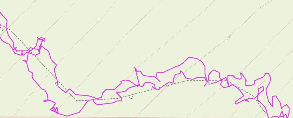
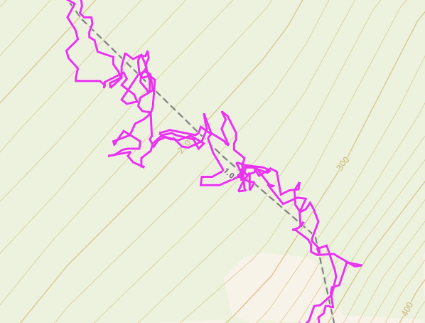
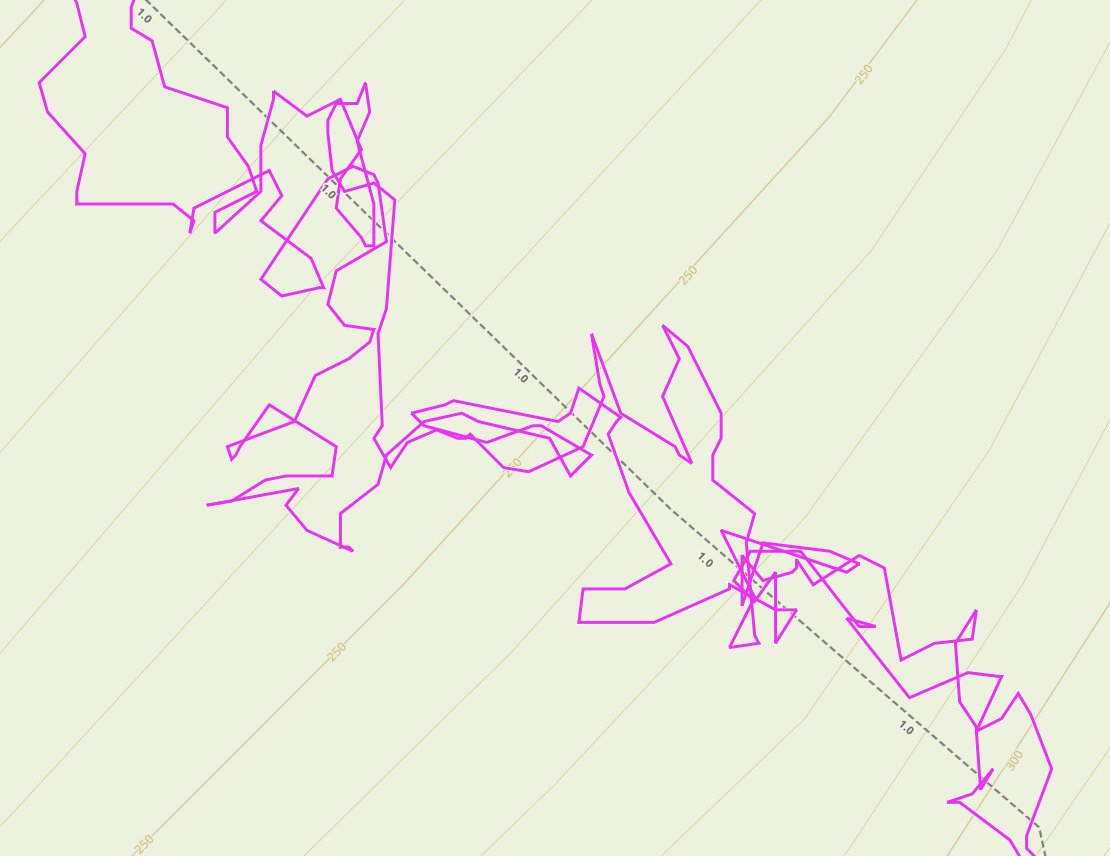
In this and the previous tweet you can see a track that& #39;s all over the place - upwards of 30 m displacement between the trip up and the trip down.
The first thing affecting the track is obvious if you can read the contours: we& #39;re north facing.
The first thing affecting the track is obvious if you can read the contours: we& #39;re north facing.
Why north facing? The way GPS Satellites work, there& #39;s a higher probability of them being to the south (if you& #39;re in the northern hemisphere), so if you& #39;re on the north side of a mountain you& #39;re less likely to have a clear line of sight to most of the satellites in view.
The other thing is this route goes through mature, unlogged timber so the trees are going to interfere with the signal.
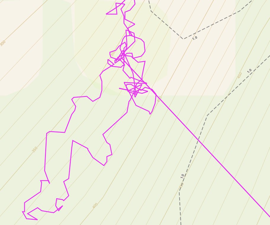
But there& #39;s one final thing near the top of the trail that could be adding more error: multipath signal.
But there& #39;s one final thing near the top of the trail that could be adding more error: multipath signal.
Right near the top we come across this face and the track gets really unreliable.
I suspect multipath errors but I can& #39;t be certain.
Multipath is when the GPS signal "bounces" off a large flat surface, giving the receiver two signals to choose from, one slightly slower.
I suspect multipath errors but I can& #39;t be certain.
Multipath is when the GPS signal "bounces" off a large flat surface, giving the receiver two signals to choose from, one slightly slower.
That single large deviation in the track is 90m and happened while my son and I were standing still eating lunch with the smart phone in my hand.
I have experience multipath errors in the Squamish area quite a few times over the years - once in my vehicle GPS.
I have experience multipath errors in the Squamish area quite a few times over the years - once in my vehicle GPS.
Vehicle GPS units "solve" GPS signal errors multiple ways.
1) "lock" your position to the underlying road geometry in the map.
2) "dismiss" big errors and try again assuming you& #39;re moving and the next position will be more reliable.
3) use kallman filtering to smooth errors
1) "lock" your position to the underlying road geometry in the map.
2) "dismiss" big errors and try again assuming you& #39;re moving and the next position will be more reliable.
3) use kallman filtering to smooth errors
GPS units are nearly magical devices doing math that takes into account the relativistic effects of moving satellites and the speed of light to calculate where you are, but it is important to understand their limitations.
For greater accuracy
1) external antenna if possible
2) clear view of the southern sky
3) take it off your chest or out of your pocket and hold it up
These help to improve results in any consumer GPS.
1) external antenna if possible
2) clear view of the southern sky
3) take it off your chest or out of your pocket and hold it up
These help to improve results in any consumer GPS.

 Read on Twitter


