Today, let& #39;s take a tour inside Jaffa Gate in Jerusalem & see some of the shops & buildings around the turn of the 20th century
Photochrom of the exterior of the Gate, 1890s
https://www.loc.gov/pictures/item/2002724999/
(note">https://www.loc.gov/pictures/... the Cook& #39;s sign, directing you to their travel office inside the gate)
~mp
Photochrom of the exterior of the Gate, 1890s
https://www.loc.gov/pictures/item/2002724999/
(note">https://www.loc.gov/pictures/... the Cook& #39;s sign, directing you to their travel office inside the gate)
~mp
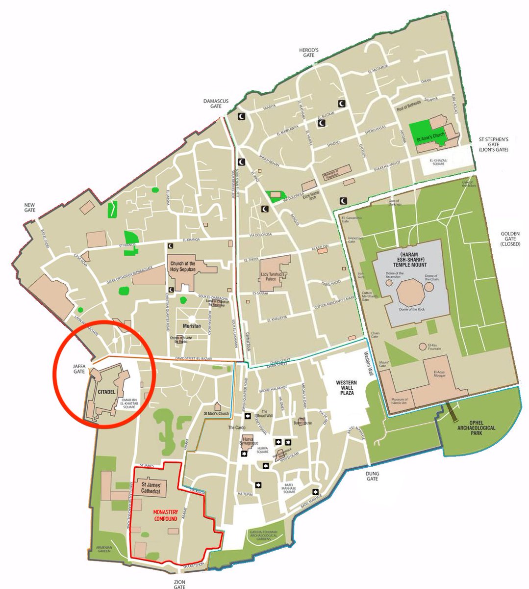
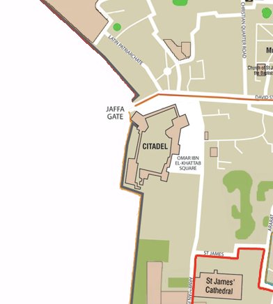
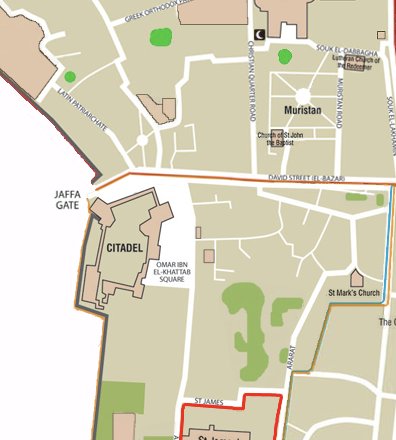
For orientation, here& #39;s a map of the Old City of Jerusalem (via Wikimedia Commons), with the area we& #39;re looking at -- the west entrance to the Old City -- circled in red and in detail on the right.
https://commons.wikimedia.org/wiki/File:Map_of_Jerusalem_-_the_old_city_-_EN.png
~mp">https://commons.wikimedia.org/wiki/File...
https://commons.wikimedia.org/wiki/File:Map_of_Jerusalem_-_the_old_city_-_EN.png
~mp">https://commons.wikimedia.org/wiki/File...
The wide entrance -- unlike the other narrow gates of the Old City -- was caused by a breach in the wall in 1898, to allow for the procession of the German kaiser Wilhelm II into the city.
Here& #39;s a view c. 1900-1907
https://www.loc.gov/pictures/item/2019698086/">https://www.loc.gov/pictures/...
Here& #39;s a view c. 1900-1907
https://www.loc.gov/pictures/item/2019698086/">https://www.loc.gov/pictures/...
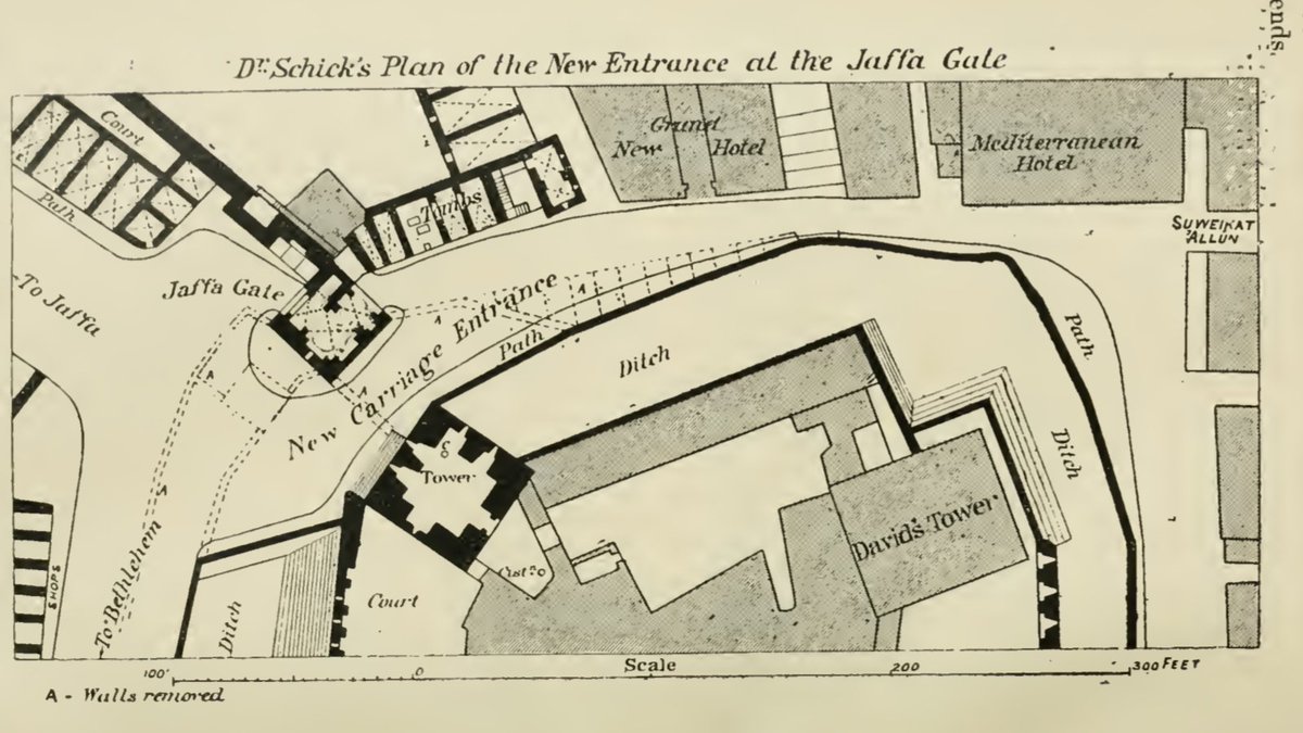
The kaiser& #39;s visit meant not only a breach in the wall but enlarging the road just inside gate.
You can see the changes in this plan made at the time, with the dotted lines all removed (including a series of wooden shops just north of "Ditch".
You can see the changes in this plan made at the time, with the dotted lines all removed (including a series of wooden shops just north of "Ditch".
(The plan was made by Conrad Schick, longtime engineer and missionary in Jerusalem, and published in the PEF Quarterly Statement for January 1899)
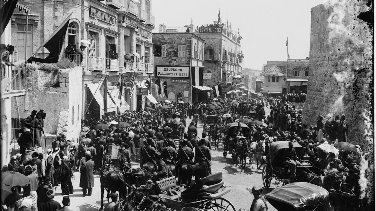
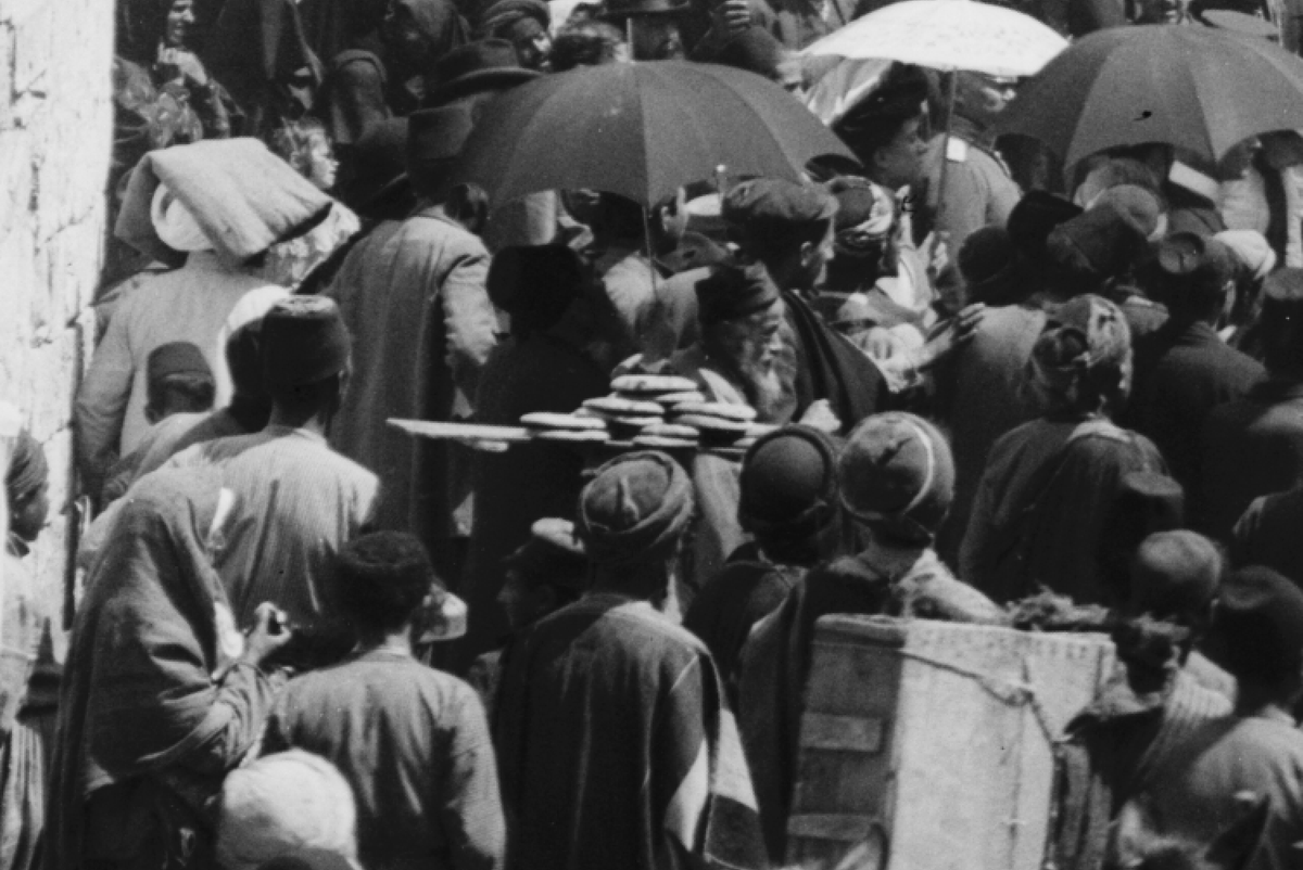
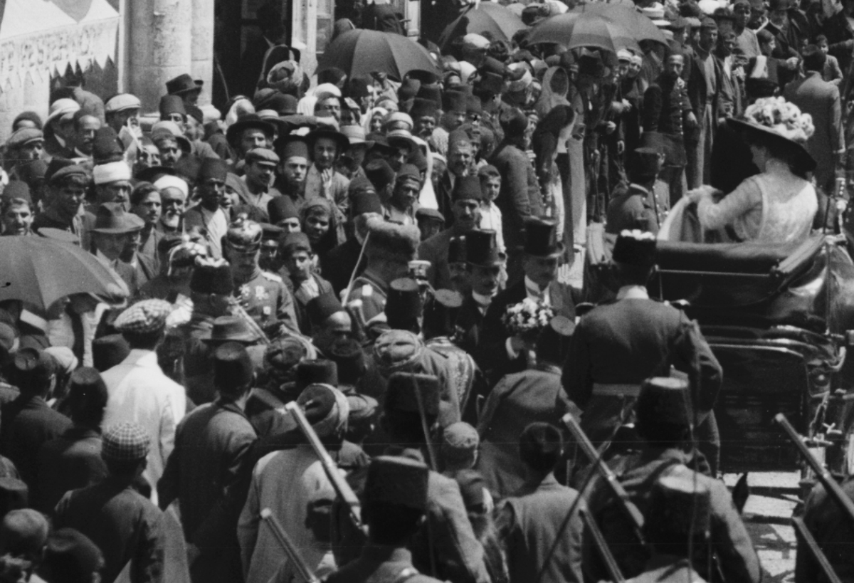
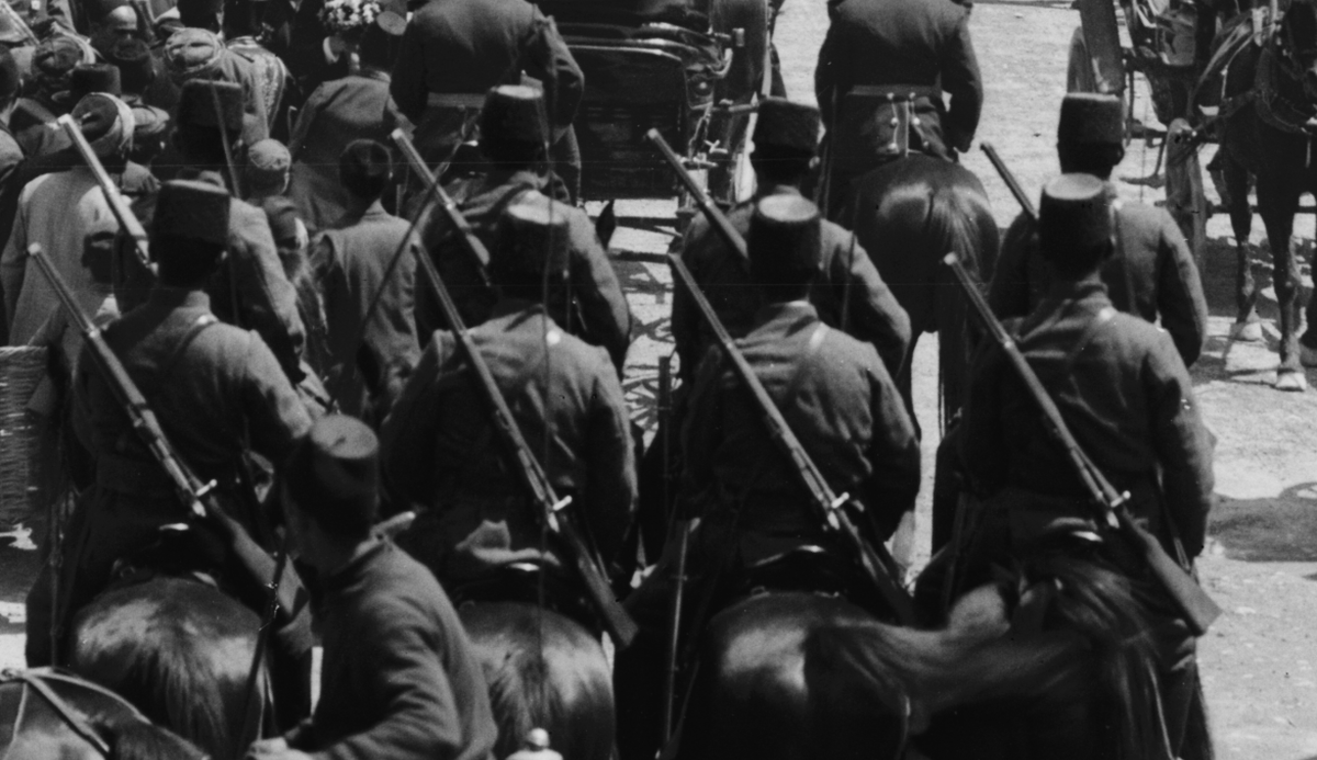
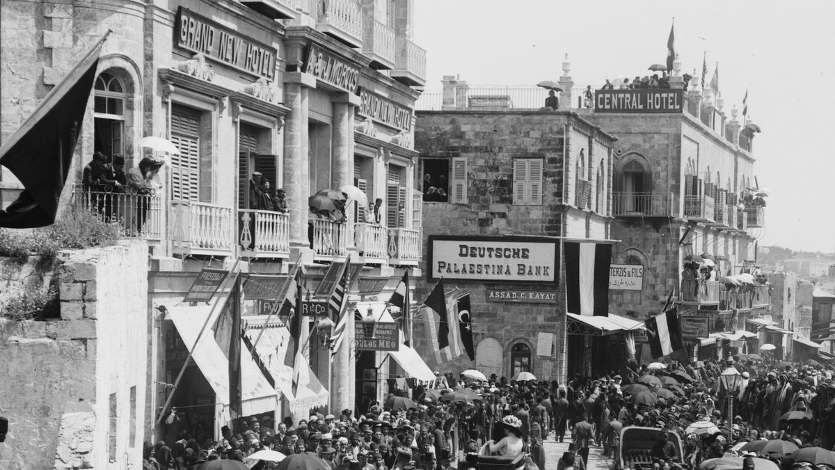
This photo, looking just inside the gate, appears to have been taken at the time of the kaiser& #39;s 1898 visit -- including crowds of onlookers, a procession, and perhaps the kaiser himself.
(Photo by the American Colony via LoC)
https://www.loc.gov/pictures/item/2019695064/
~mp">https://www.loc.gov/pictures/...
(Photo by the American Colony via LoC)
https://www.loc.gov/pictures/item/2019695064/
~mp">https://www.loc.gov/pictures/...
This is a wonderful photo, and I want to highlight some of the details: the bread seller in the crowd, the kaiser himself(?), the file of soldiers, some of the onlookers.
https://www.loc.gov/pictures/item/2019695064/
~mp">https://www.loc.gov/pictures/...
https://www.loc.gov/pictures/item/2019695064/
~mp">https://www.loc.gov/pictures/...
As you walk inside Jaffa Gate, to the right is the large structure known as the Citadel (aka the Tower of David, a name originally given just to one of its towers) -- a medieval fortress built on older fortifications.
(American Colony photo via LoC)
https://loc.gov/pictures/item/2019698399/
~mp">https://loc.gov/pictures/...
(American Colony photo via LoC)
https://loc.gov/pictures/item/2019698399/
~mp">https://loc.gov/pictures/...
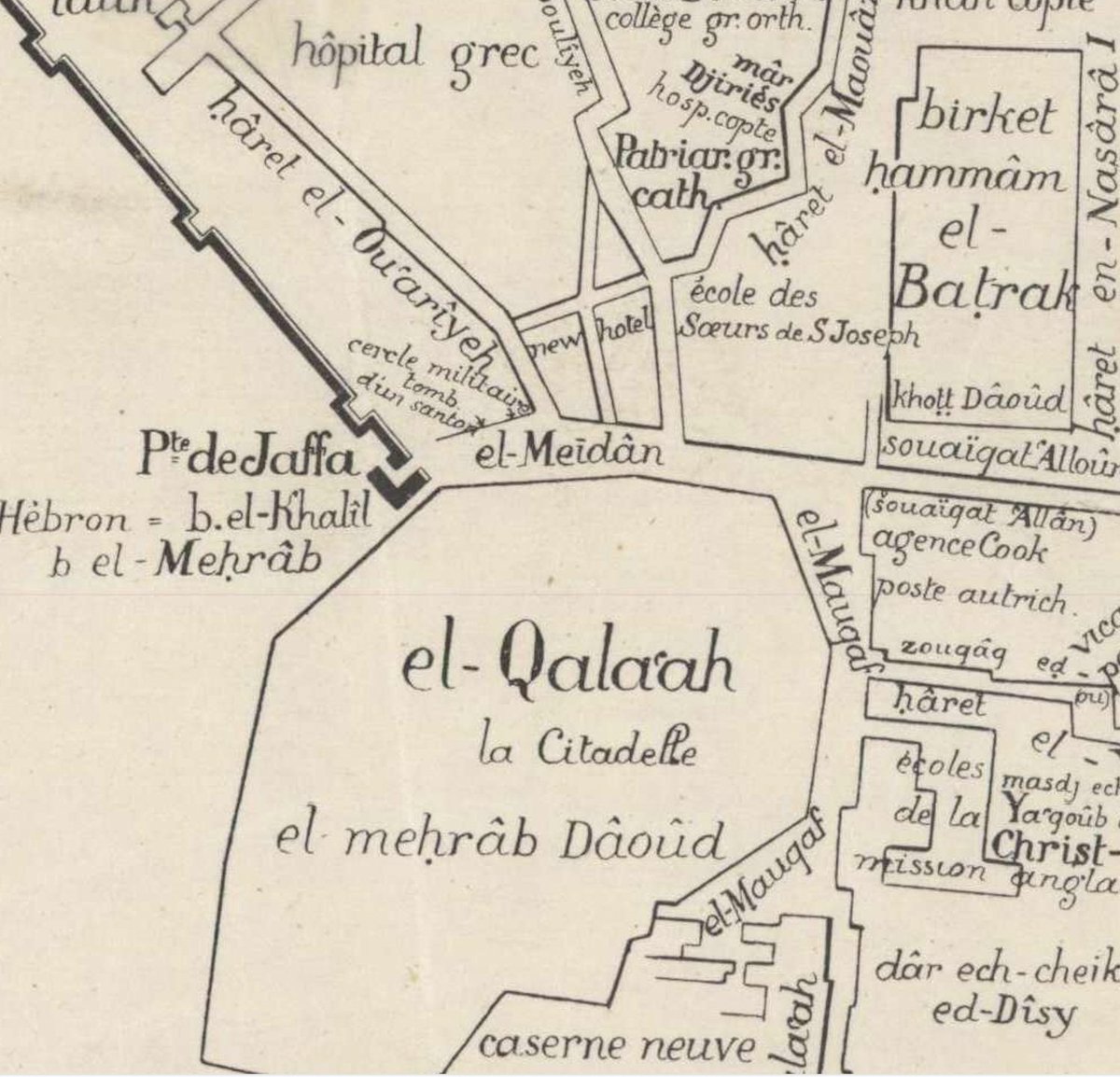
The street east from the gate (and to the north of the Citadel, or in Arabic al-Qala& #39;a) is sometimes called al-Maidan ("the square") or sometimes David Street, the name of its continuation to the east.
(L.H. Vincent, Jérusalem, vol. 1, pl. iii, 1912)
http://iaa-archives.org.il/zoom/zoom.aspx?id=2349&folder_id=18&type_id=&loc_id=2">https://iaa-archives.org.il/zoom/zoom...
(L.H. Vincent, Jérusalem, vol. 1, pl. iii, 1912)
http://iaa-archives.org.il/zoom/zoom.aspx?id=2349&folder_id=18&type_id=&loc_id=2">https://iaa-archives.org.il/zoom/zoom...
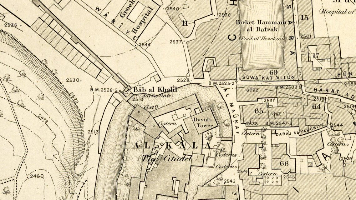
The area north of the Maidan was built up over the 2nd half of the 19th century; here in 1865 it& #39;s mostly empty lots.
(btw note the Arabic name of Jaffa Gate, Bab al-Khalil)
Ordnance Survey map, via the R.F. Burton Map Collection, Huntington Library
https://hdl.huntington.org/digital/collection/p15150coll4/id/7159/
~mp">https://hdl.huntington.org/digital/c...
(btw note the Arabic name of Jaffa Gate, Bab al-Khalil)
Ordnance Survey map, via the R.F. Burton Map Collection, Huntington Library
https://hdl.huntington.org/digital/collection/p15150coll4/id/7159/
~mp">https://hdl.huntington.org/digital/c...
The building the kaiser appears to be coming out of above is the Grand New Hotel, a Greek Orthodox construction dating to the 1880s on one of those empty lots.
Today it is still a hotel, the New Imperial Hotel
http://dla.library.upenn.edu/dla/holyland/image.html?q=grand%20new%20hotel&id=HOLYLAND_lenkin_4912&">https://dla.library.upenn.edu/dla/holyl...
Today it is still a hotel, the New Imperial Hotel
http://dla.library.upenn.edu/dla/holyland/image.html?q=grand%20new%20hotel&id=HOLYLAND_lenkin_4912&">https://dla.library.upenn.edu/dla/holyl...
The ground floor of the hotel was built to contain a gallery of shops, known at the time as the New Bazaar
(Plan by Conrad Schick, PEF Quarterly Statement October 1887)
~mp
(Plan by Conrad Schick, PEF Quarterly Statement October 1887)
~mp
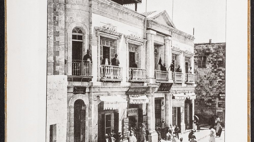
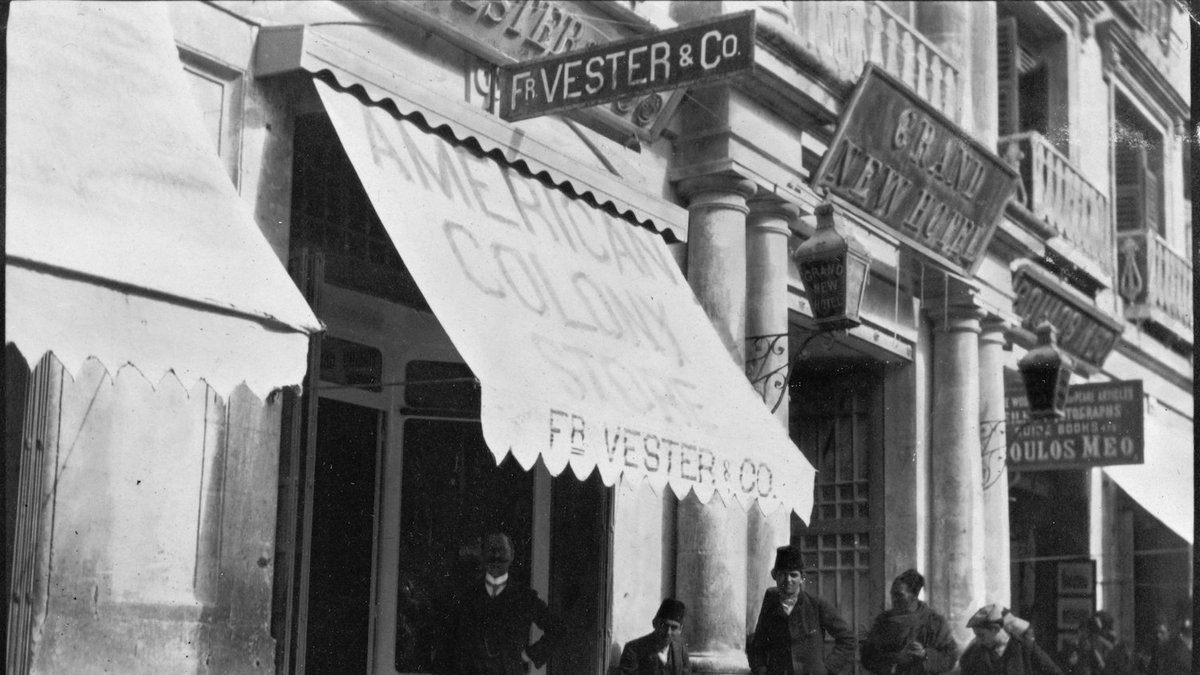
The 1898 photo above provides a nice view:
Note the names of the Morcos brothers who ran the hotel, and the shops on the exterior of the ground floor -- Fr. Vester and Co. (aka the American Colony Store) & Boulos Meo, 2 of the best-known souvenir shops of the time
~mp
Note the names of the Morcos brothers who ran the hotel, and the shops on the exterior of the ground floor -- Fr. Vester and Co. (aka the American Colony Store) & Boulos Meo, 2 of the best-known souvenir shops of the time
~mp
Here& #39;s the Vester store c. 1905-1913 -- right at the time it was transitioning more toward selling antiquities -- with Frederick Vester himself standing out front.
(photo via LoC)
https://www.loc.gov/pictures/item/2008676309/
~mp">https://www.loc.gov/pictures/...
(photo via LoC)
https://www.loc.gov/pictures/item/2008676309/
~mp">https://www.loc.gov/pictures/...
The Grand New Hotel also happened to be the first home (1900-1906) of the American School in Jerusalem--a center for American (& other) scholars studying the archaeology and history of the country--now the Albright Institute on Salah ad-Din St.
https://aiar.org/
~mp">https://aiar.org/">...
https://aiar.org/
~mp">https://aiar.org/">...
The building just east of the Grand New Hotel housed Swiss/German businesses in the late 19th century: a shop run first by the missionary Christian Spittler & then by Wilhelm Duisberg (one of the main advocates of Shapira& #39;s Moabite pottery); & the bank of Johann Frutiger
~mp
~mp
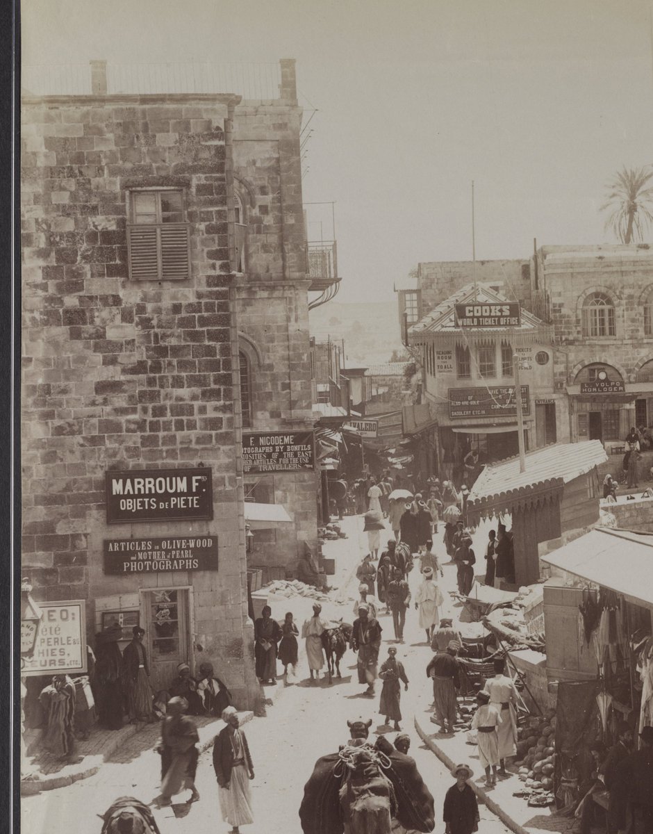
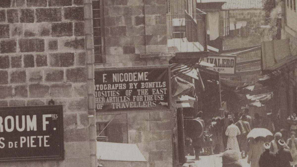
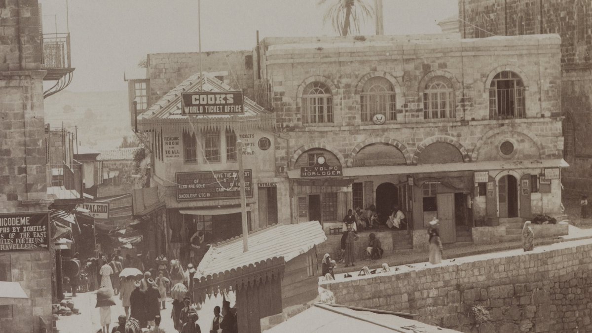
Frutiger& #39;s bank went bankrupt in 1896, and in these photos from the 1890s we see the names of other businesses in & near the building: another bank, & souvenir shops like Marroum and Nicodème.
(Photo on left by Bonfils c. 1890s)
http://hdl.library.upenn.edu/1017/d/holyland/lenkin_1346">https://hdl.library.upenn.edu/1017/d/ho...
(Photo on left by Bonfils c. 1890s)
http://hdl.library.upenn.edu/1017/d/holyland/lenkin_1346">https://hdl.library.upenn.edu/1017/d/ho...
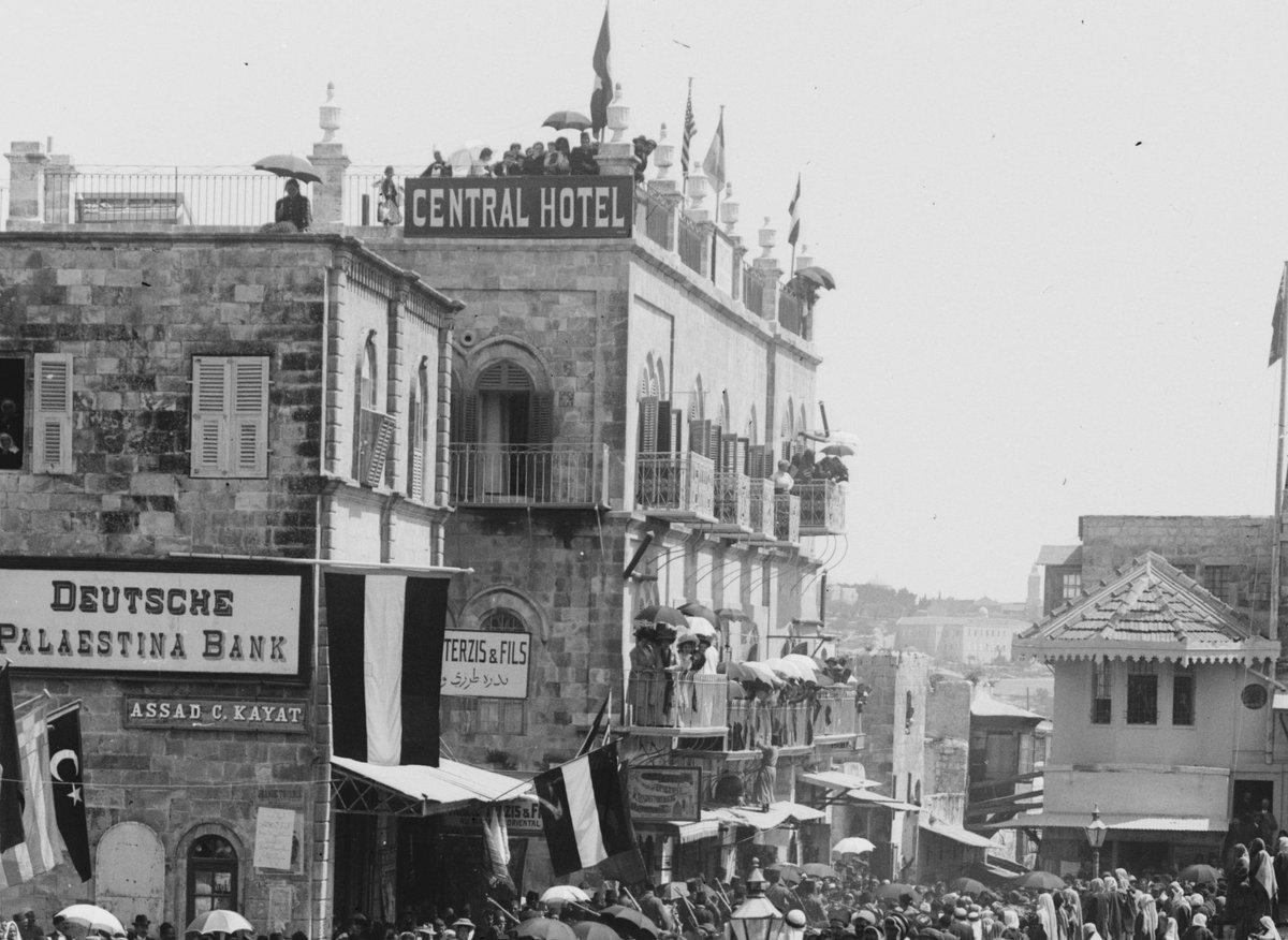
Next door was another hotel, known as the Central Hotel in 1898 (previously the Rosenthal, Mediterranean, Europe, and Dardanelles Hotel; today the Petra Hostel)
~mp
~mp
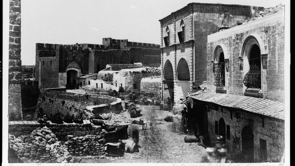
Here& #39;s a view to the west from the 1870s, when it was the Mediterranean Hotel. Note the amount of construction yet to happen west of Duisberg& #39;s shop/Frutiger& #39;s bank!
(photo by Bonfils)
https://www.loc.gov/pictures/item/92500556/
~mp">https://www.loc.gov/pictures/...
(photo by Bonfils)
https://www.loc.gov/pictures/item/92500556/
~mp">https://www.loc.gov/pictures/...
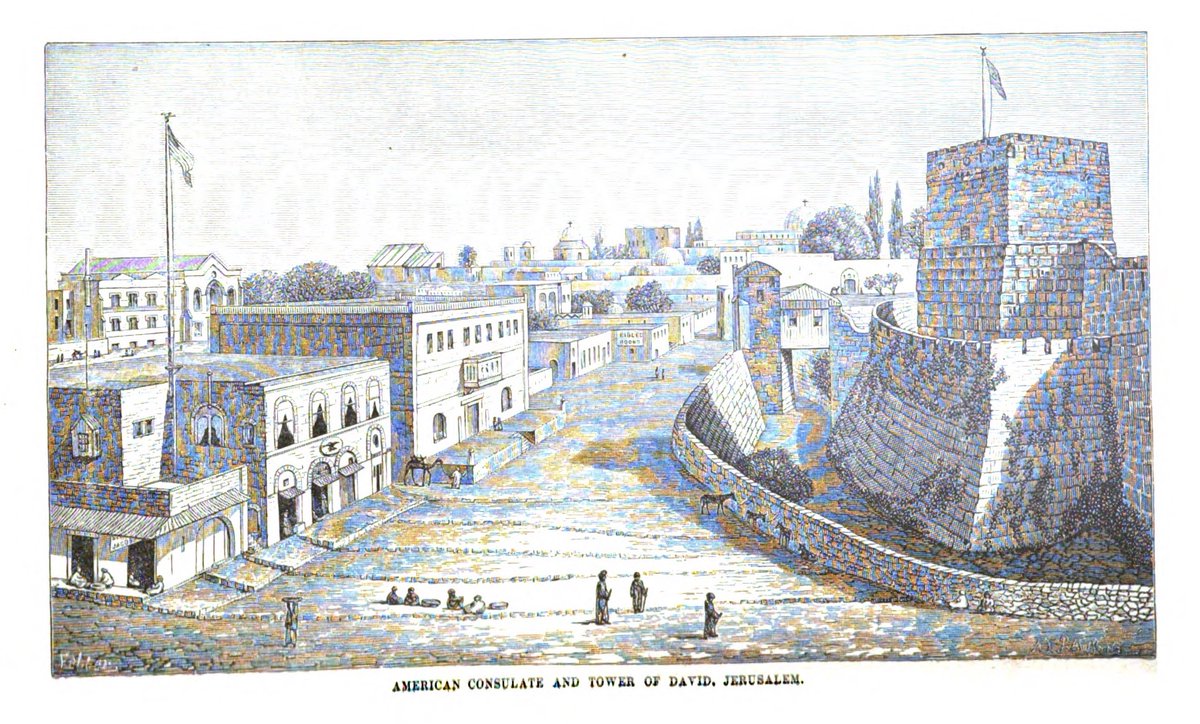
Here& #39;s a view to the south, where the Maidan turns in that direction, from the early 1880s; the Citadel on the right, and on the left what was then the American consulate.
(De Hass, Buried Cities Recovered, 1882)
~mp
(De Hass, Buried Cities Recovered, 1882)
~mp
The building had previously served as the Bergheim bank in the 1850s and 1860s (it then moved to Christian St., and went bankrupt in 1892); in the 1890s, when the American Consulate joined the other consulates outside the walls, it became the Cook& #39;s ticket office.
~mp
~mp
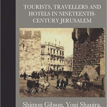
If you& #39;re interested in more on the Jaffa Gate area, or Jerusalem in general, in this period, you might check out Gibson, Shapira, and Chapman& #39;s exhaustive look at 19c Jerusalem hotels, and Kroyanker& #39;s books on Jerusalem architecture
~mp
~mp
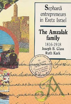
Joseph Glass and Ruth Kark have co-authored books on the Amzalak family (the owners of the Central Hotel building) and the Valero family.
And there is Vincent Lemire& #39;s 2016 book Jérusalem 1900, translated into English in 2017
https://press.uchicago.edu/ucp/books/book/chicago/J/bo19585779.html
~mp">https://press.uchicago.edu/ucp/books...
https://press.uchicago.edu/ucp/books/book/chicago/J/bo19585779.html
~mp">https://press.uchicago.edu/ucp/books...

 Read on Twitter
