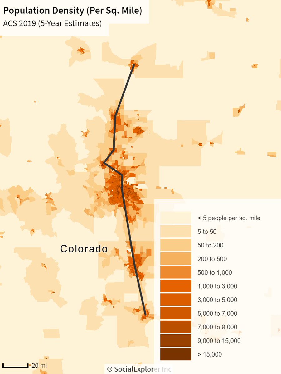
Rail corridor planning 101 will tell you that connecting cities which exist along a line is really good. Cheyenne and Pueblo demarcate the north and south ends of a rel. populous corridor following the front range of the Rockies. https://twitter.com/mattyglesias/status/1379950762063630344">https://twitter.com/mattygles...
There are criticisms to be made of The Map, but can we please make them after we spend more than a few seconds thinking about what we& #39;re gonna type?
As others have noted, this Politico article basically boils down to "Amtrak should be investing in the NEC vs a bunch of extensions in the (Mid)west." Yet, the bill provides more money for the NEC than the rest of the country *combined*! https://twitter.com/samjmintz/status/1379880153724162049?s=20">https://twitter.com/samjmintz...
Irrespective of my own quibbles with how this money will be used, it& #39;s just a bit dishonest to paint this map as an Oprah-style giveaway of rail service. The corridors selected do, generally, connect real markets! https://twitter.com/BrendanDawe/status/1377632974586310657?s=20">https://twitter.com/BrendanDa...
I was feeling incredibly Done with the discourse, so I made a map of The Map overlaid on pop density. News flash: these routes generally connect real and dense places!
I& #39;ll be the first one to admit that Amtrak& #39;s plan has flaws and faces real challenges. And there are a few actually questionable routes here!
But my two cents on this issue is our debating time would be much better spent agitating around construction costs, fleet strategy, incremental speed improvements, and national rail capacity planning. The corridors Amtrak chose are (generally) sound.
(h/t to @BrendanDawe for making my life easier with this) https://twitter.com/BrendanDawe/status/1377632974586310657?s=20">https://twitter.com/BrendanDa...

 Read on Twitter


