TPB Scan #1
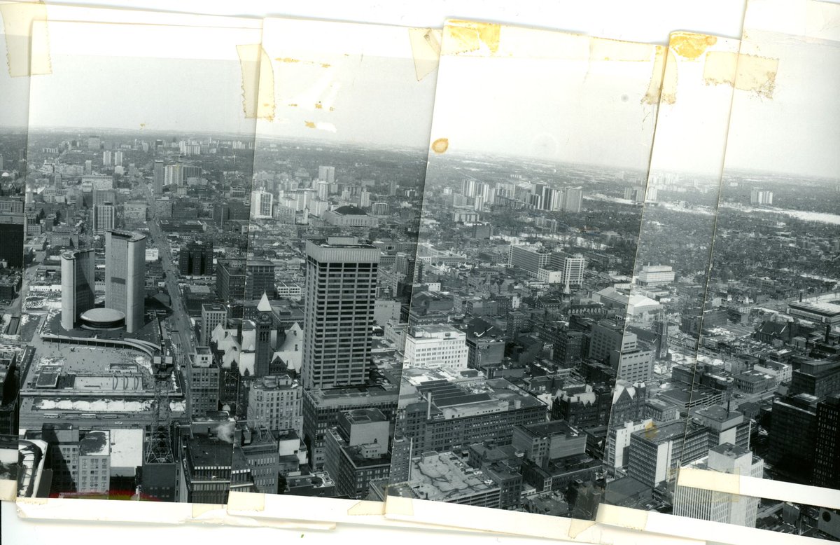
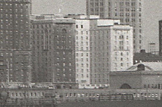
Let’s begin with a classic view: late 1960s, looking north over City Hall, taken from the top of TD Centre’s then recently-completed main tower.
This is a composite of four photos, merged in Photoshop.
Let’s begin with a classic view: late 1960s, looking north over City Hall, taken from the top of TD Centre’s then recently-completed main tower.
This is a composite of four photos, merged in Photoshop.
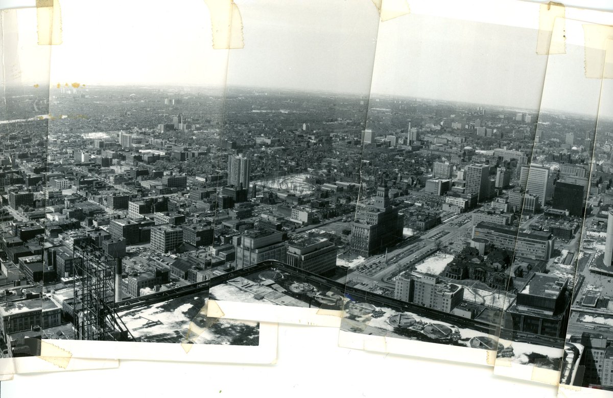
The original panorama looked like this - a taped-together set of 24 photos, creating a nearly 360 degree view.
I’ve deconstructed it, scanned the individual photos, and am reassembling in Photoshop. The west/south/east views are great - we’ll get to them a little later, though.
I’ve deconstructed it, scanned the individual photos, and am reassembling in Photoshop. The west/south/east views are great - we’ll get to them a little later, though.
Should this series be:
#TPBscan #2
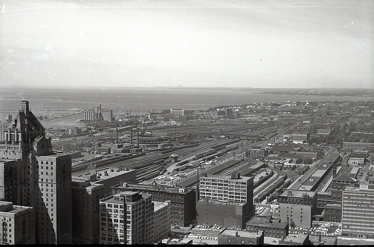
Another rooftop view, but from the Canadian Bank of Commerce Building, probably a decade earlier, looking west. So much rail.
Today this view would include financial core, Metro Hall, King West/CityPlace/Fort York condos, CN Tower, Rogers Centre, Convention Centre...
Another rooftop view, but from the Canadian Bank of Commerce Building, probably a decade earlier, looking west. So much rail.
Today this view would include financial core, Metro Hall, King West/CityPlace/Fort York condos, CN Tower, Rogers Centre, Convention Centre...
The shot from the Canadian Bank of Commerce Building is scanned from a negative, not a print. It’s part of a short roll, taken from that vantage point, that I will work through in the next few days.
#TPBscan #3
A similar view to yesterday’s, but the photographer has zoomed in and the plane of focus has shifted outward, revealing more detail in the mid-ground. For example, you can now make out Maple Leaf Stadium next to the Tip Top Tailors Building.
A similar view to yesterday’s, but the photographer has zoomed in and the plane of focus has shifted outward, revealing more detail in the mid-ground. For example, you can now make out Maple Leaf Stadium next to the Tip Top Tailors Building.
#TPBscan #4
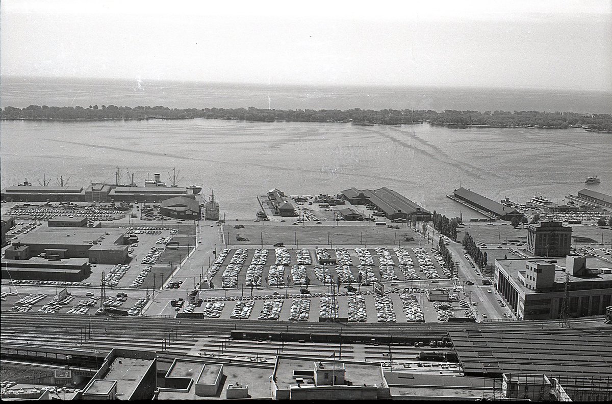
The view swings south.
1959. No Gardiner. Lots of parking. Marine Terminal 27, with several ships docked (Now Pier 27 condos). Toronto Postal Delivery Building (now Scotiabank Arena). Toronto Harbour Commission Building. Old ferry docks, and a ferry in the water.
The view swings south.
1959. No Gardiner. Lots of parking. Marine Terminal 27, with several ships docked (Now Pier 27 condos). Toronto Postal Delivery Building (now Scotiabank Arena). Toronto Harbour Commission Building. Old ferry docks, and a ferry in the water.
#TPBscan #5
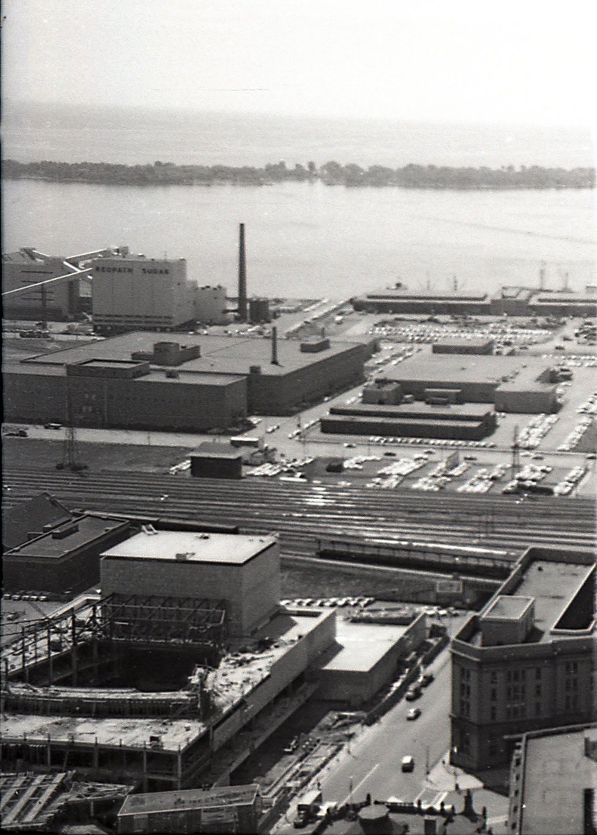
Last shot from this roll (presumably others have been lost over the years).
Looking SE, over the LCBO office/warehouse, towards the Redpath plant. Coolest part of this shot is the O’Keefe Centre, under construction, in the foreground.
Last shot from this roll (presumably others have been lost over the years).
Looking SE, over the LCBO office/warehouse, towards the Redpath plant. Coolest part of this shot is the O’Keefe Centre, under construction, in the foreground.
#TPBscan #6
It’s 1963. Let’s hit the streets on the east side of downtown. This roll starts at the Fred Victor Mission, southeast corner of Queen and Jarvis.
It’s 1963. Let’s hit the streets on the east side of downtown. This roll starts at the Fred Victor Mission, southeast corner of Queen and Jarvis.
#TPBscan #7
I suspect this laneway location no longer exists as photographed. This was likely somewhere north of Queen, near Jarvis.
The car is a mid-50s Mercury Meteor.
I suspect this laneway location no longer exists as photographed. This was likely somewhere north of Queen, near Jarvis.
The car is a mid-50s Mercury Meteor.
#TPBscan #8
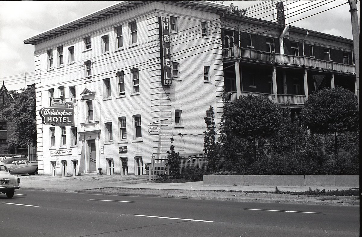
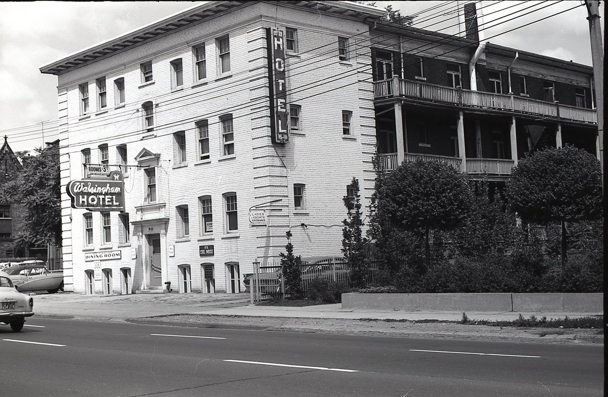
321 Jarvis, the Walsingham Hotel.
‘Rooms $3.50’
‘It’s Cool Inside’
‘Ladies’ & Escorts’ Entrance’
321 Jarvis, the Walsingham Hotel.
‘Rooms $3.50’
‘It’s Cool Inside’
‘Ladies’ & Escorts’ Entrance’
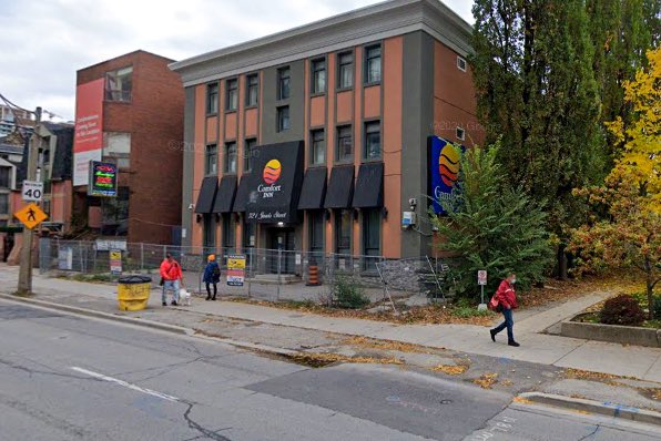
Same site, then and now.
Today, a fenced-in Comfort Inn awaiting redevelopment (there is an application for a 46-storey condo on the site).
Today, a fenced-in Comfort Inn awaiting redevelopment (there is an application for a 46-storey condo on the site).
#TPBscan #9
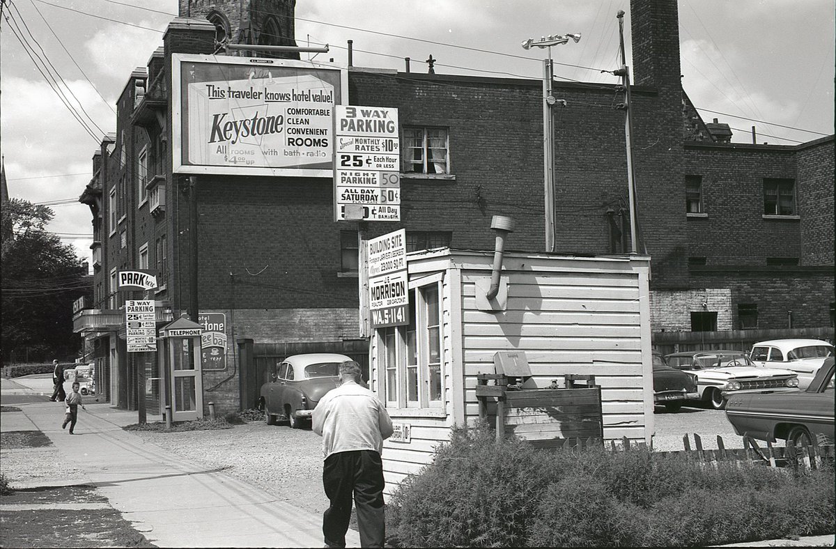
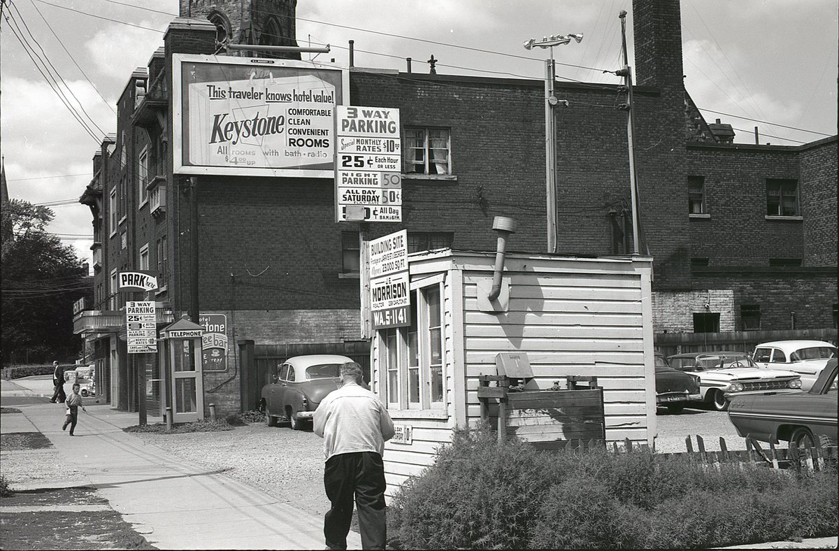
Looking north toward 335 Jarvis, then the Keystone Hotel. Jarvis Street Baptist Church tower peeking out behind.
Parking lot in the foreground has a sign reading, ‘building site, frontage on Jarvis St & George St, 23,000 Sq. Ft.’
Looking north toward 335 Jarvis, then the Keystone Hotel. Jarvis Street Baptist Church tower peeking out behind.
Parking lot in the foreground has a sign reading, ‘building site, frontage on Jarvis St & George St, 23,000 Sq. Ft.’
Same view, then & now.
The hotel building endures - today an EconoLodge.
The parking lot/building site is now a townhome complex that runs through the block to George St.
The hotel building endures - today an EconoLodge.
The parking lot/building site is now a townhome complex that runs through the block to George St.
#TPBscan #10
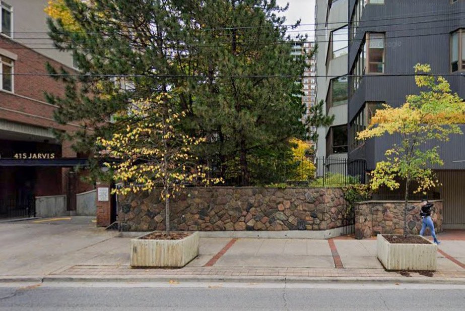
A great shot looking southeast at the Four Seasons Motor Hotel, 415 Jarvis, designed by Peter Dickinson. The original Four Seasons property, it opened in 1961 and was demolished by the early ‘90s.
A great shot looking southeast at the Four Seasons Motor Hotel, 415 Jarvis, designed by Peter Dickinson. The original Four Seasons property, it opened in 1961 and was demolished by the early ‘90s.
While the former Jarvis Four Seasons is long gone, this small section of wall, just to the south, feels like a remnant detail that once may have tied in to the design of the neighbouring hotel.
#TPBscan #11
443/447 Jarvis, the Caldwell Building. Then home to Caldwell broadcast advertising, Caldwell A-V Equipment, and other related film/TV businesses.
443/447 Jarvis, the Caldwell Building. Then home to Caldwell broadcast advertising, Caldwell A-V Equipment, and other related film/TV businesses.
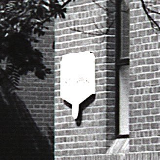
This was a tricky location to figure out, but I noticed a small sign on the building, and I was able to rescan the negative and some more details out of it.
#TPBscan #13
This one has me stumped. Based on the other shots on the roll, it would likely have been somewhere between Jarvis and Bleecker, north of Wellesley.
This one has me stumped. Based on the other shots on the roll, it would likely have been somewhere between Jarvis and Bleecker, north of Wellesley.
Mystery solved by @davidcapizzano. I had been looking in the wrong place - apparently the photographer’s route was a bit more winding than I had anticipated.
 https://abs.twimg.com/emoji/v2/... draggable="false" alt="⬇️" title="Pfeil nach unten" aria-label="Emoji: Pfeil nach unten"> https://twitter.com/davidcapizzano/status/1382731768009228292">https://twitter.com/davidcapi...
#TPLscan #14
Bleecker Street, above Wellesley, looking north. Today, part of St. James Town.
On the right, 265 Bleecker, Wellesley Garage.
On the left, 286-8 Bleecker, Charles Wilson Ltd (soda beverages - one of their trucks visible down the street).
Bleecker Street, above Wellesley, looking north. Today, part of St. James Town.
On the right, 265 Bleecker, Wellesley Garage.
On the left, 286-8 Bleecker, Charles Wilson Ltd (soda beverages - one of their trucks visible down the street).
#TPBscan #15
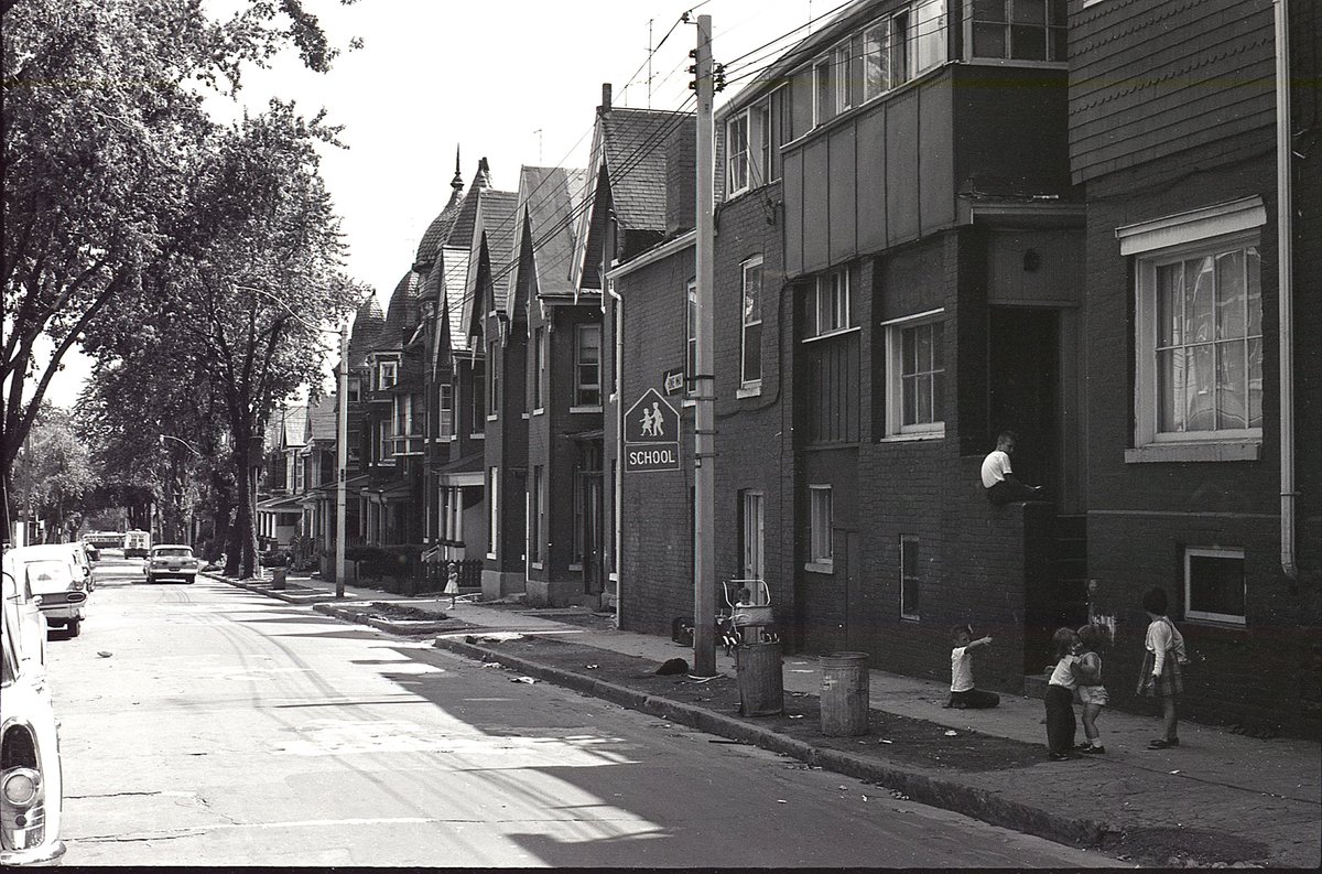
It annoys me that I haven’t been able to pinpoint this location, as there are several clues:
- one way
- school crossing
- very distinctive roof a few houses down, on the right
- streetcar passing in the distance
Should be in or around what is now St. James Town.
It annoys me that I haven’t been able to pinpoint this location, as there are several clues:
- one way
- school crossing
- very distinctive roof a few houses down, on the right
- streetcar passing in the distance
Should be in or around what is now St. James Town.
Today’s mystery solved by @structura_ (and @KeishaStLouis was also REALLY close).
 https://abs.twimg.com/emoji/v2/... draggable="false" alt="⬇️" title="Pfeil nach unten" aria-label="Emoji: Pfeil nach unten"> https://twitter.com/structura_/status/1383571336950206466">https://twitter.com/structura...
#TPBscan #16
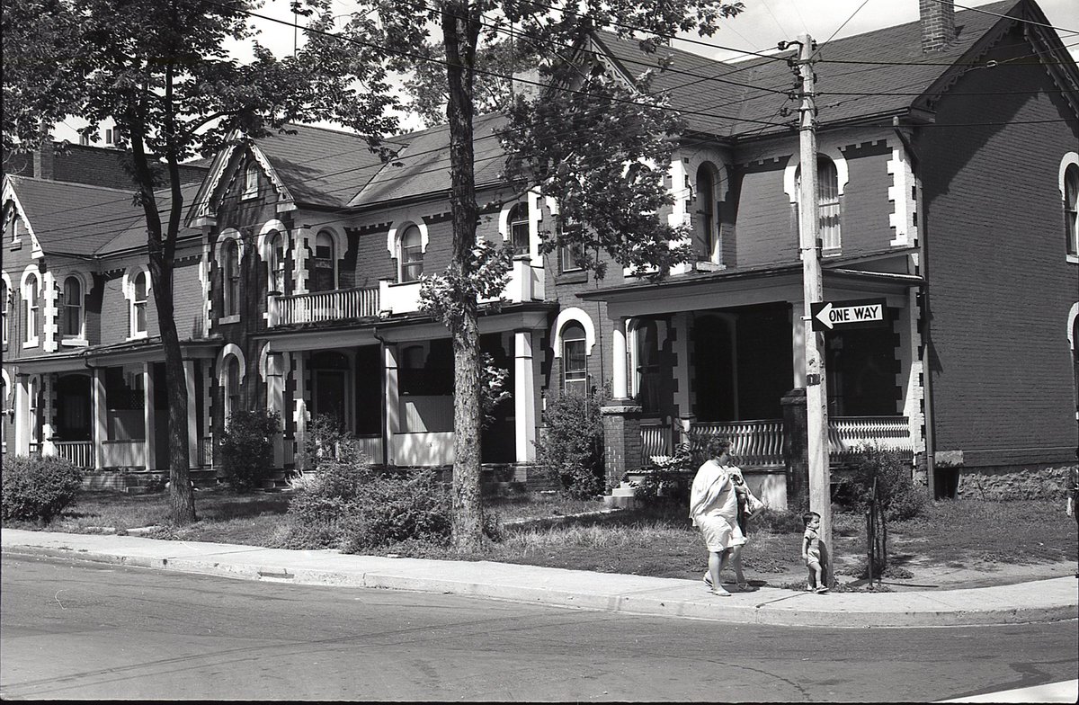
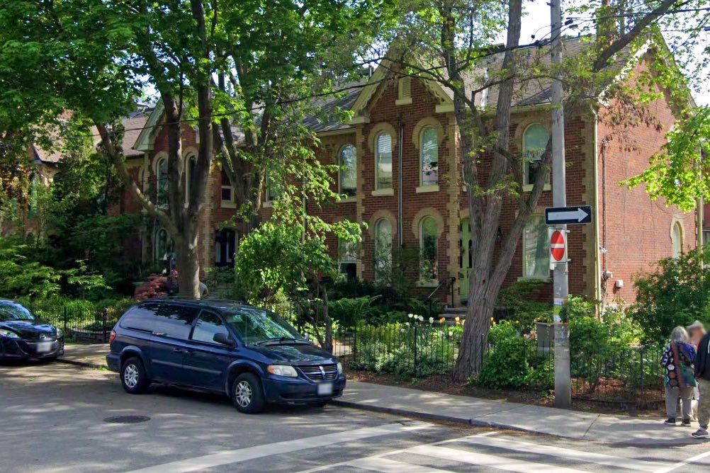
Northeast corner of Rose Ave & Winchester St. These houses still stand today. The one-way now runs in the other direction.
Northeast corner of Rose Ave & Winchester St. These houses still stand today. The one-way now runs in the other direction.
#TPBscan #17
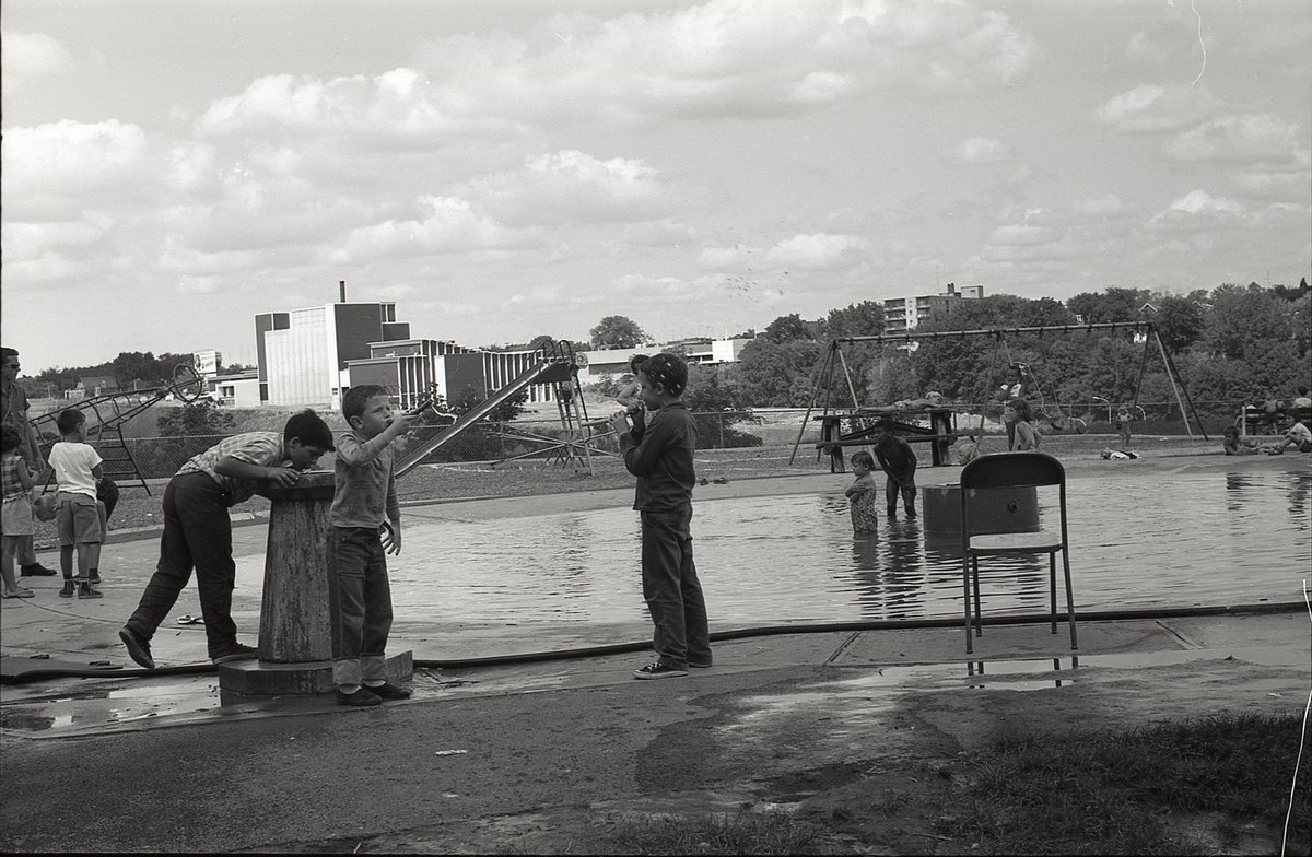
Looking northeast from the old wading pool at Wellesley Park, across the Don Valley. Today the view would be obscured by mature trees. In the distance, Parkway Vocational School, now City Adult Learning Centre.
Bonus: a classic rocket/capsule playground climber!
Looking northeast from the old wading pool at Wellesley Park, across the Don Valley. Today the view would be obscured by mature trees. In the distance, Parkway Vocational School, now City Adult Learning Centre.
Bonus: a classic rocket/capsule playground climber!
#TPBscan #18
Riverdale Zoo.
Not sure everybody was happy to be caught on camera.
Signs on the enclosures seem to read ‘mountain lion’ and ‘tiger’ (there is more, but can only make out part of it).
Riverdale Zoo.
Not sure everybody was happy to be caught on camera.
Signs on the enclosures seem to read ‘mountain lion’ and ‘tiger’ (there is more, but can only make out part of it).
#TPBscan #19
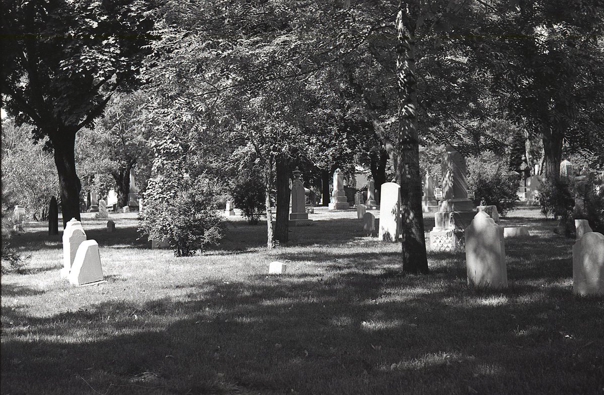
Based on the locations of other photographs in this roll, this was likely taken at Toronto Necropolis.
Based on the locations of other photographs in this roll, this was likely taken at Toronto Necropolis.
#TPBscan #20
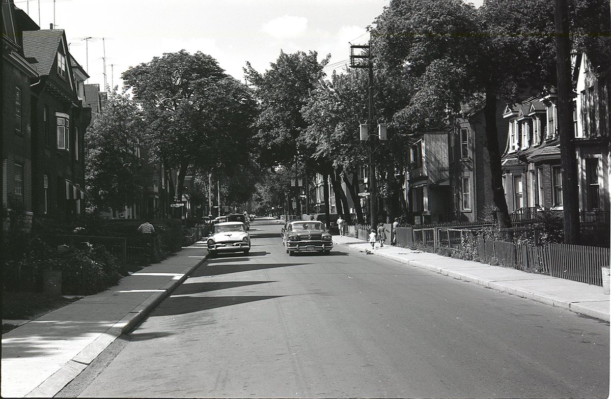
Looking north along Sackville Street, toward the intersection with Sackville Place/Millington Street.
Looking north along Sackville Street, toward the intersection with Sackville Place/Millington Street.
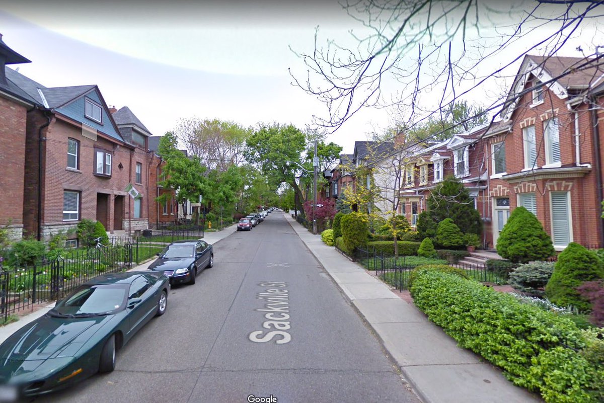
A lot of big trees have been lost over the years, and the front landscaping has sure changed, but the houses pretty much seem to all remain.
#TPBscan #21
SW corner of Spruce and Sumach.
Then the Gerrard Kiwanis Boys Club, now the Toronto Kiwanis Boys & Girls Clubs, Miles & Kelly Nadal Youth Centre.
SW corner of Spruce and Sumach.
Then the Gerrard Kiwanis Boys Club, now the Toronto Kiwanis Boys & Girls Clubs, Miles & Kelly Nadal Youth Centre.
#TPBscan #22
Pretty sure this location is Carlton and Sumach, by Riverdale Park, looking east along the last block of Carlton.
Love the old snack vending cart. Versions of those things used to be everywhere.
Pretty sure this location is Carlton and Sumach, by Riverdale Park, looking east along the last block of Carlton.
Love the old snack vending cart. Versions of those things used to be everywhere.
#TPBscan #23
West side of Parliament, at Gerrard, looking north.
- M & M Store (gifts & toys / post office / Borden’s ice cream)
- Power grocery store up the street
- 3 of the next 4 pics have streetcar cameos (Cc: @SwanBoatSteve)
West side of Parliament, at Gerrard, looking north.
- M & M Store (gifts & toys / post office / Borden’s ice cream)
- Power grocery store up the street
- 3 of the next 4 pics have streetcar cameos (Cc: @SwanBoatSteve)
#TPBscan #24
Two front porches that appear to be chained off, and a sign on one door that reads ‘CONDEMNED, UNFIT FOR HABITATION’.
Unsure of address, but likely near Gerrard & Parliament.
Two front porches that appear to be chained off, and a sign on one door that reads ‘CONDEMNED, UNFIT FOR HABITATION’.
Unsure of address, but likely near Gerrard & Parliament.
#TPBscan #25
South side of Gerrard, just on the edge of Regent Park, looking west towards Parliament.
Dominion grocery across the street (‘mainly because of the meat’), followed by The Gerrard Tavern. Library visible at the end of the block.
South side of Gerrard, just on the edge of Regent Park, looking west towards Parliament.
Dominion grocery across the street (‘mainly because of the meat’), followed by The Gerrard Tavern. Library visible at the end of the block.
#TPBscan #26
Last photo from this roll.
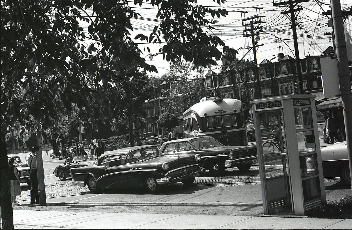
Phone booths, streetcars, and vintage vehicles at Gerrard and Parliament. Taken from the southeast corner, looking northwest across the island parkette.
I’m no car guy, but I do enjoy some of the old ‘50s/‘60s models in these pics.
Last photo from this roll.
Phone booths, streetcars, and vintage vehicles at Gerrard and Parliament. Taken from the southeast corner, looking northwest across the island parkette.
I’m no car guy, but I do enjoy some of the old ‘50s/‘60s models in these pics.
#TPBscan #27
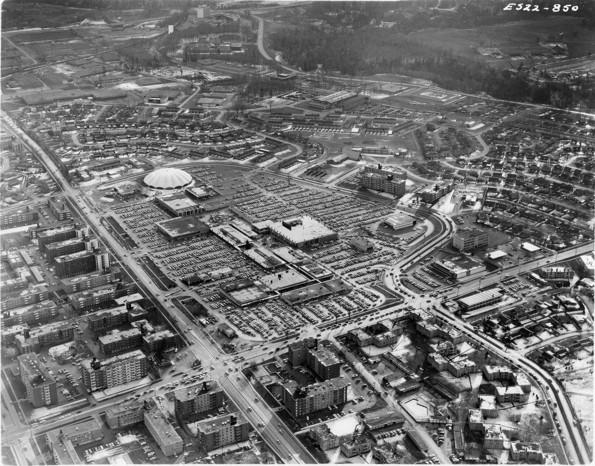
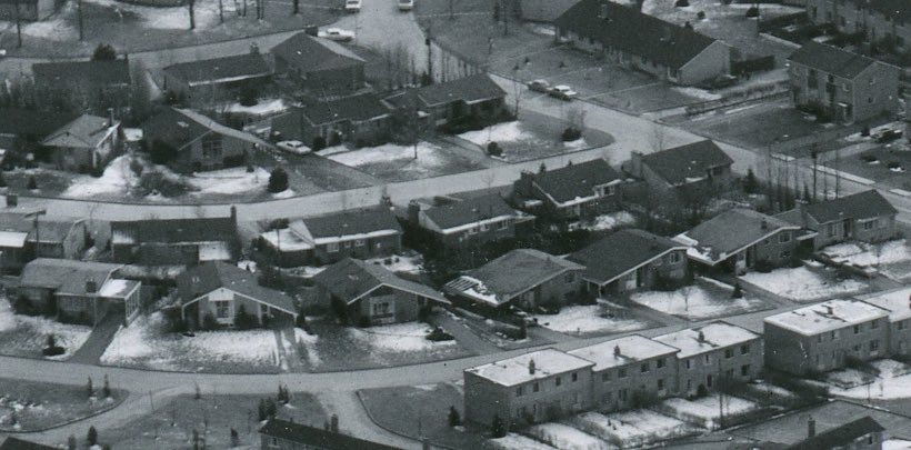
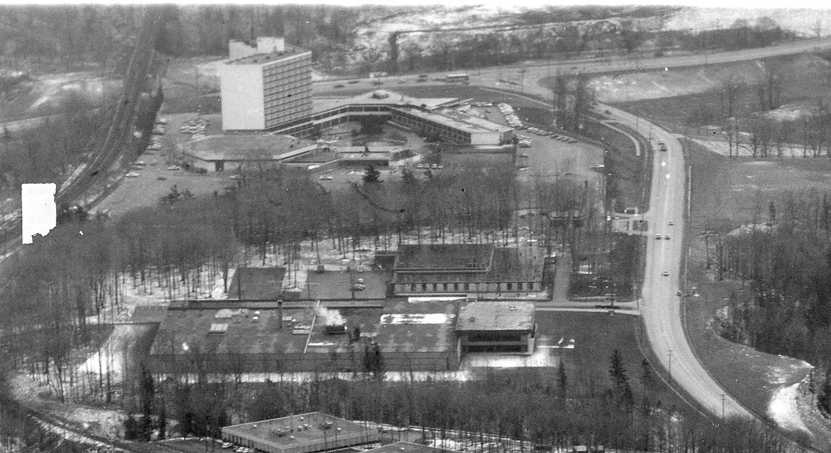
A Lockwood Survey aerial photograph of Don Mills. I could have done a thread on this one shot - if you zoom in, there is a LOT of detail here. Some good views of the Don Mills Centre open air mall. Unsure of the date - some other aerials were 1968.
A Lockwood Survey aerial photograph of Don Mills. I could have done a thread on this one shot - if you zoom in, there is a LOT of detail here. Some good views of the Don Mills Centre open air mall. Unsure of the date - some other aerials were 1968.
As pointed out by @fellowplanner, The Inn on the Park (another Peter Dickinson-designed hotel/resort) is visible at the top edge of the aerial photo.

 Read on Twitter
