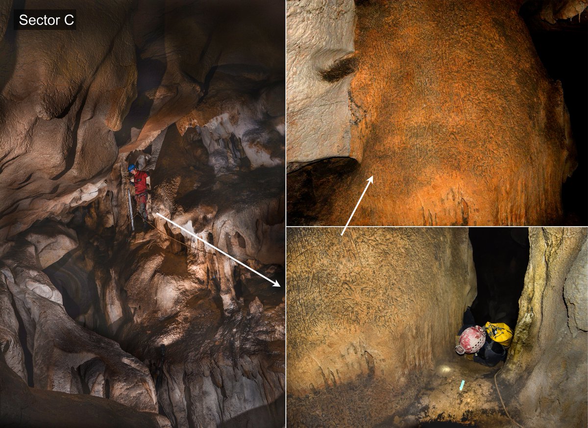
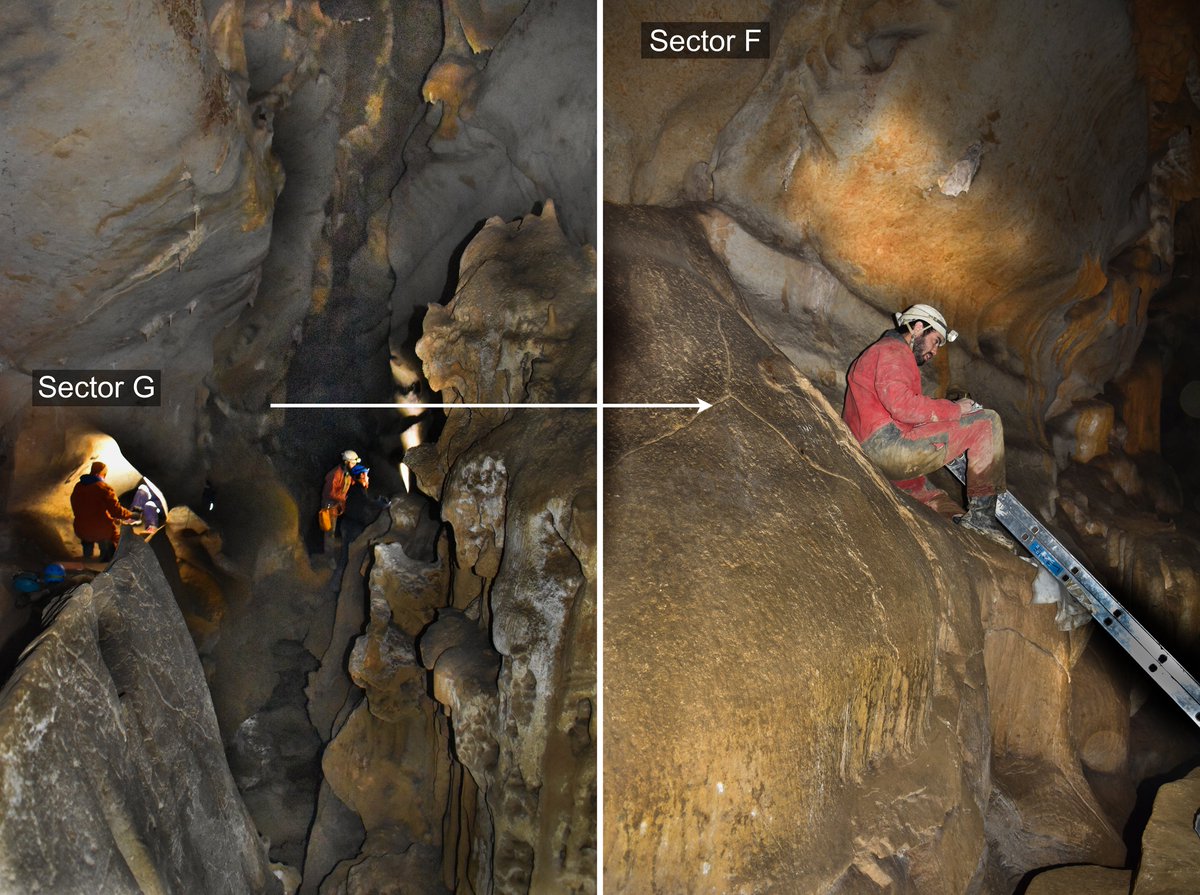
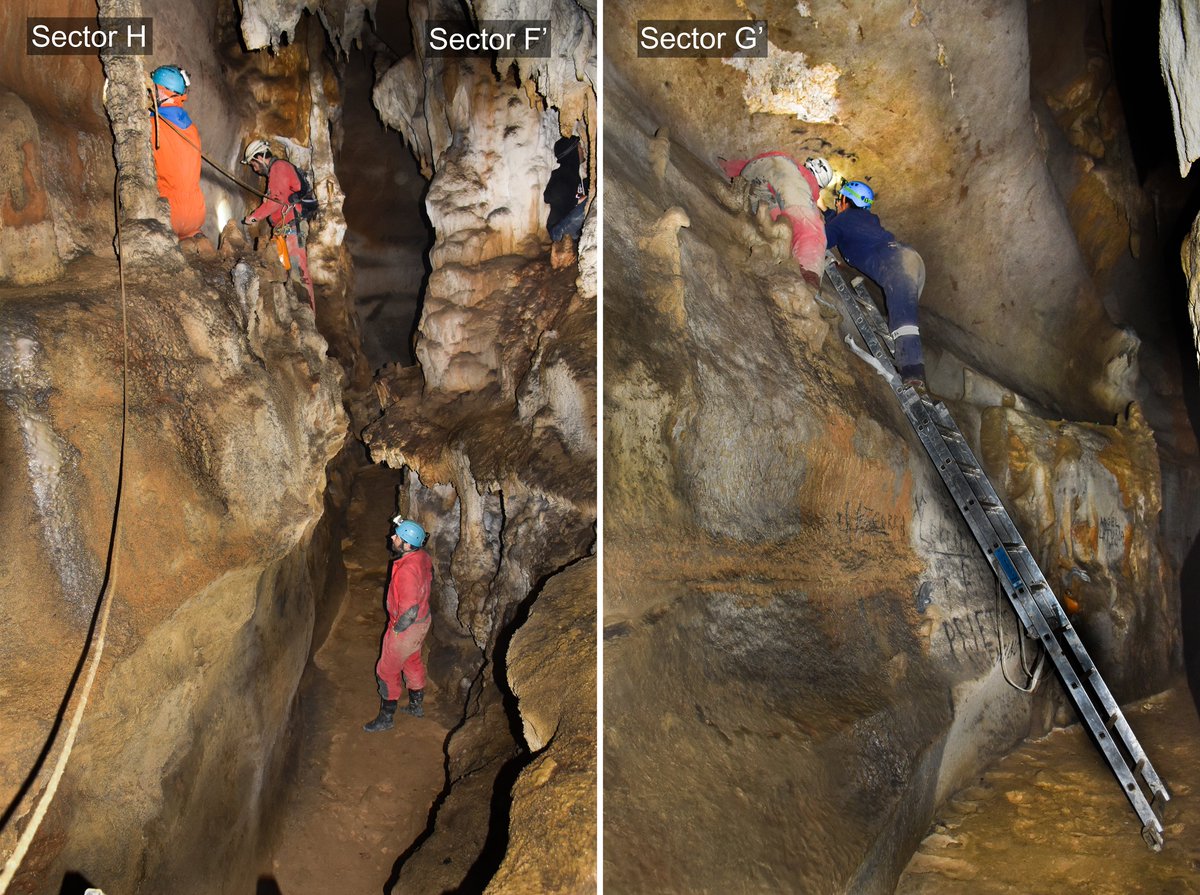
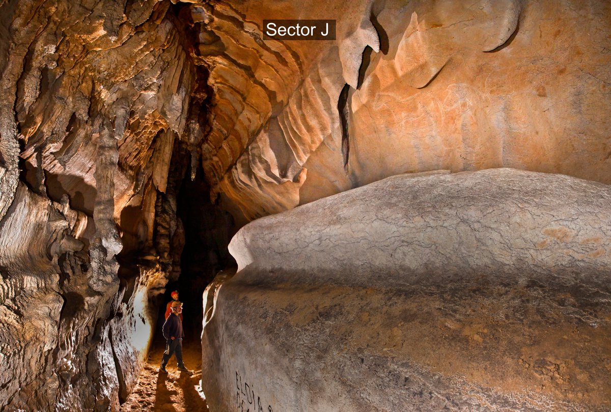
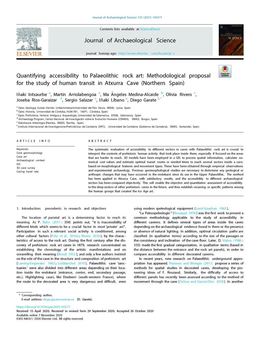
Hello https://abs.twimg.com/emoji/v2/... draggable="false" alt="👋" title="Waving hand" aria-label="Emoji: Waving hand">! We are glad to present a new paper in Journal of Archaeological Science @sciencedirect with a methodological proposal to assess the difficulty values of access to reach the decorated sectors in caves with Palaeolithic art
 https://abs.twimg.com/emoji/v2/... draggable="false" alt="👇" title="Rückhand Zeigefinger nach unten" aria-label="Emoji: Rückhand Zeigefinger nach unten">
 https://abs.twimg.com/emoji/v2/... draggable="false" alt="😉" title="Zwinkerndes Gesicht" aria-label="Emoji: Zwinkerndes Gesicht">:
https://www.sciencedirect.com/science/article/pii/S0305440320301928?via%3Dihub
https://www.sciencedirect.com/science/a... href="https://twtext.com//hashtag/Paleospeleology"> #Paleospeleology
https://www.sciencedirect.com/science/article/pii/S0305440320301928?via%3Dihub
The study, carried out by researchers of @upvehu, @Univcordoba, @LabTecUsal ( @usal), @CENIEH, @EdestiaurreInfo and IIIPC ( @unican), is part of the PhD project of @inaki_intxaurbe ( @before_art) (directed by @GarateDiego and @497bce3721874fb).  https://abs.twimg.com/emoji/v2/... draggable="false" alt="👇" title="Rückhand Zeigefinger nach unten" aria-label="Emoji: Rückhand Zeigefinger nach unten">
 https://abs.twimg.com/emoji/v2/... draggable="false" alt="😉" title="Zwinkerndes Gesicht" aria-label="Emoji: Zwinkerndes Gesicht"> https://www.researchgate.net/project/The-exploration-and-appropriation-of-the-underground-environment-in-the-paleolithic-an-approach-from-geology-and-parietal-art">https://www.researchgate.net/project/T...
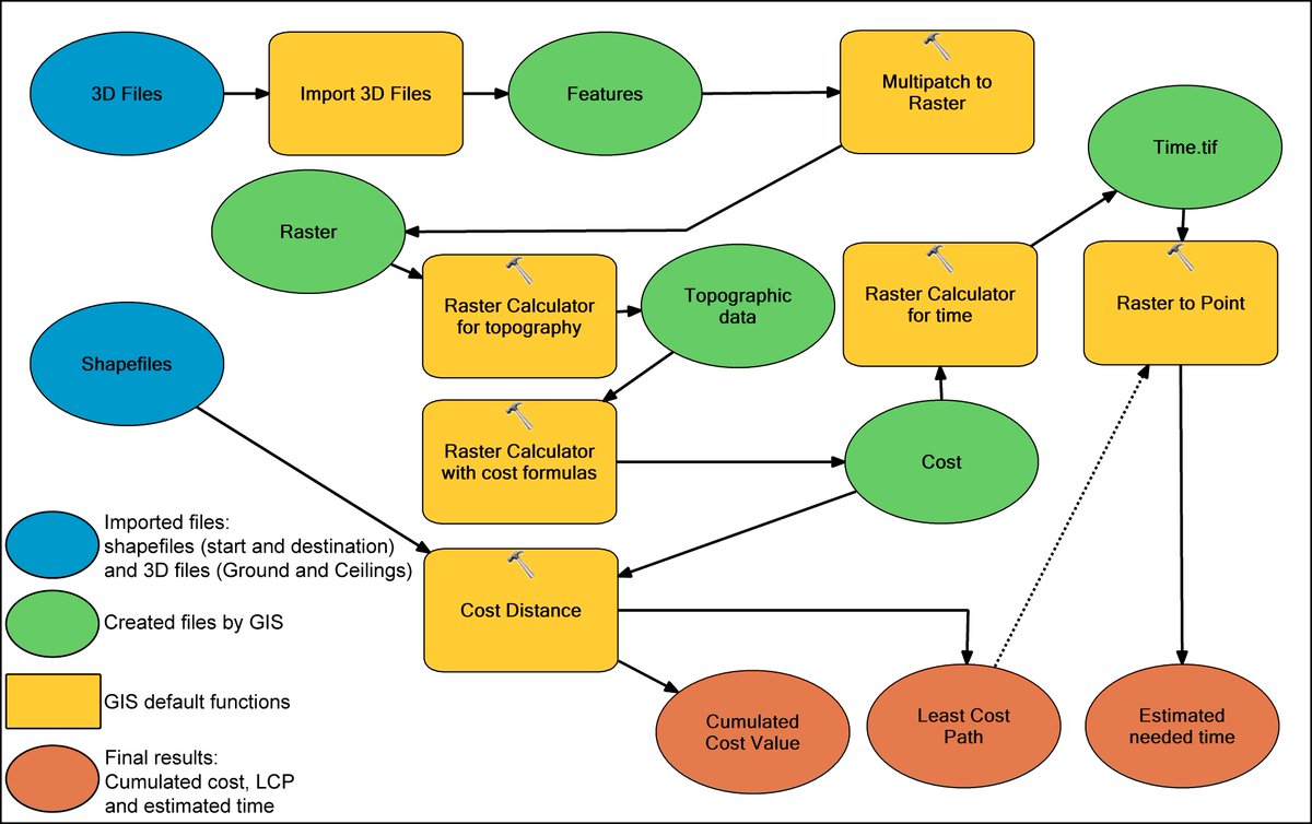
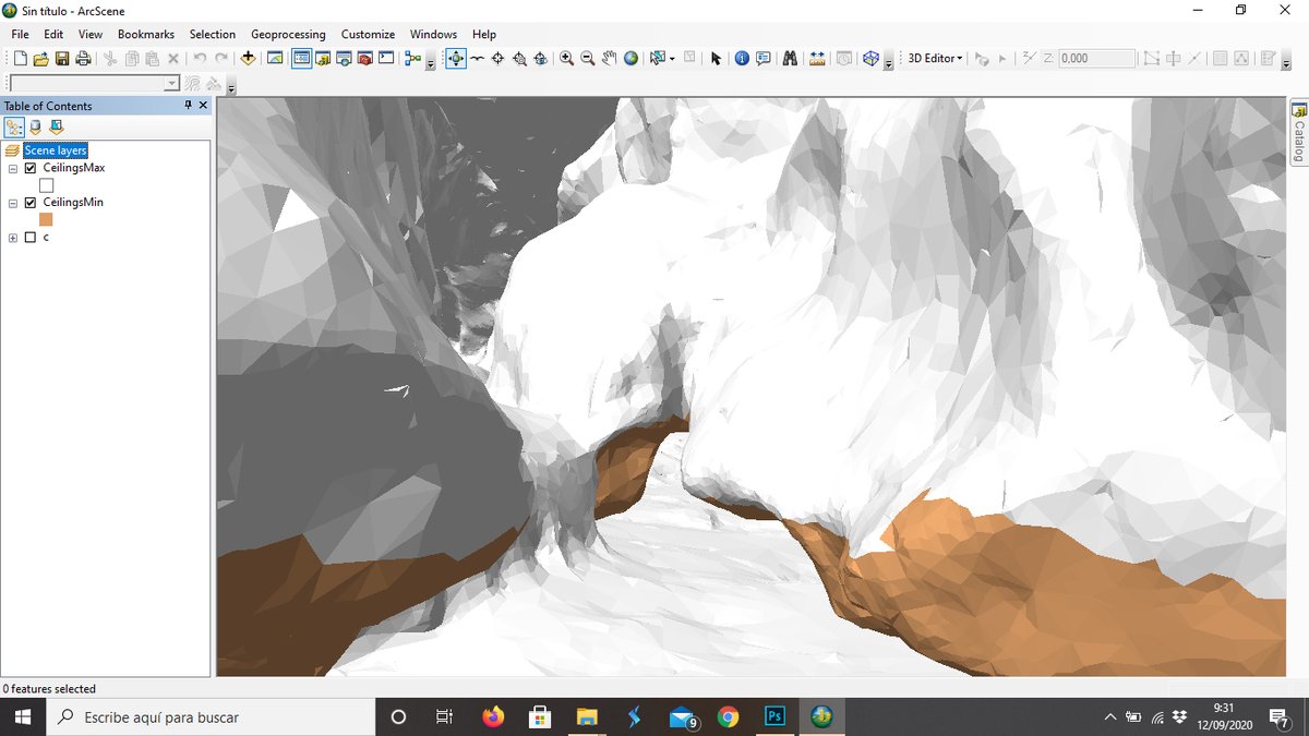
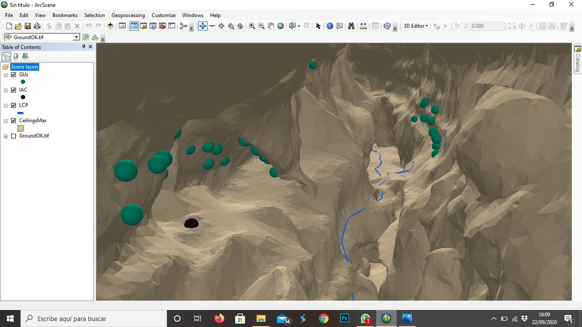
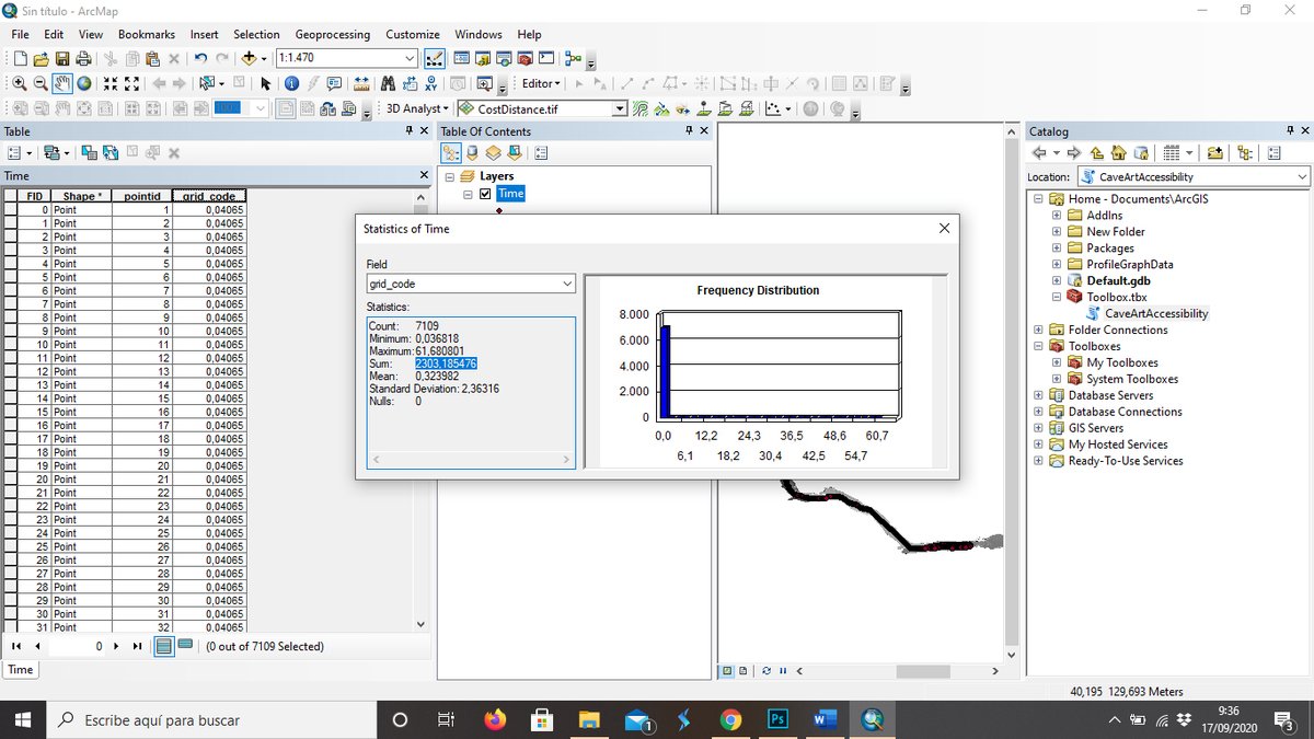
In this new work, 3D models have been employed in a #GIS to process spatial information, calculate numerical cost values and estimate optimal transit routes or needed times to reach several sectors inside a cave, based on morphological features and movement types.
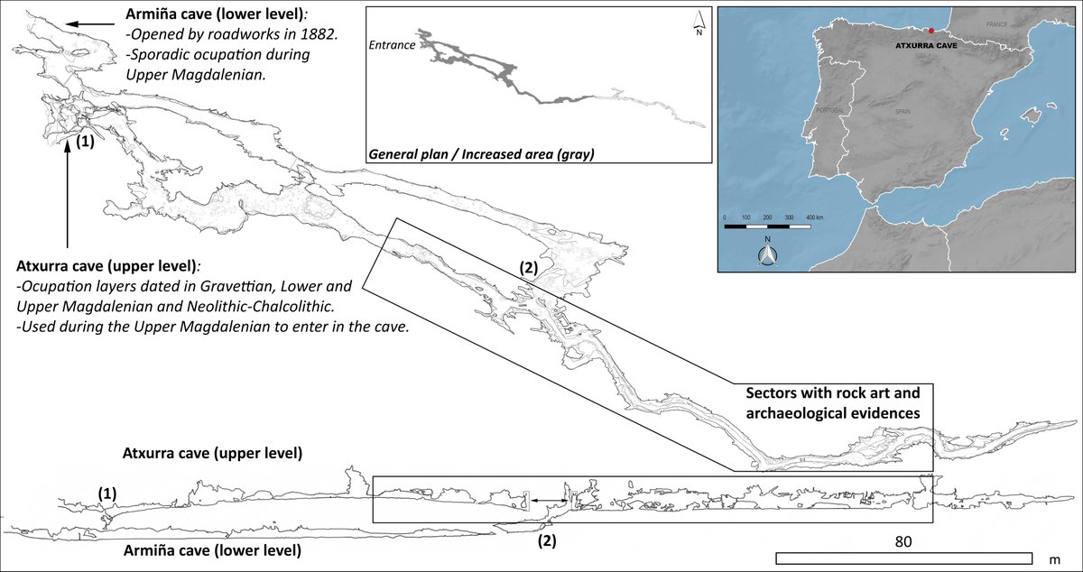
Previous #geomorphological studies are necessary to determine any geological or anthropic changes that may have occurred in the endokarst since its use in the Upper Palaeolithic.  https://abs.twimg.com/emoji/v2/... draggable="false" alt="🤔" title="Denkendes Gesicht" aria-label="Emoji: Denkendes Gesicht">
 https://abs.twimg.com/emoji/v2/... draggable="false" alt="🔬" title="Mikroskop" aria-label="Emoji: Mikroskop">
 https://abs.twimg.com/emoji/v2/... draggable="false" alt="⛏️" title="Spitzhacke" aria-label="Emoji: Spitzhacke">
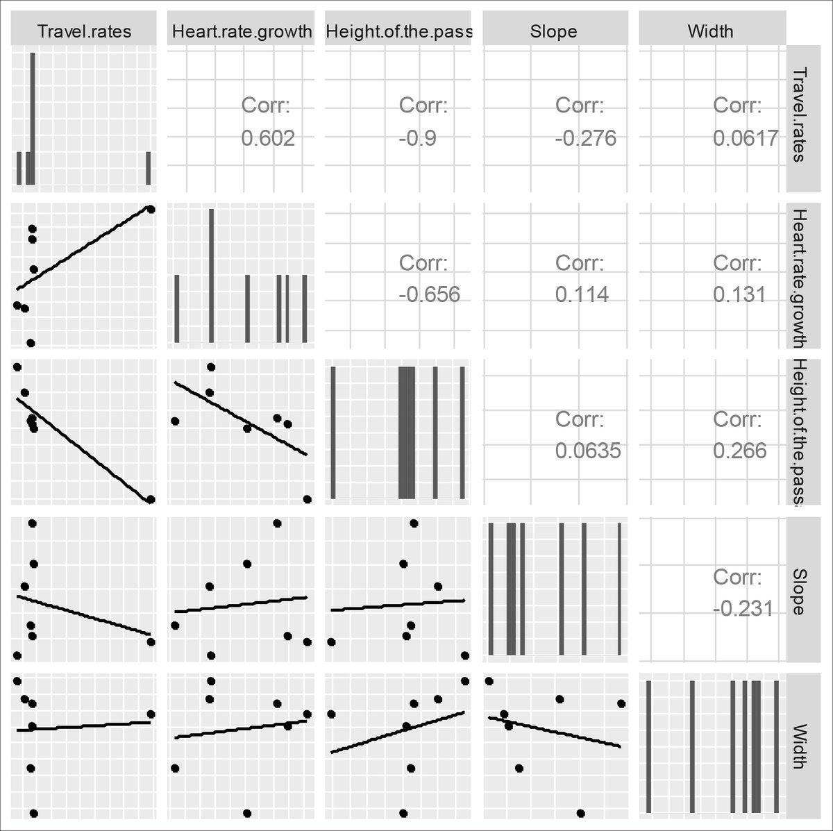
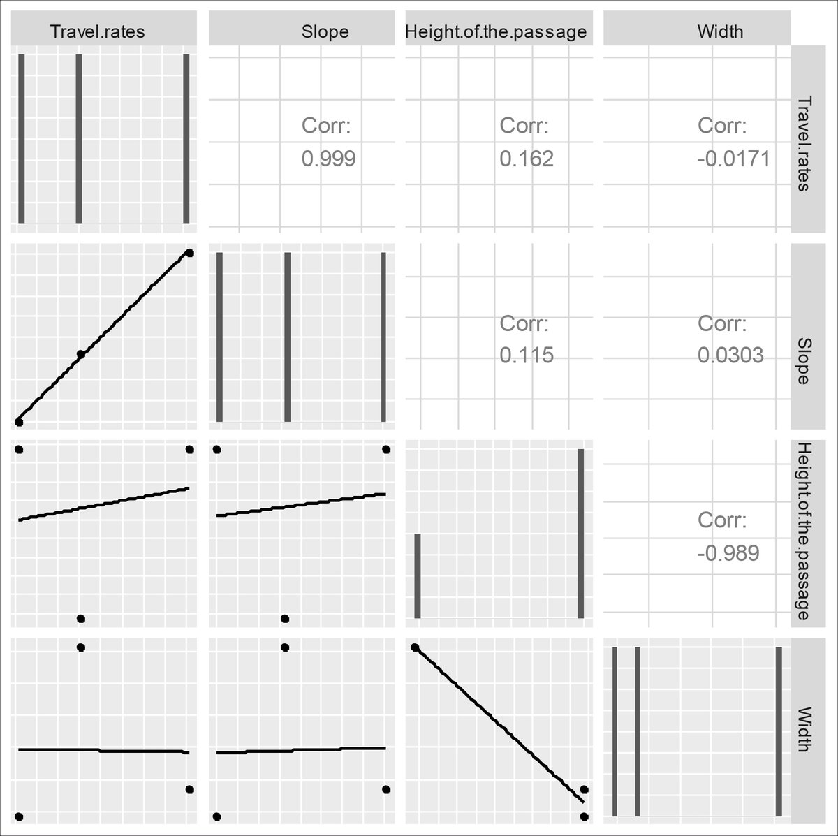
These have been obtained through empirical observations and experimental archaeology, with people with different physical and sports skills, coming from different disciplines (cavers, archaeologist, biologist and geologist) and different levels of experience in caving https://abs.twimg.com/emoji/v2/... draggable="false" alt="📸" title="Kamera mit Blitz" aria-label="Emoji: Kamera mit Blitz">.
The workflow has been resumed in a python script  https://abs.twimg.com/emoji/v2/... draggable="false" alt="💻" title="Computer" aria-label="Emoji: Computer"> to make it more accessible to other researchers. We will be able to identify common patterns in the selection of the most inaccessible and deepest decorated and anthropized spaces, and analyse the characteristics of the...
... graphic production and other activities carried out in them compared with spaces with easier access, in order to observe any differences in the patterns and envisage the possible solutions or mechanisms that Palaeolithic groups designed for the exploration of the caves.
In conclusion, the application of this new methodology will achieve a better understanding of human behaviour inside the caves and the complexity of artistic activities, in order to unravel the symbolic purposes of Palaeolithic societies.
End of thread!!! https://abs.twimg.com/emoji/v2/... draggable="false" alt="👋" title="Waving hand" aria-label="Emoji: Waving hand">
 https://abs.twimg.com/emoji/v2/... draggable="false" alt="😜" title="Winking face with tongue" aria-label="Emoji: Winking face with tongue">
End of thread!!!

 Read on Twitter
 https://abs.twimg.com/emoji/v2/... draggable="false" alt="🔬" title="Mikroskop" aria-label="Emoji: Mikroskop">https://abs.twimg.com/emoji/v2/... draggable="false" alt="⛏️" title="Spitzhacke" aria-label="Emoji: Spitzhacke">" title="Previous #geomorphological studies are necessary to determine any geological or anthropic changes that may have occurred in the endokarst since its use in the Upper Palaeolithic. https://abs.twimg.com/emoji/v2/... draggable="false" alt="🤔" title="Denkendes Gesicht" aria-label="Emoji: Denkendes Gesicht">https://abs.twimg.com/emoji/v2/... draggable="false" alt="🔬" title="Mikroskop" aria-label="Emoji: Mikroskop">https://abs.twimg.com/emoji/v2/... draggable="false" alt="⛏️" title="Spitzhacke" aria-label="Emoji: Spitzhacke">">
 https://abs.twimg.com/emoji/v2/... draggable="false" alt="🔬" title="Mikroskop" aria-label="Emoji: Mikroskop">https://abs.twimg.com/emoji/v2/... draggable="false" alt="⛏️" title="Spitzhacke" aria-label="Emoji: Spitzhacke">" title="Previous #geomorphological studies are necessary to determine any geological or anthropic changes that may have occurred in the endokarst since its use in the Upper Palaeolithic. https://abs.twimg.com/emoji/v2/... draggable="false" alt="🤔" title="Denkendes Gesicht" aria-label="Emoji: Denkendes Gesicht">https://abs.twimg.com/emoji/v2/... draggable="false" alt="🔬" title="Mikroskop" aria-label="Emoji: Mikroskop">https://abs.twimg.com/emoji/v2/... draggable="false" alt="⛏️" title="Spitzhacke" aria-label="Emoji: Spitzhacke">">
 https://abs.twimg.com/emoji/v2/... draggable="false" alt="🔬" title="Mikroskop" aria-label="Emoji: Mikroskop">https://abs.twimg.com/emoji/v2/... draggable="false" alt="⛏️" title="Spitzhacke" aria-label="Emoji: Spitzhacke">" title="Previous #geomorphological studies are necessary to determine any geological or anthropic changes that may have occurred in the endokarst since its use in the Upper Palaeolithic. https://abs.twimg.com/emoji/v2/... draggable="false" alt="🤔" title="Denkendes Gesicht" aria-label="Emoji: Denkendes Gesicht">https://abs.twimg.com/emoji/v2/... draggable="false" alt="🔬" title="Mikroskop" aria-label="Emoji: Mikroskop">https://abs.twimg.com/emoji/v2/... draggable="false" alt="⛏️" title="Spitzhacke" aria-label="Emoji: Spitzhacke">">
 https://abs.twimg.com/emoji/v2/... draggable="false" alt="🔬" title="Mikroskop" aria-label="Emoji: Mikroskop">https://abs.twimg.com/emoji/v2/... draggable="false" alt="⛏️" title="Spitzhacke" aria-label="Emoji: Spitzhacke">" title="Previous #geomorphological studies are necessary to determine any geological or anthropic changes that may have occurred in the endokarst since its use in the Upper Palaeolithic. https://abs.twimg.com/emoji/v2/... draggable="false" alt="🤔" title="Denkendes Gesicht" aria-label="Emoji: Denkendes Gesicht">https://abs.twimg.com/emoji/v2/... draggable="false" alt="🔬" title="Mikroskop" aria-label="Emoji: Mikroskop">https://abs.twimg.com/emoji/v2/... draggable="false" alt="⛏️" title="Spitzhacke" aria-label="Emoji: Spitzhacke">">
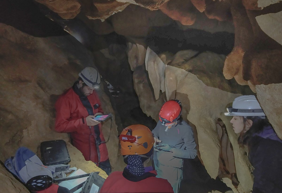 ." title="These have been obtained through empirical observations and experimental archaeology, with people with different physical and sports skills, coming from different disciplines (cavers, archaeologist, biologist and geologist) and different levels of experience in cavinghttps://abs.twimg.com/emoji/v2/... draggable="false" alt="📸" title="Kamera mit Blitz" aria-label="Emoji: Kamera mit Blitz">.">
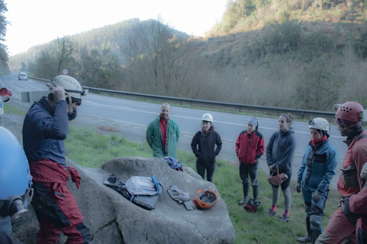 ." title="These have been obtained through empirical observations and experimental archaeology, with people with different physical and sports skills, coming from different disciplines (cavers, archaeologist, biologist and geologist) and different levels of experience in cavinghttps://abs.twimg.com/emoji/v2/... draggable="false" alt="📸" title="Kamera mit Blitz" aria-label="Emoji: Kamera mit Blitz">.">
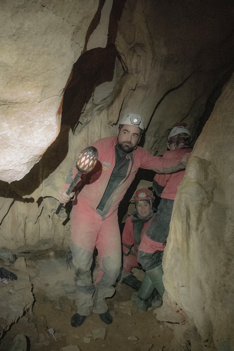 ." title="These have been obtained through empirical observations and experimental archaeology, with people with different physical and sports skills, coming from different disciplines (cavers, archaeologist, biologist and geologist) and different levels of experience in cavinghttps://abs.twimg.com/emoji/v2/... draggable="false" alt="📸" title="Kamera mit Blitz" aria-label="Emoji: Kamera mit Blitz">.">
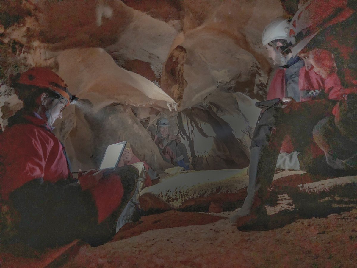 ." title="These have been obtained through empirical observations and experimental archaeology, with people with different physical and sports skills, coming from different disciplines (cavers, archaeologist, biologist and geologist) and different levels of experience in cavinghttps://abs.twimg.com/emoji/v2/... draggable="false" alt="📸" title="Kamera mit Blitz" aria-label="Emoji: Kamera mit Blitz">.">
 to make it more accessible to other researchers. We will be able to identify common patterns in the selection of the most inaccessible and deepest decorated and anthropized spaces, and analyse the characteristics of the..." title="The workflow has been resumed in a python script https://abs.twimg.com/emoji/v2/... draggable="false" alt="💻" title="Computer" aria-label="Emoji: Computer"> to make it more accessible to other researchers. We will be able to identify common patterns in the selection of the most inaccessible and deepest decorated and anthropized spaces, and analyse the characteristics of the...">
 to make it more accessible to other researchers. We will be able to identify common patterns in the selection of the most inaccessible and deepest decorated and anthropized spaces, and analyse the characteristics of the..." title="The workflow has been resumed in a python script https://abs.twimg.com/emoji/v2/... draggable="false" alt="💻" title="Computer" aria-label="Emoji: Computer"> to make it more accessible to other researchers. We will be able to identify common patterns in the selection of the most inaccessible and deepest decorated and anthropized spaces, and analyse the characteristics of the...">
 to make it more accessible to other researchers. We will be able to identify common patterns in the selection of the most inaccessible and deepest decorated and anthropized spaces, and analyse the characteristics of the..." title="The workflow has been resumed in a python script https://abs.twimg.com/emoji/v2/... draggable="false" alt="💻" title="Computer" aria-label="Emoji: Computer"> to make it more accessible to other researchers. We will be able to identify common patterns in the selection of the most inaccessible and deepest decorated and anthropized spaces, and analyse the characteristics of the...">
 to make it more accessible to other researchers. We will be able to identify common patterns in the selection of the most inaccessible and deepest decorated and anthropized spaces, and analyse the characteristics of the..." title="The workflow has been resumed in a python script https://abs.twimg.com/emoji/v2/... draggable="false" alt="💻" title="Computer" aria-label="Emoji: Computer"> to make it more accessible to other researchers. We will be able to identify common patterns in the selection of the most inaccessible and deepest decorated and anthropized spaces, and analyse the characteristics of the...">
