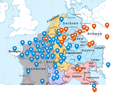
So, I asked my third-year Special Subject students (Lothar II& #39;s divorce) to map places mentioned in the Annals of St-Bertin and the Annals of Fulda, to create comparative geographies of the Carolingian world. With their permission, here are some of the results:
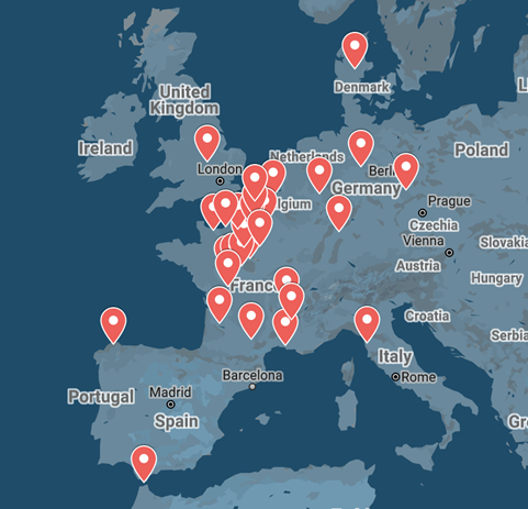
Here& #39;s a map of Viking attacks recorded 855-860.
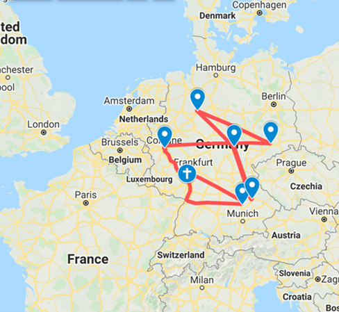
Here are the places mentioned in the Annals of Fulda 855-860 (look how concentrated it is on the Rhine)
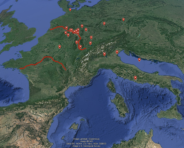
Here& #39;s the Annals of St-Bertin compared with the Annals of Fulda, 865-870
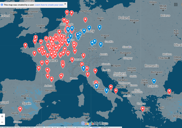
And here& #39;s a similar map, with the places plotted on an approximate political map.
There are plenty more, but I won& #39;t burden your timeline with them all! It& #39;s the first time I& #39;ve tried this exercise but I think I& #39;ll be doing it again: it& #39;s great for source-work, geographical familiarisation, and data visualisation.
PS: well done HST31030 students: overall a really good start to the module :)

 Read on Twitter