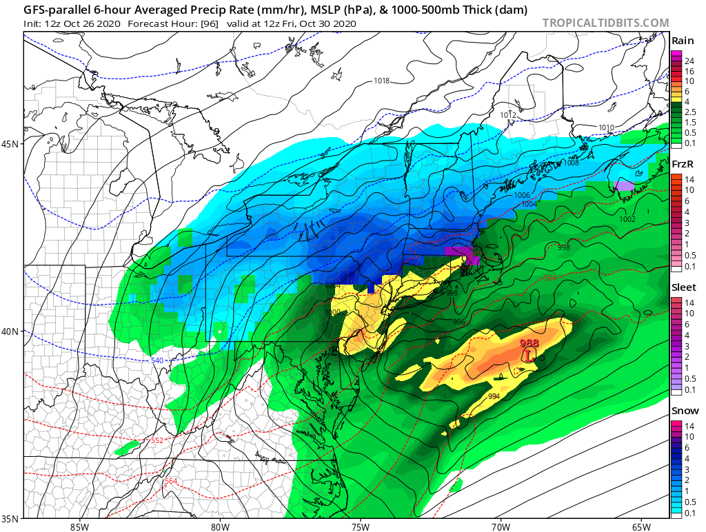
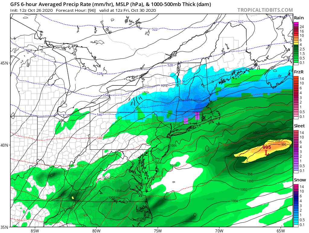
The new/upcoming GFS-PARA (at left) and the old/standard GFS (at right) have consistently had very different solutions for a potential snowstorm in the northeast late this week.
The former has consistently had more snow than the latter. Let& #39;s look at some reasons! #nywx
The former has consistently had more snow than the latter. Let& #39;s look at some reasons! #nywx
The current iteration of the GFS maintains the cyclonic circulation of #Zeta as the primary circulation throughout the event, until another very sheared out cyclone forms east of the coast, but too late to really do much for the northeast. #nywx
Meanwhile, the GFS-PARA is a bit faster with #Zeta, but then develops a much more coherent secondary low over the DC region. With colder air already in place and plentiful moisture, this solution is much more efficient at producing snow. #nywx
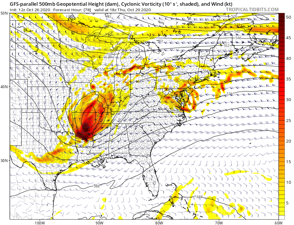
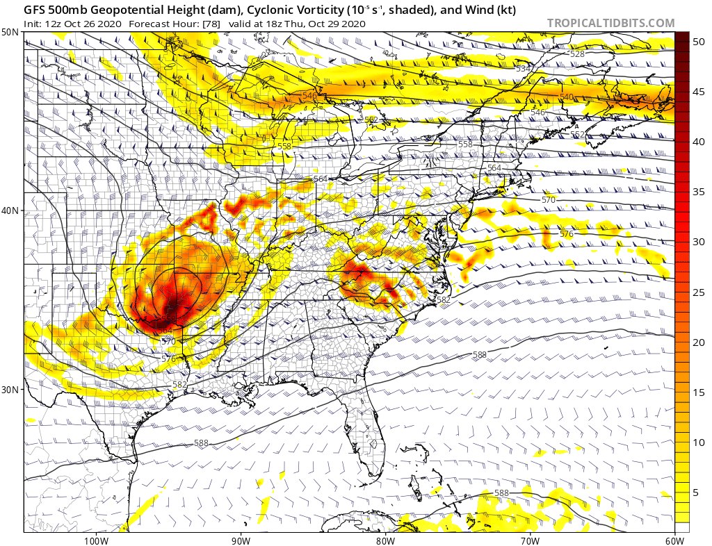
Note the difference in phasing potential between the GFS-PARA (left) and the GFS (right). In the latter, the cutoff is further west, but the northern stream vorticity further east. This northern stream difference helps shuts down and shear out secondary development. #nywx

 Read on Twitter


