Artsakh is Armenia — a long thread with historical facts, maps, documents and photographs  https://abs.twimg.com/emoji/v2/... draggable="false" alt="🇦🇲" title="Flagge von Armenien" aria-label="Emoji: Flagge von Armenien">
 https://abs.twimg.com/emoji/v2/... draggable="false" alt="❤️" title="Rotes Herz" aria-label="Emoji: Rotes Herz">
#PeaceforArmenians #StopAzerbaijaniAggression
#PeaceforArmenians #StopAzerbaijaniAggression
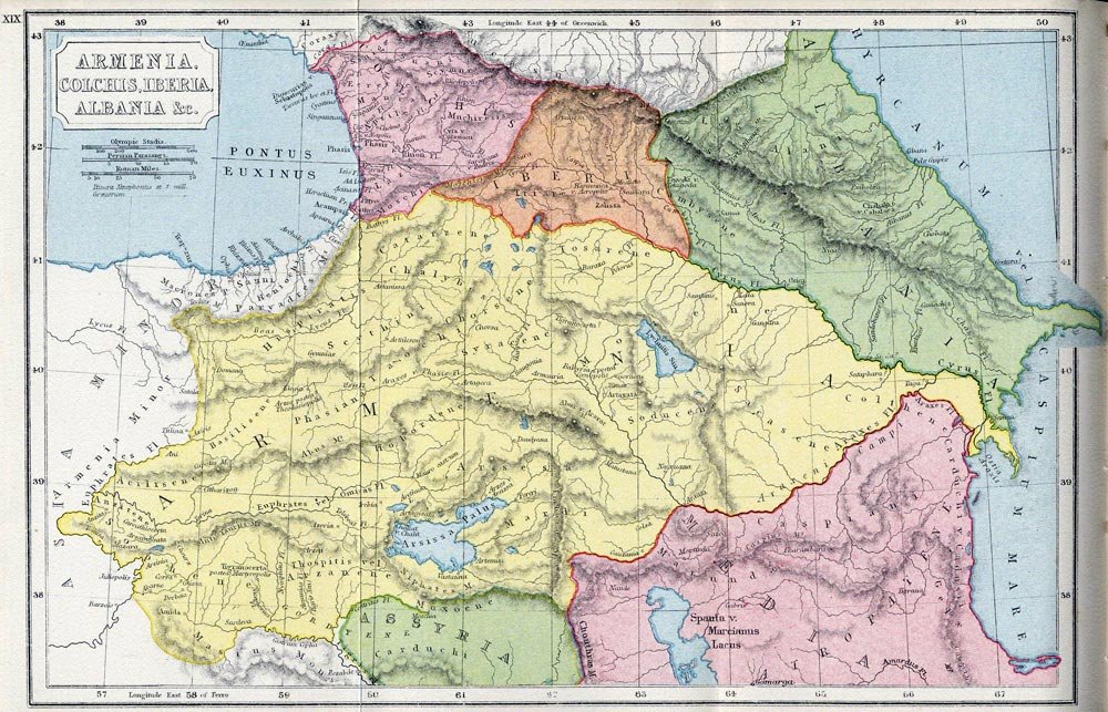
#Artsakh (Nagorno-Karabakh), as a part of Armenia, is mentioned in the works of
- Strabo
- Pliny the Elder
- Claudius Ptolemy
- Plutarch
- Dio Cassius and other ancient authors.
- Strabo
- Pliny the Elder
- Claudius Ptolemy
- Plutarch
- Dio Cassius and other ancient authors.
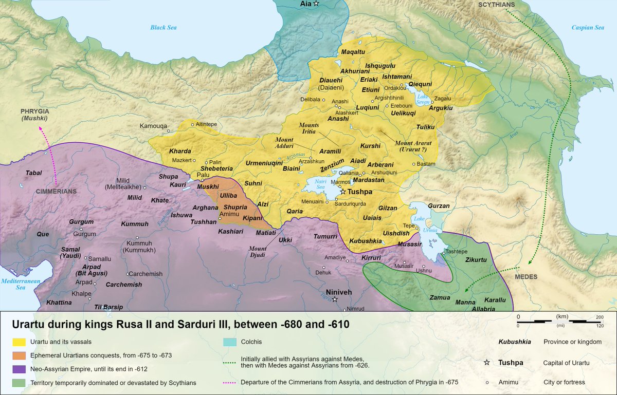
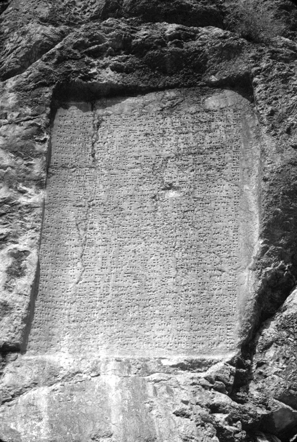
The first mentioning of #Artsakh dates back to the cuneiform script from the Uratuian King Sardur II of #Armenia (763-734 BC). The document mentions the country of Urtekhini, which the Greek geographer Strabo (63/64 BC - 24 AD) called Orkhistene, Artsakh in Armenian.
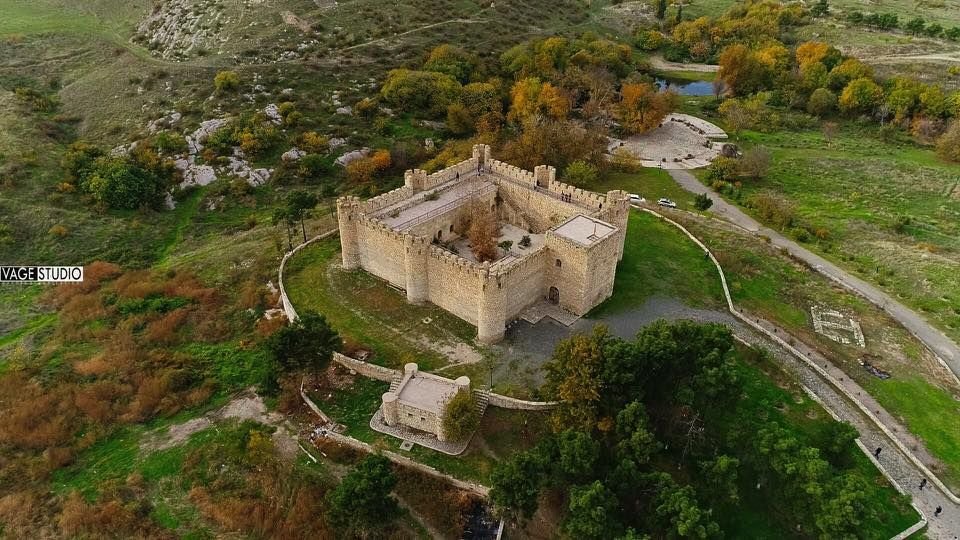
The ruins of the city #Tigranakert of #Artsakh, named after the Armenian King Tigran the Great (Tigran II), who ruled between 95 and 55 BC, was unearthed in 2005 under the supervision of archaeologist Dr Hamlet Petrosyan, near present-day Agdam.
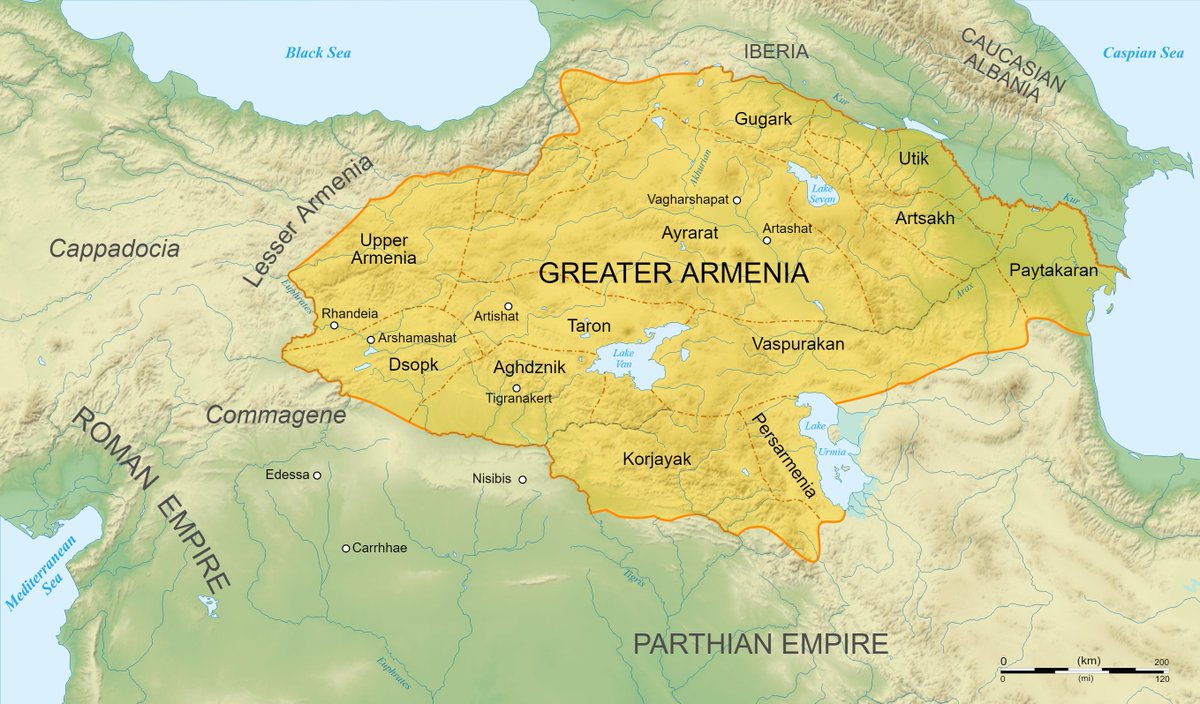
According to Strabo, as early as 100 BC, the people who lived in Greater #Armenia, including #Artsakh and Utik, spoke the same language, namely Armenian.
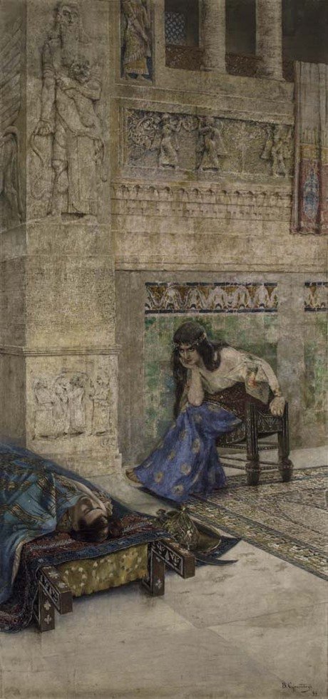
Speaking about the etymology of #Artsakh — the name Artsakh contains the root "tsakh" (ցախ) meaning "woods" in old #Armenian. And the "Ar" (Ար) part is related to the Armenian King Ara the Beautiful. As a whole, the word means "The woods of Ara".
(Artist: Vardges Surenyants)
(Artist: Vardges Surenyants)
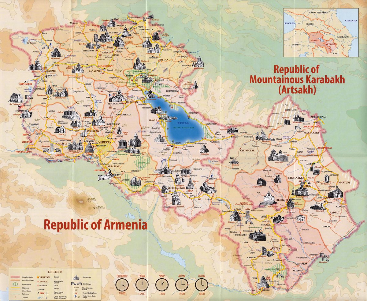
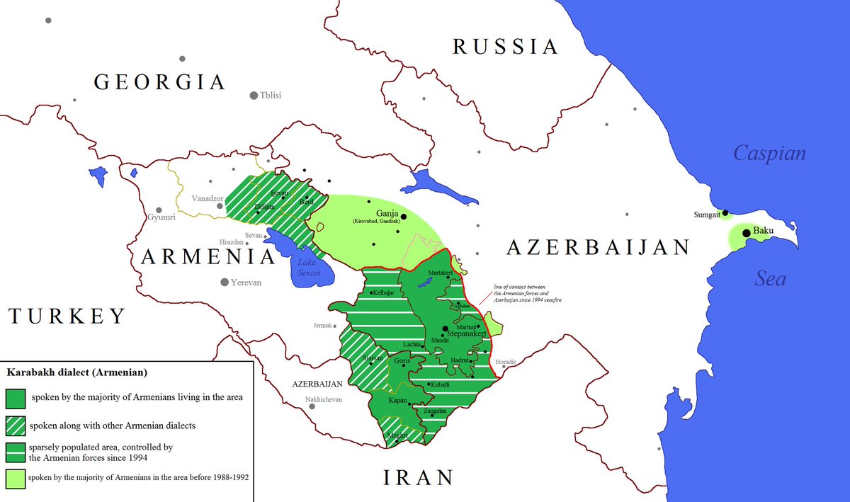
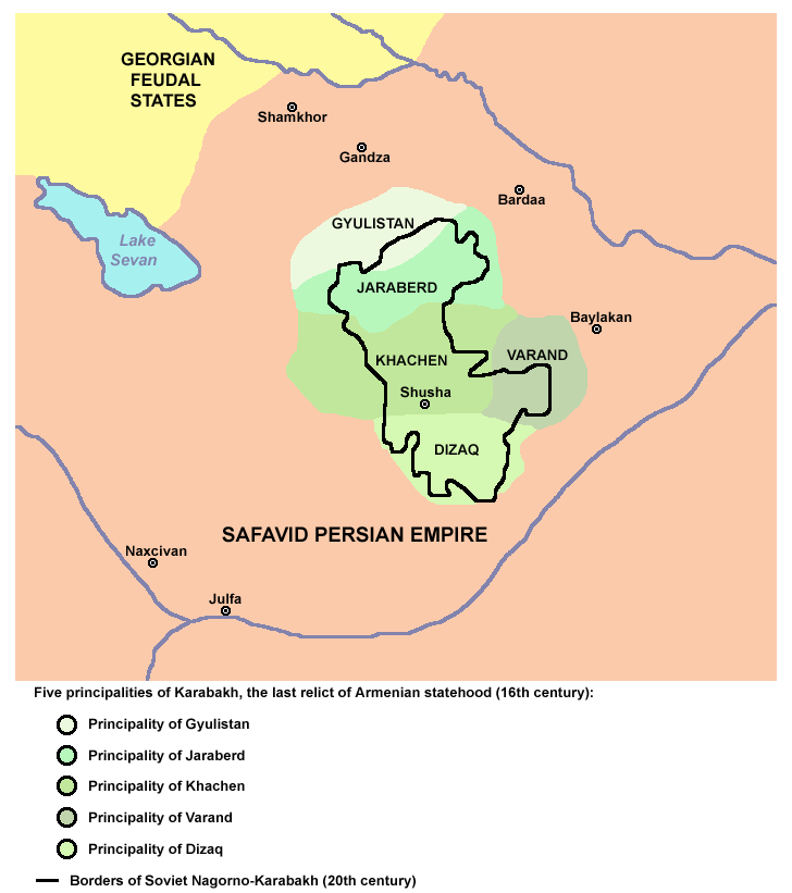
While Artsakh, in a traditional sense, is a larger region of ~15,000 square km, its political and cultural heir - the Republic of #Artsakh (NKR) - lays within the limits of Artsakh& #39;s five core counties: Giulistan, Jraberd, Khachen, Varanda and Dizak (5,300 sq km overall).
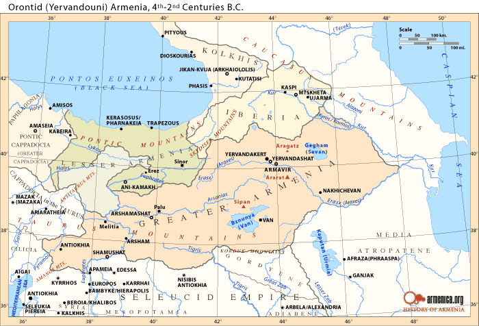
The #Armenian historian, Movses Khorenatsi (5th century AD), states that the province of Utik was during the 4th and 2nd centuries BC, along with #Artsakh, part of the Armenian Kingdom of Yervandouni, also known as Orontids.
According to the geography book belonging to the Armenian royal dynasty of Arshakounian "Greater #Armenia was divided into fifteen provinces, covering [...] #Artsakh, Siunik and Utik."
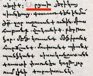
A paragraph related to #Artsakh (red-lined) from a manuscript copy of the “Ashkharhatsuyts”. This book, often translated as Geography in English sources, is an early Medieval #Armenian illustrated book by Anania Shirakatsi.
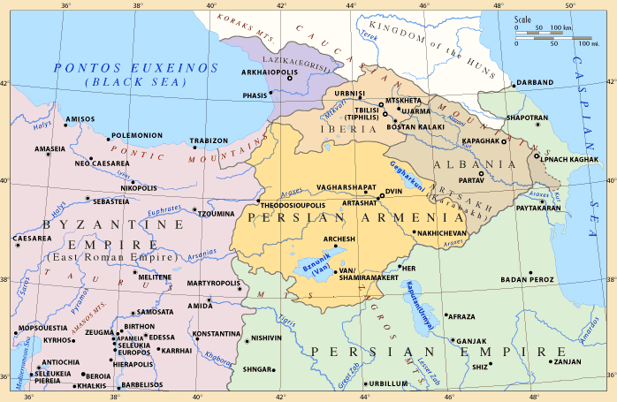
One of the present-day arguments mentioned by Azerbaijan is that Artsakh belonged to Azerbaijan& #39;s predecessor, Caucasian Albania. However, Strabo, Ptolemy and Pliny confirmed unanimously the border between Greater Armenia and Caucasian Albania was Kur river.
The fact that the River Kur is Albania& #39;s southern border and #Artsakh is located south of that river shows that there is no evidence that the area belonged to Albania or any other state than #Armenia.
The 8th-century #Armenian historian Stepanos Syunetsi was the first one to mention the local dialect of #Artsakh. In his «Բառք եղերականք» (Words of Tragedy), he wrote about the dialect of զԱրցախային meaning "of Artsakh", the historical Armenian name of Karabakh.
In 387, Armenia was divided between the Roman Empire and Persia, Artsakh, Utik and Paytakaran, ended up in Caucasian Albania& #39;s rule, which was a satrapy under the Persian Sasanid Dynasty. This Albanian sovereignty was very brief and lasted roughly 200 years, until the early 7th c
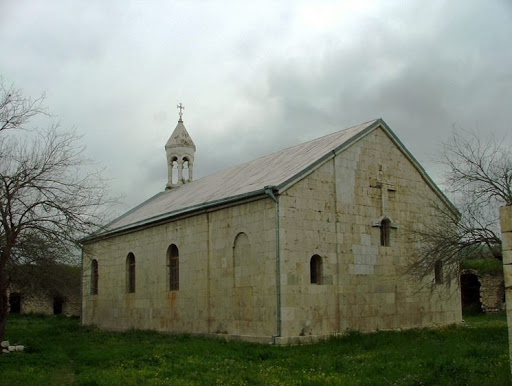
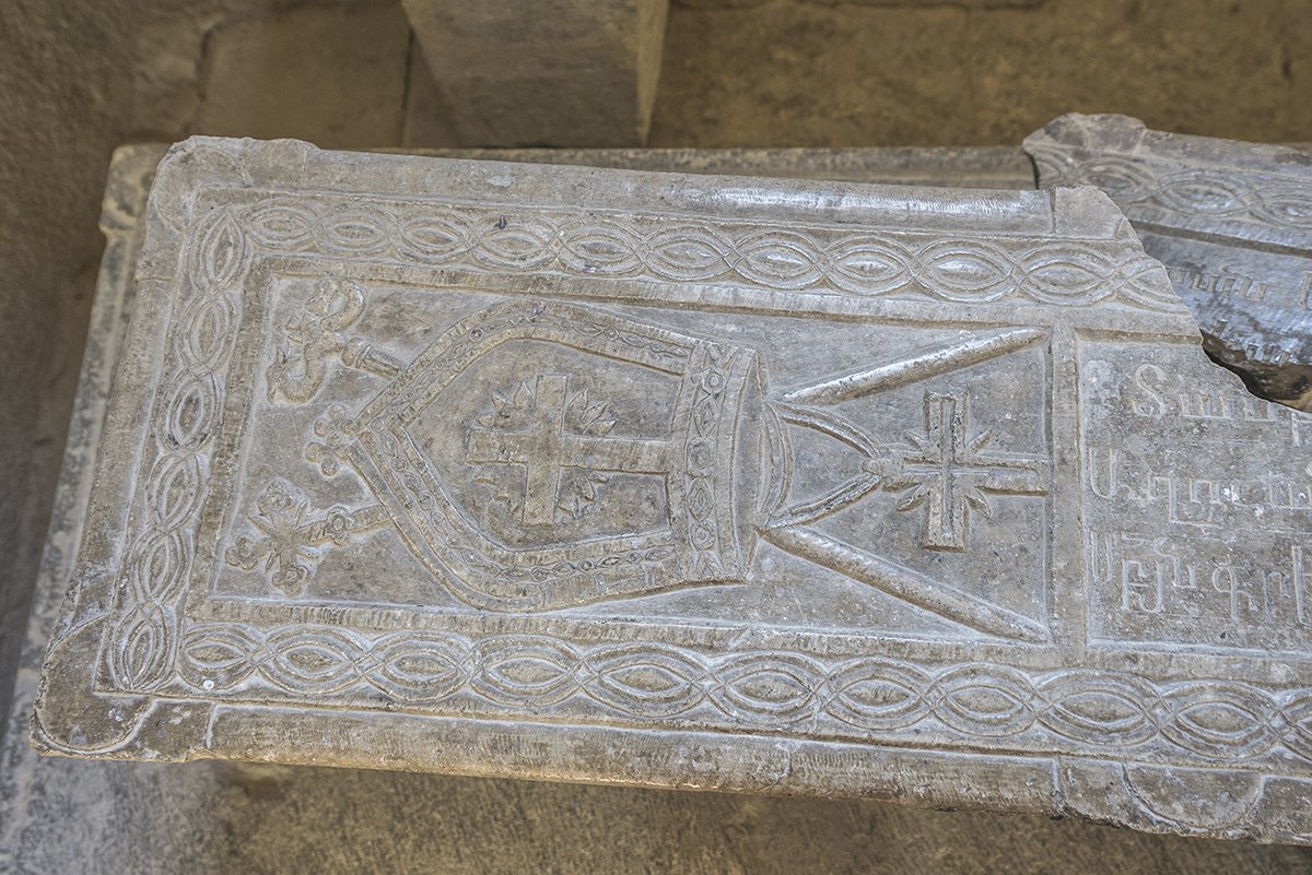
During the 4th century, #Christianity began to spread in #Artsakh. Amaras was the burial place of St. Gregory the Illuminator& #39;s grandson, St. Grigoris (died in 338). A tomb built for his remains still survives under the apse of the nineteenth-century church of St. Grigoris.
Yeghishe Arakyal Monastery or Monastery of Yeghishe the Apostle (5th century) is an #Armenian Apostolic Church located on the bank of the Tartar in the #Artsakh Republic. Because of the close proximity to the militarized border, no visitors are allowed to travel to the monastery.
From the beginning of the 9th century, Khachen and Dizak were storing up strength. During this time, valuable architecture was constructed, such as Hovanes Mkrtich church and the vestibule of Gandzasar monastery, the Dadi Monastery Cathedral Church.
[Gandzasar Monsatery]
[Gandzasar Monsatery]
The flag of Principality of Khachen dated 1214 portrays a golden cross in the first third of the length of the apricot field. The word "Khachen" originates from the word khach, which means "cross" in Armenian. The Royal apricot colour symbolizes the royal family. #Artsakh
During the latter half of the 13th century, #Artsakh fell in the hands of Tatars and Mongolians and it is during this period that the Turkish name Kara-bakh, black garden, is first mentioned.
#Karabakh
[a miniature of Mongols]
#Karabakh
[a miniature of Mongols]
In the 17th century, #Artsakh was divided into five small #Armenian principalities, also called Melikdoms:
1) Giulistan or Talish Melikdom
2) Jraberd or Charaberd Melikdom
3) Khachen Melikdom
4) Varanda Melikdom i
5) Dizak Melikdom
1) Giulistan or Talish Melikdom
2) Jraberd or Charaberd Melikdom
3) Khachen Melikdom
4) Varanda Melikdom i
5) Dizak Melikdom
Thanks to the meliks from the end of the 17th century in #Artsakh arouse and spread the idea of #Armenian independence from Persia. Parallel with the armed struggle, Armenians in that period made diplomatic efforts, at first turning to Europe, then – to Russia.
The House of Hasan-Jalalyan (Հասան-Ջալալյաններ) was an Armenian dynasty, owners of the last bastion of #Armenian independence in the region. Through their many patronages of churches and other monuments, the Hasan-Jalalyans helped cultivate Armenian culture throughout the region.
In 1722, Peter the Great& #39;s Russo-Persian War (1722–23) began. At the very beginning, the Russian forces succeeded in occupying Derbent and Baku. Armenians encouraged by the Russians concluded the union with Georgians and collected an army in #Karabakh.
[Fleet of Peter the Great]
[Fleet of Peter the Great]
However, having conquered the area, in order to lay the foundation for future expansion to the south, Peter the Great urged the Armenians in #Artsakh to abandon their fatherland and move to Baku and northern Persia. However, #Armenians refused to comply.
In 1724, #Artsakh was invaded by the #Ottoman Turks and the Armenian population became the principal targets of numerous attacks and massacres.
[The 17th century Ottoman Empire]
[The 17th century Ottoman Empire]
In the 1720s, in #Artsakh formed host concentrated in three military camps or Skhnakhs.
1) Great Skhnakh — situated in the Mrav Mountain near the Tartar River
2) Pokr (Minor) Skhnakh — on the slope of the Kirs Mountain in the province of Varanda
3) In Kapan
[Mrav Mountain]
1) Great Skhnakh — situated in the Mrav Mountain near the Tartar River
2) Pokr (Minor) Skhnakh — on the slope of the Kirs Mountain in the province of Varanda
3) In Kapan
[Mrav Mountain]
In 1733, the #Armenians, encouraged by Nadir Shah Of Persia, in one day killed all Ottoman army stood on the winter quartiers in Khamsa. Nadir released the meliks of Khamsa from submission to khans of Ganja, appointed the governor above them Avan, melik of Dizak.
[Nadir Shah]
[Nadir Shah]
The consequence of the pressure of the Muslim tribes was the formation of the Karabakh Khanate, a self-proclaimed but short-lived Muslim principality in Artsakh that in 1805 was absorbed into the Russian Empire, after 40 years, and eventually abolished.
[Mosque of Govhar aga]
[Mosque of Govhar aga]
After the creation of an Armenian province in the Russian Empire, the Armenians who were scattered throughout the historic Artsakh moved to the five traditional Armenian principalities in the mountainous part of #Artsakh.
[“Goarkarpet”, Artsakh, 1700]
[“Goarkarpet”, Artsakh, 1700]
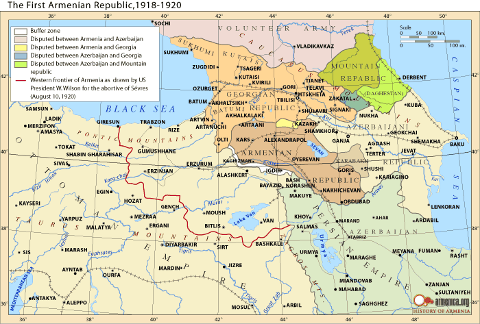
When the Russian Empire was dissolved as a result of the Russian Revolution of October 1917, at first a Transcaucasian Federation was created, which later (spring of 1918) gave place to the three independent republics of Georgia, #Armenia and #Azerbaijan․
It was on this date (May 28, 1918) which the Tatars, or rather more accurately, the Muslims of the Transcaucasus, assumed the name of Azeri and called their country Azerbaijan.
[a map used by the #Azerbaijani side]
[a map used by the #Azerbaijani side]
In 1918-1920 Nagorno-Karabakh ( #Artsakh) was a self-governing unit and had all the attributes of a sovereign state.
[ #Armenian village guards from Nagorno Karabakh (1918-1921)]
[ #Armenian village guards from Nagorno Karabakh (1918-1921)]
Between May 1918 and April 1920, the military units of #Azerbaijan committed violence and pogroms against the Armenian population. Only in March 1920, the armed units of Azerbaijan massacred and displaced about 40 thousand Armenians in Shushi, the capital of #Artsakh.
[Shushi]
[Shushi]

 Read on Twitter
![According to the geography book belonging to the Armenian royal dynasty of Arshakounian "Greater #Armenia was divided into fifteen provinces, covering [...] #Artsakh, Siunik and Utik." According to the geography book belonging to the Armenian royal dynasty of Arshakounian "Greater #Armenia was divided into fifteen provinces, covering [...] #Artsakh, Siunik and Utik."](https://pbs.twimg.com/media/ElHmpD2WMAAGl2B.png)

![From the beginning of the 9th century, Khachen and Dizak were storing up strength. During this time, valuable architecture was constructed, such as Hovanes Mkrtich church and the vestibule of Gandzasar monastery, the Dadi Monastery Cathedral Church. [Gandzasar Monsatery] From the beginning of the 9th century, Khachen and Dizak were storing up strength. During this time, valuable architecture was constructed, such as Hovanes Mkrtich church and the vestibule of Gandzasar monastery, the Dadi Monastery Cathedral Church. [Gandzasar Monsatery]](https://pbs.twimg.com/media/ElH5uQnWAAE_e1s.jpg)

![During the latter half of the 13th century, #Artsakh fell in the hands of Tatars and Mongolians and it is during this period that the Turkish name Kara-bakh, black garden, is first mentioned. #Karabakh[a miniature of Mongols] During the latter half of the 13th century, #Artsakh fell in the hands of Tatars and Mongolians and it is during this period that the Turkish name Kara-bakh, black garden, is first mentioned. #Karabakh[a miniature of Mongols]](https://pbs.twimg.com/media/ElH_OBGWMAI9m9L.png)

![In 1722, Peter the Great& #39;s Russo-Persian War (1722–23) began. At the very beginning, the Russian forces succeeded in occupying Derbent and Baku. Armenians encouraged by the Russians concluded the union with Georgians and collected an army in #Karabakh.[Fleet of Peter the Great] In 1722, Peter the Great& #39;s Russo-Persian War (1722–23) began. At the very beginning, the Russian forces succeeded in occupying Derbent and Baku. Armenians encouraged by the Russians concluded the union with Georgians and collected an army in #Karabakh.[Fleet of Peter the Great]](https://pbs.twimg.com/media/ElKU86LXEAAWMc3.jpg)
![In 1724, #Artsakh was invaded by the #Ottoman Turks and the Armenian population became the principal targets of numerous attacks and massacres.[The 17th century Ottoman Empire] In 1724, #Artsakh was invaded by the #Ottoman Turks and the Armenian population became the principal targets of numerous attacks and massacres.[The 17th century Ottoman Empire]](https://pbs.twimg.com/media/ElKWoQoX0AAVvc6.jpg)
![In the 1720s, in #Artsakh formed host concentrated in three military camps or Skhnakhs. 1) Great Skhnakh — situated in the Mrav Mountain near the Tartar River2) Pokr (Minor) Skhnakh — on the slope of the Kirs Mountain in the province of Varanda3) In Kapan[Mrav Mountain] In the 1720s, in #Artsakh formed host concentrated in three military camps or Skhnakhs. 1) Great Skhnakh — situated in the Mrav Mountain near the Tartar River2) Pokr (Minor) Skhnakh — on the slope of the Kirs Mountain in the province of Varanda3) In Kapan[Mrav Mountain]](https://pbs.twimg.com/media/ElKYIHRX0AAWnqc.jpg)
![In 1733, the #Armenians, encouraged by Nadir Shah Of Persia, in one day killed all Ottoman army stood on the winter quartiers in Khamsa. Nadir released the meliks of Khamsa from submission to khans of Ganja, appointed the governor above them Avan, melik of Dizak. [Nadir Shah] In 1733, the #Armenians, encouraged by Nadir Shah Of Persia, in one day killed all Ottoman army stood on the winter quartiers in Khamsa. Nadir released the meliks of Khamsa from submission to khans of Ganja, appointed the governor above them Avan, melik of Dizak. [Nadir Shah]](https://pbs.twimg.com/media/ElKY7U2WMAAvUq9.png)
![The consequence of the pressure of the Muslim tribes was the formation of the Karabakh Khanate, a self-proclaimed but short-lived Muslim principality in Artsakh that in 1805 was absorbed into the Russian Empire, after 40 years, and eventually abolished.[Mosque of Govhar aga] The consequence of the pressure of the Muslim tribes was the formation of the Karabakh Khanate, a self-proclaimed but short-lived Muslim principality in Artsakh that in 1805 was absorbed into the Russian Empire, after 40 years, and eventually abolished.[Mosque of Govhar aga]](https://pbs.twimg.com/media/ElKaf9vX0AQqukx.png)
![After the creation of an Armenian province in the Russian Empire, the Armenians who were scattered throughout the historic Artsakh moved to the five traditional Armenian principalities in the mountainous part of #Artsakh. [“Goarkarpet”, Artsakh, 1700] After the creation of an Armenian province in the Russian Empire, the Armenians who were scattered throughout the historic Artsakh moved to the five traditional Armenian principalities in the mountainous part of #Artsakh. [“Goarkarpet”, Artsakh, 1700]](https://pbs.twimg.com/media/ElKcyLNXIAEXubA.png)
![It was on this date (May 28, 1918) which the Tatars, or rather more accurately, the Muslims of the Transcaucasus, assumed the name of Azeri and called their country Azerbaijan. [a map used by the #Azerbaijani side] It was on this date (May 28, 1918) which the Tatars, or rather more accurately, the Muslims of the Transcaucasus, assumed the name of Azeri and called their country Azerbaijan. [a map used by the #Azerbaijani side]](https://pbs.twimg.com/media/ElKfwlsWAAE5l2q.jpg)
![In 1918-1920 Nagorno-Karabakh ( #Artsakh) was a self-governing unit and had all the attributes of a sovereign state. [ #Armenian village guards from Nagorno Karabakh (1918-1921)] In 1918-1920 Nagorno-Karabakh ( #Artsakh) was a self-governing unit and had all the attributes of a sovereign state. [ #Armenian village guards from Nagorno Karabakh (1918-1921)]](https://pbs.twimg.com/media/ElKhX7QX0AAibE3.jpg)
![Between May 1918 and April 1920, the military units of #Azerbaijan committed violence and pogroms against the Armenian population. Only in March 1920, the armed units of Azerbaijan massacred and displaced about 40 thousand Armenians in Shushi, the capital of #Artsakh.[Shushi] Between May 1918 and April 1920, the military units of #Azerbaijan committed violence and pogroms against the Armenian population. Only in March 1920, the armed units of Azerbaijan massacred and displaced about 40 thousand Armenians in Shushi, the capital of #Artsakh.[Shushi]](https://pbs.twimg.com/media/ElKiSJPXEAA_TpP.png)


