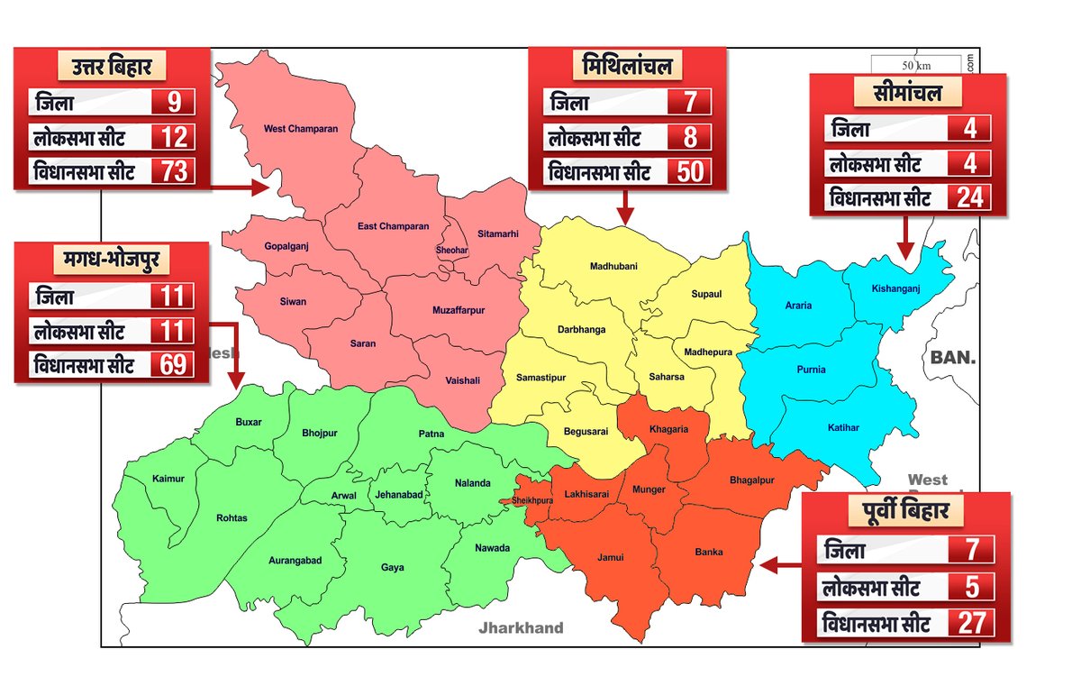
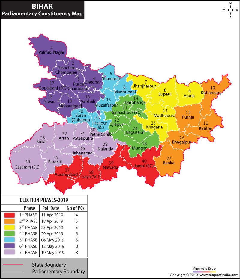
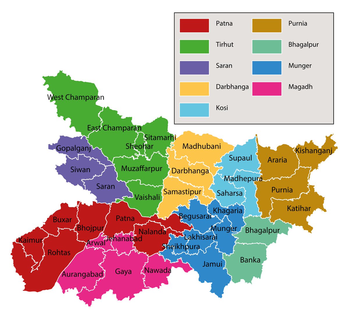
Thread to explain different "Regions" used by different analysts / newspaper/ channels in a State to analyse elections or any other political trend. Important to know that in India the administrative boundaries are different from Electoral boundaries. They are not the same..
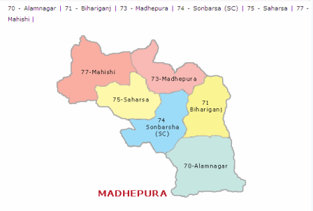
For example Madhepura Lok Sabha seat has six Vidhan Sabha segments. Three of these: Alamnagar, Bihariganj and Madhepura are in Madhepura district, while remaining three: Sonbarsa, Saharsa and Mahishi are in Saharsa district.
Or in Khagaria Lok Sabha area, fours seats of Alauli, Khagaria, Beldaur and Parbatta are in Khagaria district (East Bihar Region), while Simri Bakhtiarpur is in Saharsa district and Hasanpur is in Samastipur district (both in Mithila region). So the two & #39;Regions& #39; are overlapping.
The basic unit of administration in India is & #39;District& #39; while the basic electoral unit is & #39;Vidhan Sabha& #39; segment. While many Assembly segments make one Lok Sabha seat, same is not true about District Maps.. This is why, Electoral Maps never sync with Administrative maps.
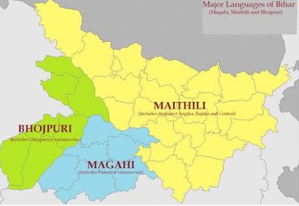
Now, generally speaking different kind of regions are drawn in Different states. Some are on Linguistic lines based on different kind of dialects spoken in any particular state. For example in Bihar: the Mithila region is the one where Maithili is spoken and so on..
These could be taken to next level by getting in the local dialects also counted as main language. As they say "kos kos par badle paani, chaar (or sometimes paanch) kos par baani,", there are many variations in this regard. Maithili alone has Bajjika,Angika, Thethi and more ...
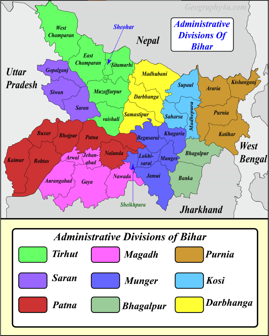
Some prefer to analyse the state politics on Administrative divisions as these are the units where you can get all Development related data from Administration and one could analyze Election results with various development parameters.
Similarly sometimes analysts with Economic bent of mind also use regions derived from Agro-Climatic zones, because they are not just related to economic activities, but surprisingly even to Disaster Mitigation as Floods and Draughts are seasonal cycled that Rural India faces.
Similarly many analyst like to analyse the Political regions based on Historic and Cultural lines, which might gel better with demographic explanation of that particular state. For example, many of us divide Bihar into Anga, Bhojpur, Magadh, Mithila, Seemanchal and Tirhut...
Many like to analyse it in more of demographic way where the Political profiling of electorate and leaders are easier to study and explain. Funny thing is even if two analysts agree to same set of regions, there would always be slight variation due to District/Lok Sabha mapping.
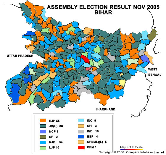
For example, in the above map (which is based on Lok Sabha boundaries) you can clearly see the difference if number in Districts and Lok Sabha seats. So within the same regional specifications, one can get 2 slightly different versions of Regions depending on which map is used..
Any analyst carving a region while mapping District boundaries will get it different by using the lok sabha boundaries, even though they will be referring to same region. But generally speaking these variations are minor in nature, and the broad analysis remains the same..
So when you hear or read any analysis trying to make some sense of regional data in terms of Electoral analysis or Development Analysis, figure which map they are referring: Is it District based map or ECI Electoral boundaries based map, and just keep the broad trends in mind.

 Read on Twitter

