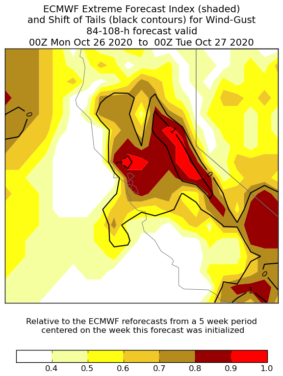
Confidence increases regarding a significant offshore flow event late in the weekend - not just strong winds, but the very dry airmass with it. Comparing offshore gradients SFO-WMC. (1/4)
2017 Wine Country Fires -17.8mb
2019 Kincade -16.3mb
2020 Model Fcst Sunday night -18 -20mb
2017 Wine Country Fires -17.8mb
2019 Kincade -16.3mb
2020 Model Fcst Sunday night -18 -20mb
Regarding the model forecast - I& #39;ve seen this before where the models put out -20mb, but verify closer to the upper teens. That was the case 2017. Here& #39;s a look at the wind anomaly - wish there was a 925 mb layer as that is a key level for the Bay Area. (2/4)
More wind info from ECMWF Extreme Forecast Index 0.5 to 0.8 is an unusual pattern and >0.8 is very unusual. In other words on the extreme end. (3/4).

 Read on Twitter


