Happy Mashujaa day to you all.
Kenya& #39;s 47 counties are delineated through boundaries that are mostly marked by geographical features.
This thread will highlight some major geographical features which form boundaries between two or more counties.
Kenya& #39;s 47 counties are delineated through boundaries that are mostly marked by geographical features.
This thread will highlight some major geographical features which form boundaries between two or more counties.
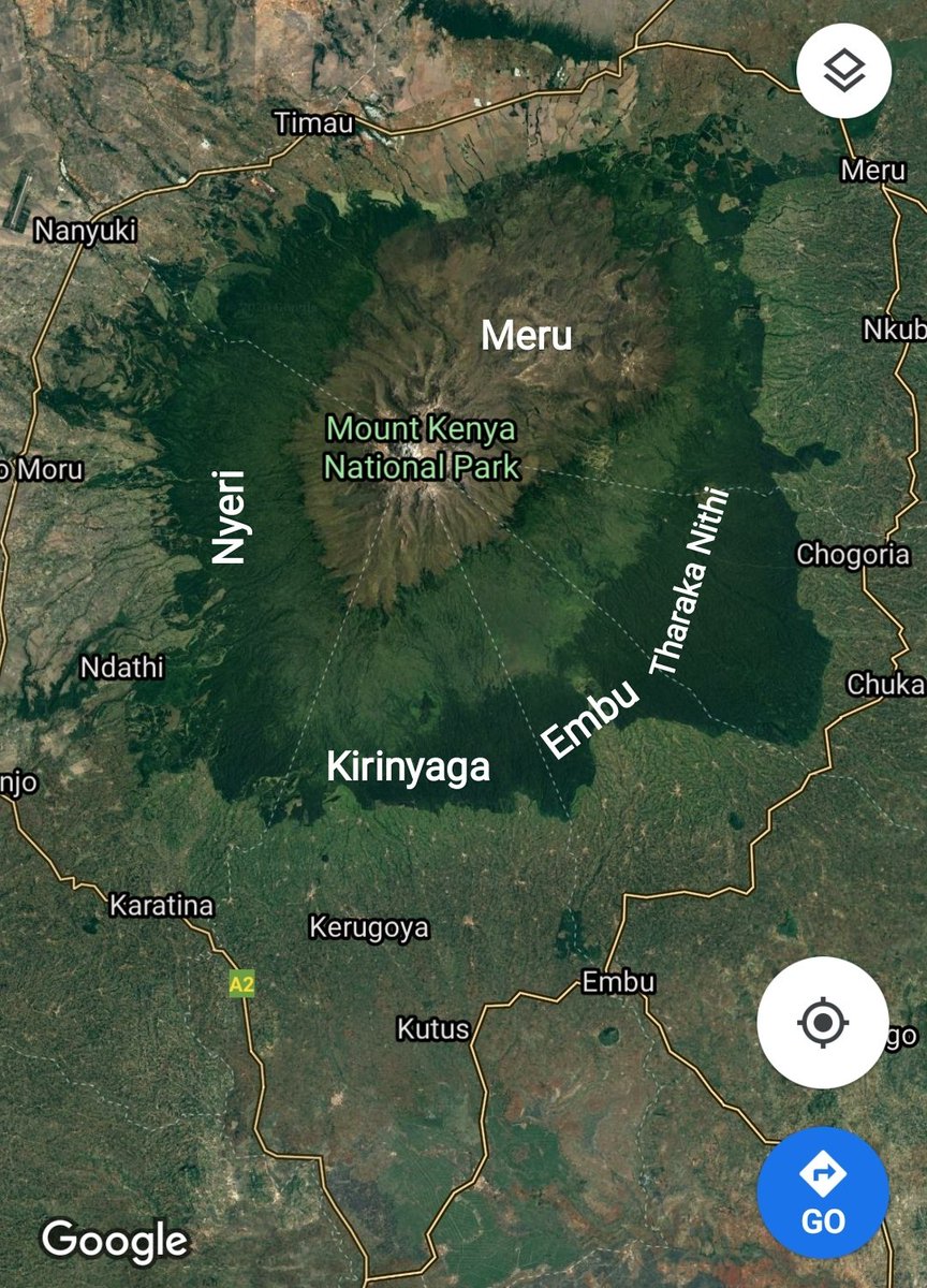
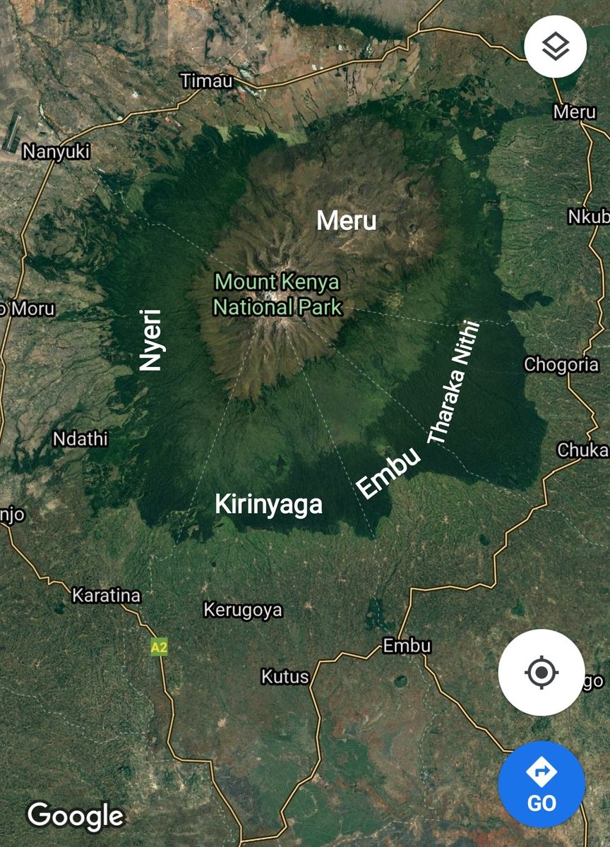
1. Mt. KENYA - The boundaries of Meru, Tharaka Nithi, Embu, Kirinyaga & Nyeri meet at the top of Mt. Kenya. Each of the counties surrounding the mountain has an equitable share of Africa& #39;s second highest mountain.
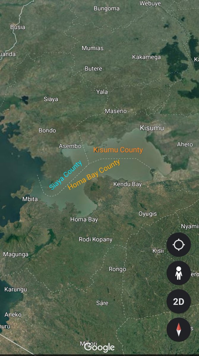
2. LAKE VICTORIA - Africa& #39;s largest lake by area and the world& #39;s second-largest fresh water lake by surface area is also shared by the three Lake Victoria counties.
The boundary of Kisumu, Siaya and Homabay is found in the middle of Lake Victoria.
The boundary of Kisumu, Siaya and Homabay is found in the middle of Lake Victoria.
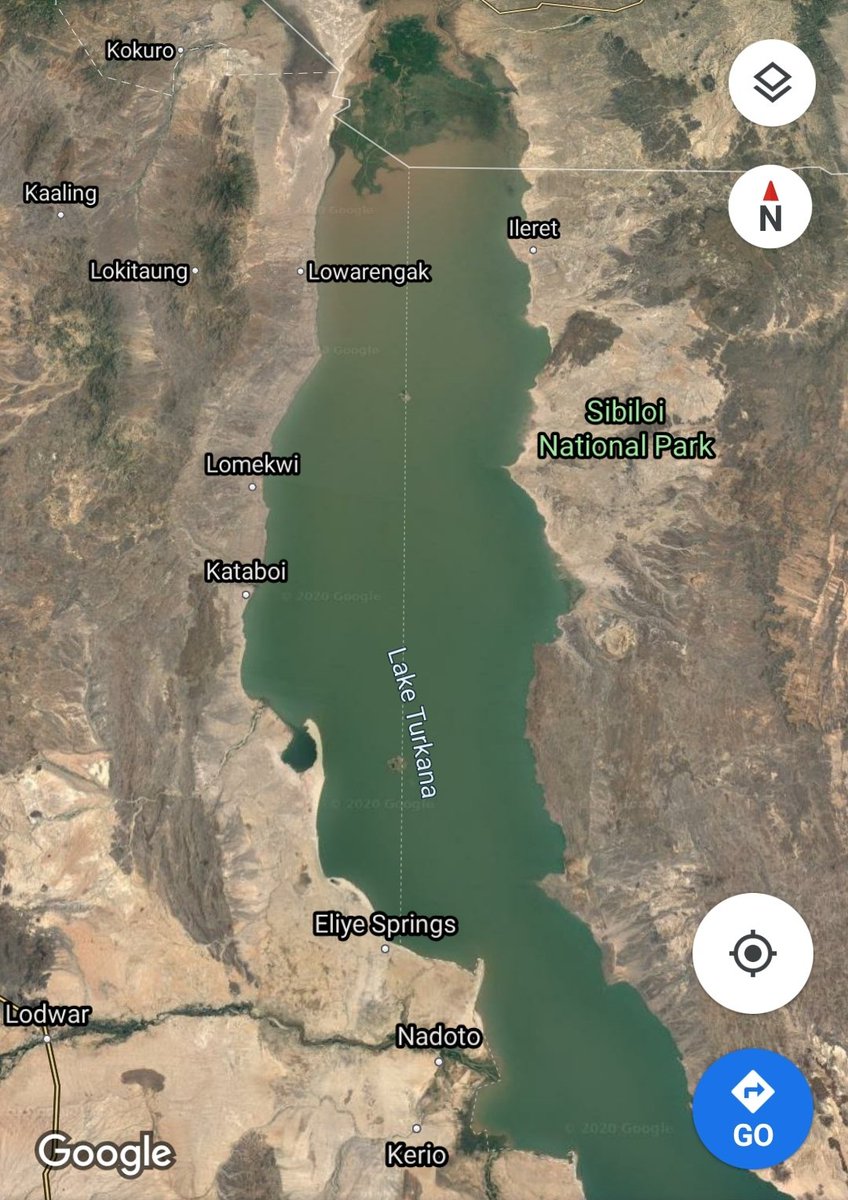
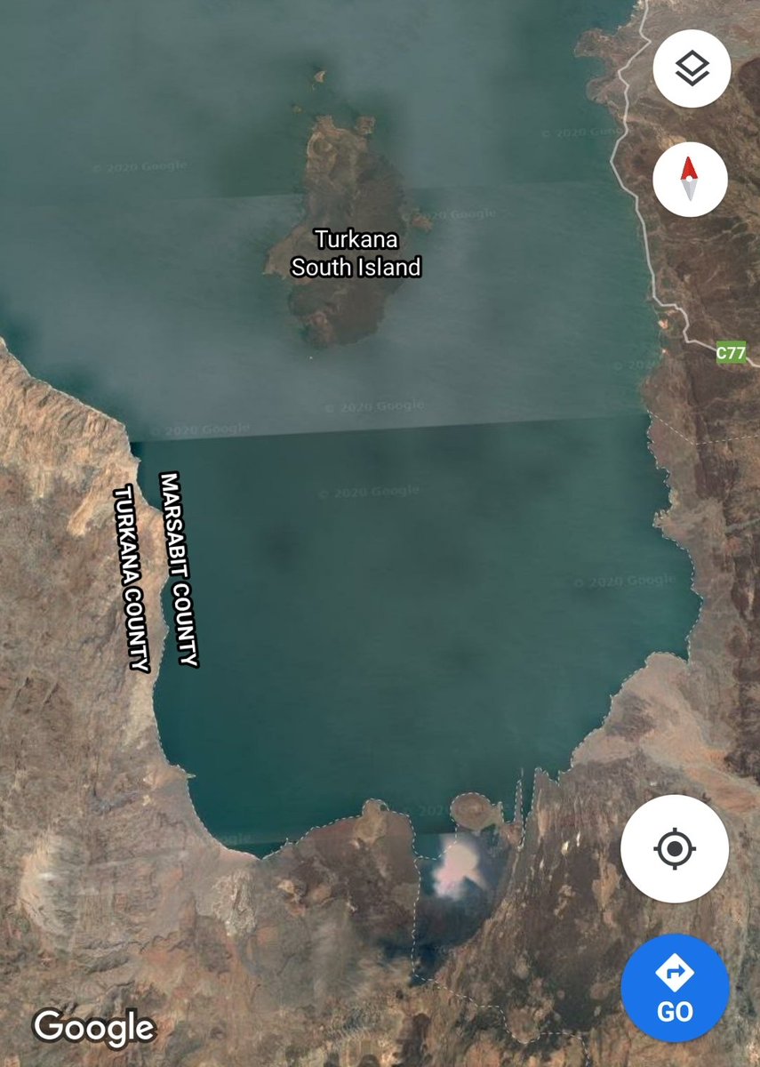
3. LAKE TURKANA - The world& #39;s largest permanent desert lake marks the boundary between Marsabit & Turkana counties.
From the lake& #39;s southern tip to Eliye spring, the western shore marks the boundary. The boundary then goes north to the Ethiopian border via Central & North Island
From the lake& #39;s southern tip to Eliye spring, the western shore marks the boundary. The boundary then goes north to the Ethiopian border via Central & North Island
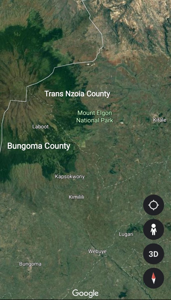
4. Mt. ELGON - The counties of Bungoma and Trans Nzoia share Mt. Elgon on the Kenyan side where their respective boundaries meet at the top of the border mountain.
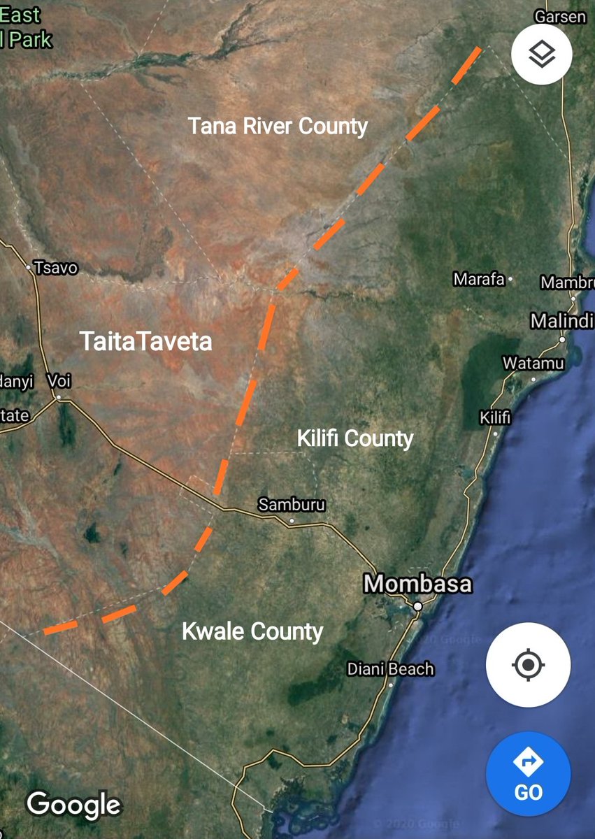
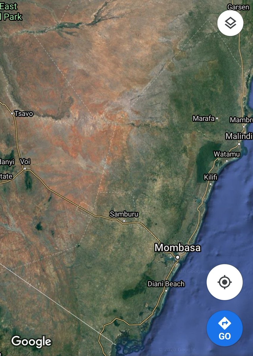
5. Coastal Plain - Ecological zones are also used to mark boundaries between counties in Kenya.
The end of the coastal plain and the beginning of the arid zone marks the boundary between the coastal counties of Kwale/Kilifi and the counties of Taita Taveta & Tana River.
The end of the coastal plain and the beginning of the arid zone marks the boundary between the coastal counties of Kwale/Kilifi and the counties of Taita Taveta & Tana River.
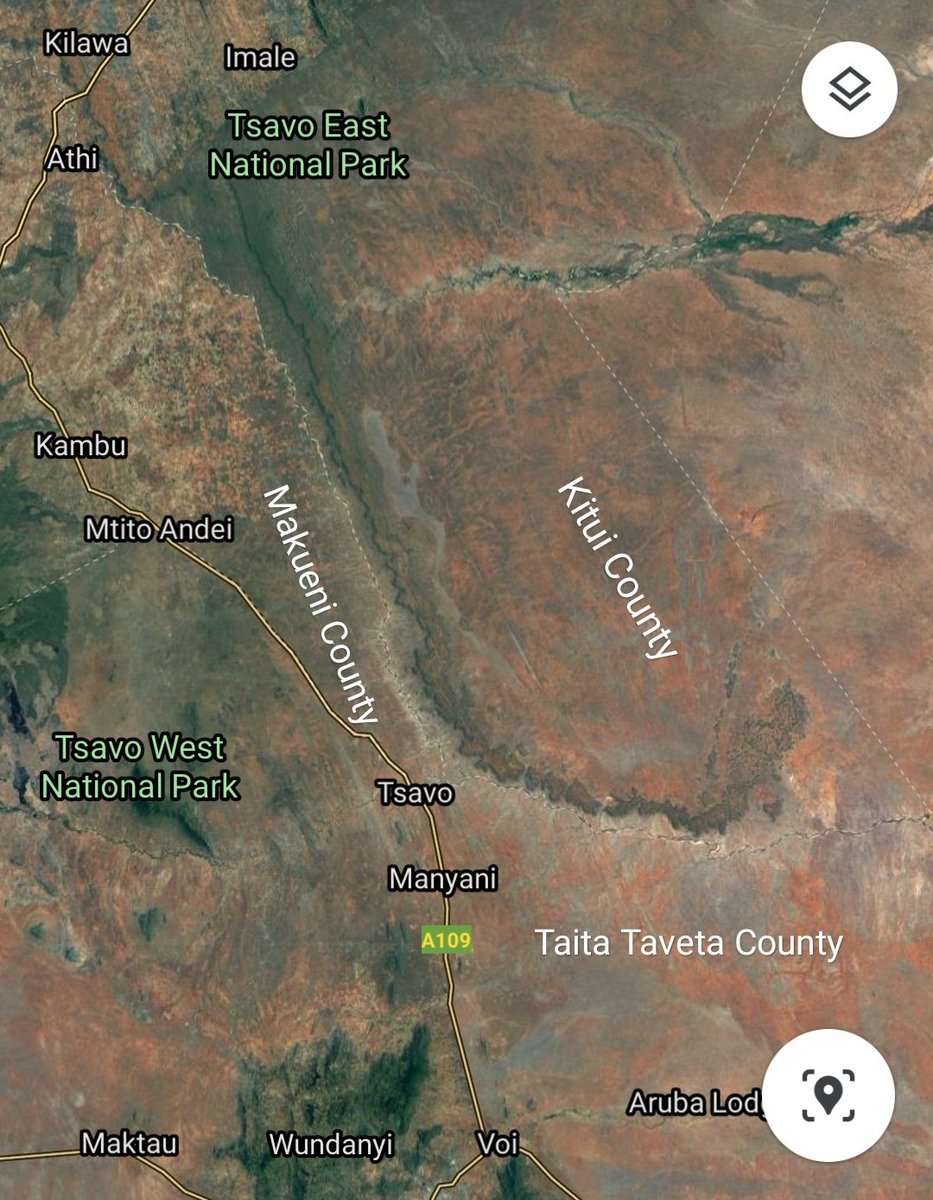
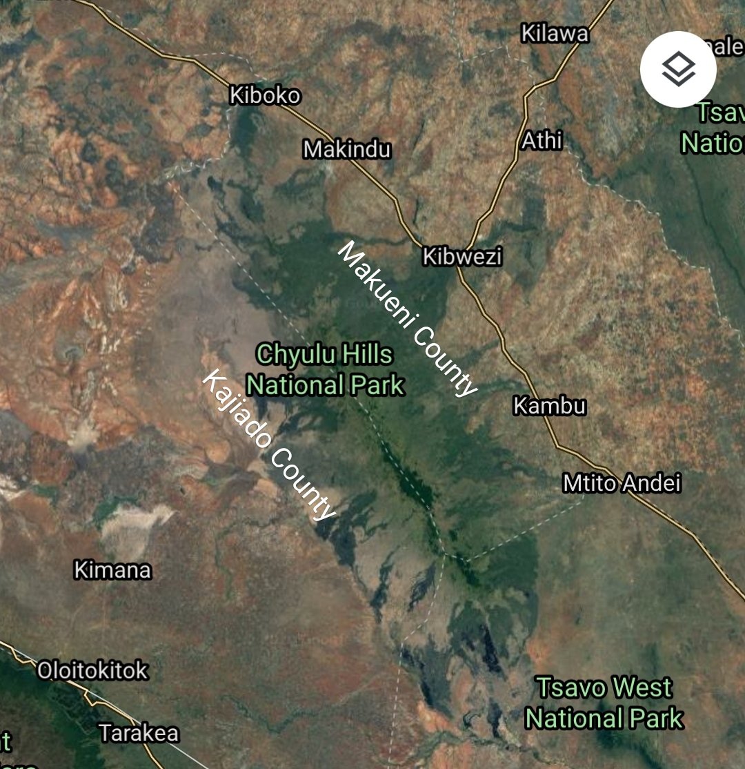
6. CHYULU HILLS - The volcanic range of Chyulu Hills in South Eastern Kenya partly marks the boundary between Kajiado and Makueni counties.
The northern facing side of the hill is in Makueni while the southern slopes are in Kajiado county.
The northern facing side of the hill is in Makueni while the southern slopes are in Kajiado county.
7. ABERDARES/NYANDARUA RANGE - The country& #39;s longest mountain range and second highest mountain marks the boundary between Nyeri and Nyandarua counties.
The boundary starts at Mt. Kinangop in Aberdares south and runs along the peak to the northern end of the range.
The boundary starts at Mt. Kinangop in Aberdares south and runs along the peak to the northern end of the range.
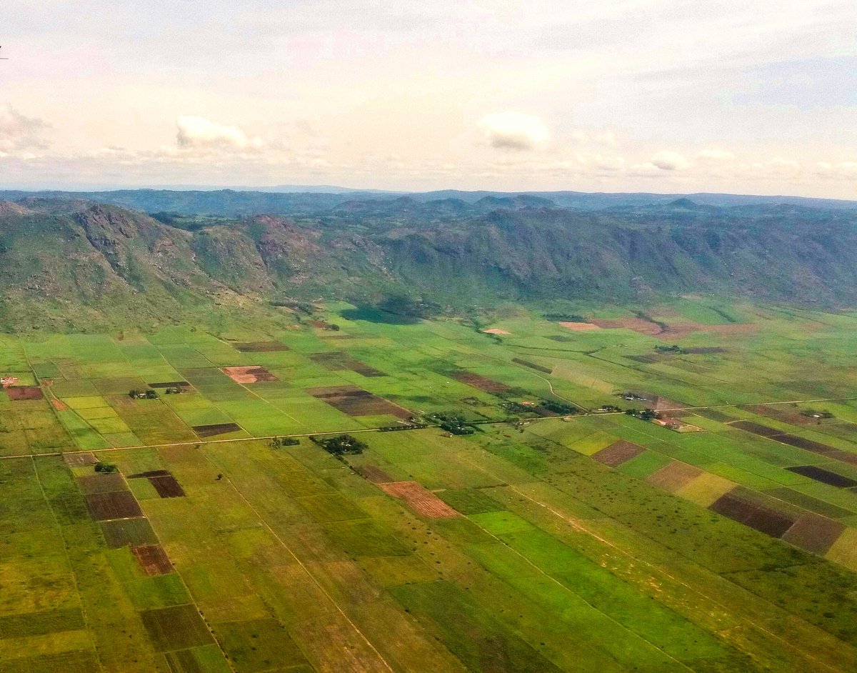
8. NYANDO/NANDI ESCARPMENT - This escarpment found along the Kavirondo Rift Valley is the boundary between Kisumu and Nandi counties.
Nandi county is located on the highlands above (Nandi Hills) while Kisumu county is found on the valley floor.
Nandi county is located on the highlands above (Nandi Hills) while Kisumu county is found on the valley floor.
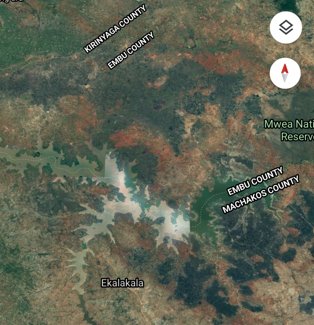
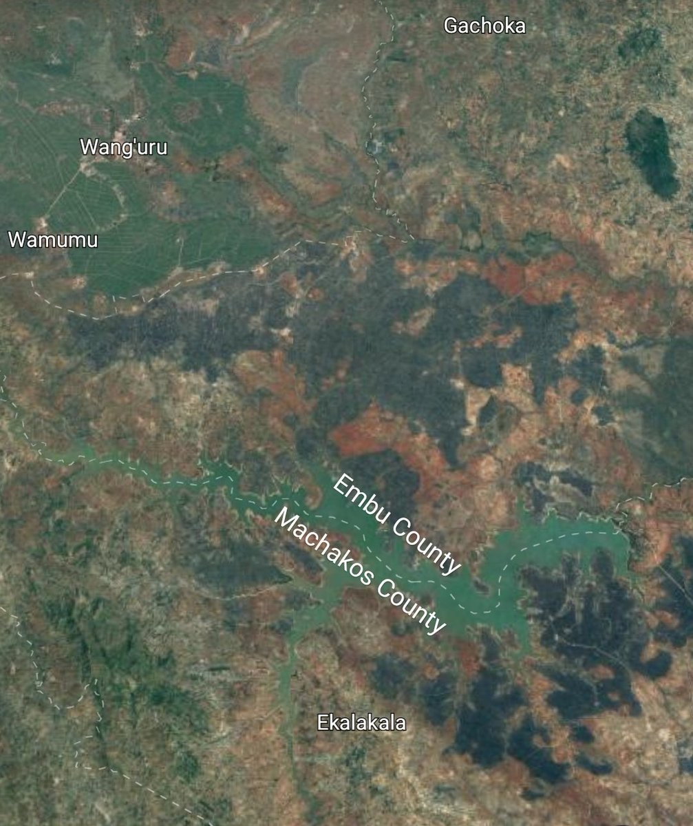
9. MASINGA DAM - The largest hydroelectric dam in Kenya marks the boundary between Embu and Machakos counties.
The boundary runs across the dam dividing it roughly into two.
The boundary runs across the dam dividing it roughly into two.
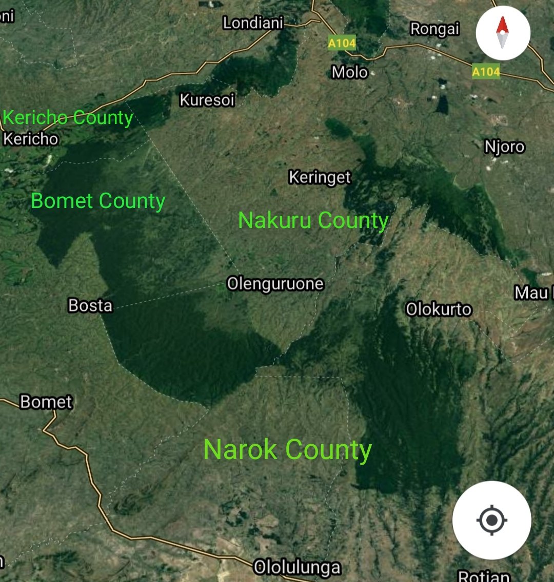
10. MAU - The largest water tower in Kenya marks the boundary between Nakuru, Narok, Bomet & Kericho counties.
Nakuru occupies the north eastern section of the highland forest which has been virtually cleared. Narok is in the south while Bomet & Kericho are in western Mau.
Nakuru occupies the north eastern section of the highland forest which has been virtually cleared. Narok is in the south while Bomet & Kericho are in western Mau.
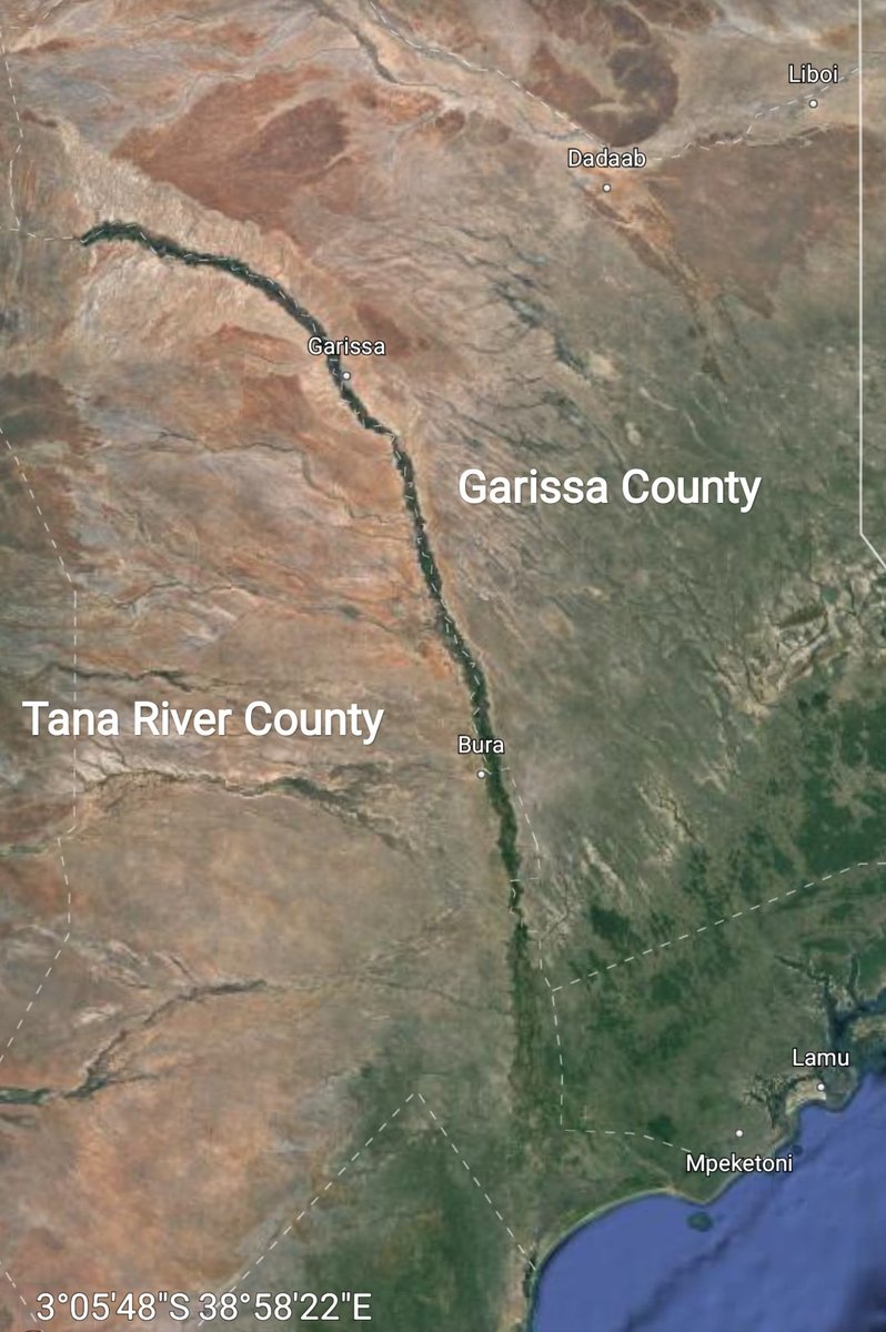
11. TANA RIVER - The longest river in Kenya marks the boundary between Garissa and the county it lends a name to, Tana River.
The eastern banks of Tana river are in Garissa county while the western banks are in Tana River county.
The eastern banks of Tana river are in Garissa county while the western banks are in Tana River county.
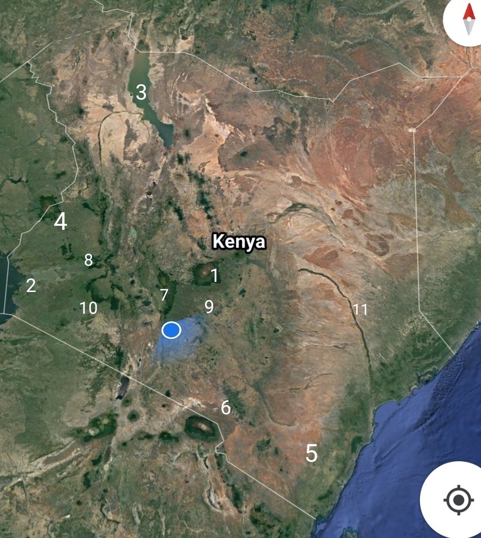
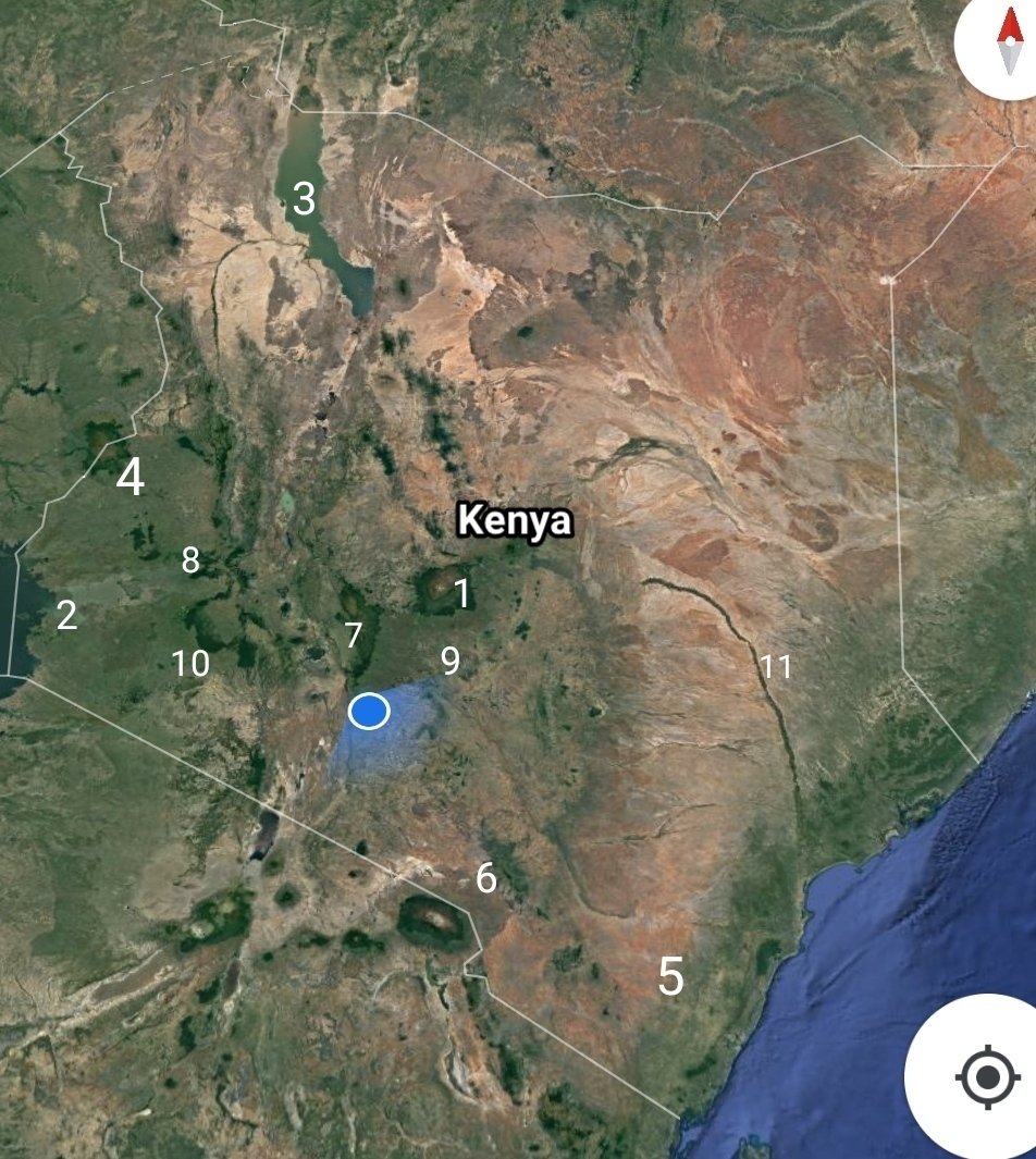
Finally, here& #39;s a map of Kenya with all the geographical features highlighted.
1. Mt. Kenya
2. Lake Victoria
3. Lake Turkana
4. Mt. Elgon
5. Coastal Plain
6. Chyulu Hills
7. Aberdares mountain
8. Nyando/Nandi escarpment
9. Masinga Dam
10. Mau
11. Tana River.
Happy Mashujaa day.
1. Mt. Kenya
2. Lake Victoria
3. Lake Turkana
4. Mt. Elgon
5. Coastal Plain
6. Chyulu Hills
7. Aberdares mountain
8. Nyando/Nandi escarpment
9. Masinga Dam
10. Mau
11. Tana River.
Happy Mashujaa day.
Images c/o Google Maps.

 Read on Twitter