Dear coastal Alaska:
Pay attention & be ready to head inland.
Dear coastal PNW:
Keep an eye on the news until we have tsunami confirmation. https://twitter.com/nws_ntwc/status/1318296316141658113">https://twitter.com/nws_ntwc/...
Pay attention & be ready to head inland.
Dear coastal PNW:
Keep an eye on the news until we have tsunami confirmation. https://twitter.com/nws_ntwc/status/1318296316141658113">https://twitter.com/nws_ntwc/...
Subduction zone earthquakes involve vertical movement of the sea floor. This displacement can trigger tsunami.
While we’re very, very good at forecasting how fast tsunami will travel where, we don’t know how big they’ll be until they start coming on shore.
While we’re very, very good at forecasting how fast tsunami will travel where, we don’t know how big they’ll be until they start coming on shore.
If you’re on a coast and feel severe shaking, RUN the moment shaking stops. Don’t wait around for assessments or formal warnings, just get as far uphill & inland as you can get as quickly as possible.
Same if you ever see the ocean pull back & exposing sea floor.
Same if you ever see the ocean pull back & exposing sea floor.
We detect tsunami through data from ocean buoys:
1. Coastal buoys that tell us how big a tsunami is as it comes on shore
2. Deep sea (DART) buoys that detect the pressure wave of tsunami traveling in open ocean.
But first a potential tsunami needs to reach the buoys.
1. Coastal buoys that tell us how big a tsunami is as it comes on shore
2. Deep sea (DART) buoys that detect the pressure wave of tsunami traveling in open ocean.
But first a potential tsunami needs to reach the buoys.
Tsunami are so freaking huge that they behave like shallow-water waves even in open ocean. That’s convenient physics because it makes calculating travel time simpler.
In open ocean, tsunami travel at airplane speeds.
Near shore, tsunami travel at highway speeds.
In open ocean, tsunami travel at airplane speeds.
Near shore, tsunami travel at highway speeds.
It COULD BE that a tsunami is only centimeters big. It still exists, we can still detect it, but it’s mostly harmless. (Aside from nasty & potentially deadly currents; no frolicking in the surf!)
Or it COULD BE huge and devastating. TBD.
But we know arrival times: https://twitter.com/nws_ntwc/status/1318304261143367681">https://twitter.com/nws_ntwc/...
Or it COULD BE huge and devastating. TBD.
But we know arrival times: https://twitter.com/nws_ntwc/status/1318304261143367681">https://twitter.com/nws_ntwc/...
Every tsunami has a frequency: timing between wave crests.
Sometimes that frequency aligns with the resonance frequency of bays or fjords. Then constructive interferences amplifies tsunami into seiche, building bigger than the original waves.
It’s devastating when that happens.
Sometimes that frequency aligns with the resonance frequency of bays or fjords. Then constructive interferences amplifies tsunami into seiche, building bigger than the original waves.
It’s devastating when that happens.
Alaskan earthquakes have a nasty tendency to produce tsunami that resonate into seiche among the many nooks & crannies of the surrounding coasts. Famous examples are 1964 Port Alberti, BC & 1946 Hilo Bay, Hawaii.
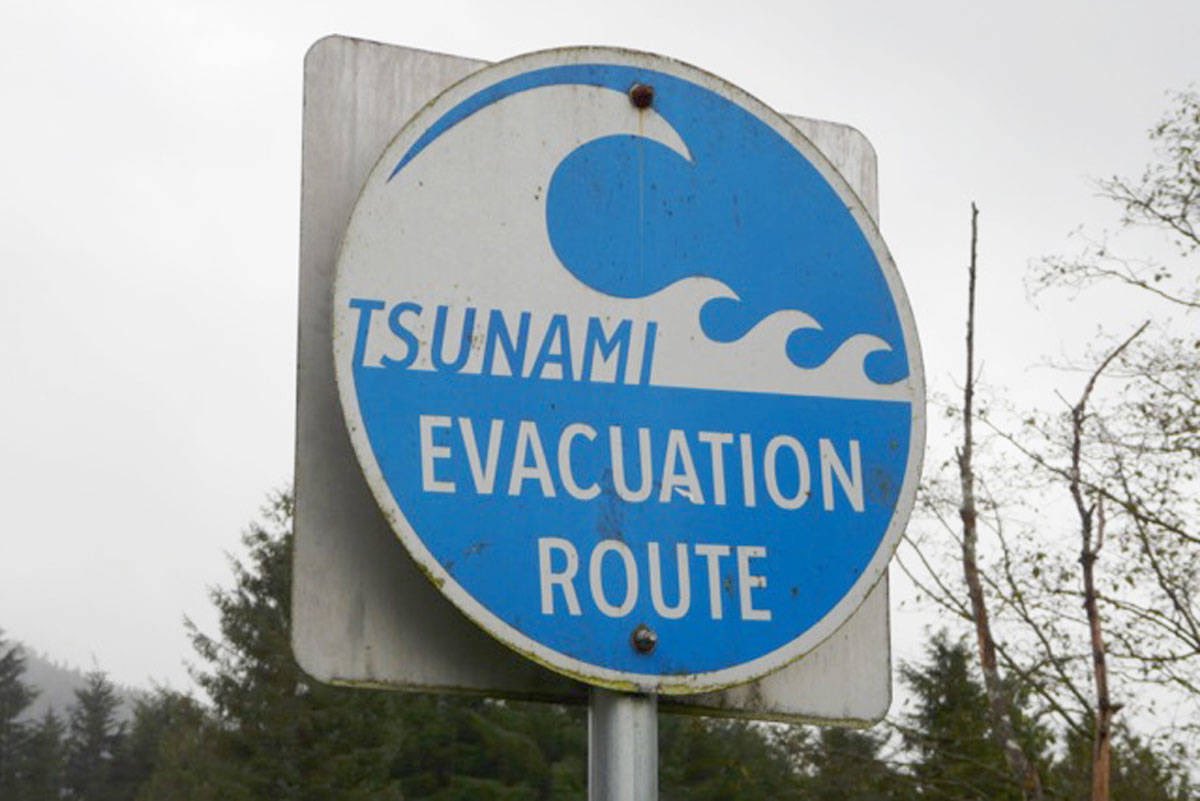
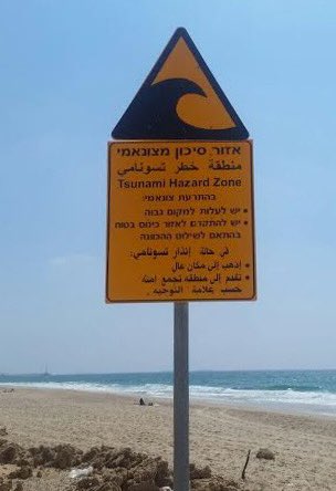
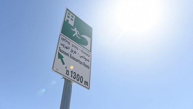
Of all the geohazards, tsunami evac routes & vertical refuges (very strong tall buildings in flat coastal areas) have the most consistent international signage.
Even if you don’t speak local language, look for signs of cresting waves & follow the arrows to safety.
Even if you don’t speak local language, look for signs of cresting waves & follow the arrows to safety.
Note: Tsunami do NOT look like cresting waves and you cannot surf them.
They look like a rapid tide. Crest or trough can hit first (50/50 random chance), so it may be ocean pulling back or rapidly rising. Tsunami are MULTIPLE waves & first wave isn’t necessarily the biggest.
They look like a rapid tide. Crest or trough can hit first (50/50 random chance), so it may be ocean pulling back or rapidly rising. Tsunami are MULTIPLE waves & first wave isn’t necessarily the biggest.
Tsunami can be triggered by any major displacement of the water column: earthquake moving sea floor, landslide, glacier calving, even asteroid impact.
Today’s quake was large magnitude (M7.5), but far from population centers thus low impact: https://earthquake.usgs.gov/earthquakes/eventpage/us6000c9hg/dyfi/intensity">https://earthquake.usgs.gov/earthquak...
Today’s quake was large magnitude (M7.5), but far from population centers thus low impact: https://earthquake.usgs.gov/earthquakes/eventpage/us6000c9hg/dyfi/intensity">https://earthquake.usgs.gov/earthquak...
Quick aside on the quake:
Initial assessments of limited data often get revised as we get more data & have human interpretation instead of automated alerts. It’s normal the quake magnitude calculation adjusted from M7.4 to M7.5.
This is a neat initial interp of plate movement: https://twitter.com/cppgeophysics/status/1318313399307022336">https://twitter.com/cppgeophy...
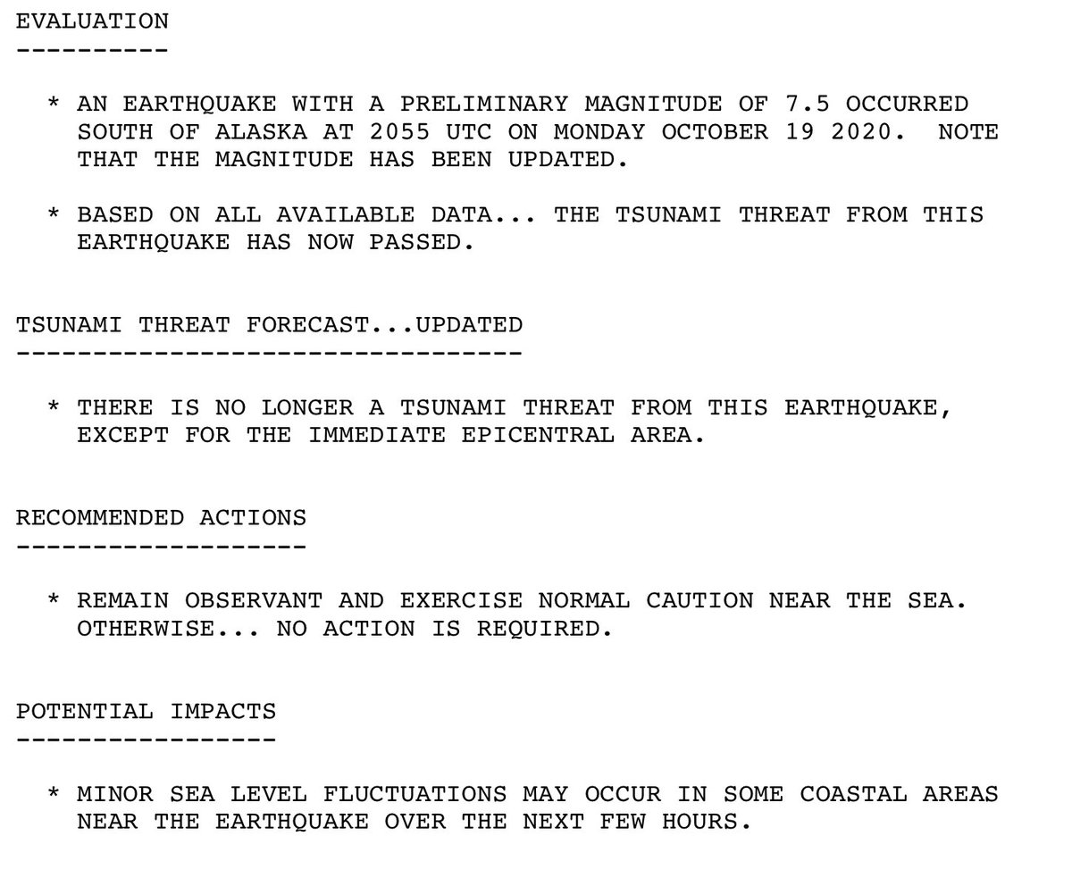
And we’re clear!
Mostly: Nearby Alaskans should keep paying attention.
Details & source: https://tsunami.gov/events/PHEB/2020/10/19/20293005/2/WEPA40/WEPA40.txt">https://tsunami.gov/events/PH...
Mostly: Nearby Alaskans should keep paying attention.
Details & source: https://tsunami.gov/events/PHEB/2020/10/19/20293005/2/WEPA40/WEPA40.txt">https://tsunami.gov/events/PH...

 Read on Twitter


