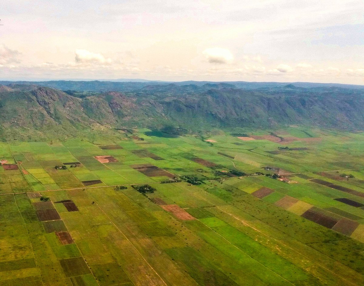
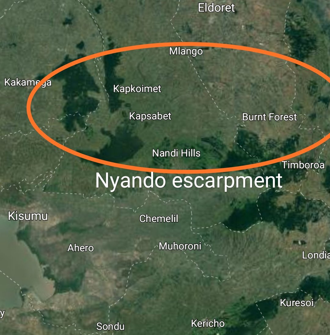
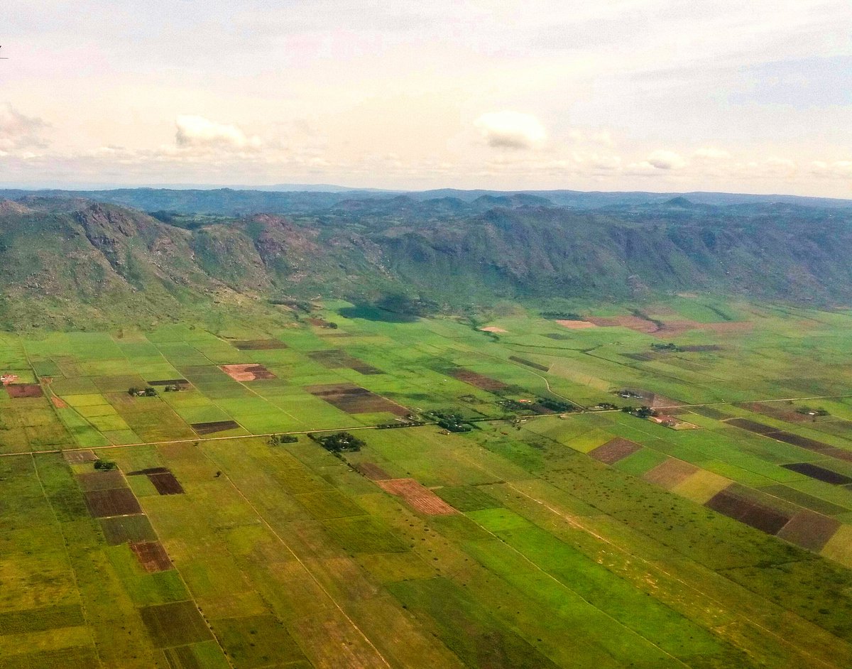
The Nyando escarpment is part of the Kavirondo Rift Valley and forms a social, political & economic boundary between Kisumu county and Nandi county.
Sugar plantations dot the valley floor while the highlands above are part of Nandi Hills where tea is grown.
THREAD.
Sugar plantations dot the valley floor while the highlands above are part of Nandi Hills where tea is grown.
THREAD.
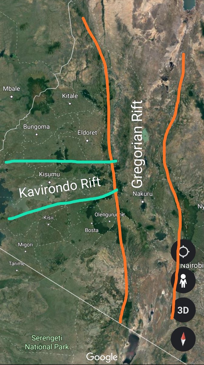
The Kavirondo Rift Valley runs perpendicular to the main Rift system in Kenya. It is located west of the main Rift system and runs for about 100km from Timboroa area to Lake Victoria.
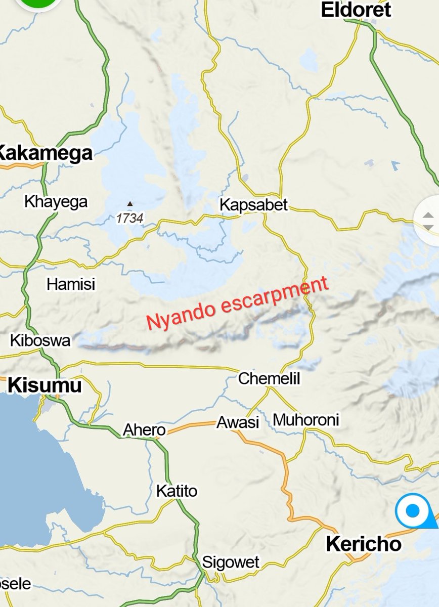
Nyando escarpment forms the northern wall that rises high above the valley floor.
Nyando escarpment forms the northern wall that rises high above the valley floor.
Like the Aberdares, Nyando escarpment is marked by a series of volcanoes that collectively form the Nandi Hills. These forested highland areas includes Timboroa, Kapkut, Tinderet & Londiani.
The valley below is Kenya& #39;s & #39;sugar belt& #39; including Chemelil, Ahero, Miwani & Muhoroni.
The valley below is Kenya& #39;s & #39;sugar belt& #39; including Chemelil, Ahero, Miwani & Muhoroni.
The image showcases the terrain upon which the fabled Lwanda Magere led his warriors to battle against Nandi warriors from the Highlands above.
In modern times, the steep escarpment face provides a formidable hiking trail with beautiful views of Lake Victoria and the valley floor from above.
Perhaps historical tours with beautiful vistas can be considered in future. The location would also be great for paragliding.
End
Perhaps historical tours with beautiful vistas can be considered in future. The location would also be great for paragliding.
End

 Read on Twitter