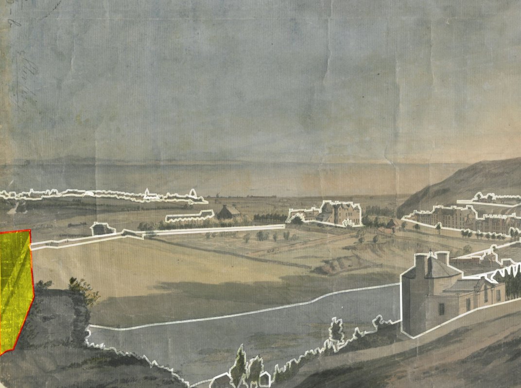
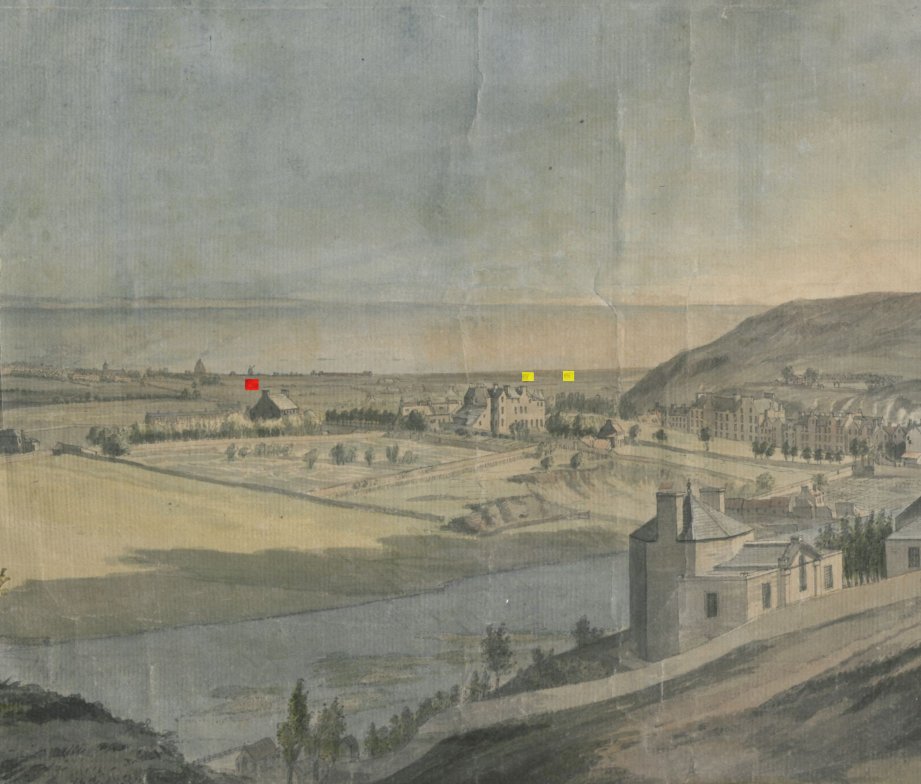
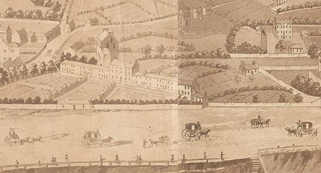
The @britishlibrary have put up a really great scan of this Paul Sandby watercolour sketch of the vista north from Edinburgh Castle in 1750. ( https://www.flickr.com/photos/britishlibrary/50263334808)">https://www.flickr.com/photos/br... It& #39;s a moment before a great transition in Edinburgh, a few decades later the view would be forever transformed
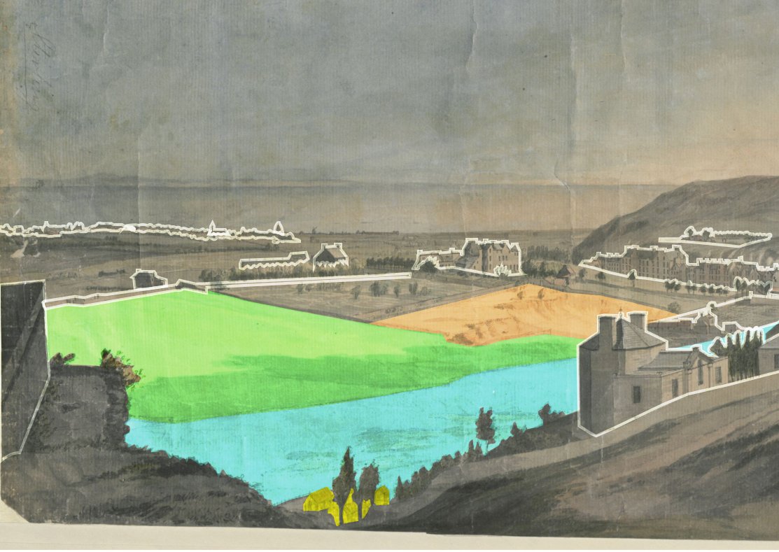
I& #39;m going to try and highlight some of the features in it. One of the main things is just how big Calton Hill appears, as it& #39;s been built upon and what we think of now as the hill is just the top poking out. Also the Castle Esplanade has not yet been landscaped
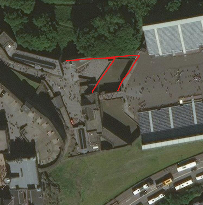
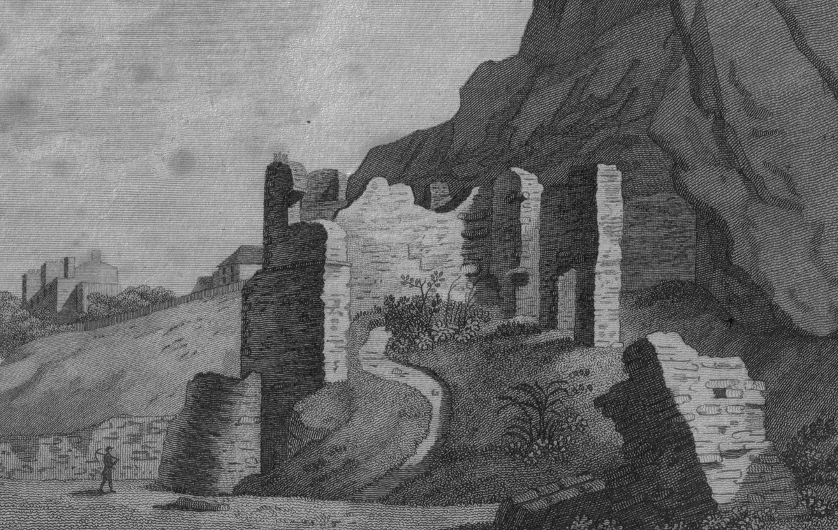
Let& #39;s start on the left. First up we see the "North Flanker" of the Castle& #39;s outer defences, one of a pair of arrowhead bastions defending the outer gatehouse still there (in a remodelled manner) to this day.
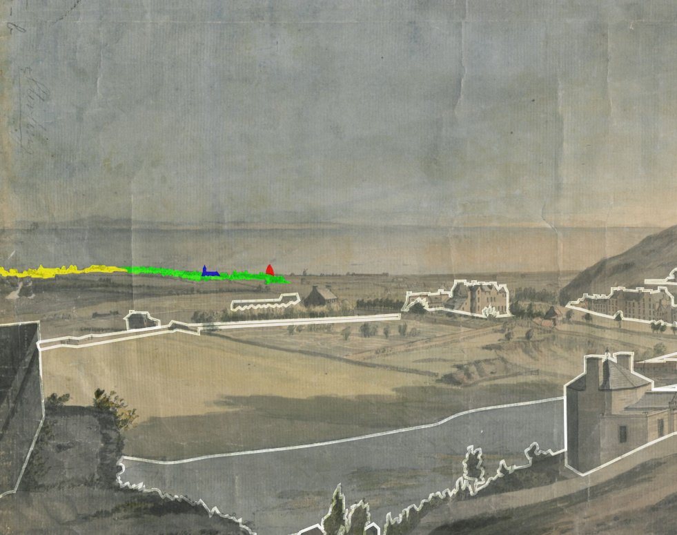
On the shores of the Forth we can see North Leith and Newhaven (yellow), South Leith (green), St. Mary& #39;s Kirk (blue) and the first of the glassworks cones (red). Not marked to the right of the glass cone is a windmill and the long, low huts of the ropeworks.
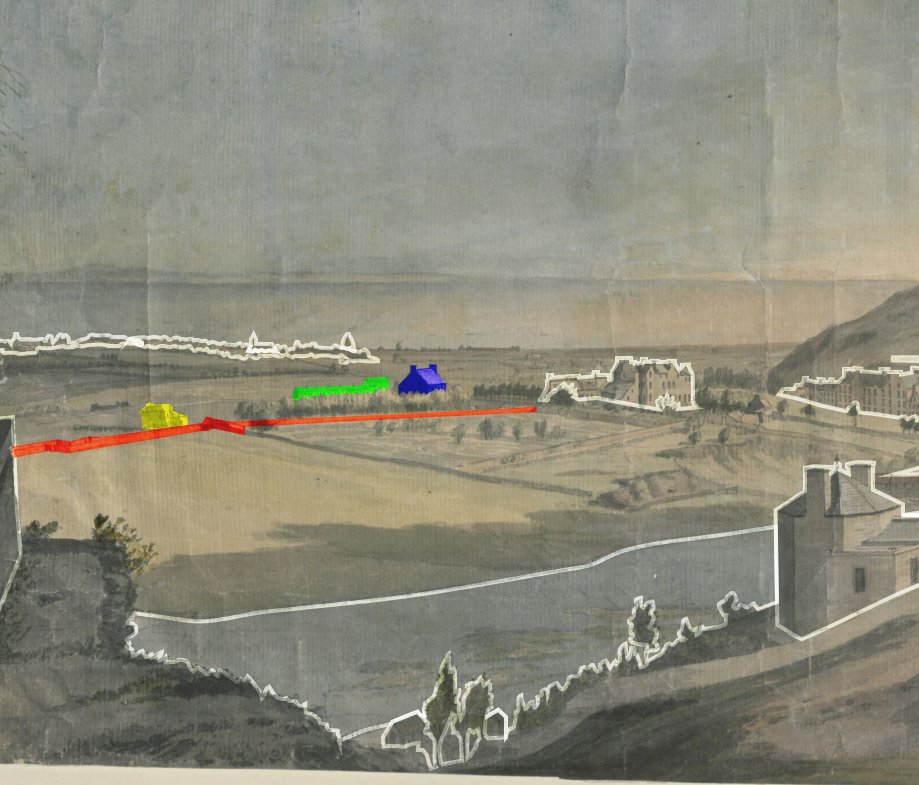
Where Princes St. now runs, is a narrowed, walled roadway, the "Lang Dykes" or "Lang Gait" (red). In green is the village of Picardy, established in 1730 to accommodate French weavers brought in to improve the local industry. Also, houses belonging to Sim (blue) and Hogg (yellow)
South of the Lang Dykes is the area of fields and parkland (green) known as the "Barefoot& #39;s Park", and beyond that fancifully blue area of the Nor& #39; Loch. At this point it would have been a partially drained swamp. In orange is an area of quarrying where the Waverley Mall now sits
And from that last image in yellow is a collection of buildings around the Castle Wellhouse fortifications, which I believe were used by tanners.
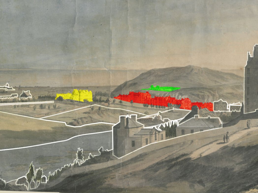
In yellow is the collection of houses known as Moutrie& #39;s or Multer& #39;s Hill (now Multrees), roughly where the Register House was soon to be built. In red, the tenements of the Low Calton. And on the hill (green) the original Calton Burial Ground, later cut through by Waterloo Place
At the head of the Nor& #39; Loch is the Physick Garden, where medicinal herbs and plants were cultivated - a direct fore-runner of the @TheBotanics. By it are Trinity College Kirk (yellow) and Hospital (blue) and behind (red) is Paul& #39;s Work, a charitable poorhouse cum hospital
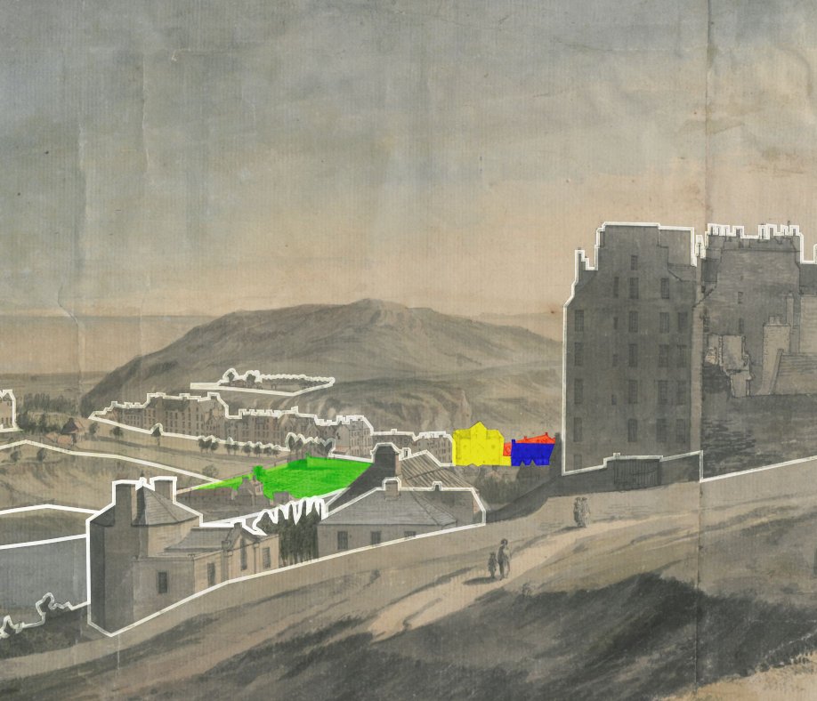
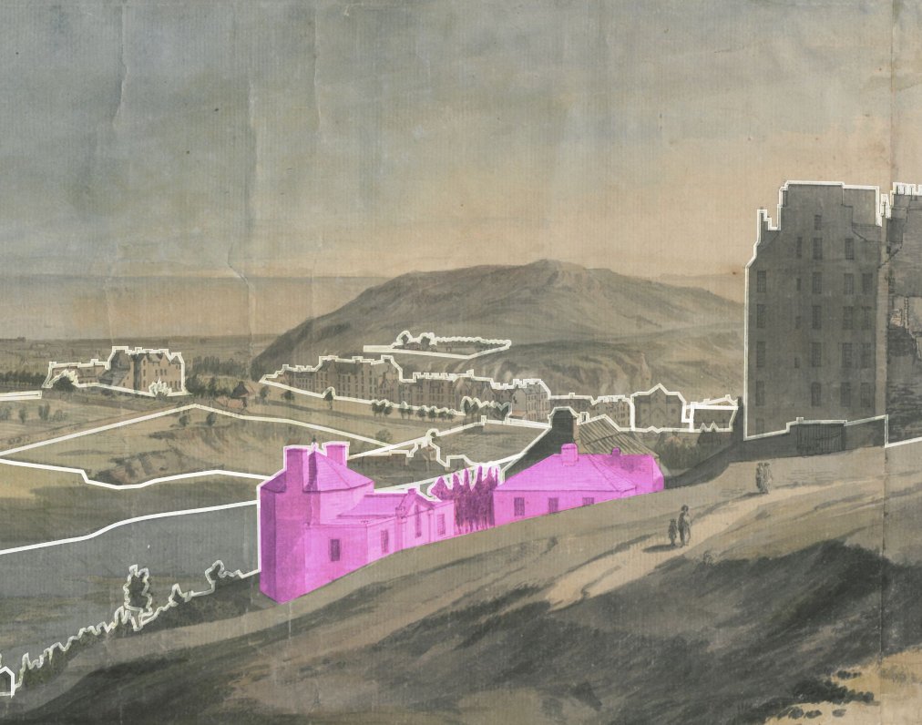
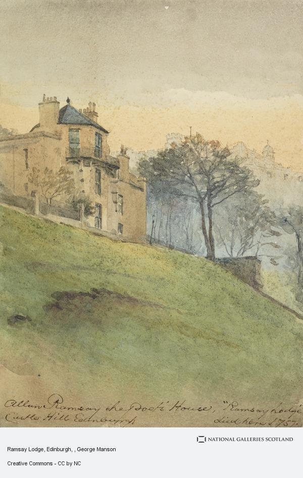
On the north slopes of the Castle ridge, is Alan Ramsay& #39;s house and garden (no guesses where they took the name Ramsay Garden for the Victorian pile from). Ramsay& #39;s house or lodge, built about 1740, was known as the "Goose Pie" on account of its tall, octagonal form.
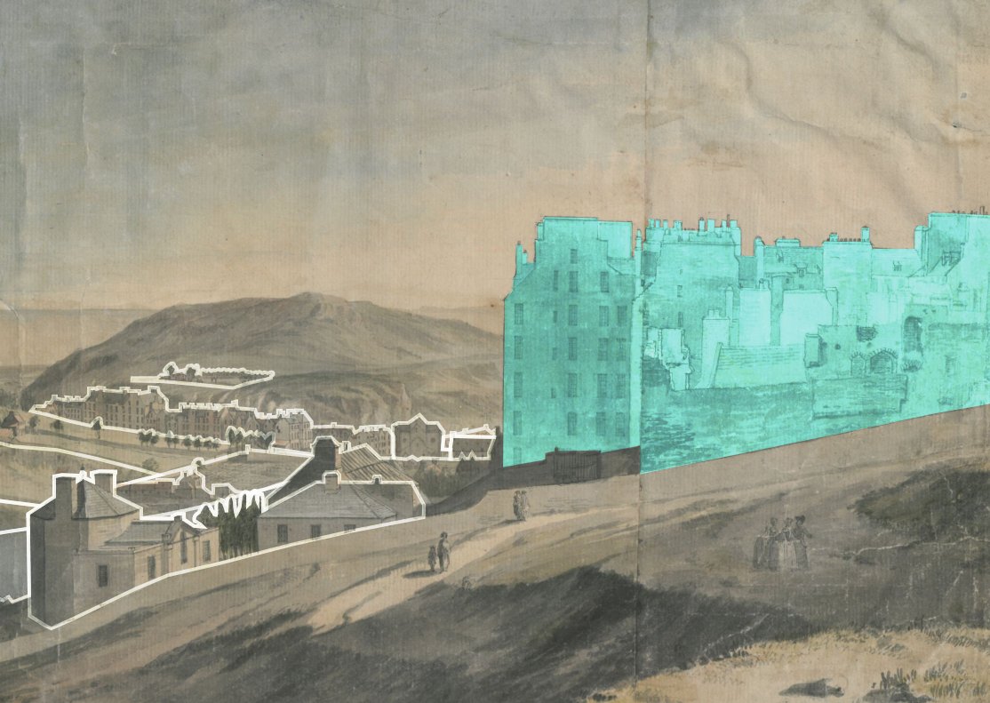
On the right in blue are the tall tenements (at least 9 or 10 storeys tall) of the Castlehill. The lower structures are clearly damaged, perhaps from the brief siege of the & #39;45 when the castle& #39;s guns were turned on the Jacobites.
Less distinct, but we can probably make out Pilrig House (red) in the lands between Edinburgh and Leith, and down by Leith Links are 2 big hooses, possibly Coatfield Mains and Hermitage House (in yellow).
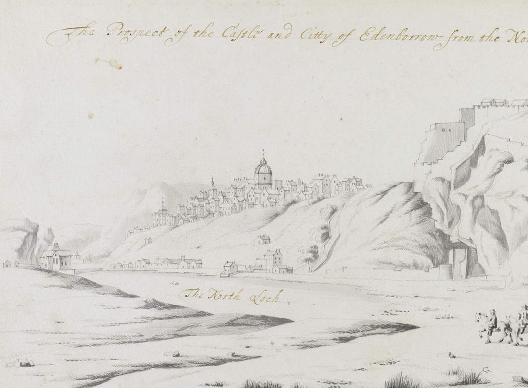
We have some really great plans and engravings of 18th century Edinburgh, but rarely do they look this way. Probably one of the best early sources is the late 17th. century sketches of John Slezer, a Dutch or German surveyor in government employ in Scotland
Slezer& #39;s view across the Nor& #39; Loch shows us (L to R) the Trinity College Kirk, the Old Town and St. Giles Kirk, the tanners& #39; buildings on the shores of the loch, the well house tower and the castle (pic = Edinburgh City Libraries)
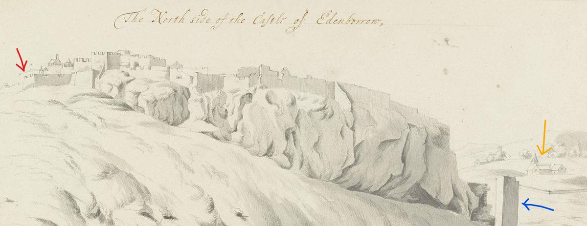
His view of the "North Side of the Castle" shows where Paul Sandby would have made his sketch 60 years later (red arrow), the Well House tower (blue) and the West Kirk of @cuthbert_church (orange)
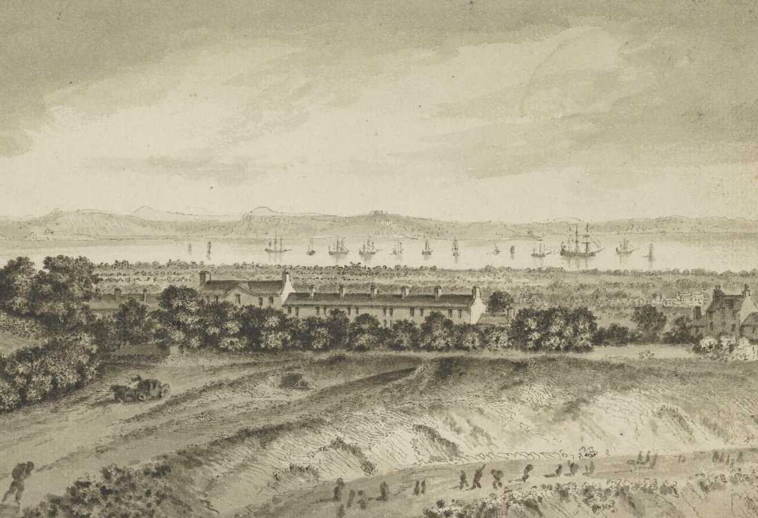
About 100 years after Slezer, John Clerk of Eldin made sketches which give invaluable views of the edges of Edinburgh at the time. This view shows Picardy village and the house of Gayfield, from the north side of Calton Hill. The two levels of the road to Leith in the foreground
There are 30 copies of engravings of John Clerk& #39;s sketches of Edinburgh available from @TalesOfOneCity here; #6dpksDMXNdIAAAF1Ozm3VQ/43892">https://www.capitalcollections.org.uk/view-item?key=SXsiUCI6eyJ2YWx1ZSI6ImpvaG4gY2xlcmsiLCJvcGVyYXRvciI6MSwiZnV6enlQcmVmaXhMZW5ndGgiOjMsImZ1enp5TWluU2ltaWxhcml0eSI6MC43LCJtYXhTdWdnZXN0aW9ucyI6MywiYWx3YXlzU3VnZ2VzdCI6bnVsbH19&WINID=1603018246058 #6dpksDMXNdIAAAF1Ozm3VQ/43892">https://www.capitalcollections.org.uk/view-item...
And then about 20 years later, Robert Barker& #39;s spectacular panorama of Edinburgh from the Calton Hill - although you have to allow for many of the details of the New Town being a representation of what was to come, not what was already built #6dpksDMXNdIAAAF1Ozm3VQ/39165">https://www.capitalcollections.org.uk/view-item?key=SXsiUCI6eyJ2YWx1ZSI6InJvYmVydCBiYXJrZXIiLCJvcGVyYXRvciI6MSwiZnV6enlQcmVmaXhMZW5ndGgiOjMsImZ1enp5TWluU2ltaWxhcml0eSI6MC43LCJtYXhTdWdnZXN0aW9ucyI6MywiYWx3YXlzU3VnZ2VzdCI6bnVsbH19&WINID=1603018246058&fullPage=1 #6dpksDMXNdIAAAF1Ozm3VQ/39165">https://www.capitalcollections.org.uk/view-item...
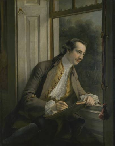
Back to Sandby, he was an English artist and surveyor, who had gotten himself a position in the military drawing department in London. He came to Scotland after the & #39;45 to assist in surveying military works associated with the "pacification" of the Highlands.
Sandy started making sketches and watercolours in the course of his work, documenting the changes going on around him at the time. He left military employ in 1751 to become an artist and became known for making "real views from nature in this Country"
The @NatGalleriesSco have quite a few good Sandby pictures in their online collection; mainly landscapes and not just Edinburgh but all over Scotland https://www.nationalgalleries.org/search?search=Paul%20Sandby&page=0">https://www.nationalgalleries.org/search...
The "Horse Fair on Bruntsfield Links" is a bit more unusual for all the crowd scene added in the foreground https://www.nationalgalleries.org/art-and-artists/19098/horse-fair-bruntsfield-links-edinburgh?search=Paul%20Sandby&page=2&search_set_offset=122">https://www.nationalgalleries.org/art-and-a...
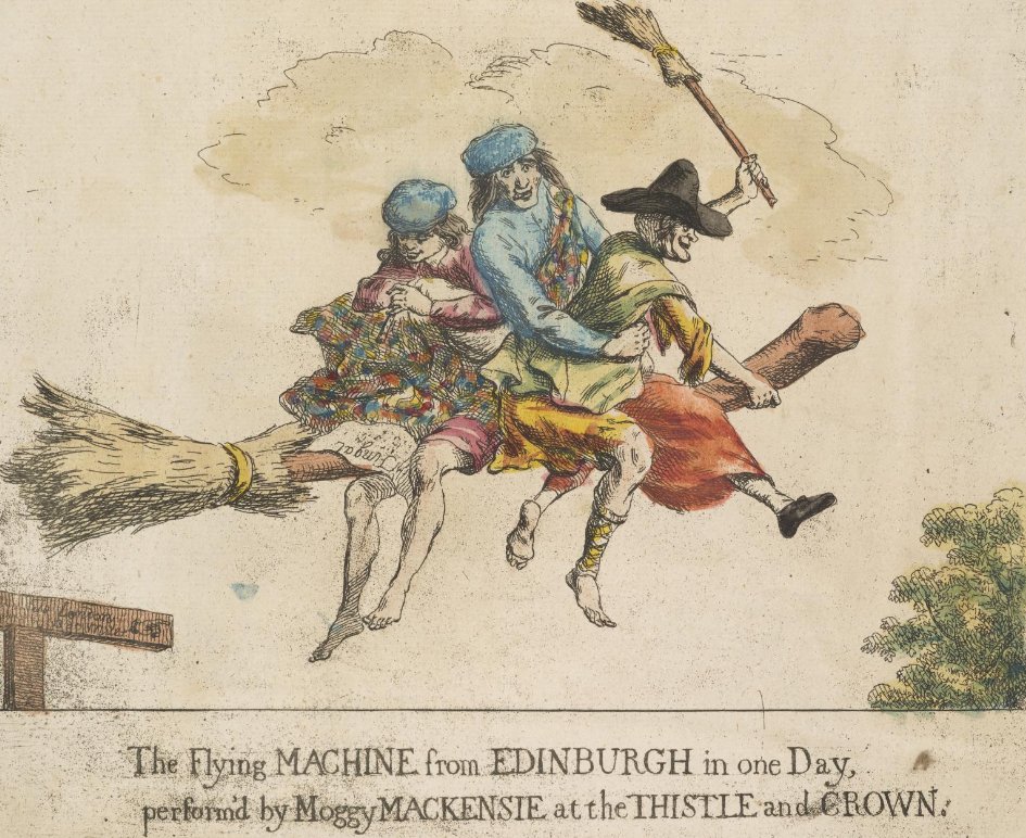
And much more ridiculous, "The Flying Machine from Edinburgh in one day performed by Moggy Mackenzie at the Thistle and Crown" which we can assume was inspired by a piece of theatre. https://www.nationalgalleries.org/art-and-artists/36321/flying-machine-edinburgh-one-day-performed-moggy-mackenzie-thistle-and-crown?search=Paul%20Sandby&page=2&search_set_offset=145">https://www.nationalgalleries.org/art-and-a...

 Read on Twitter
