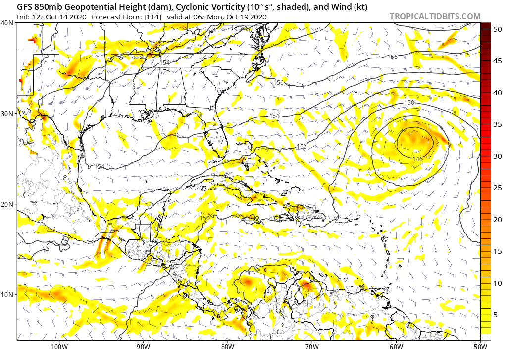
I took some time to analyze the 12z GFS run and how it handles the TCG of the potential Caribbean storm next week. From what I see, it looks like the interaction of the vorticity from an ITCZ breakdown in combination with a Caribbean Gyre initiates the cyclogenesis. 1/
The TPW at 850mb shows the progression of the moisture bubble of the TW/ITCZ breakdown quite well. 93L (red) moves through the islands while the disturbance (Yellow) interacts with the gyre (purple) deep in the Caribbean Sea. 2/
After reading a paper from 2015 this morning, I saw a few similarities between the TCG of Sandy back in 2012 and this run. This leads me to believe that this type of TCG is common for late-season storms where the CG in late season needs a push in order to develop something. 3/
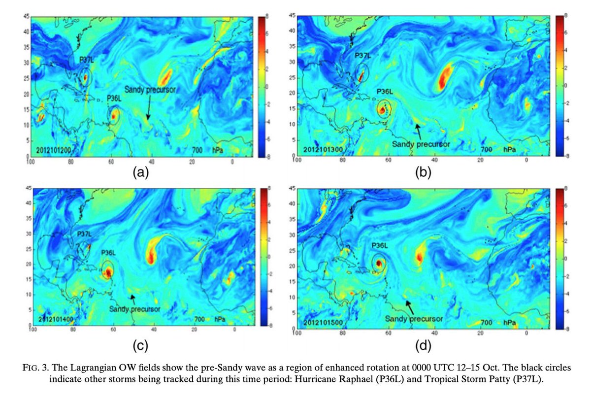
Using the study, it denotes that Sandy originated from an ITCZ wave which preceded the closest AEW like mentioned in the TSR. The vorticity then moved west and became hard to distinguish until it met up with a Caribbean Gyre from here it was able to develop. Sound Familiar? 4/
Using graphics from the study (link below) we can see that Sandy wasn& #39;t a clearly defined entity entering the Caribbean. A little more than a vort max in the grand scheme of things. 5/
https://met.nps.edu/~mtmontgo/papers/Pub_126.pdf">https://met.nps.edu/~mtmontgo...
https://met.nps.edu/~mtmontgo/papers/Pub_126.pdf">https://met.nps.edu/~mtmontgo...
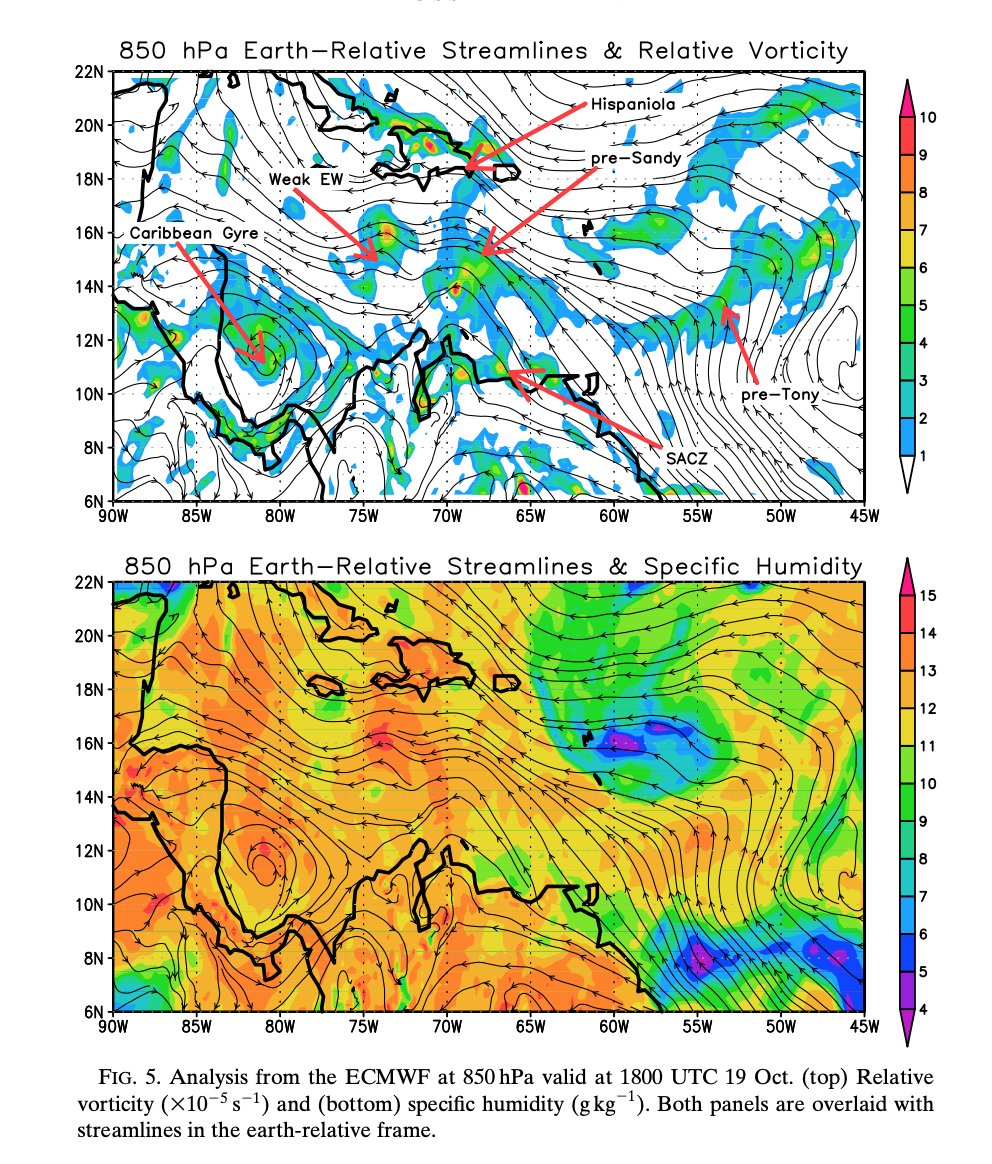
More graphics from the study shows how the setup in the Caribbean is fairly similar to what the GFS is showing. This time around, the incoming vorticity is less defined which is something to keep in mind. 6/
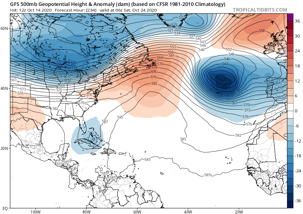
For the record I& #39;m not saying this will be Sandy 2.0, just noting that these late season Caribbean storms share a common theme. That being said the 500mb pattern between Sandy and this potential storm 10 days out is quite different as of now. 7/
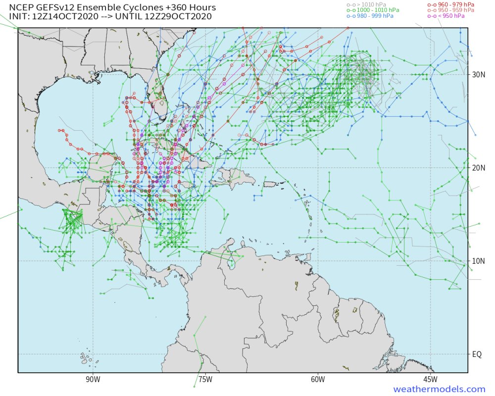
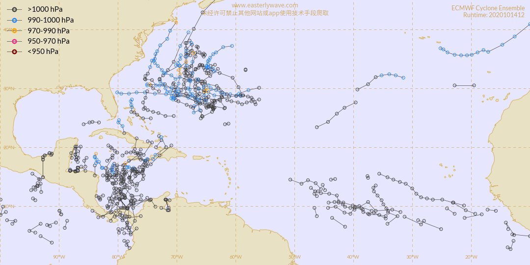
As I was making this thread, I saw the GEFS and ECEF run from 12z and I don& #39;t like it... Could have subtropical development as well as the storm in the Caribbean. Funnily enough, the development of the STC storm will have large implications on the track of the Carib Storm. 8/8

 Read on Twitter