Another pattern amplification is about to occur over the United States
While pattern amplification will also occur over the Pacific Ocean, that this occurs simultaneously over North America suggests that it is more than Pacific forcing, which is correct.
Over the Pacific, a strong cyclone will form, and cold advection behind this cyclone and warm advection ahead of it will amplify both the upstream trough and downstream ridge. Classic self-development feedback for midlatitude cyclones.
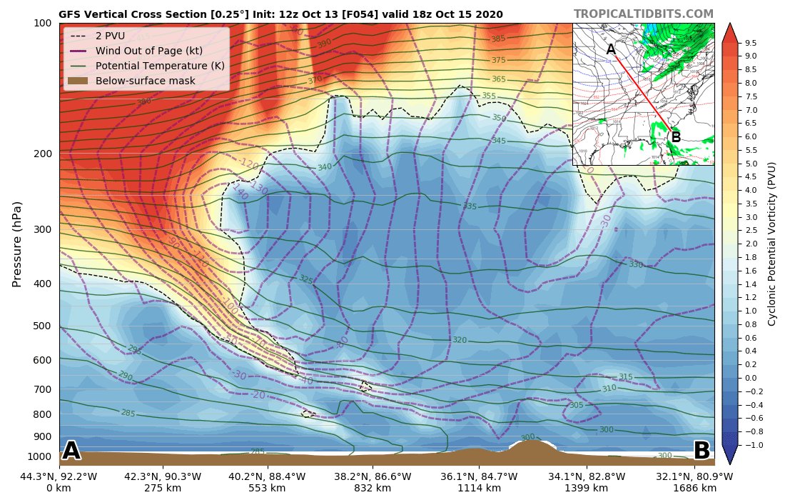
Over North America, the strong jet upstream of the trough axis amplifies the trough via the advection of cyclonic shear vorticity into the trough
Furthermore, cold advection by the jet serves to further amplify the trough via tilting of horizontal and then stretching of vertical of vorticity aloft in response to upper-level frontogenesis.
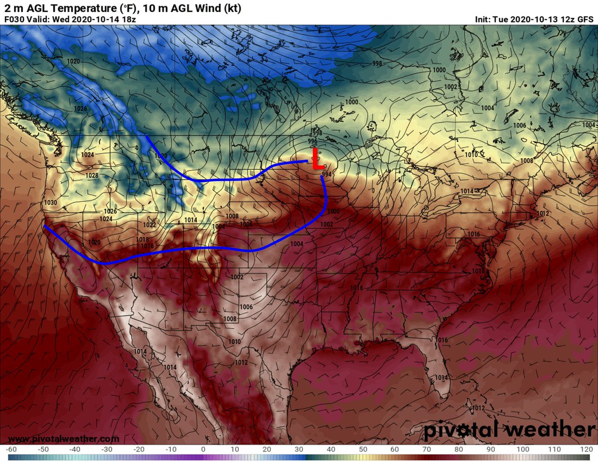
At the surface, a strong cyclone that impacted western Washington and British Columbia today will jump the Rocky Mountains and lee cyclogenesis will occur over Montana/Alberta, in response to westerly flow traversing the N-S mountain range. This is typical.
By Wed afternoon, two cold fronts are apparent. The leading front is the Pacific cold front, and the trailing front is the polar front. The initial low over the Pacific could not access polar air (blocked by mountains), but the lee low advects polar air southward on its west side
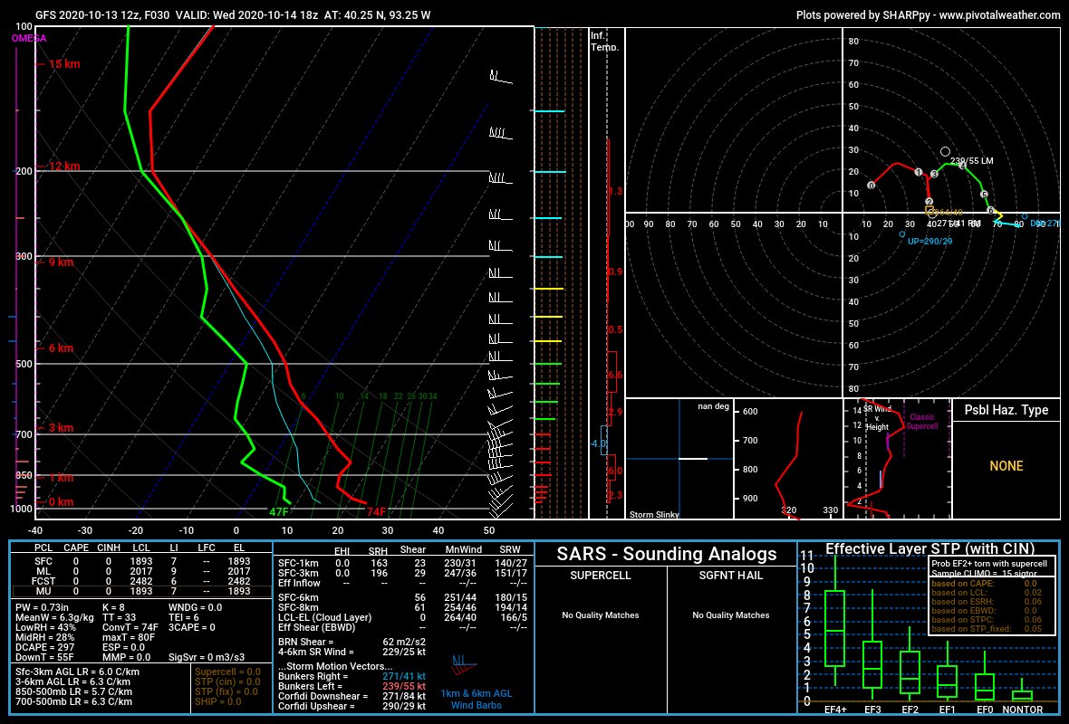
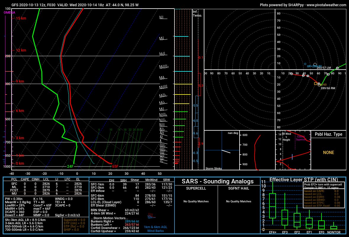
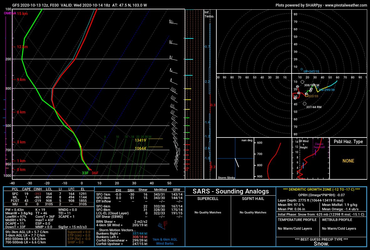
Soundings reveal warm air in the warm sector (1), much cooler temps aloft behind the Pacific front, but not much cooler air at the surface owing to latent heat release ascending the Cascades and adiabatic descent on the lee side (2), and much cooler air behind the polar front (3)
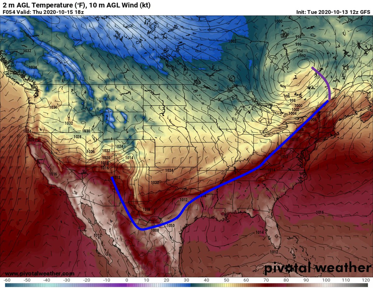
A loop of surface temperatures, however, reveals that the Pacific front is almost indistinguishable as it crosses the western mountains, owing to surface elevation changes, adiabatic ascent/descent, and solar heating in the now dry post-frontal air
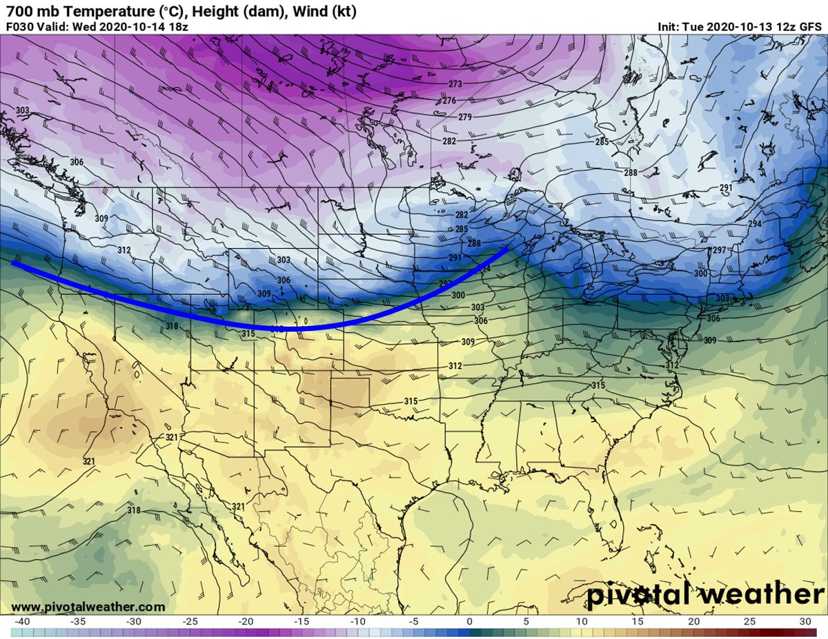
A loop of 700 mb temperatures, however, reveals that the Pacific front is clearly contiguous as it crosses the mountains of the western United States.
By Wednesday afternoon, the 700 mb cold front (Pacific front/cold front aloft) is well ahead of the polar front, as should be expected.
By Thursday afternoon, the polar front has caught the Pacific front (NW winds ahead of the polar front increase its speed), and the result is the typical cold front observed over the central and eastern United States.
If you& #39;re a weather enthusiast and are confused by all of this, I encourage you to apply to @DAS_Illinois and we will teach you! This is an encapsulation of my weather briefing in my synoptic class this afternoon.

 Read on Twitter