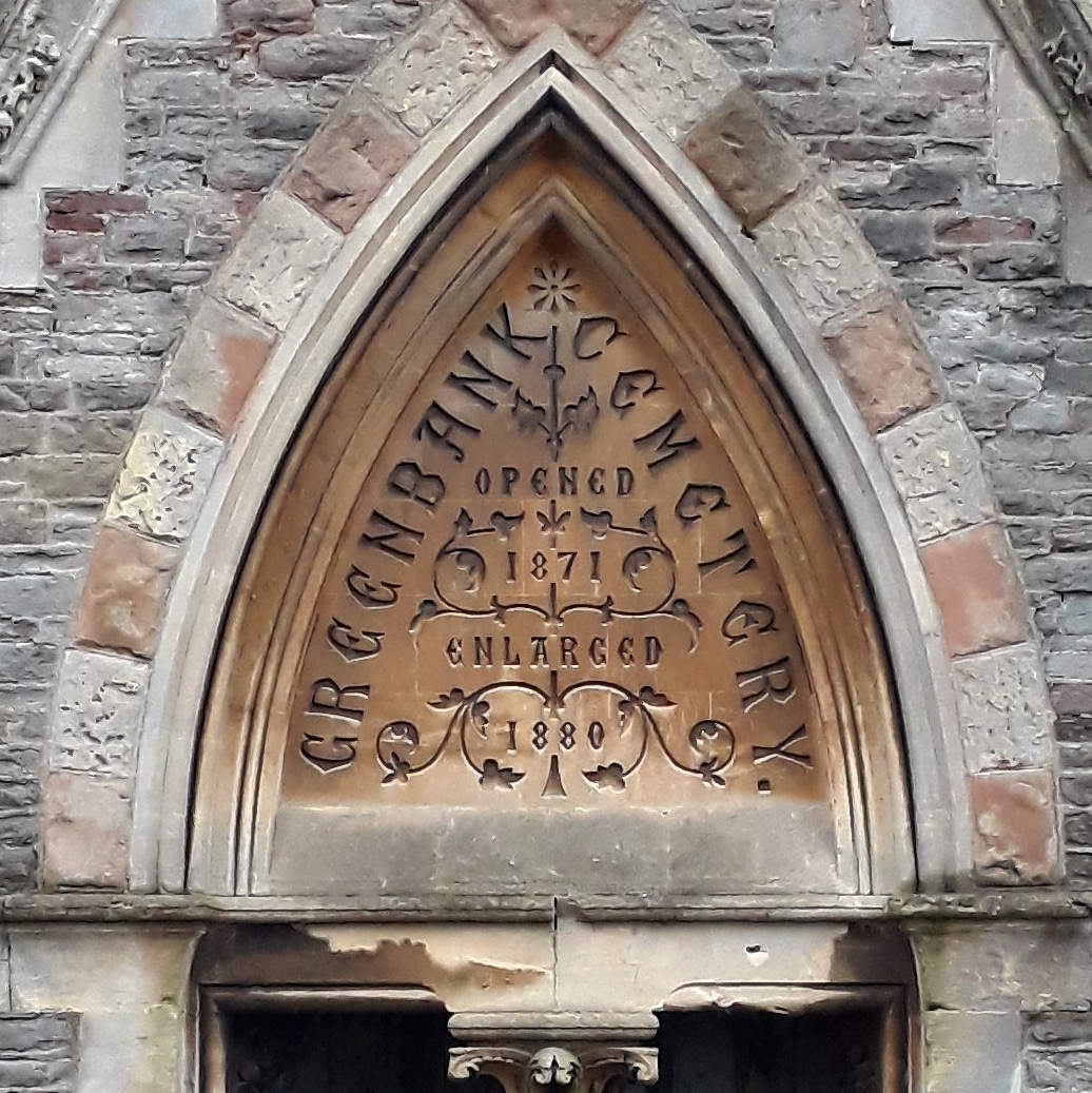
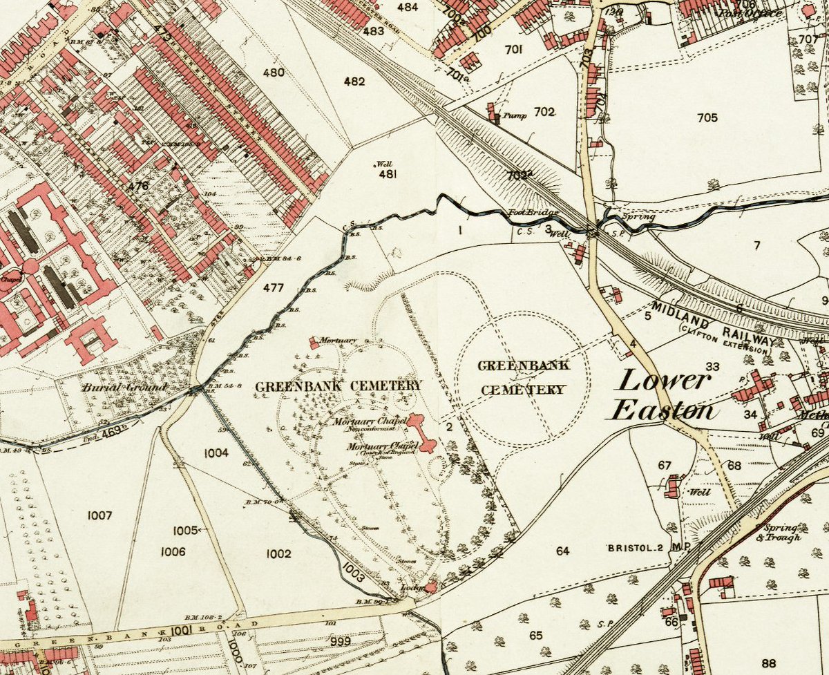
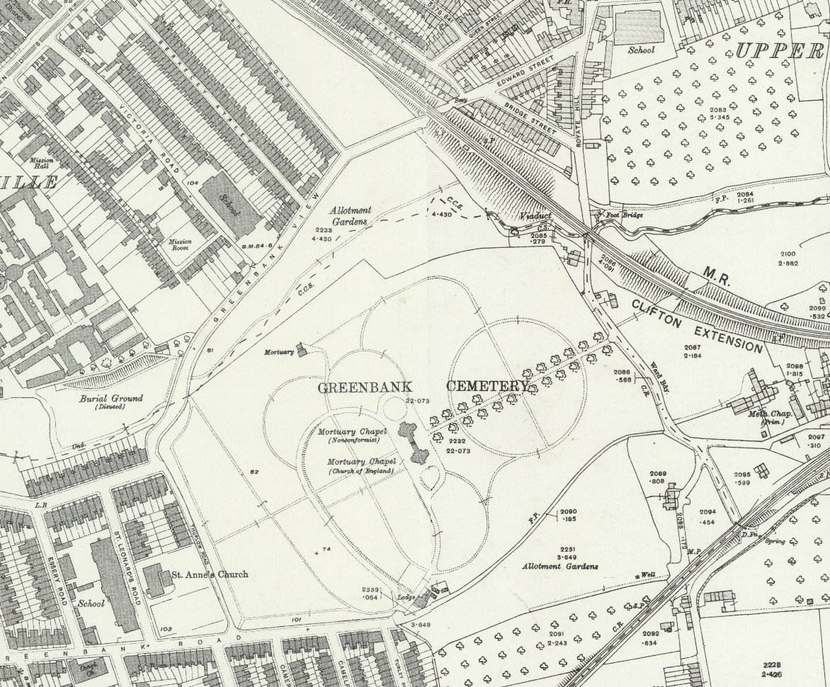
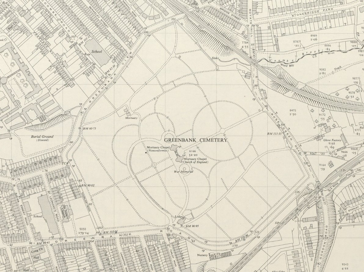
Went for a wander around Greenbank Cemetery today and saw the sign saying "Opened 1871, Enlarged 1880" and not for the first time I wondered which bits are the enlarged bits. So here is: three phases in the life of Greenbank
The maps show Greenbank in the 1870s, circa 1900, and circa 1950. Note how by 1900 the cemetery has allotments on north and south sides: I wonder if the council bought the land deliberately intending it as cemetery expansion space
Note also the workhouse burial ground at Rosemary Green, still in use in the 1870s but disused by the end of the century; and the relatively late date of some of the roads in the area
If I& #39;d extended the map to the east a little, you& #39;d have seen Kingswood Junction, including the line connecting to Deep Pit and the Peckett & Sons locomotive works
Of course I wouldn& #39;t have been able to put this thread together without the brilliant https://maps.bristol.gov.uk/kyp/?edition= ">https://maps.bristol.gov.uk/kyp/... and @KYPBristol

 Read on Twitter


