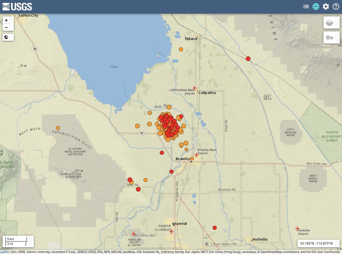
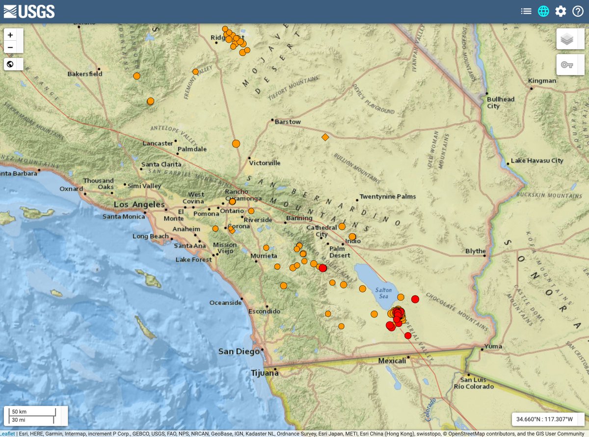
An #earthquake swarm has kicked off southwest of the #SaltonSea today, producing 240 earthquakes as of 8pm Pacific. The largest earlier this evening was M4.9.
So what does this mean? We’ve put together some scenarios to explain what could happen next. https://www.usgs.gov/center-news/earthquake-forecast-westmorland-swarm-beginning-sept-30-2020">https://www.usgs.gov/center-ne...
So what does this mean? We’ve put together some scenarios to explain what could happen next. https://www.usgs.gov/center-news/earthquake-forecast-westmorland-swarm-beginning-sept-30-2020">https://www.usgs.gov/center-ne...
The most likely scenario is that the rate of earthquakes in the swarm will decrease over the next 7 days. Some additional moderate-sized earthquakes (M4.5 to 5.4) may occur. Smaller magnitude earthquakes (M3.0+) may be felt by people close to the epicenters.
A less likely scenario is a somewhat larger earthquake could occur (up to a M6.9). Earthquakes of this size could cause damage around the area close to the swarm and would be followed by aftershocks that would increase the number of smaller earthquakes per day.
The least likely scenario, compared to the other two scenarios, is that the ongoing swarm could trigger an earthquake significantly larger (M7.0 or above). While this is a low probability, if such an earthquake were to occur, it would have serious impacts for nearby communities.
No one can predict the exact time or place of any earthquake, including aftershocks or swarms. Our forecasts give us an understanding of the chances of having more quakes within a given time period in the affected area. One uncertain aspect of this swarm is how long it will last.
The chance of large earthquakes will remain elevated as long as the swarm continues. About half of the swarms in this area are over within a week. We will update our forecast as swarm activity increases or decreases, or if larger earthquakes occur. https://www.usgs.gov/center-news/earthquake-forecast-westmorland-swarm-beginning-sept-30-2020">https://www.usgs.gov/center-ne...
We are carefully monitoring activity throughout the region and will continue to provide information to help people stay safe and care for themselves and each other. Info on the latest quakes is always posted on our “Latest Earthquakes” map: https://earthquake.usgs.gov/earthquakes/map/?extent=20.59165,-140.80078&extent=50.76426,-97.20703&magnitude=all&listOnlyShown=true&baseLayer=terrain&timeZone=utc&settings=true">https://earthquake.usgs.gov/earthquak...

 Read on Twitter


