https://novascotia.ca/natr/forestry/programs/LandscapePlanning/Sept2020_ForestConnectivity.pdf">https://novascotia.ca/natr/fore...
Ecological connectivity tells us how well a landscape allows for wildlife to move freely and ecological processes to function normally.
It can tell us a lot about habitat fragmentation, how resilient a landscape is to climate change and identify key areas for wildlife movement.
It can tell us a lot about habitat fragmentation, how resilient a landscape is to climate change and identify key areas for wildlife movement.
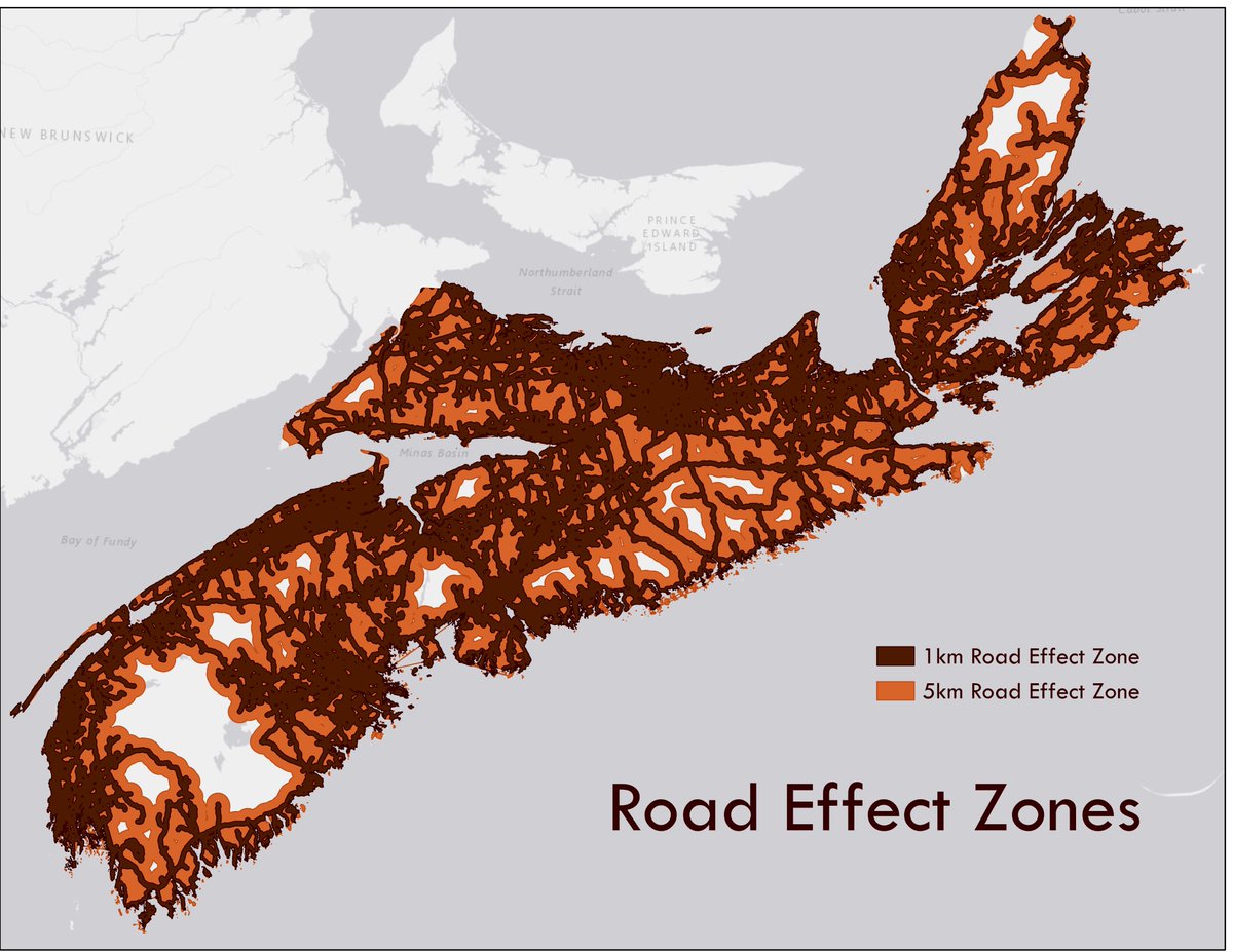
Roads are one of the biggest barriers to connectivity, but their impacts on the environment and wildlife go far beyond the edge of the road
So, we ran our analyses on the landscape as is, and on areas further than 1 and 5 km from roads.
So, we ran our analyses on the landscape as is, and on areas further than 1 and 5 km from roads.
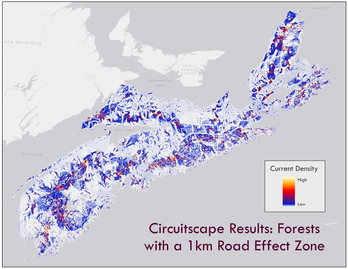
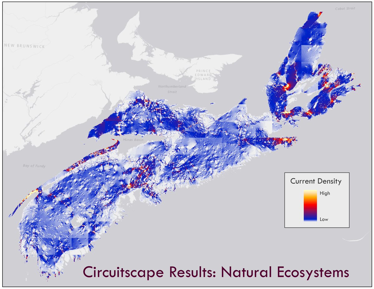
We looked at the connectivity of natural ecosystems, forests and mature forests across the province and compared today& #39;s landscape to what the land would have looked like at the time of colonization.
As a visual, these are all of the different landscapes we looked at:
As a visual, these are all of the different landscapes we looked at:
We measured and mapped connectivity across the province using a number of different metrics and methods which gave us the opportunity to compare and contrast the different results.
Some key results:
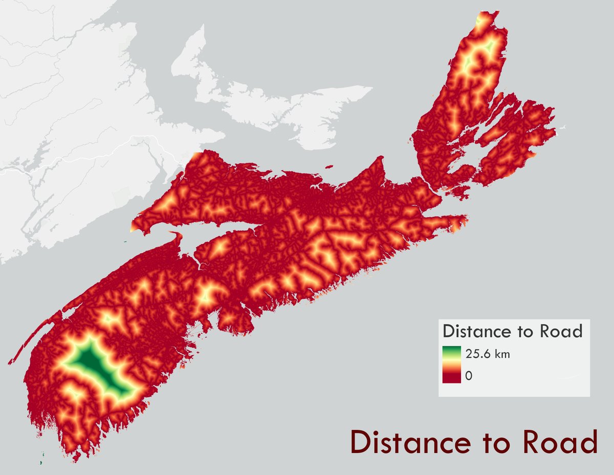
- There are A LOT of roads in NS and the average distance to a road across the whole province is 1.8 km and the max distance is 25.6 km
- In general, the places with the lowest density of roads had the highest connectivity
- There are A LOT of roads in NS and the average distance to a road across the whole province is 1.8 km and the max distance is 25.6 km
- In general, the places with the lowest density of roads had the highest connectivity
- Connectivity has been best maintained in southwest Nova and the Cape Breton Highlands BUT these are also places where connectivity is naturally lower because of the shape of the land and large amounts of waterways.

 Read on Twitter


