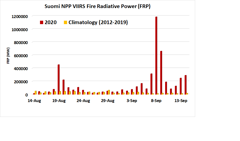
To measure the heat and intensity of wildfires, satellites rely on a measurement called fire radiative power. Fire radiative (FRP) power tells us about the heat released by a given fire in megawatts, using data from the #VIIRS instrument on the #NOAA20 and #SNPP satellites.
The highest fire radiative power value for the devastating fires in Calif., Ore., and Wash. occurred on Sept 8, at about 1.2 million megawatts. For perspective, the average FRP for this date from 2012 to 2019 was 0.013 million, and the highest value: 0.065 million megawatts.
“Fires with an FRP value of 1.2 million megawatts can release 20 to 40 tons of smoke into the atmosphere in one second,” said Dr. Shobha Kondragunta, a physical scientist at @NOAA& #39;s National Environmental Satellite, Data, and Information Service and @AerosolWatch
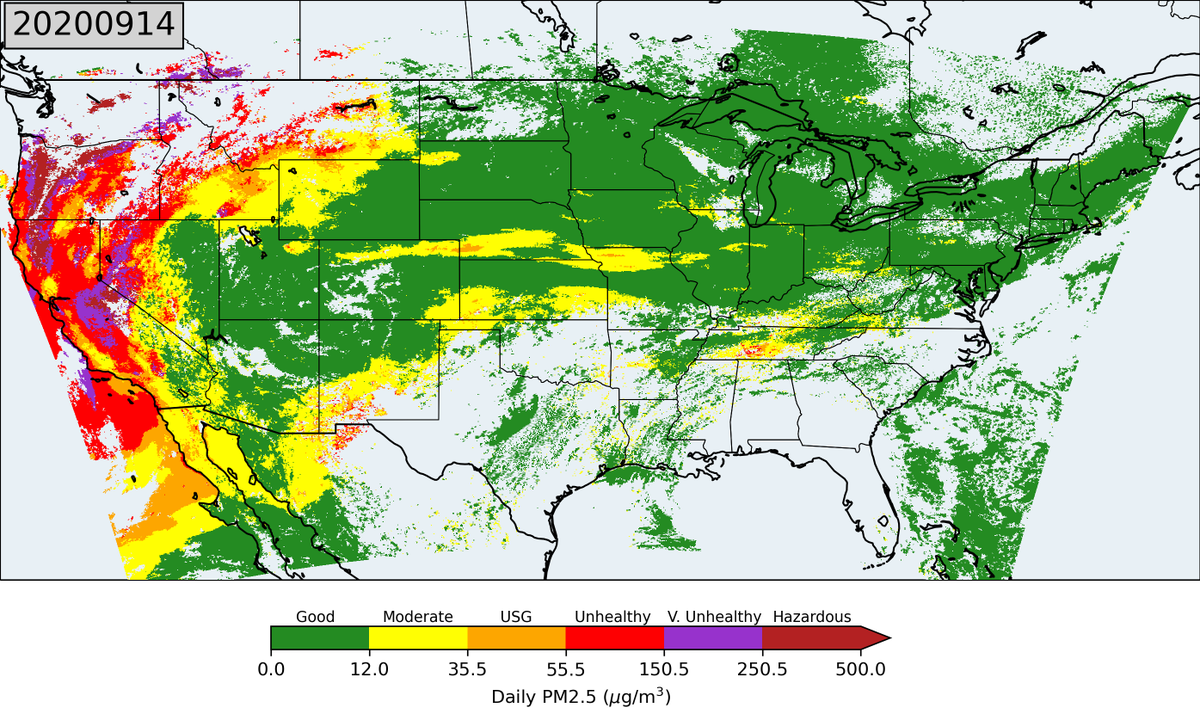
Fine particulates are the primary pollutant in wildfire smoke. @EPA tracks concentrations of PM2.5, particles that are small enough to enter the respiratory system & cause lung tissue damage and cardiovascular disease. You can see PM2.5 levels from Sept 14 in this U.S. map.
Smoke from these fires has also migrated across the U.S. On Sept 16, @NOAASatellites aerosol imagery helped @UMD_AOSC fly instrumented aircraft NE of Baltimore to sample smoke and found it at an altitude of 1.5 to 2.5 miles.
Thanks to Dr. F. Li and Dr. X. Y. Zhang (SDSU);
Dr. H. Zhang and Dr. A. Huff (IMSG); Dr. X. Ren (NOAA/ARL); Dr. R. Dickerson, H. Daley (UMD AOSC)for contributions and images.
Dr. H. Zhang and Dr. A. Huff (IMSG); Dr. X. Ren (NOAA/ARL); Dr. R. Dickerson, H. Daley (UMD AOSC)for contributions and images.

 Read on Twitter


