Before I begin this thread, I& #39;m issuing this disclaimer. This scenario that I& #39;m about to discuss is in the long-range and the forecast can change. Take this with a grain of salt.
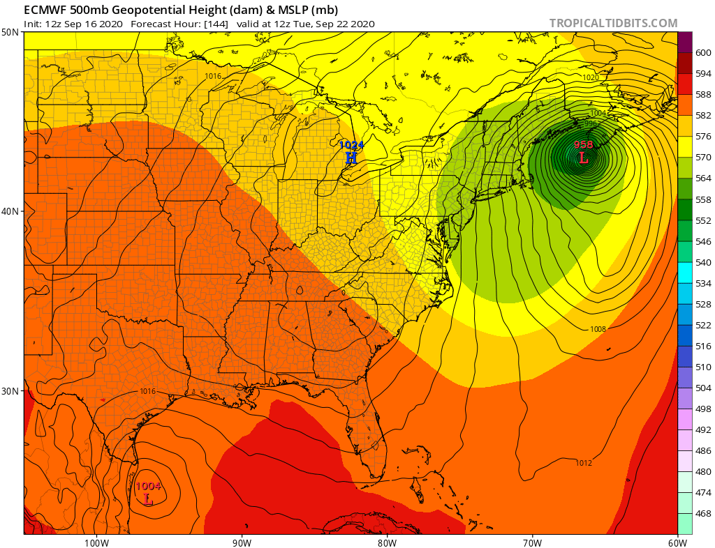
The EURO forecast solution for #Teddy is potentially worrisome for the NE US and Maritime Canada...
The EURO forecast solution for #Teddy is potentially worrisome for the NE US and Maritime Canada...
As the storm treks NW on the east side of a ridge, it& #39;ll find itself in the vicinity of Bermuda in 5 days. At the same time, a cutoff low originating from a LW trough over Canada will be dipping SW along the eastern seaboard west of Teddy. And this is where things get hairy...
At this point in the run, Teddy gets caught within the flow of this low, phases with it (causing the low to stop moving SW), and resulting in the storm tracking further west. And further west means towards land, namely New England and Nova Scotia in this solution...
The ensemble members are mostly in agreement with the parent model, though a few members miss the connection and recurve it like normal. Other global models do not show this solution and simply have Teddy recurving out to sea, but...
EURO is the one forecasting this and not other global models, and that& #39;s concerning. EURO tends to handle phasing events better than most models, and it famously nailed Sandy, which was also a phasing event (it was a more complex setup, however). On the other hand, look at...
Joaquin, which was forecasted by all models except the EURO to phase and strike the east coast. And the EURO reigned supreme there. Now I& #39;m not saying Teddy will be anything like Sandy or Joaquin, but if this verifies, it could be bad. But reread the start of this thread.
/end.
/end.

 Read on Twitter


