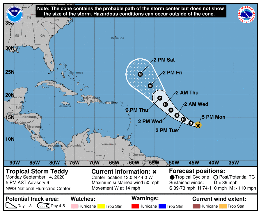
While Hurricane #Sally has been getting most the attention recently, and rightfully so, I thought I& #39;d create a thread on #Teddy and the continual west shifts. It may not look so formidable right now but has a chance of becoming the strongest storm in the NATL so far. 1/
The latest @NHC_Atlantic track has it turning north past 50W becoming a hurricane in 24 hours and a major hurricane by the end of the week. As of now, it looks like it stays OTS with it being a threat to Bermuda next week. 2/
I personally believe that there will be more shifts west in the track for a couple of reasons that I& #39;ll list below
1) ULAC displacing convection down shear
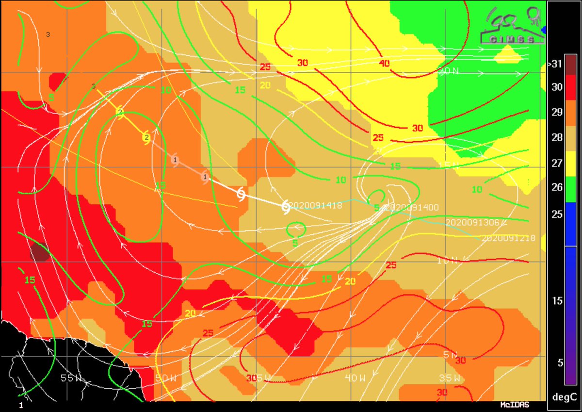
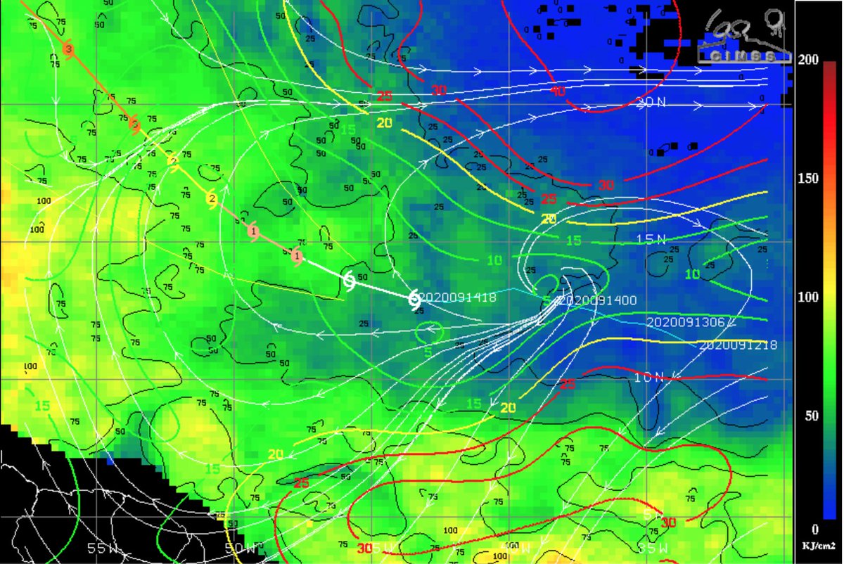
2) SSTs + OHC favouring convection to the W
3) A weaker storm than initially progged 3/
1) ULAC displacing convection down shear
2) SSTs + OHC favouring convection to the W
3) A weaker storm than initially progged 3/
The ULAC currently isn& #39;t imparting shear vectors that are necessarily detrimental to the storm as most shear maps have the storm under 10kts of shear. However, it& #39;ll force convection to form down shear which is SW of the LLC, where most of the convection is currently located. 4/
Coincidentally areas to the S & W where convection is present is where the highest OHC and warmest SSTs are located. The warmer SSTs and higher OHC values will favour convection forming in that quadrant and thus "pulling the storm further W. 5/
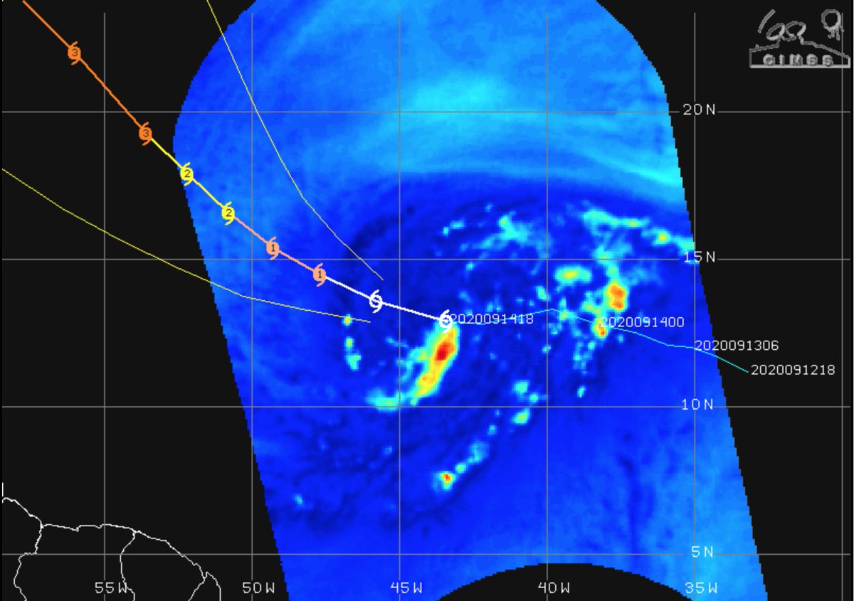
In addition to all of this, the LLC is exposed to the north with recent microwave imagery further showing that the core isn& #39;t well developed. This makes the storm more susceptible to dry air intrusions and shear. 6/
What does this all mean? Not much to be honest, the west shifts will continue but enough so that it is in a place to impact the East Coast or other areas. @jhomenuk has a nice gif for the long term which shows the uncertainty regarding this storm. 7/7 https://twitter.com/jhomenuk/status/1305603782940733441">https://twitter.com/jhomenuk/...
not enough*

 Read on Twitter


