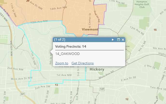
1. After a number of inquiries, I& #39;ve posted interactive maps of all the current #NCGA House and Senate districts, as well as the #NC Congressional districts. All the maps include current #precinct boundaries as well. For map links and details see thread.  https://abs.twimg.com/emoji/v2/... draggable="false" alt="🧵" title="Thread" aria-label="Emoji: Thread"> #NCPol #FairMaps
2. Here& #39;s the map of the NC State _House_ districts. See below in thread for some tips. #NCPol #NCGA #FairMaps https://arcg.is/zfD4G1 ">https://arcg.is/zfD4G1&qu...
3. Here& #39;s the map of the NC State _Senate_ districts. See below in thread for some tips. #NCPol #NCGA #FairMaps https://arcg.is/1CyyqS ">https://arcg.is/1CyyqS&qu...
4. Here& #39;s the map of the NC _Congressional_ districts. See below in thread for some tips. #NCPol #NCGA #FairMaps https://arcg.is/0aXeWr ">https://arcg.is/0aXeWr&qu...
5. More on the precincts, which are what set these maps apart from most other district maps out there. You need to zoom in to see the #precinct boundaries and their labels. Clicking on an individual precinct should also bring up the precinct name.
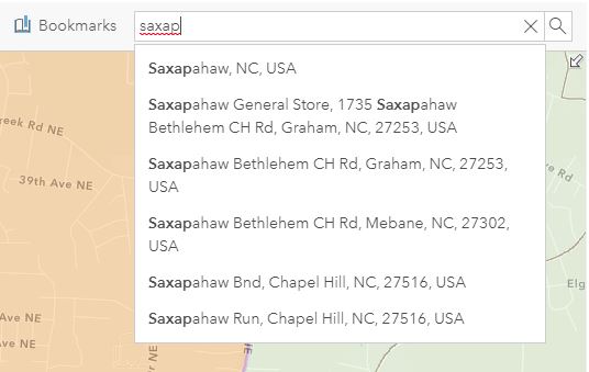
6. You can use the search window in the upper right of the map (large screen device) to search for a place or specific address.
7. The #NCGA website has some nice interactive maps available from their #redistricting pages, but they show VTDs (listed as Voting Districts), not precincts. The two are similar but not the same. See  https://abs.twimg.com/emoji/v2/... draggable="false" alt="⬇️" title="Pfeil nach unten" aria-label="Emoji: Pfeil nach unten">for more on that ... https://medium.com/mit-election-lab/mismatched-the-trouble-with-making-a-national-precinct-return-shapefile-fc16a3d3ff94">https://medium.com/mit-elect...
8. Thanks are due to @NCOneMap for making the boundary layers available as #GeoServices, which makes publishing maps like these a lot easier.  https://abs.twimg.com/emoji/v2/... draggable="false" alt="🙏🏻" title="Folded hands (heller Hautton)" aria-label="Emoji: Folded hands (heller Hautton)"> https://www.nconemap.gov/ ">https://www.nconemap.gov/">...
9./9. Some may recall that I posted similar maps last fall after districts were redrawn. But those were showcasing the new districts, and some of the links are now broken. Still if you& #39;ve read this far, you might find pieces of the post  https://abs.twimg.com/emoji/v2/... draggable="false" alt="⬇️" title="Pfeil nach unten" aria-label="Emoji: Pfeil nach unten">of interest.
  https://abs.twimg.com/emoji/v2/... draggable="false" alt="😃" title="Lächelndes Gesicht mit geöffnetem Mund" aria-label="Emoji: Lächelndes Gesicht mit geöffnetem Mund"> https://blog.districks.com/2019/11/20/web-maps-for-exploring-new-nc-state-legislative-districts/">https://blog.districks.com/2019/11/2...

 Read on Twitter
 #NCPol #FairMaps" title="1. After a number of inquiries, I& #39;ve posted interactive maps of all the current #NCGA House and Senate districts, as well as the #NC Congressional districts. All the maps include current #precinct boundaries as well. For map links and details see thread. https://abs.twimg.com/emoji/v2/... draggable="false" alt="🧵" title="Thread" aria-label="Emoji: Thread"> #NCPol #FairMaps" class="img-responsive" style="max-width:100%;"/>


