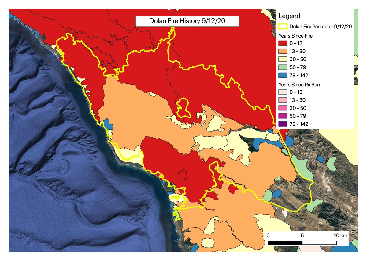
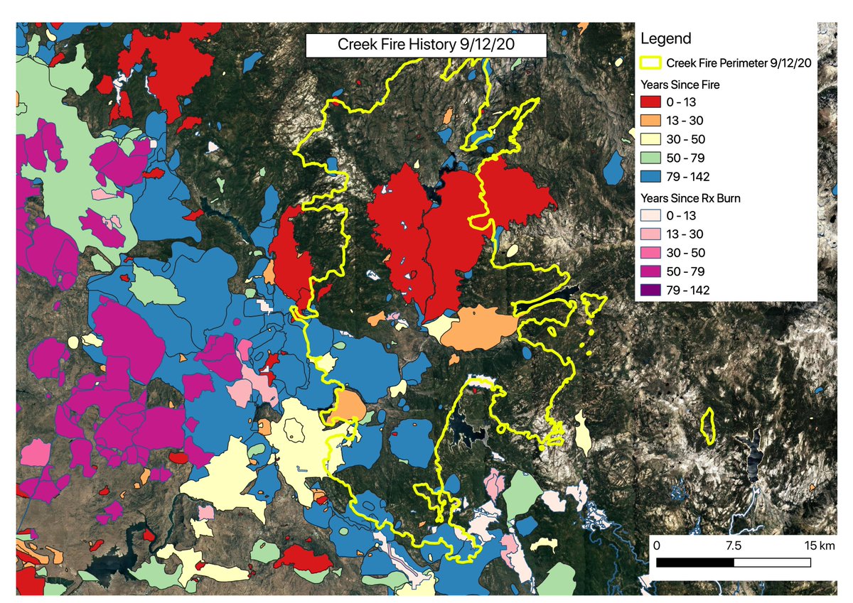
As we talk about these fires, one thing that comes up often is the fire history of these places & how long it has been since the land burned. I find it helpful to map this, so I put together some quick recent fire history maps of several of the current CA fires. (thread)
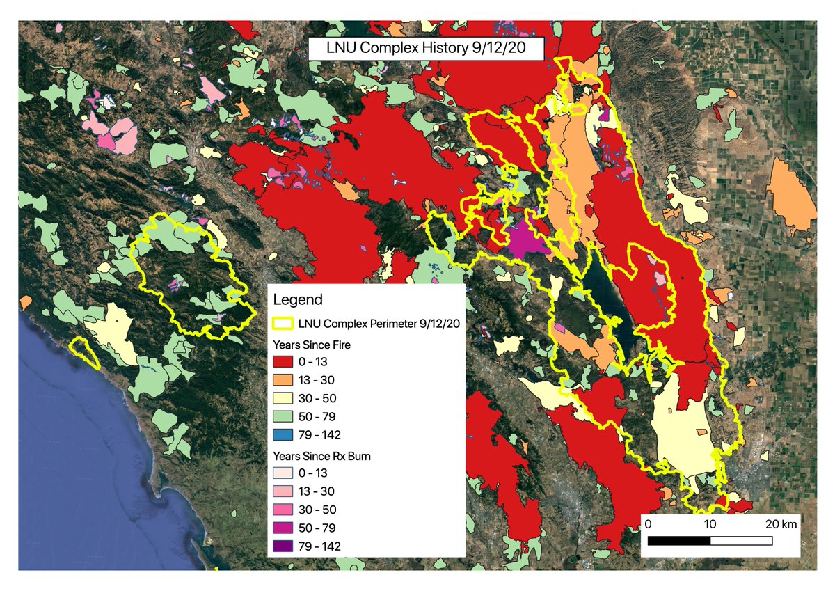
LNU up first. Yellow is current perimeter, colors are past fires, colored to show how long ago it happened (intervals fairly arbitrary). A huge portion of the area has burned in the last 30 years, most in the last 5 yrs. Some areas that haven& #39;t burned in a long time, though.
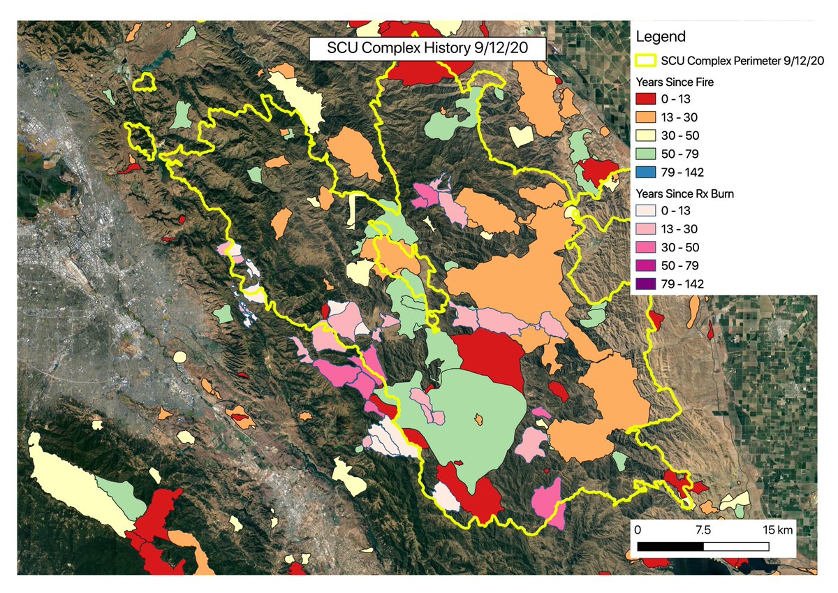
Next is SCU. Also some large areas that have burned in the last 30 years, including some Rx fire, but overall less recent burn than LNU.
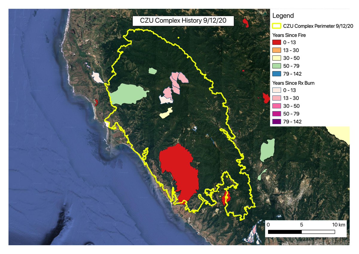
Here& #39;s our Big Basin Fire, the CZU Complex. Strikingly different from something like the LNU or SCU. Except for a large fire from 2009 and a small area of prescribed burning, almost completely unburned in many many decades, likely over a century.
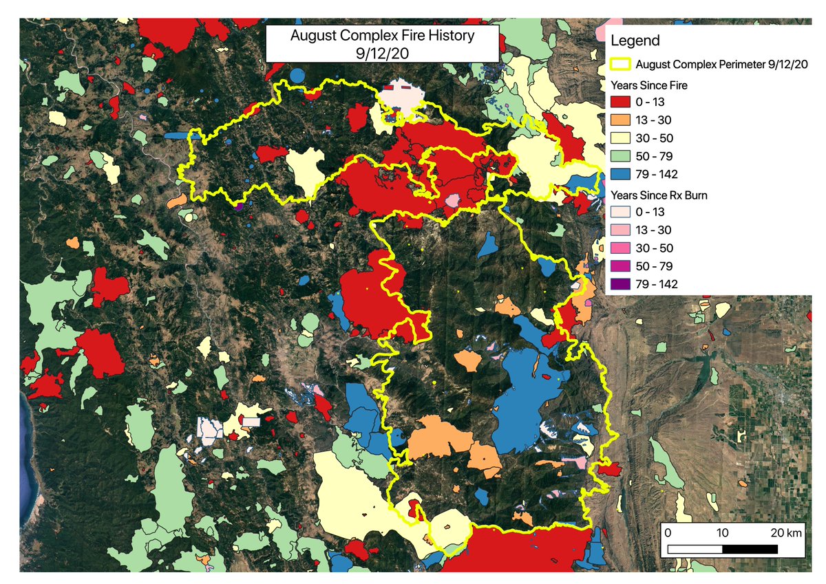
I originally made those a couple weeks ago, but just added more. Here is the August Complex, now the biggest on record in CA. Some recent burn in the upper section, but largely unburned for a long time.
On the other end, here& #39;s the Dolan Fire in Big Sur. Almost all of it has burned within 30 years, much of that within 13 years.
Finally, the Creek Fire. A large of area of very recent fire in the middle, but mostly unburned for a long time.
A few notes: data are from FRAP & NIFC. The historical perimeters get less complete the further back in time you get. Also, the way it& #39;s set up, newer fires cover older ones.
Also important: these are just perimeters. They don& #39;t tell you anything about past fire severity--gotta use a different map for that & I was keeping it simple for now.
I mostly put this here w/out detailed analysis, but I& #39;d say the main takeaway is this: every fire is different. Some places haven& #39;t seen fire in forever, others have had a lot. Their historical fire intervals are different, too. LNU tells a very different story than CZU.
It& #39;s clear that fuel buildup over many decades or a century due to fire suppression & loss of indigenous burning is part of the story in many of these fires. But other places have had plenty of fire & perhaps fresh post-fire growth (esp invasives) have made them more vulnerable.
Under extreme conditions, recent fire on the ground, esp. w/out regular maintenance, may not be enough to stop or even slow a fire much (tho I& #39;m very curious to see fire severity maps for these fires vs. fire history).
A bit more on my first thoughts on the LNU, SCU, and CZU fires from when I first made their maps is here: https://talkaboutfire.com/2020/09/02/a-still-developing-story-of-three-fires/">https://talkaboutfire.com/2020/09/0...

 Read on Twitter