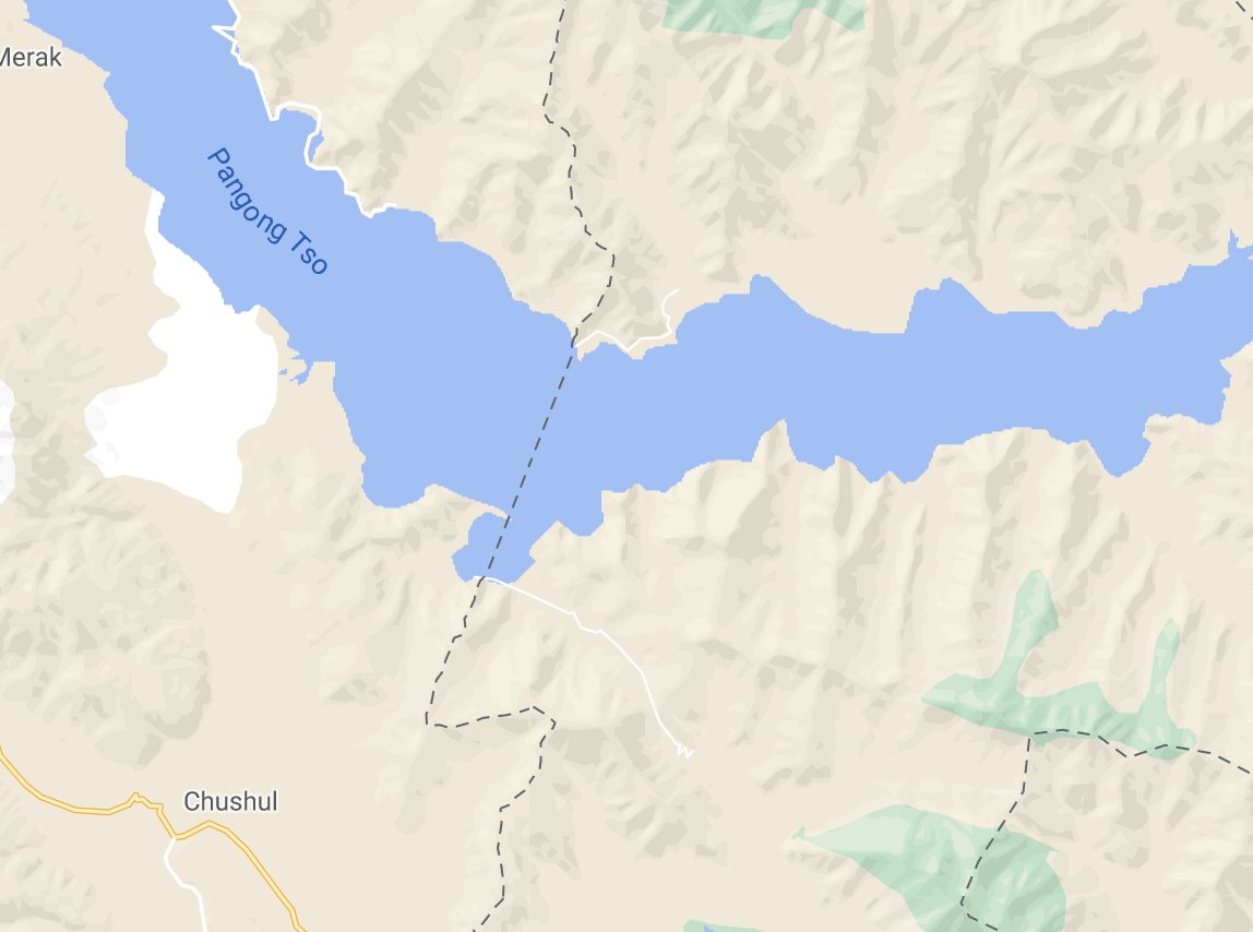
A short thread on China& #39;s claims on the southern bank of Pangong Lake, in light of escalating tensions in the past week and hours. 1/
Bottom-line up-front: China& #39;s claims immediately on the southern bank lie to the west of India& #39;s view of the LAC. In fact, it may be one area where China& #39;s claims lie beyond its view of the LAC. Thus, this is a potentially volatile area. 2/
For India& #39;s view of the LAC on the southern bank, see this map:
https://twitter.com/nitingokhale/status/1302247226249412609?s=20">https://twitter.com/nitingokh... 3/
https://twitter.com/nitingokhale/status/1302247226249412609?s=20">https://twitter.com/nitingokh... 3/
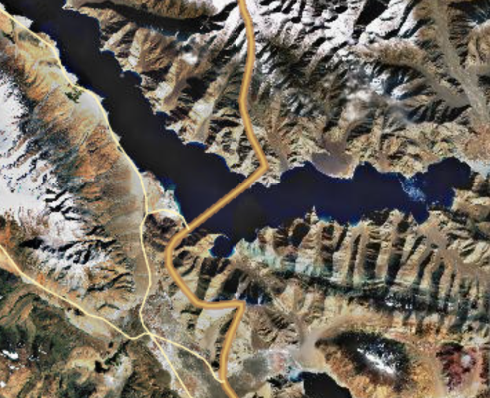
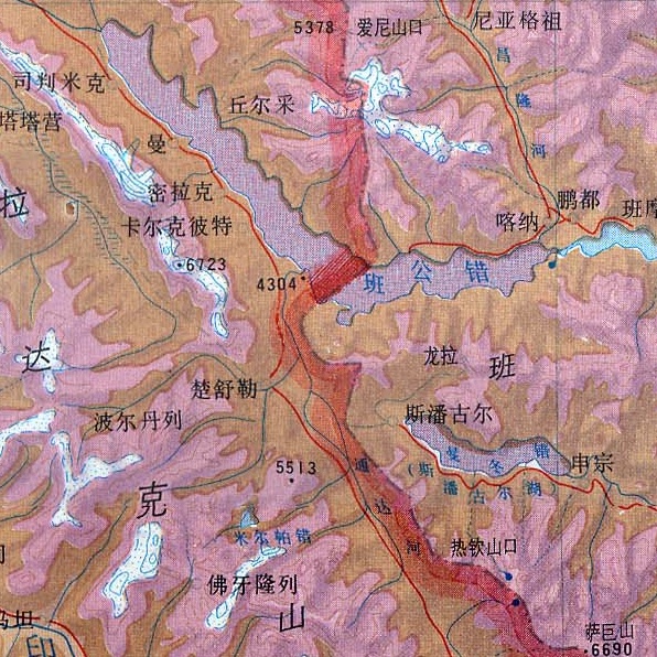
This authoritative Chinese map shows the hill on which India& #39;s Thakung observation post is located as lying within the territory China claims. (Source: China& #39;s National Platform for Common Geospatial Information Services under the Ministry of Natural Resources.) 4/
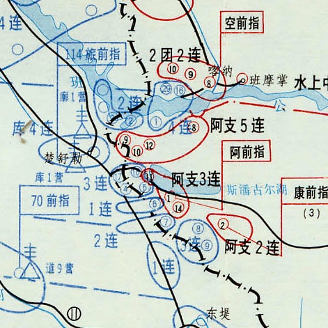
This map from an official Chinese military history of the 1962 war also shows China& #39;s claim to the area, along with how forces contested this area in the run-up to the war. (China& #39;s positions in red, India& #39;s in blue.) 5/
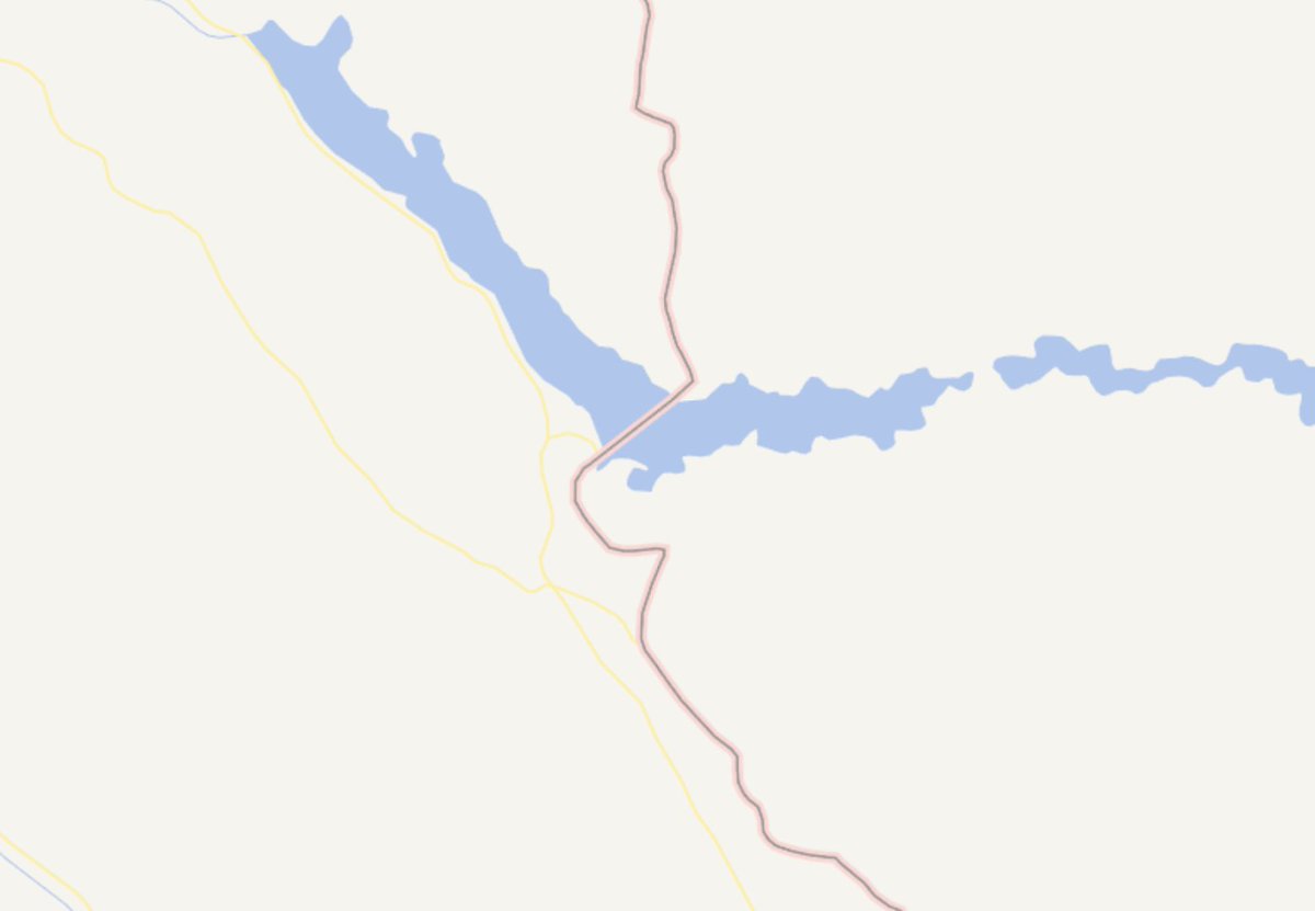
However, some sources such as Google maps show the Chinese claim as lying to the east, which might create confusion about China& #39;s position when compared with Chinese maps. 7/
Thus, the immediate area on the south bank of the Pangong Lake where Indian and Chinese claims overlap is especially volatile. END/

 Read on Twitter