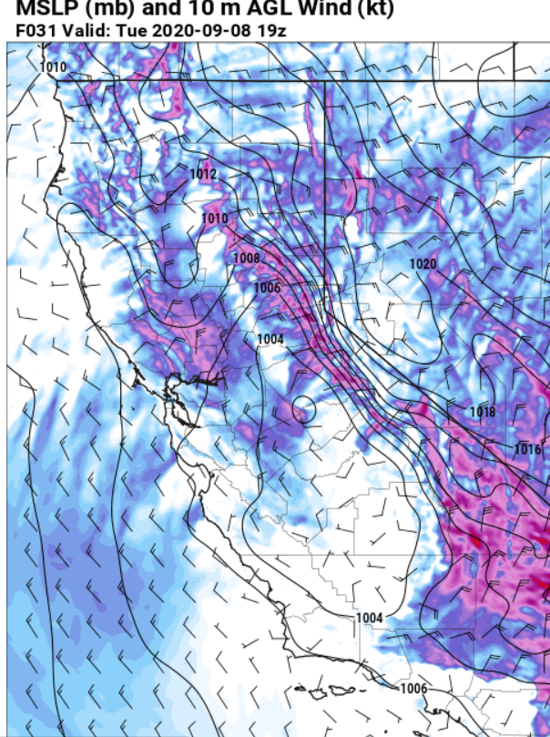
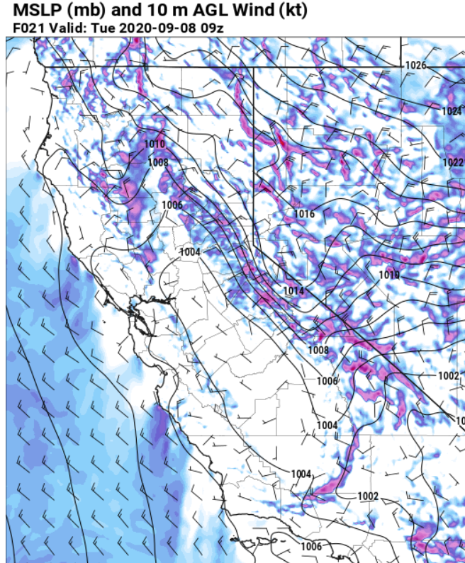
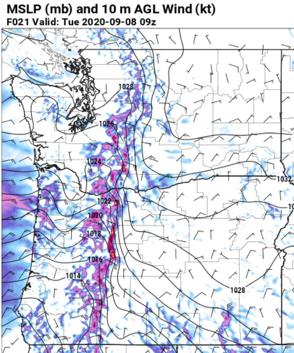
Extremely dry and easterly windy conditions will develop over the Cascades later today followed by a moderate event in the N Sierra Foothills, Sac Valley and N Bay Area, then a Santa Ana. Quick roundup of what NWS offices are saying about this event: 1/n
#cawx #orwx #firewx
#cawx #orwx #firewx
NWS Portland:
“All the ingredients are coming together as expected for a potent and likely historic September East Wind event
... that only occurs a couple times a century in September. Extreme fire danger and locally damaging winds are likely. 2/n
“All the ingredients are coming together as expected for a potent and likely historic September East Wind event
... that only occurs a couple times a century in September. Extreme fire danger and locally damaging winds are likely. 2/n
NWS Portland cont:
"The strongest east winds still appear to focus through the gap in the high Cascades between Mt Adams and Mt Hood … western portions of the Columbia Gorge, Portland/Vancouver metro area, north Oregon Coast and Coast Range” The Coast Range too!. 3/n
"The strongest east winds still appear to focus through the gap in the high Cascades between Mt Adams and Mt Hood … western portions of the Columbia Gorge, Portland/Vancouver metro area, north Oregon Coast and Coast Range” The Coast Range too!. 3/n
NWS Sac:
"A period of strong north to east winds later tonight and Tuesday, especially along the western edge of
the Sacramento Valley and across the foothills and west slopes of the northern Sierra." 4/n
"A period of strong north to east winds later tonight and Tuesday, especially along the western edge of
the Sacramento Valley and across the foothills and west slopes of the northern Sierra." 4/n
NWS Sac cont: "Local gusts of 40-50 mph will be possible as both the MFR-SAC and RNO-SAC gradient is forecast to get to 12-14 mbs Tuesday morning."
NWS Bay Area "Pressure gradients from SFO-WMC would definitely raise some eyebrows as they approach the upper teens. " 5/n
NWS Bay Area "Pressure gradients from SFO-WMC would definitely raise some eyebrows as they approach the upper teens. " 5/n
NWS Bay Area cont
"A deeper dive into the details shows the placement for the upper low isn`t ideal and the stronger flow isn`t through the entire column.Gusty offshore winds are likely in the hills starting Monday evening, mainly at higher elevationsinthe North Bay Hills" 6/n
"A deeper dive into the details shows the placement for the upper low isn`t ideal and the stronger flow isn`t through the entire column.Gusty offshore winds are likely in the hills starting Monday evening, mainly at higher elevationsinthe North Bay Hills" 6/n
NWS Bay cont
"… with slightly weaker winds over the E Bay Hills and SC Mountains. Wind gusts of between 25-35 mph are likely in the hills of the N and E Bay late Monday night and Tuesday morning, with gusts of 45 to 65 mph possible across N Napa and NE Sonoma Counties."
7/n
"… with slightly weaker winds over the E Bay Hills and SC Mountains. Wind gusts of between 25-35 mph are likely in the hills of the N and E Bay late Monday night and Tuesday morning, with gusts of 45 to 65 mph possible across N Napa and NE Sonoma Counties."
7/n

 Read on Twitter


