
https://abs.twimg.com/emoji/v2/... draggable="false" alt="1️⃣" title="Tastenkappe Ziffer 1" aria-label="Emoji: Tastenkappe Ziffer 1">Out of curiosity went today to visit the St Cassien lake/dam near me in the outskirts of Massif de l’Esterel. Below picture shows the bordering rocks. The Hydrogeological mapping actually is extensive in literature and dates back in 1959.

https://abs.twimg.com/emoji/v2/... draggable="false" alt="3️⃣" title="Tastenkappe Ziffer 3" aria-label="Emoji: Tastenkappe Ziffer 3"> Studies for
#BisriDam were commissioned to the CDR in Lebanon and barely indulged in geotechnical analysis because the decision makers wanted to secure funding for the project, at any cost. They didn’t consider a second that if they controlled well the process, they’d fail.

https://abs.twimg.com/emoji/v2/... draggable="false" alt="4️⃣" title="Tastenkappe Ziffer 4" aria-label="Emoji: Tastenkappe Ziffer 4">CDR commissioned AUB students to analyse water samples in their lab. Most of the EIA focused on fauna, flora and population displacement angles. When challenged by activists following the enormity of the risk of losing the Valley,
@WorldBank finally demanded consultations.

https://abs.twimg.com/emoji/v2/... draggable="false" alt="6️⃣" title="Tastenkappe Ziffer 6" aria-label="Emoji: Tastenkappe Ziffer 6"> The CDR has decided a while ago, that keeping its poor report on line is a PR disaster and had decided to pull that out, until now.
https://twitter.com/hayssman/status/1283968966491242502?s=21">https://twitter.com/hayssman/...
https://twitter.com/hayssman/status/1283968966491242502">https://twitter.com/hayssman/...

https://abs.twimg.com/emoji/v2/... draggable="false" alt="7️⃣" title="Tastenkappe Ziffer 7" aria-label="Emoji: Tastenkappe Ziffer 7"> Now that they project is cancelled, Lebanese officials but also WB’s have to answer to why we got here. Why we didn’t commission a hydrological resources plan? Why are we not considering more urban storage facilities that fill in winter? Why not rationalise consumption?

 Read on Twitter
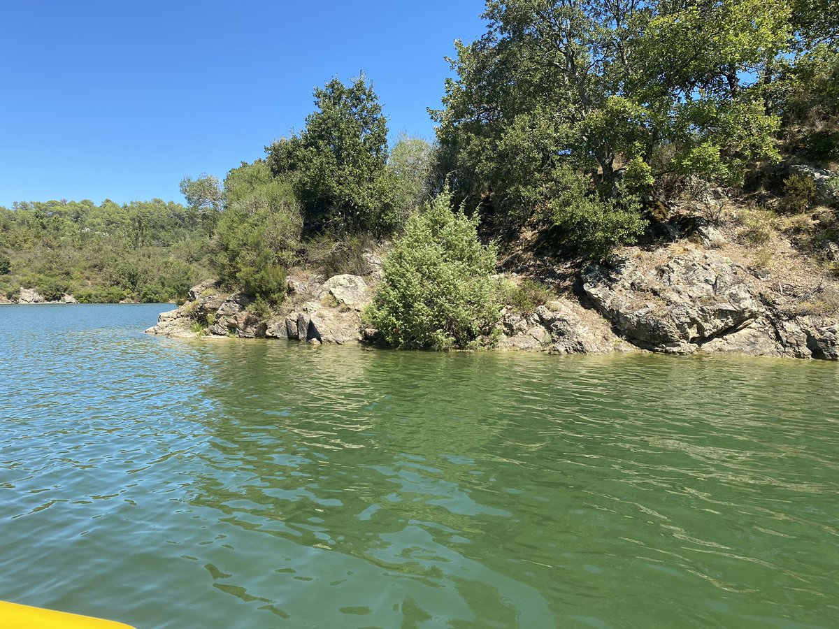 Out of curiosity went today to visit the St Cassien lake/dam near me in the outskirts of Massif de l’Esterel. Below picture shows the bordering rocks. The Hydrogeological mapping actually is extensive in literature and dates back in 1959." title="https://abs.twimg.com/emoji/v2/... draggable="false" alt="1️⃣" title="Tastenkappe Ziffer 1" aria-label="Emoji: Tastenkappe Ziffer 1">Out of curiosity went today to visit the St Cassien lake/dam near me in the outskirts of Massif de l’Esterel. Below picture shows the bordering rocks. The Hydrogeological mapping actually is extensive in literature and dates back in 1959." class="img-responsive" style="max-width:100%;"/>
 Below picture taken from another project around the lake feasibility study (200 pages). I circuled the word I was looking for: Impermeable." title="https://abs.twimg.com/emoji/v2/... draggable="false" alt="2️⃣" title="Tastenkappe Ziffer 2" aria-label="Emoji: Tastenkappe Ziffer 2"> Below picture taken from another project around the lake feasibility study (200 pages). I circuled the word I was looking for: Impermeable.">
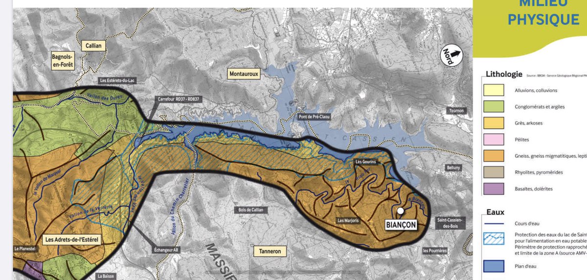 Below picture taken from another project around the lake feasibility study (200 pages). I circuled the word I was looking for: Impermeable." title="https://abs.twimg.com/emoji/v2/... draggable="false" alt="2️⃣" title="Tastenkappe Ziffer 2" aria-label="Emoji: Tastenkappe Ziffer 2"> Below picture taken from another project around the lake feasibility study (200 pages). I circuled the word I was looking for: Impermeable.">
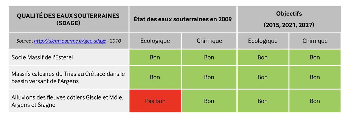 Below picture taken from another project around the lake feasibility study (200 pages). I circuled the word I was looking for: Impermeable." title="https://abs.twimg.com/emoji/v2/... draggable="false" alt="2️⃣" title="Tastenkappe Ziffer 2" aria-label="Emoji: Tastenkappe Ziffer 2"> Below picture taken from another project around the lake feasibility study (200 pages). I circuled the word I was looking for: Impermeable.">
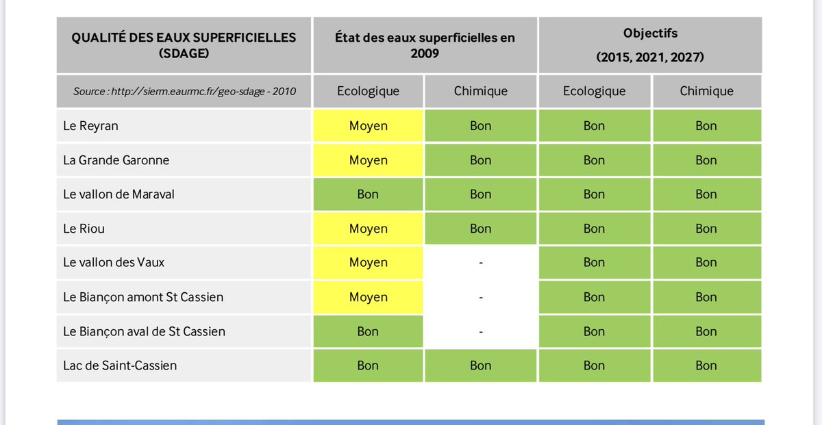 Below picture taken from another project around the lake feasibility study (200 pages). I circuled the word I was looking for: Impermeable." title="https://abs.twimg.com/emoji/v2/... draggable="false" alt="2️⃣" title="Tastenkappe Ziffer 2" aria-label="Emoji: Tastenkappe Ziffer 2"> Below picture taken from another project around the lake feasibility study (200 pages). I circuled the word I was looking for: Impermeable.">
 Studies for #BisriDam were commissioned to the CDR in Lebanon and barely indulged in geotechnical analysis because the decision makers wanted to secure funding for the project, at any cost. They didn’t consider a second that if they controlled well the process, they’d fail." title="https://abs.twimg.com/emoji/v2/... draggable="false" alt="3️⃣" title="Tastenkappe Ziffer 3" aria-label="Emoji: Tastenkappe Ziffer 3"> Studies for #BisriDam were commissioned to the CDR in Lebanon and barely indulged in geotechnical analysis because the decision makers wanted to secure funding for the project, at any cost. They didn’t consider a second that if they controlled well the process, they’d fail." class="img-responsive" style="max-width:100%;"/>
 As everything here, the project was driven by politics and not by in depth scientific studies. Most of lebanon is covered in limestone mostly Karstic systems (see below schema). This lead us to develop speleological tourism such as visiting Jeita Grotto." title="https://abs.twimg.com/emoji/v2/... draggable="false" alt="5️⃣" title="Tastenkappe Ziffer 5" aria-label="Emoji: Tastenkappe Ziffer 5"> As everything here, the project was driven by politics and not by in depth scientific studies. Most of lebanon is covered in limestone mostly Karstic systems (see below schema). This lead us to develop speleological tourism such as visiting Jeita Grotto.">
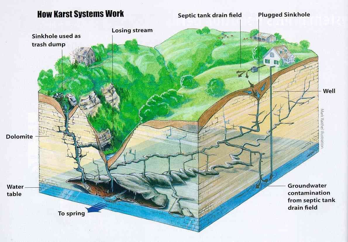 As everything here, the project was driven by politics and not by in depth scientific studies. Most of lebanon is covered in limestone mostly Karstic systems (see below schema). This lead us to develop speleological tourism such as visiting Jeita Grotto." title="https://abs.twimg.com/emoji/v2/... draggable="false" alt="5️⃣" title="Tastenkappe Ziffer 5" aria-label="Emoji: Tastenkappe Ziffer 5"> As everything here, the project was driven by politics and not by in depth scientific studies. Most of lebanon is covered in limestone mostly Karstic systems (see below schema). This lead us to develop speleological tourism such as visiting Jeita Grotto.">
 The CDR has decided a while ago, that keeping its poor report on line is a PR disaster and had decided to pull that out, until now. https://twitter.com/hayssman/... https://twitter.com/hayssman/..." title="https://abs.twimg.com/emoji/v2/... draggable="false" alt="6️⃣" title="Tastenkappe Ziffer 6" aria-label="Emoji: Tastenkappe Ziffer 6"> The CDR has decided a while ago, that keeping its poor report on line is a PR disaster and had decided to pull that out, until now. https://twitter.com/hayssman/... https://twitter.com/hayssman/..." class="img-responsive" style="max-width:100%;"/>


