THREAD:
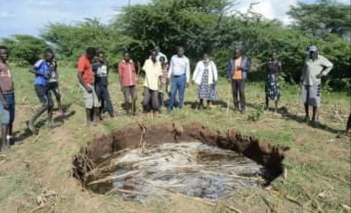
Following the discussion on lake level rises at #LakeBaringo #Kenya (see below thread), it has been brought to my attention that a “sinkhole” has now opened up near #Loropil here’s a quick update so far & some of my initial thoughts @GovernorKiptis @kenyangeography https://twitter.com/kenyangeography/status/1295992704653025280">https://twitter.com/kenyangeo...
Following the discussion on lake level rises at #LakeBaringo #Kenya (see below thread), it has been brought to my attention that a “sinkhole” has now opened up near #Loropil here’s a quick update so far & some of my initial thoughts @GovernorKiptis @kenyangeography https://twitter.com/kenyangeography/status/1295992704653025280">https://twitter.com/kenyangeo...
Firstly residents reported seeing smoke rising from the ground shortly before the ground began to sink, this was followed by water flowing in to the hole.
Initial reports from residents indicate that despite water from the lake flowing into the hole, the hole has not yet filled
It is highly unlikely that what the local residents saw was smoke. Instead is was likely dust rising from the ground as it started to move. It could also have been steam as shallow ground temperatures in the region are elevated due to the geology
Scientifically sinkholes are typically linked with rock types such as limestone. When CO2 mixes with water it can create a very mild acid. Although very mild, it can dissolve limestone with relative ease.
Where this happens to buried limestones, the soil above the void created by the dissolved rock collapses in to the space creating this sinking of the ground surface
The term sinkhole has become much more widely used in cases if ground subsidence/collapse as it is quite easy for people with a limited scientific background to conceptually understand what has happened. I’m OK with this
The geological maps for the area fo not suggest there are any limestone rocks. Instead what is likely happening is something similar to the #KenyaCrack event of 2018 in Narom/Suswa Counties
What we saw there was high rainfall that eventually flowed underground. The water followed the line of rift valley faults that have been buried by 100s-1000s of years of sediment accumulation so no one really new they were there
The water washed away soil & sediments a few meters underground, & the overlying soil collapsed into the void. So quite similar in some aspects to sinkhole formation
Again, we have seen significant rainfall & flooding this time in the Baringo area. Again there are lake sediment accumulation, and again although there is no evidence at the surface of faults or other features water could move along, it doesn’t mean they aren’t buried
It is quite possible that once again, the large volumes of rainfall have made it underground and created a void for the ground to collapse into.
And the fact that water from the lake flows in to the hole & it doesn’t fill suggests water is flowing out of the hole underground along buried geological structures like faults & fractures at the same rate
There is no doubt in my mind that more needs to be done to survey these sediment areas. To find out what is beneath the sediments & to plan, mitigate & educate on the best way to stay safe in these regions.
This is a natural environmental hazard that has possibly been worsened by climate extremes, deforestation & poor land management. But it is not (yet) a disaster
It is also worth pointing out here, that although I have mentioned faults in this thread as possible contributing factors yo both the #KenyaCrack event & this event, that does NOT mean an earthquake has occurred
This explanation however is not meant to be the answer, but certainly some possibilities. It also does not negate the concerns of the local communities. Instead we must work to identify & confirm the causes of such hazards & support the communities moving forward
I only wish I could be there to help/advise myself

 Read on Twitter


