Since I love maps and examining them, thought I& #39;d put together some info. about Khi& #39;s urban flooding problems.
wish I had more tools to use layers and show the shift in this city& #39;s topography over the years. Nonetheless, I hope this makes for a good read.
>>
wish I had more tools to use layers and show the shift in this city& #39;s topography over the years. Nonetheless, I hope this makes for a good read.
>>
Karachi& #39;s urban flooding issues need to be seen in a larger context of this region& #39;s shifting climate. 3 days ago this story>> https://www.samaa.tv/news/2020/08/karachi-floods-because-its-half-shaped-like-a-bowl-expert/
made">https://www.samaa.tv/news/2020... the rounds showing a topographic map of the west and northern parts of the city..
>>
made">https://www.samaa.tv/news/2020... the rounds showing a topographic map of the west and northern parts of the city..
>>
While we imagine Khi as the city by the sea, is today, a half-truth. The city& #39;s settled urban spaces stretch as far west and north of the sea towards the foothills of the Kirthar mountains (Gadap town) which include the Kirthar National Park. (yes, Khi has a national park. :D
>>
>>
These hills have ridges with "dry" riverbeds stretching along the Sindh-Balochistan border. When the monsoon system brings rains to this region, the tiny pathways for rainwater, that developed over thousands of years, they flood. (Ref to img for the riverbed tracks.)
>>
>>
The seasonal rivers intersect to form the city& #39;s two main rivers: Lyari (west) & Malir (east). Some of them even have names:
Thado Nadi, Konkar Nadi, Sukaan Nadi among others. They all flood whenever rains deluge this region. Here& #39;s the interesting part>>
Thado Nadi, Konkar Nadi, Sukaan Nadi among others. They all flood whenever rains deluge this region. Here& #39;s the interesting part>>
Indigenous residents who farm around these riverbeds here will tell you about a 10 year dry and wet cycle. We& #39;re in the wet cycle rn, and this year this part of the world has been receiving above avg. rainfall. This rainfall is imp for two reasons:
>>
>>
-recharging underground aquifers.
-greening the landscape for shepherds to feed their livestock.
-bringing in non-saline water to the Indus delta sys. to the south of the city.
As Khi has expanded north and west, a lot of the land around this region has been capitalized
>>
-greening the landscape for shepherds to feed their livestock.
-bringing in non-saline water to the Indus delta sys. to the south of the city.
As Khi has expanded north and west, a lot of the land around this region has been capitalized
>>
for housing projects. The list is long, you can use Google maps to count them. But, what does this have to do with the riverbeds?
the sand.
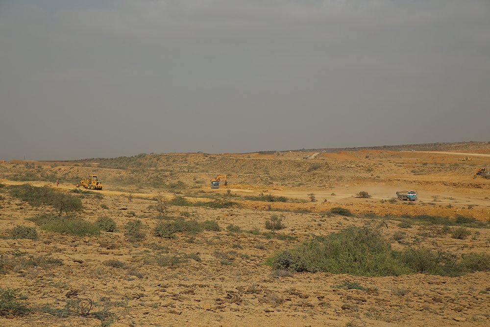
and sand mining for these housing projects. The river beds are rich in sand and "bajri" important materials that have sourced >>
the sand.
and sand mining for these housing projects. The river beds are rich in sand and "bajri" important materials that have sourced >>
the growth of these housing societies. A large part of the city exists today because of this very sand. Obv, continuously mining all this sand for "bajri" has allowed the rainwater to flow without opposition. Before, the riverbeds would slow the flow, not efficiently anymore.
Improper riverbeds don& #39;t allow underground aquifers to recharge sufficiently. Similarly largescale projects to build "worldclass" cities have changed the regions& #39; topography with no proper assessment of hw this affects the inner city (Khi dense) with all this built structure.
>>
>>
This ofc does not veil structural issues in how Khi& #39;s stormwater drains are managed. Decades of irrational urban planning while paying no attention to the serious consequences for the future is where we r now. Arif Hasan explains those technicalities here: https://twitter.com/SAMAATV/status/1297245161194389504?s=20">https://twitter.com/SAMAATV/s...
While the political dispensation keeps shifting the blame for responsibilities (public posturing obv) that were unfulfilled under their respective jurisdictions, (fed gov, Sindh, cantonments), the flooding can be seen more as a man-made cause than a weather-related event.
>>
>>
The more pertinent questions we all should be asking is why isn& #39;t anyone following established plans one of them which includes the KSDP 2020. And what is stopping them and what do they intend doing to address a very collective failure in urban governance.
Environmentalists, academics, writers, urban planners, architects and more have been warning about the consequences of such unplanned urban expansion, for many years, yet here we are, experiencing an inundation like no other.
>>
>>
So, is this city and its hardworking residents forever fated to flood in its bowl of "resilience" and "bardasht" while extreme weather becomes more frequent or is everyone finally going to say, no?
End.
End.

 Read on Twitter


