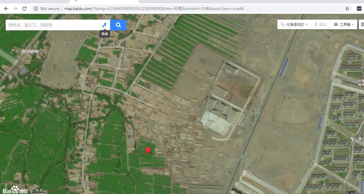
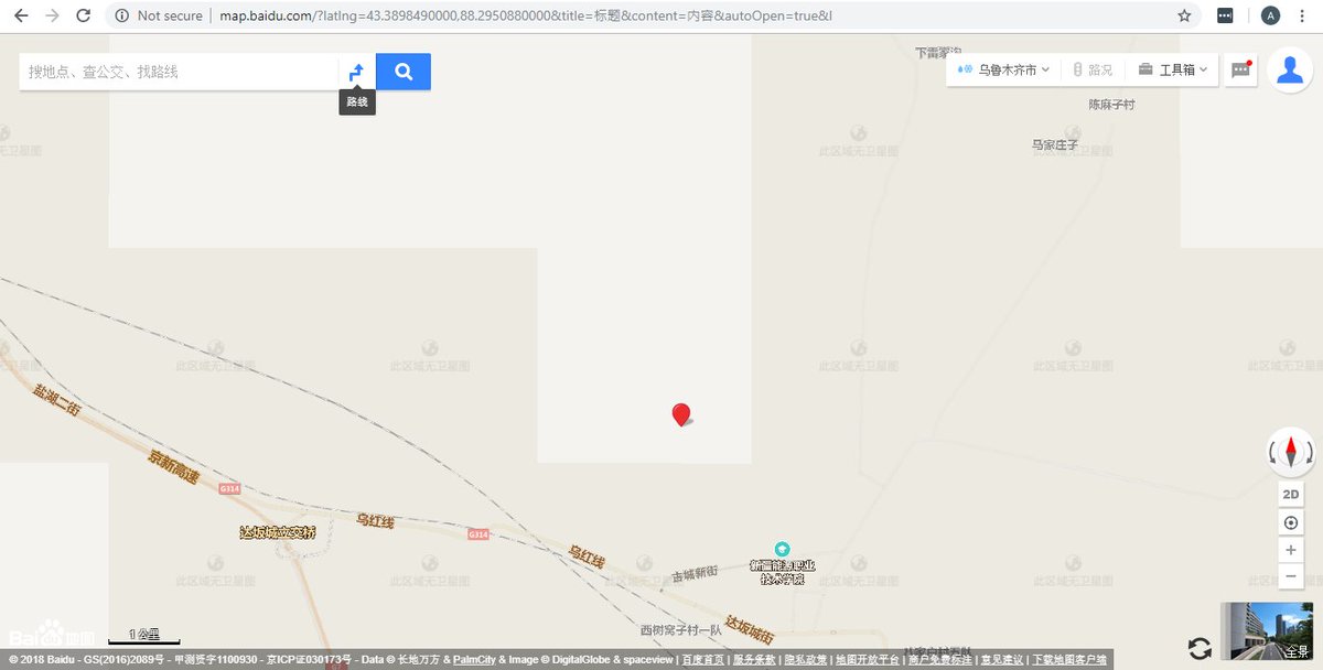
China& #39;s Baidu has blank spots in its mapping platform. We used those blank locations to look for the network of prisons and internment camps in Xinjiang, where up to a million Muslim minorities have been detained. Here& #39;s how we did it. https://www.buzzfeed.com/alison_killing/satellite-images-investigation-xinjiang-detention-camps">https://www.buzzfeed.com/alison_ki...
It& #39;s difficult for journalists to work in Xinjiang because of theheavy surveillance, active attempts by authorities to prevent journalists reporting, but also because the region is so big. That’s why we turned to satellite imagery to help us investigate.
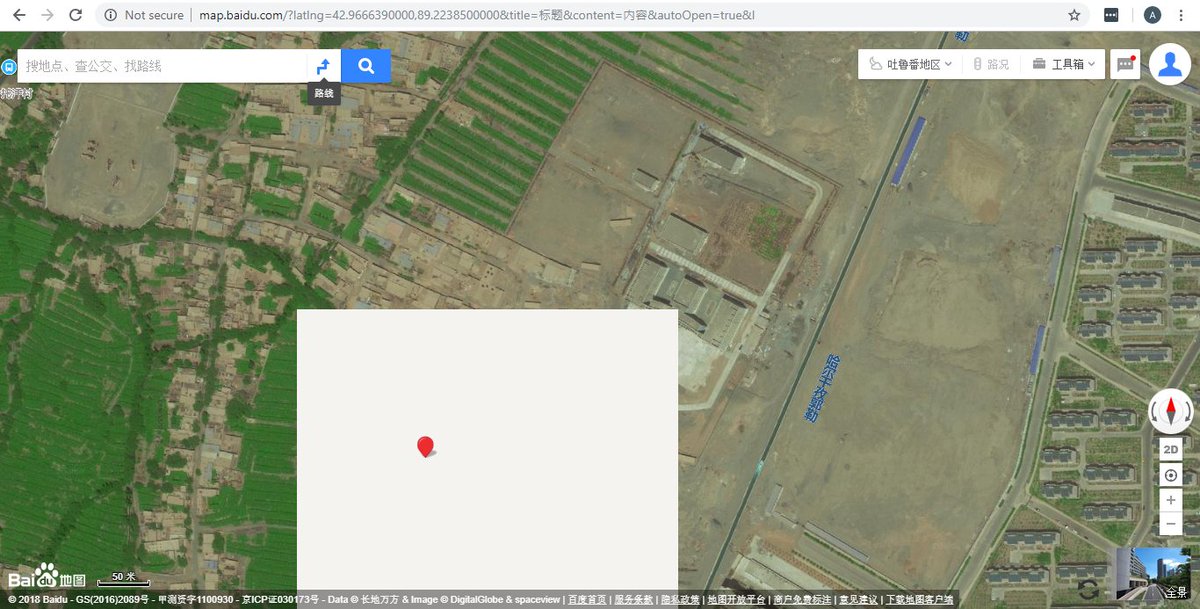
We started to look at Chinese mapping platform Baidu and quickly noticed that the satellite images seemed to be loading badly in the vicinity of one of the known internment camps. As you zoomed in, a blank light grey tile would appear…
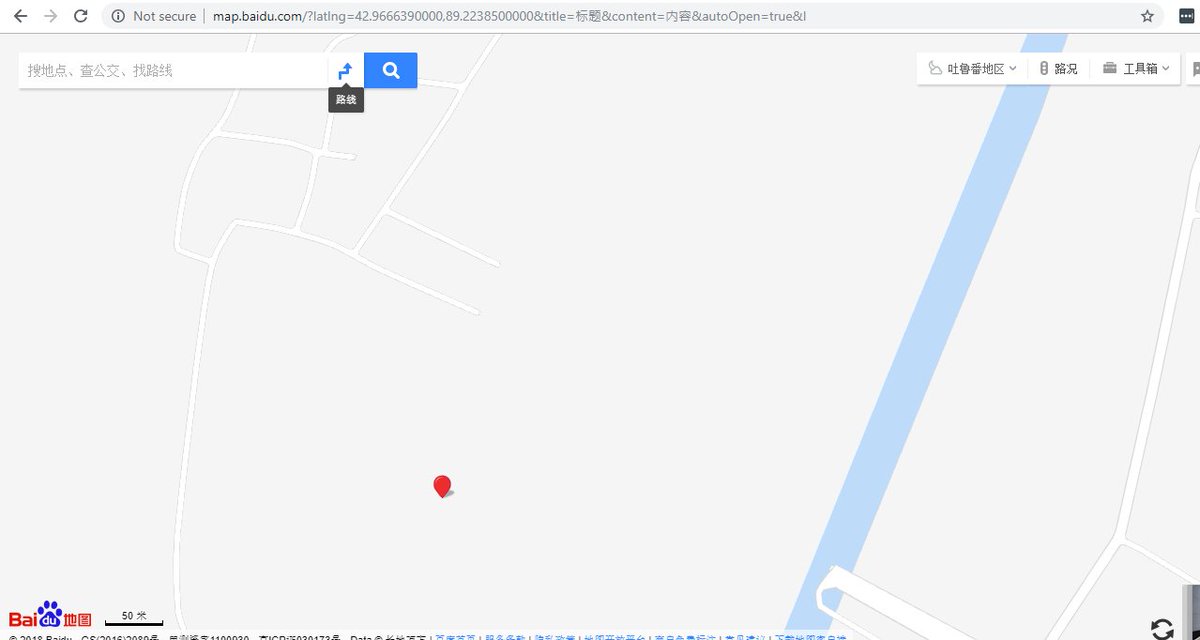
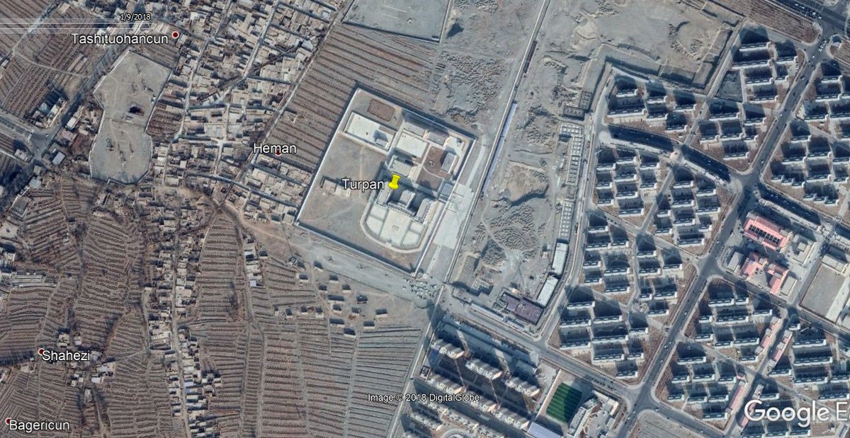
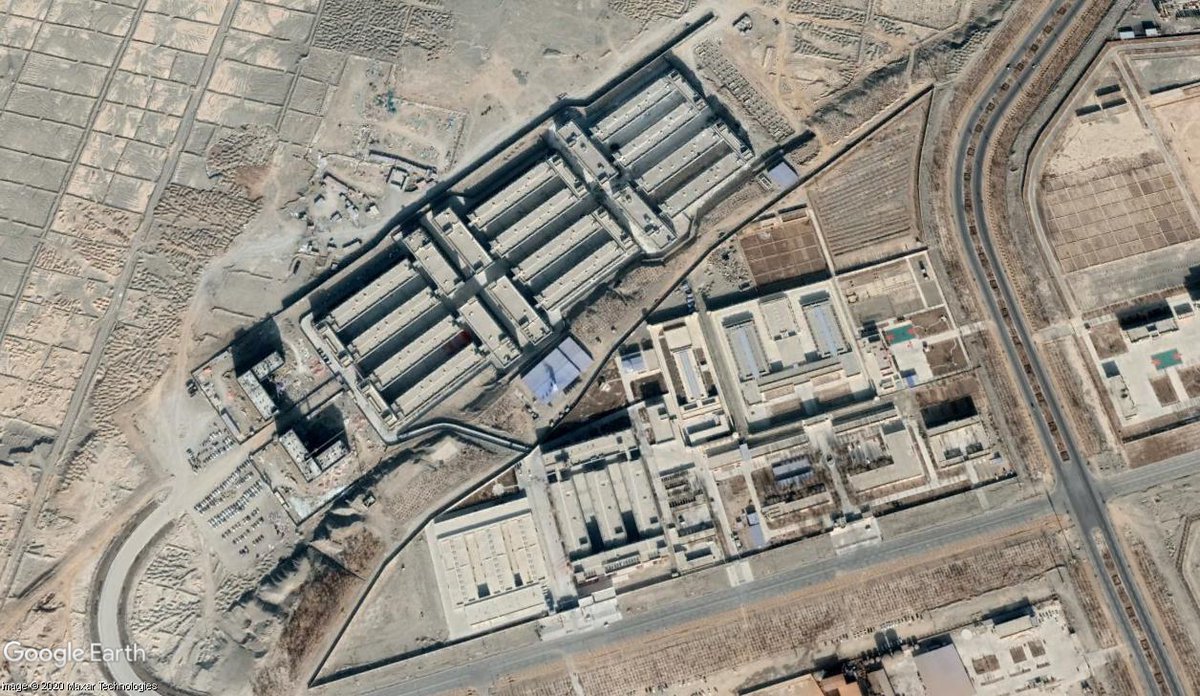
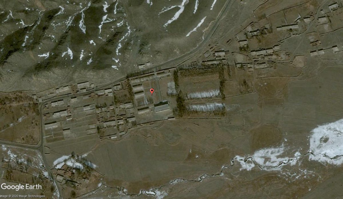
Then disappear when you zoomed in further, while the satellite imagery was replaced by standard grey reference map tiles showing roads and building outlines. This is what you saw at the same location in Google Earth.
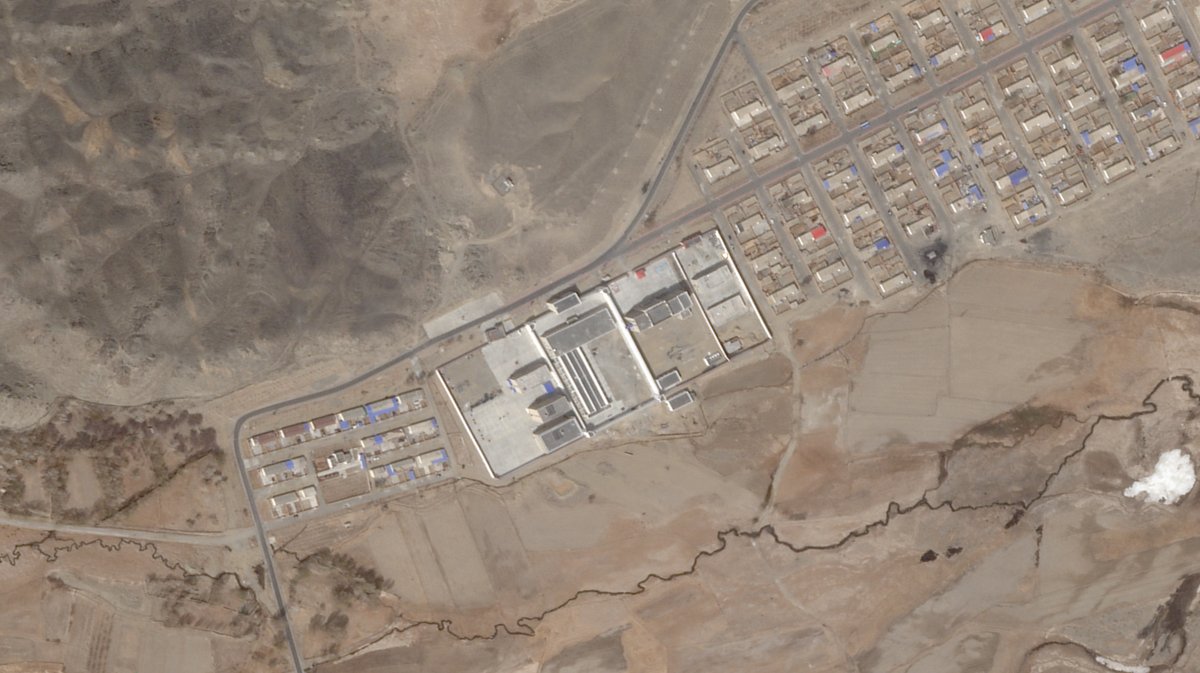
When we realised that we could repeat this process reliably, we went to look at other known camp locations to see if the same thing happened – it did. At Dabancheng, in Hotan, Kashgar, we found the same thing. This is the location of the Dabancheng camp.
So we started to look at these mask tile locations more systematically. There were over 5 million mask tile locations (!) across Xinjiang and we narrowed this down to a mere 50,000 by concentrating on the areas around towns and along major roads.
We compared these locations with imagery from Google Earth, Planet Labs and ESA’s Sentinal Hub Playground to see what was there.
In total, we’ve found 428 prison compounds across Xinjiang through our research and many of them contain multiple facilities – camps, prisons and pre-trial detention centres.
268 compounds have been built or significantly expanded since 2016-17, when the latest campaign against Turkic Muslims began. Since spring 2018, the camps and prisons being built have become MUCH larger, more permanent and appear heavily fortified, like this one at Kuqa.
In some areas of Xinjiang, however, the imagery in Google Earth wasn’t fully up to date. We were able to find likely camp locations using the mid-resolution imagery from Sentinal Hub and @planetlabs gave us access to high res imagery to help us confirm them.
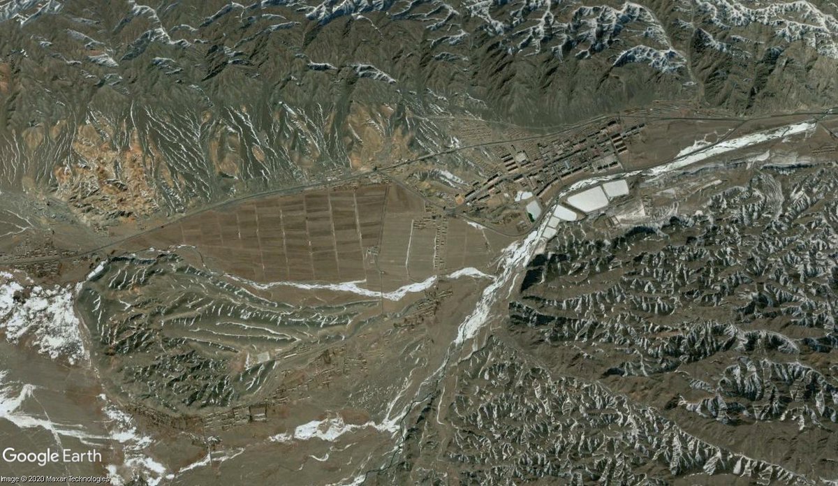
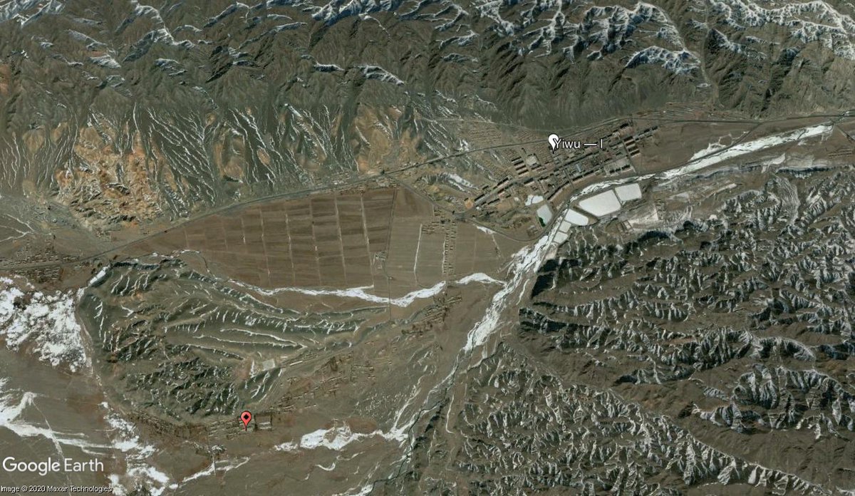
Some remote parts of Xinjiang hadn’t been photographed at high resolution since 2006 – @planetlabs also tasked a satellite for us to capture new imagery in several areas, such as Yiwu county, in Hami prefecture, in the east of Xinjiang.
In Yiwu, this meant we were able to confirm that the old detention centre (white marker) had been demolished and that a new prison (red marker) had been built on the town’s outskirts.
Here’s the site of the new prison in the most up to date, publicly available imagery – 2006. And the new prison, verified using 2020 imagery from Planet. And here’s the detention centre in 2006 and that same site today.
You can read more about how we found the camps, narrowing down our dataset using urban planning and architectural analysis and verifying the locations in our article here: https://www.buzzfeednews.com/article/alison_killing/satellite-images-investigation-xinjiang-detention-camps?bfsource=relatedmanual">https://www.buzzfeednews.com/article/a...
To be read alongside our main article on this new phase in the campaign against Xinjiang’s Muslims and the network of camps and prisons that have been built to support it: https://www.buzzfeednews.com/article/meghara/china-new-internment-camps-xinjiang-uighurs-muslims">https://www.buzzfeednews.com/article/m...
We had an amazing team who have been working on the project for around two years now - @meghara and Christo Buschek
Finally, huge thanks to @OpenTechFund and their Internet Freedom Fund, who supported our research into the blank spots on Chinese mapping platforms, satellite image analysis and verification that made this story possible.
OTF supports crucial internet freedom and anti-censorship research around the world, but are under threat from the Trump Administration, who currently want to dismantle the organisation. More info and how to support them here: https://saveinternetfreedom.tech/ ">https://saveinternetfreedom.tech/">...

 Read on Twitter