THREAD: Our new paper on surface-exposed ice along the northern margin of the Greenland Ice Sheet is out! https://twitter.com/igsoc/status/1298660225818345473">https://twitter.com/igsoc/sta...
First off...whoa. Getting even the smallest things done during a pandemic is hard. Thanks to @igsoc for a diligent peer review and publication process! I first posted about this topic in this thread on John Sonntag& #39;s photo from nearly one year ago. https://twitter.com/JoeMacGregor/status/1169649070778064903">https://twitter.com/JoeMacGre...
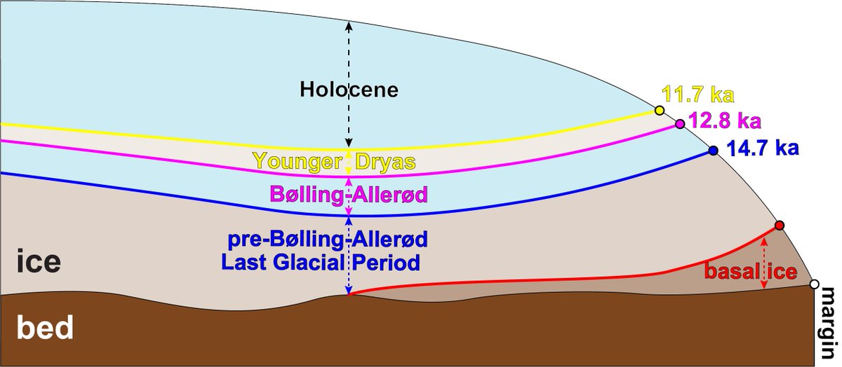
This paper arose out yet another good idea from Mark Fahnestock, our @UAFGI colleague: Can we make sense of the margin layering we can we now easily see with Landsat-8 and Sentinel-2 using Niels Reeh& #39;s ideas as a guide? Answer: Yes and it will be fun.
First, Mark figured out how to easily make a beautiful late-summer Sentinel-2A/B mosaic in Google Earth Engine, and then share it via AWS. In the paper, we provide the code for re-generating that; it& #39;s also part of the ITS_LIVE QGIS project basemaps. https://its-live.jpl.nasa.gov/ ">https://its-live.jpl.nasa.gov/">...
Here& #39;s a video zooming in on the Sentinel-2 mosaic LIVE and in real-time via AWS. Not downloaded beforehand. It& #39;s a Good Thing.
Using an unnamed well-trained individual whose life and quarantine partner has described as a "forceful and obsessive mouse clicker", we then manually traced in @qgis the boundaries that Niels Reeh first identified decades ago.
We compared them against against those older d18O isotopic concentration data, which @GlacierBytes recovered from Niels& #39; colleague, Hans Oerter. The match between satellite layers and isotopes was qualitative but best in northeastern Greenland, at Kronprins Christian Land.
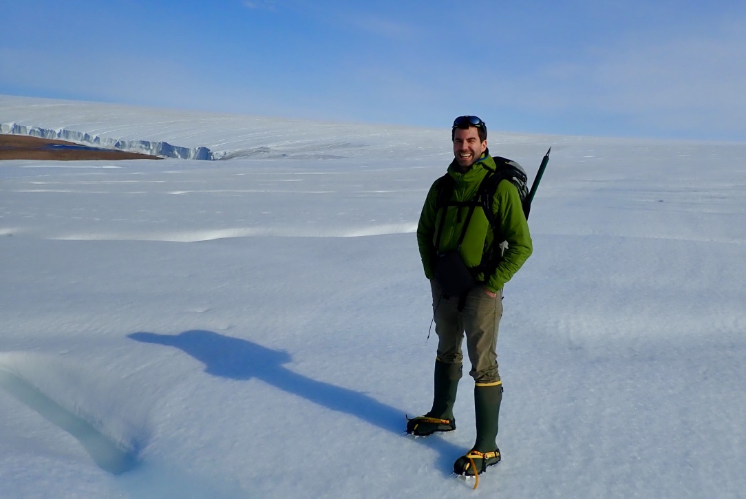
We even collected some more data ourselves! A year ago I was immensely lucky to join a field team that surveyed part of Inglefield Land, northwestern Greenland. The modern isotope data we collected matched high-resolution WorldView imagery well in this complicated region.
So now we& #39;ve got the satellite mosaicking, fieldwork and computer gruntwork done. What did we find? Lots of variability in margin stratigraphy across northern Greenland. But often laterally consistent within margin adjacent to individual lands between outlet glaciers.
Kronprins Christian Land, one of Niels Reeh& #39;s original sites, often had excellent exposures. But as Mark had originally suspected, Warming Land, between Steensby and Ryder glaciers, stood out. Great potential matches between stratigraphy there and the NorthGRIP dust record.
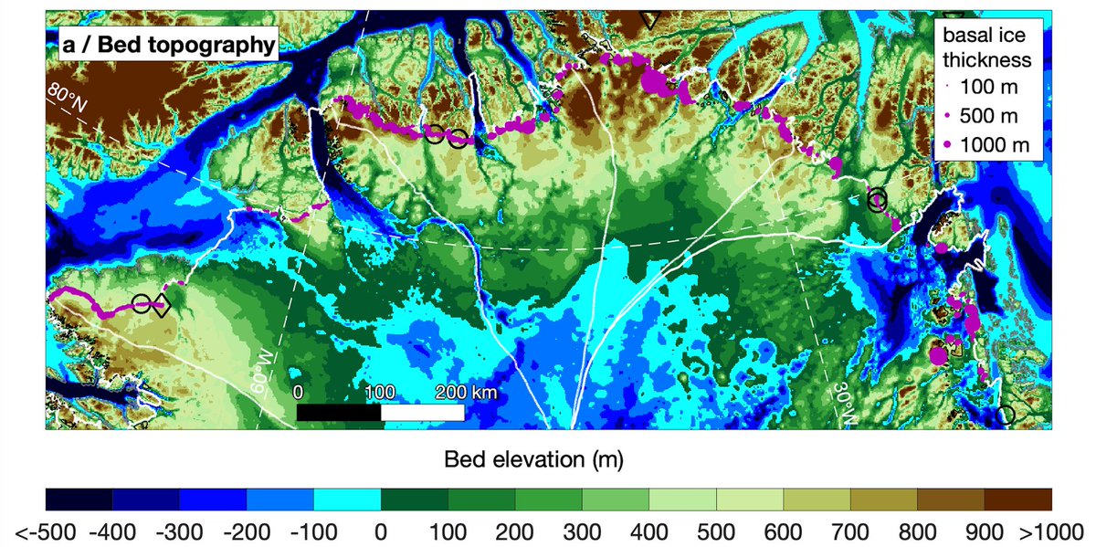
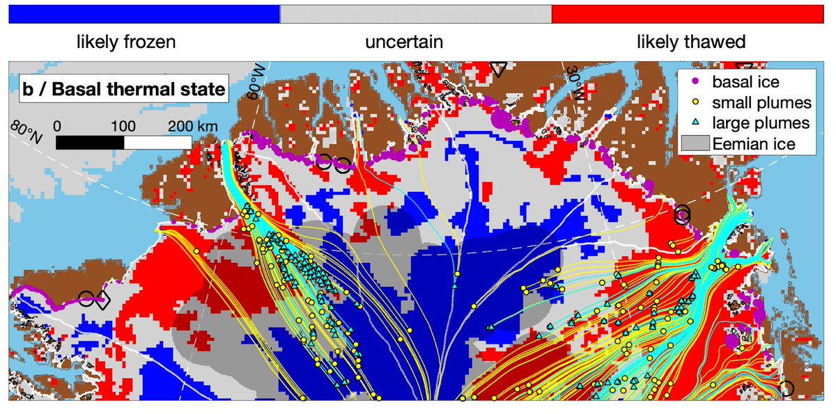
Warming Land could be a great place for a future horizontal ice core. But we also noticed a lot of darker basal ice in northern Greenland, which had never been mapped at large scales before.
But does all this basal ice mean? We& #39;re fairly sure it doesn& #39;t have much to do with basal plumes/layers/units identified previously, because those mostly flow into outlets. It may just indicate a lot of cold-based ice. TBD but a good topic of discussion among the team.  https://abs.twimg.com/emoji/v2/... draggable="false" alt="🤷♂️" title="Achselzuckender Mann" aria-label="Emoji: Achselzuckender Mann">
So this paper ended up doing/being a lot of things, admittedly a tendency of mine. But it ultimately became a satisfying investigation of northern Greenland& #39;s ice margin, with an eye toward possible future investigations there. Special thanks to the field team!

 Read on Twitter


 " title="But does all this basal ice mean? We& #39;re fairly sure it doesn& #39;t have much to do with basal plumes/layers/units identified previously, because those mostly flow into outlets. It may just indicate a lot of cold-based ice. TBD but a good topic of discussion among the team. https://abs.twimg.com/emoji/v2/... draggable="false" alt="🤷♂️" title="Achselzuckender Mann" aria-label="Emoji: Achselzuckender Mann">" class="img-responsive" style="max-width:100%;"/>


