1/ Thread with the latest on #Laura this morning...
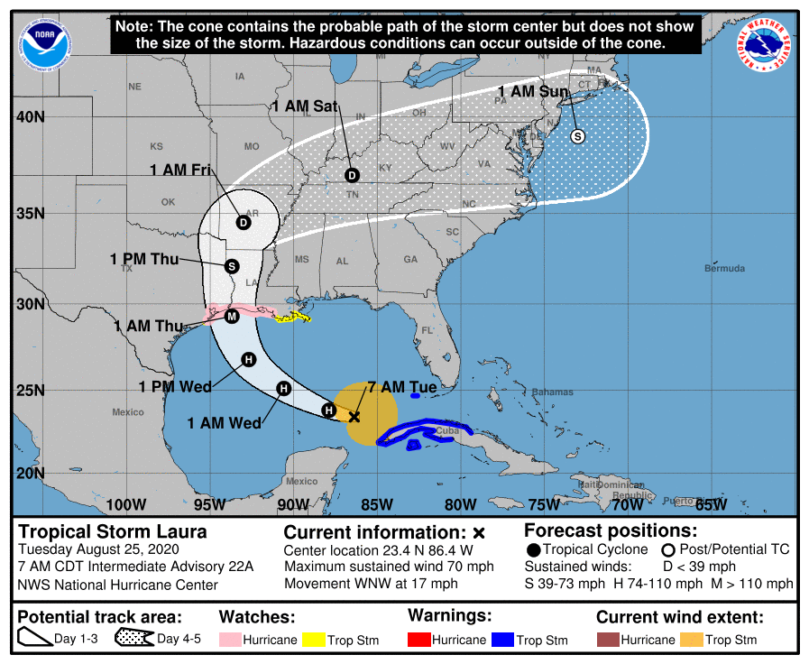
The storm has continued to slowly organize and is now a hurricane as of 7:15 AM. While there is still some wind shear in place, it is forecast to lessen and Laura is now forecast to make landfall as a major, Cat. 3 hurricane.
The storm has continued to slowly organize and is now a hurricane as of 7:15 AM. While there is still some wind shear in place, it is forecast to lessen and Laura is now forecast to make landfall as a major, Cat. 3 hurricane.
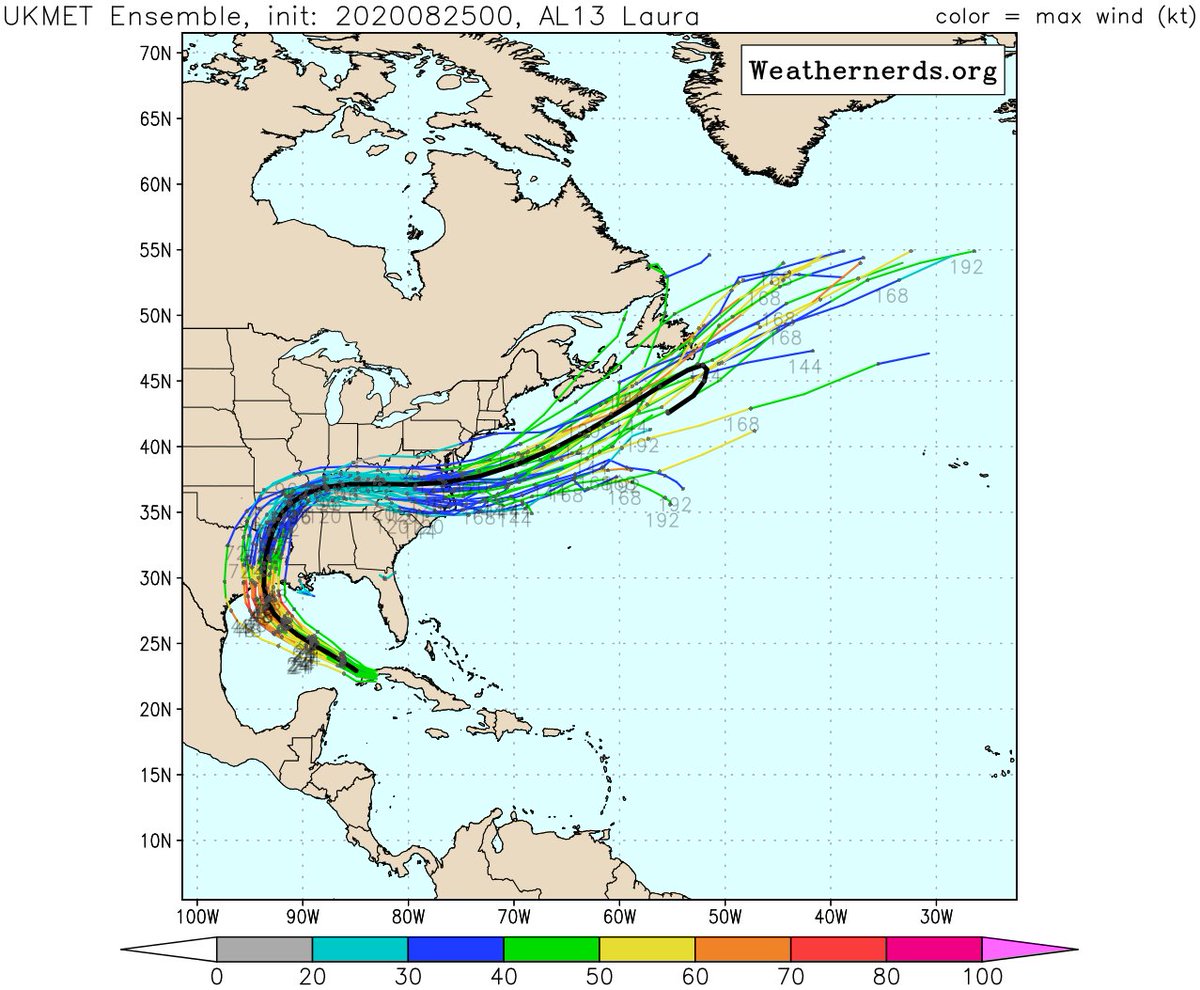
2/ The official forecast track from 4 AM still showed a landfall near the LA/TX border late Wednesday or early Thursday. But NHC acknowledged they were on the east side of most guidance & additional westward adjustments in the track may be needed.
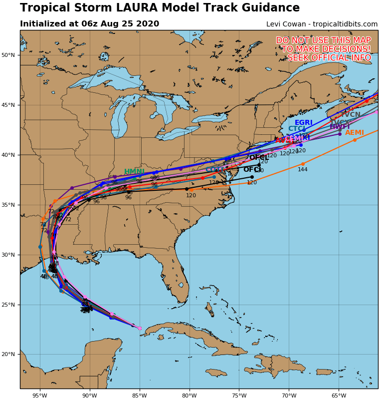
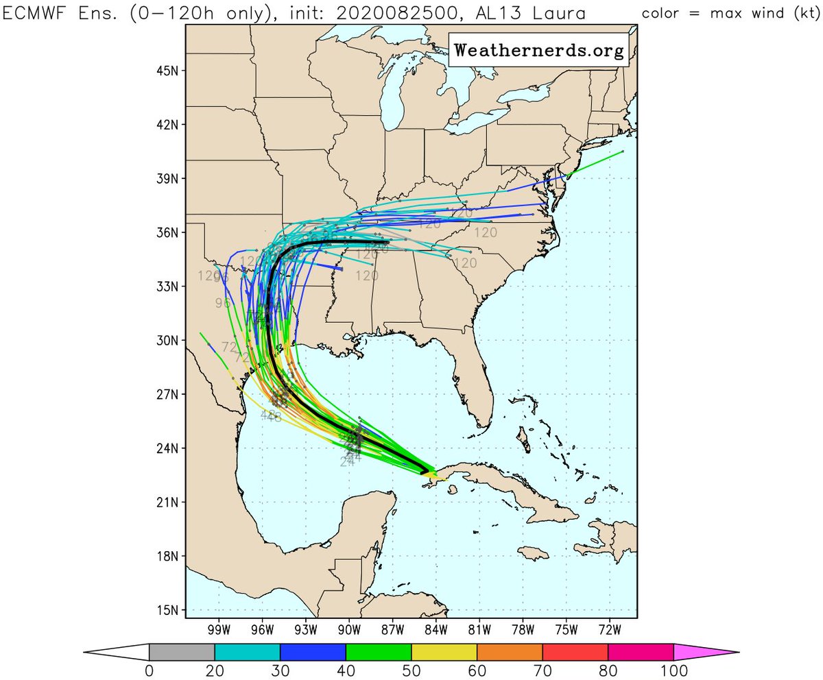
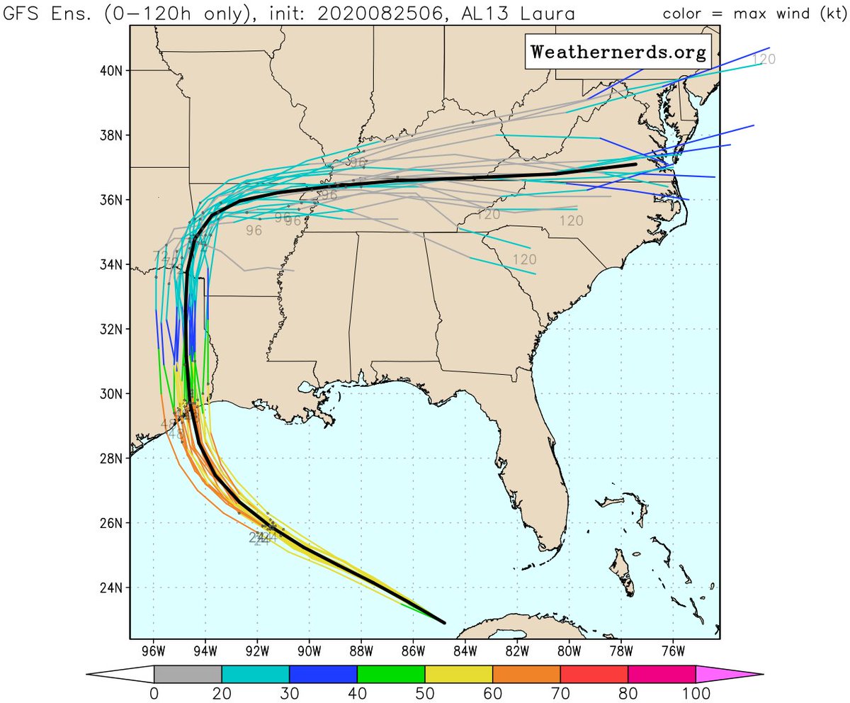
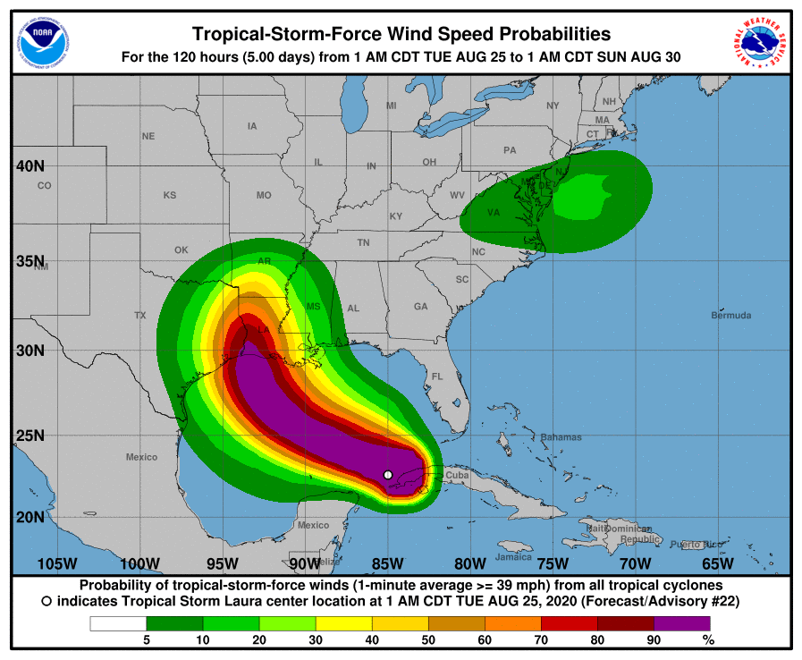
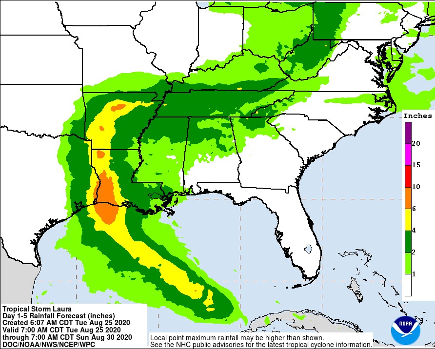
3/ Indeed, much of the guidance showed a westward shift overnight. It& #39;s not real obvious when looking at the hurricane models (1st image), but easier to see in the ensemble output from the global models (other 3 images). The threat has increased for the upper Texas coast.
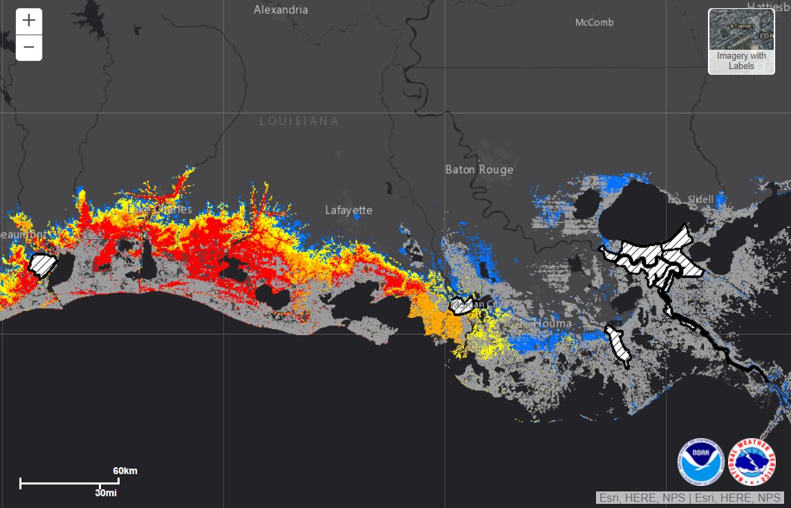
4/ Even if we see an additional westward shift in the next forecast track at 10 AM, this does not change the fact that storm surge will be a MAJOR issue for a good chunk of the Louisiana coast. Red areas on the map below indicate surge of >9 feet is possible.
5/ A westward shift should lower the potential winds for much of our viewing area, but we could still see tropical storm force winds. Odds were just over 50% for Baton Rouge as of the 4 AM advisory. May trend a little lower in next advisory. Gusts of 30-50 mph seem reasonable.
6/ Rainfall is currently forecast to range from 2"-4" in our area, with locally higher amounts possible. Distance from the storm + a fairly quick moving storm should limit flooding, but isolated heavy rain bands could still cause a few issues.
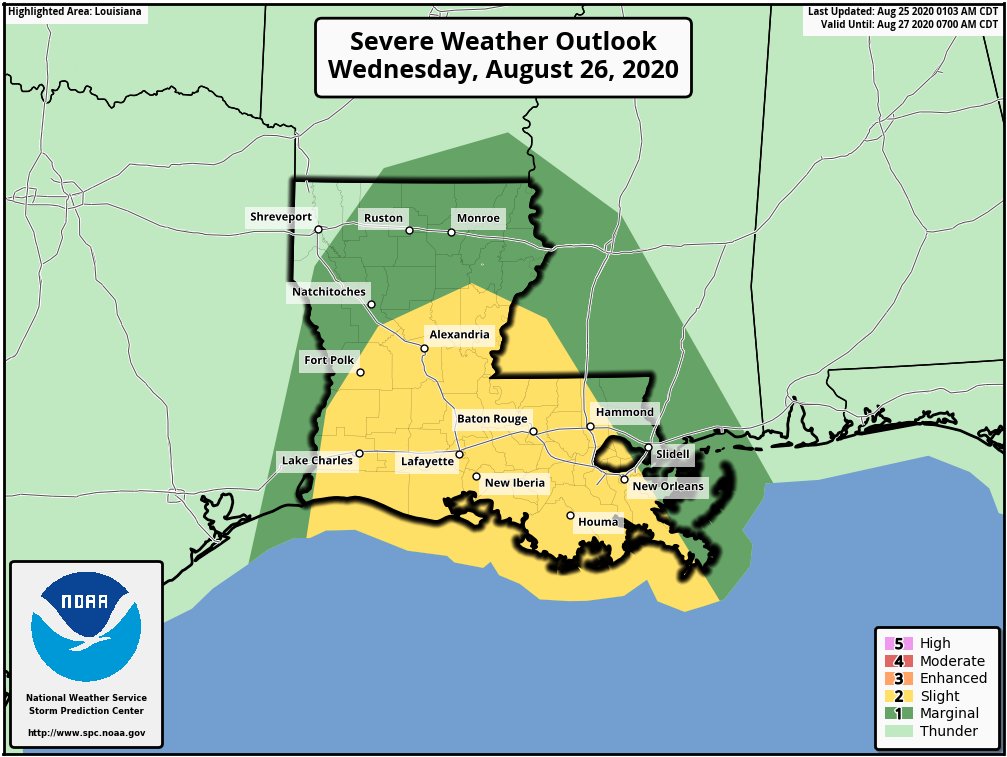
7/ One thing our local area will need to be alert for is potential tornadoes in outer bands. The Storm Prediction Center has upgraded much of our area to a Level 2 (Slight) risk of severe weather on Wednesday to cover that potential.
8/8 Most of us locally away from the coast get through this just fine. Scattered power outages are possible, and again, need to watch out for a few tornadoes.
Along the coast, storm surge continues to be a big concern.
More on the tropics here >> http://wafb.com/hurricane ">https://wafb.com/hurricane...
Along the coast, storm surge continues to be a big concern.
More on the tropics here >> http://wafb.com/hurricane ">https://wafb.com/hurricane...

 Read on Twitter