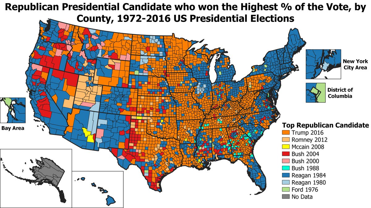
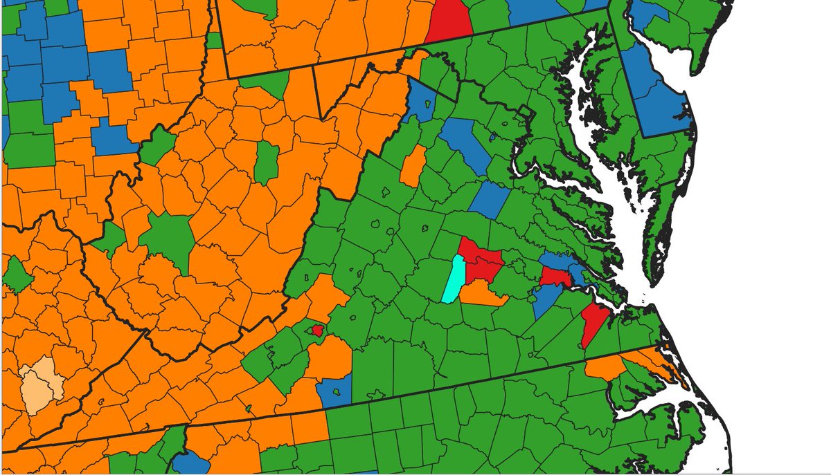
#ElectionTwitter Map of which Republican Presidential Candidate got the highest % of the vote in each county, from 1972-2016. Nixon& #39;s landslide 1972 win got the highest GOP % in 1,218 counties, followed closely by Trump 2016 with 1,174 counties due to his strength in rural areas.
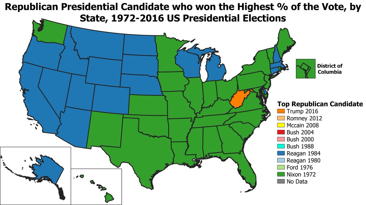
Looking at which GOP candidate got the highest % of the vote by state from 1972-2016, we can see that Nixon set the record in most Eastern/Southern states, Reagan in most Western states. Despite Trump& #39;s strong performance in rural counties, he only sets a statewide record in WV.
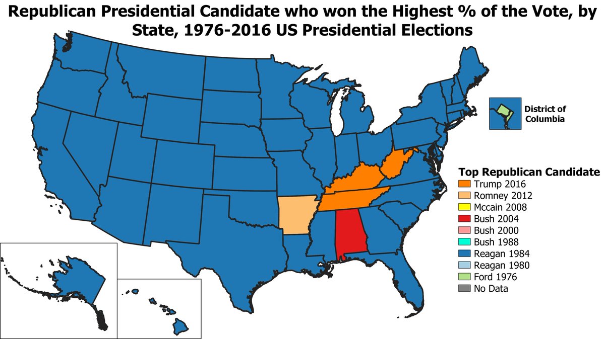
If we take out Nixon& #39;s 1972 win and start the clock at 1976, the map becomes more evenly divided between Trump& #39;s 2016 win & Reagan& #39;s landslide win in 1984. Trump was strong in rural areas, while Reagan tended to do better in more urban & liberal areas, the West, & the North-East.
After taking out Nixon& #39;s 1972 landslide, the highest GOP % by state mostly goes to Reagan in 1984, who set the GOP record in 45 of 50 states. Ford in 1976 set the GOP record in DC, Bush in 2004 in AL, Romney in AR (both Romney & Trump got 60.57% in AR), & Trump in TN, KY, & WV.
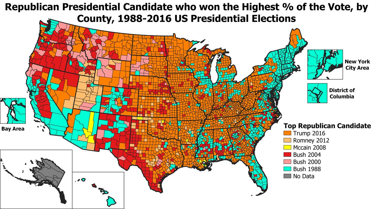
If we take out BOTH Nixon& #39;s landslide AND Reagan& #39;s landslide, starting the clock at 1988, then Trump gets the top GOP % in most counties. George HW Bush in 1988 sets the record in many liberal/urban areas, while George W Bush did very well in many Hispanic & farming areas in 2004
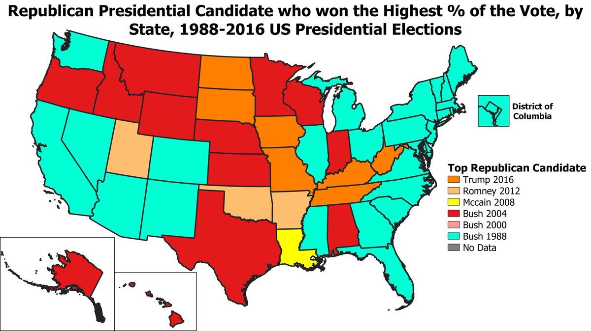
George HW Bush does better if we look at the top GOP statewide %s since 1988, setting the record in 26 states & DC. George W Bush& #39;s 2004 run sets the record in 13 states, Trump& #39;s 2016 run in 7 states, Romney& #39;s 2012 run in 3 states (UT, OK, & AR), & McCain& #39;s 2008 run in Louisiana.
Maps for highest Democratic % by county/state in this thread from yesterday: https://twitter.com/Millenarian22/status/1297227432676610050">https://twitter.com/Millenari...
I forgot to mention, neither Bush in 1992 or Bob Dole in 1996 have a record GOP % in a county. Bush in 1992 makes sense since he only got 37.4% compared to 53.4% in 1988. I was hoping Dole would at least have the record in his home county of Russell KS, but Trump is a bit higher:

 Read on Twitter
