#Short Story/Thread :
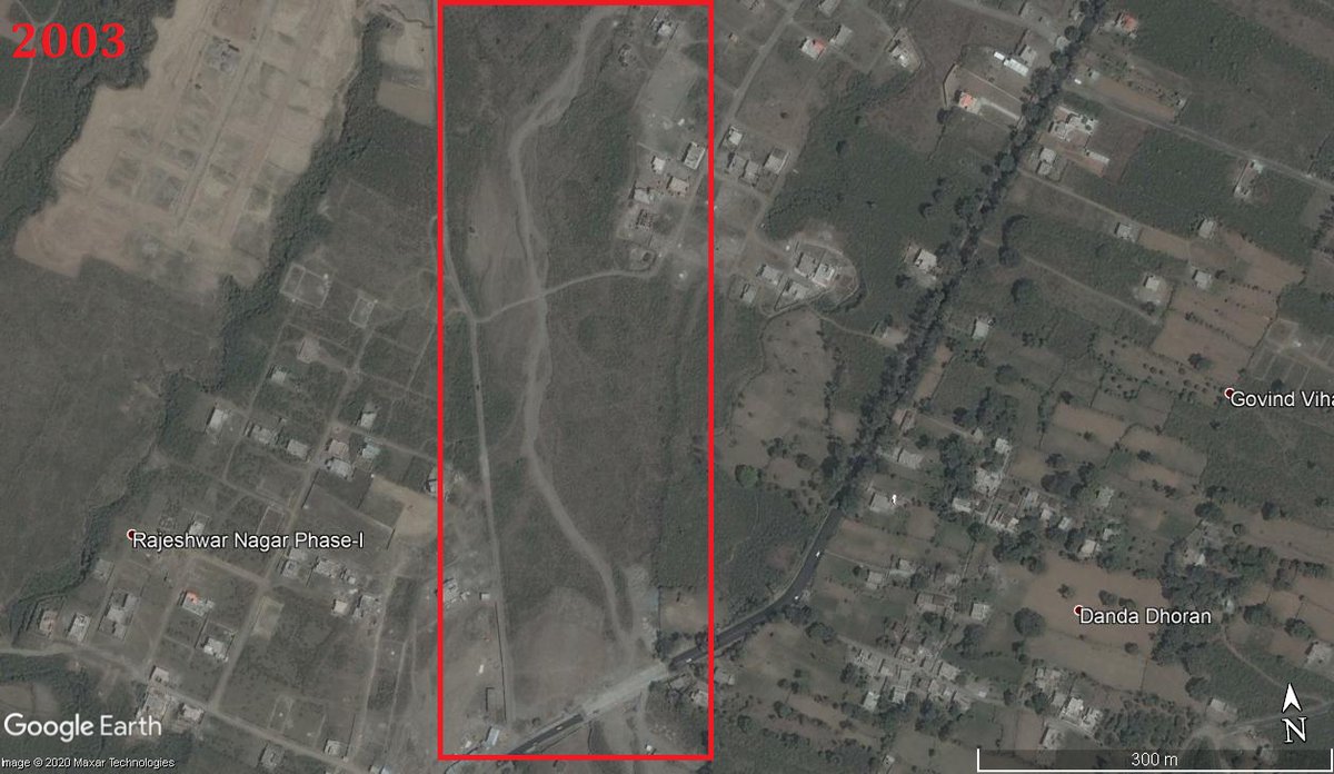
In 2003, A stream/river (seasonal) was flowing in #Dehradun near Sahastradhara Road..
Satellite Image snapshot from Google Earth
1/4
In 2003, A stream/river (seasonal) was flowing in #Dehradun near Sahastradhara Road..
Satellite Image snapshot from Google Earth
1/4
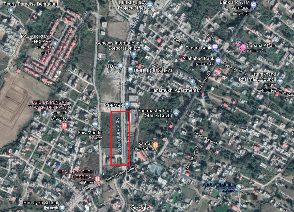
Someone thought that it was wise to construct an IT Park right on top of the river..
Satellite image shows it now (Google Earth Snapshot)
2/4
Satellite image shows it now (Google Earth Snapshot)
2/4
People might have forgotten the river/stream But the stream definitely didnt forget where it had to flow.
In 2020 after a spell of monsoon rains, the stream overflowed and the IT Park flooded!
Video below shows what happened (first of the lot) https://twitter.com/Indian_Rivers/status/1293511254737211392?s=20">https://twitter.com/Indian_Ri...
In 2020 after a spell of monsoon rains, the stream overflowed and the IT Park flooded!
Video below shows what happened (first of the lot) https://twitter.com/Indian_Rivers/status/1293511254737211392?s=20">https://twitter.com/Indian_Ri...
Please do read the entire thread. This is not an isolated incident and is not something done by one government official or a political party!

 Read on Twitter


