Another quiet weather day locally.  https://abs.twimg.com/emoji/v2/... draggable="false" alt="☀️" title="Sonne mit Strahlen" aria-label="Emoji: Sonne mit Strahlen">
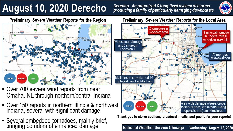
In the meantime, we continue to wrap up Monday& #39;s significant severe weather event. Wind damage was widespread to trees, crops, and some structures, utilities, and vehicles. More on Monday& #39;s derecho event: https://www.weather.gov/lot/2020aug10 ">https://www.weather.gov/lot/2020a... #ILwx
In the meantime, we continue to wrap up Monday& #39;s significant severe weather event. Wind damage was widespread to trees, crops, and some structures, utilities, and vehicles. More on Monday& #39;s derecho event: https://www.weather.gov/lot/2020aug10 ">https://www.weather.gov/lot/2020a... #ILwx
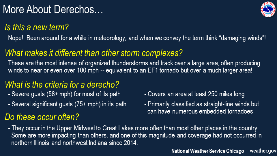
Still asking "what is a derecho"? That& #39;s ok, thankfully these don& #39;t happen often. A derecho is a long-lasting, intense complex of storms producing wind damage, some quite significant, over a large area. This region sees 1-2 a year, though Monday& #39;s was a rarer higher end one.
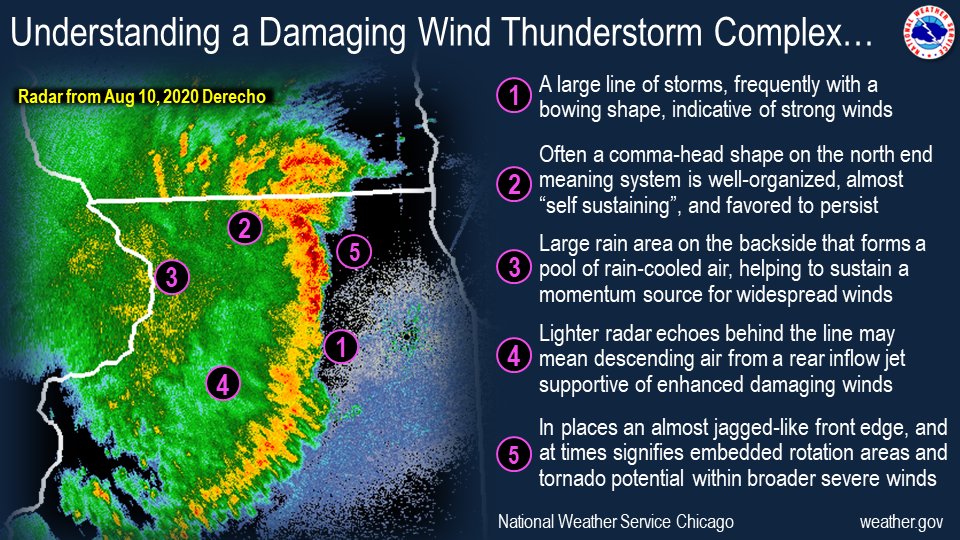
Derechos have an ominous look out the window as they approach and often have a distinct look on radar imagery too. Various radar attributes help tell us meteorologists a lot about them and help us hone in on messaging and warnings in advance, including embedded tornado potential.

 Read on Twitter
 In the meantime, we continue to wrap up Monday& #39;s significant severe weather event. Wind damage was widespread to trees, crops, and some structures, utilities, and vehicles. More on Monday& #39;s derecho event: https://www.weather.gov/lot/2020a... #ILwx" title="Another quiet weather day locally. https://abs.twimg.com/emoji/v2/... draggable="false" alt="☀️" title="Sonne mit Strahlen" aria-label="Emoji: Sonne mit Strahlen">In the meantime, we continue to wrap up Monday& #39;s significant severe weather event. Wind damage was widespread to trees, crops, and some structures, utilities, and vehicles. More on Monday& #39;s derecho event: https://www.weather.gov/lot/2020a... #ILwx" class="img-responsive" style="max-width:100%;"/>


