Good morning! https://abs.twimg.com/emoji/v2/... draggable="false" alt="☀️" title="Sonne mit Strahlen" aria-label="Emoji: Sonne mit Strahlen"> Let& #39;s talk Monday& #39;s storms.
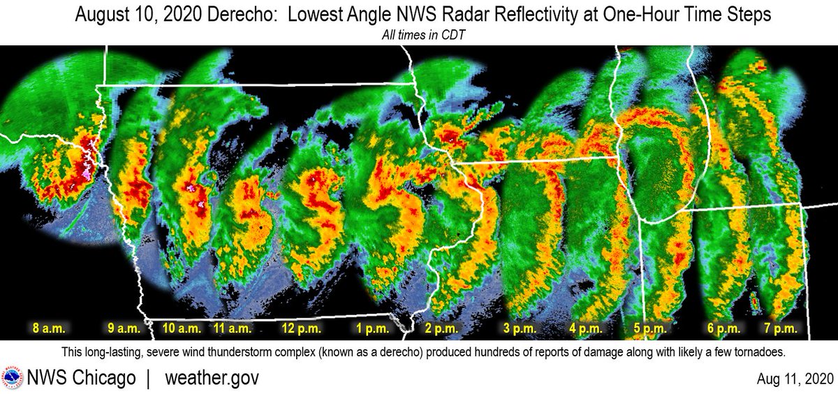
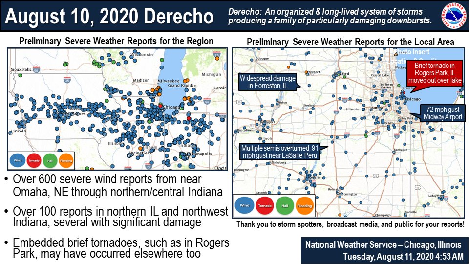
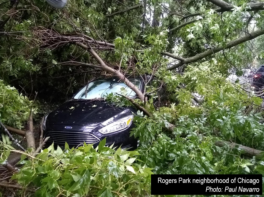
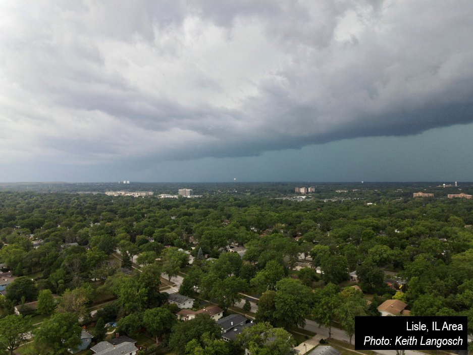
A long-lived, large storm complex tracked from the NE/IA border, across IA, northern IL, & northern IN. This produced widespread damage to trees, toppled several semis, & caused some structure damage.
Recap: https://www.weather.gov/lot/2020aug10 ">https://www.weather.gov/lot/2020a...
A long-lived, large storm complex tracked from the NE/IA border, across IA, northern IL, & northern IN. This produced widespread damage to trees, toppled several semis, & caused some structure damage.
Recap: https://www.weather.gov/lot/2020aug10 ">https://www.weather.gov/lot/2020a...
The peak gusts (measured & estimated) were frequently 70-90 mph & persisted for 15+ minutes with some locations experiencing even higher. These wind speeds are equivalent to EF-0 to EF-1 tornadoes but over a vastly larger area than a tornado would impact. #ILwx
While much of the wind damage was straight-line wind, a few tornadoes were likely embedded within the storm complex across the region, and one has been confirmed in Rogers Park, IL. This did move out over Lake MI becoming a waterspout. #ILwx
Such a complex of storms is called a derecho. A derecho brings a swath of particularly damaging thunderstorm winds over an area at least 400 miles long & 60 miles wide. The Upper Midwest to Great Lakes is a favored climatological area for such storm complexes.
Despite damage coverage/intensity, no fatalities reported & few injuries thus far. This speaks to preparedness & communication by our partners in public safety & the weather enterprise, and sharing info & responding by you the public! Safety: https://www.weather.gov/lot/severeprepare">https://www.weather.gov/lot/sever... #ILwx #INwx

 Read on Twitter
 Let& #39;s talk Monday& #39;s storms.A long-lived, large storm complex tracked from the NE/IA border, across IA, northern IL, & northern IN. This produced widespread damage to trees, toppled several semis, & caused some structure damage. Recap: https://www.weather.gov/lot/2020a..." title="Good morning!https://abs.twimg.com/emoji/v2/... draggable="false" alt="☀️" title="Sonne mit Strahlen" aria-label="Emoji: Sonne mit Strahlen"> Let& #39;s talk Monday& #39;s storms.A long-lived, large storm complex tracked from the NE/IA border, across IA, northern IL, & northern IN. This produced widespread damage to trees, toppled several semis, & caused some structure damage. Recap: https://www.weather.gov/lot/2020a..." class="img-responsive" style="max-width:100%;"/>


