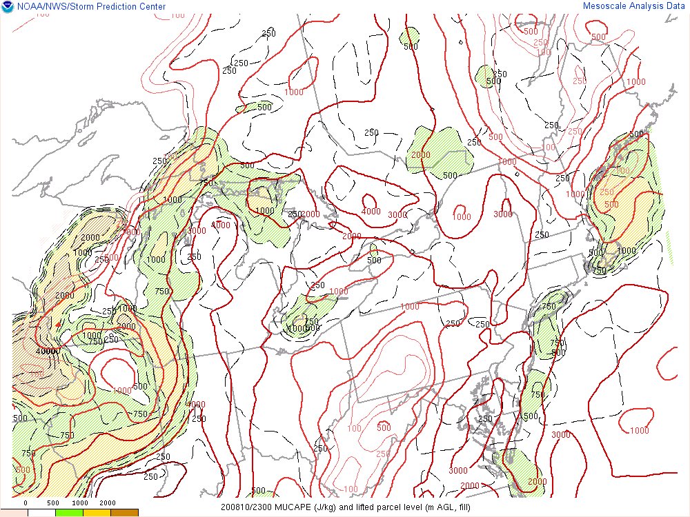
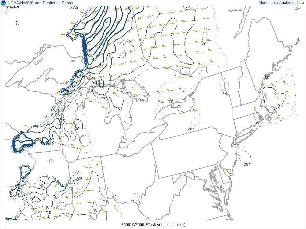
I’ve seen a lot of questions regarding severe weather chances in NE OH. I can confidently say that there’s is little to no risk for any severe weather in NE OH. There will be a couple of things working against the northern portion of this line: A Thread (1/5) #ohwx
1.) Timing...storms shouldn’t arrive until well after sunset in NE OH. This will limit the amount of energy available to the storms by the time they get to the Cleveland Area. (2/5) #ohwx
2.) Lower instability...notice how the best instability is S & W of NEO. While slightly higher values will come with the front later, quickly getting these to around 4500 (like IL & IA) up from ~500-1000 will be unlikely. These numbers will also lower after sunset (3/5) #ohwx
3.) Upper wind support...in order for a line of storms to sustain itself, it can’t allow rain-cooled air to rush ahead of the storms. Otherwise, the storms won’t have any more favorable air to ingest. Strong winds aloft ahead of the storms prevent this from happening. (4/5) #ohwx
In this analysis, however, strong enough winds are not present east of I-75. This will prevent the northern portion of the lime from lasting as long, likely causing it to die out by the time it nears I-71 #ohwx (5/5)

 Read on Twitter


