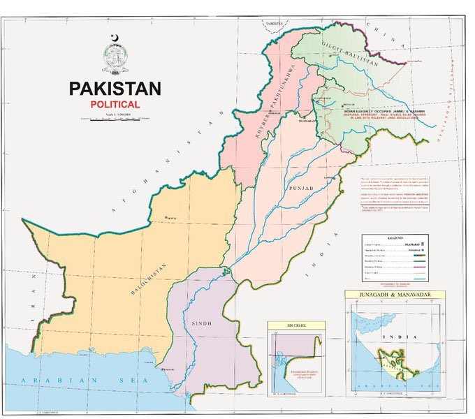
As I said in the previous tweets this map has put both the nationalist and realist sides of me at war with one another over how to feel. And seeing most of you feel the same way, let’s initially address what the map is depicting.
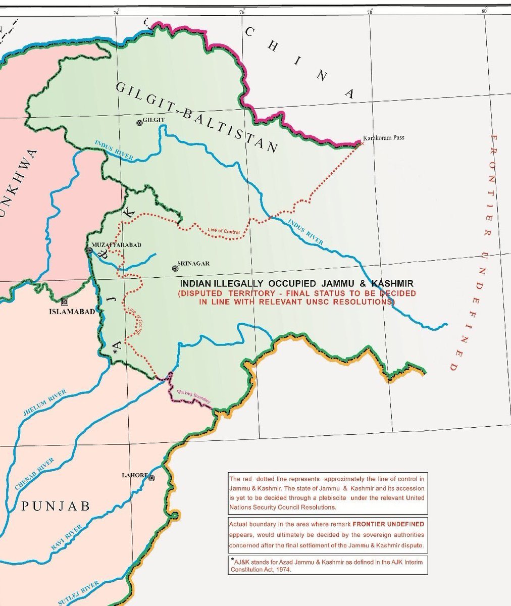
1) The map has in unequivocal terms declared the parts of Pakistani administered Kashmir as integral Pakistani Territory. This is a shift from the old maps depicting all of Pakistani administered parts either with Kashmir or only depicting Gilgit as Pakistan and -
And depicting Baltistan and AJK as disputed territory. This is a rebuttal of the narrative rising in India where all area of the erstwhile state of JK, especially Pakistani administered, were ‘Integral parts of India’. Pakistan has for the first time properly claimed these areas.
2) The Map only shows the Indian administered parts as ‘Indian occupied Kashmir’ which would be subject to the referendum. Another way to further ossify the integration of AJK and GB into Pakistan. However, Pakistan’s constitution guarantees referendum in GB and AJK.
Thus although the map places only IOK as subject to referendum, when or rather If the time comes, the entire area of the erstwhile state would be subject to plebiscite.
3) The points of interest are 2 new claims, the first one is of Sir Creek. Sir Creek is a marshland in the Indus Delta which separates Pakistani Sindh from Indian Gujrat. Both countries claim the boundary to be on opposites sides, with the Pakistani Green line & Indian Red Line.
Pakistan has once again extended its claim over the Indo - Pak boundary being on the eastern front on the Green Line and revived what has been a very dormant dispute between the 2 countries. Pertinent to note is that Both states clashed here in April 1965,
This clash was a precursor to the War of 1965. The battle are registered as one of the finest examples of Pakistani vigour when Pakistan crossed into enemy lines in the Rann of Kutch in 1965.
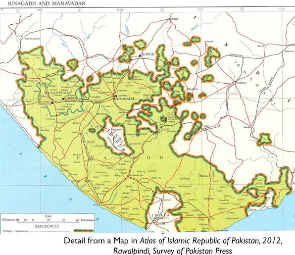
4) The Most peculiar of these are Pakistani claims on Junagadh and Manawadar. These 2 states were the polar opposites to Kashmir. Their rulers were Muslims who ruled over a predominantly Hindu populace.
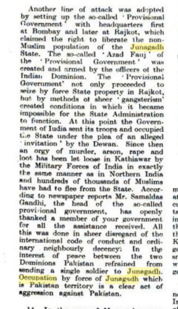
They were united with Pakistan by sea. When the Raja of Junagadh acceded to Pakistan, his hindu subjects declared independence. India put a complete blockade on the state and moved in their troops into Junagadh principalities, pressurising the state both militarily & Politically.
India also set up a provisional Govt. under Gandhi’s nephew. Though India claims that they were themselves invited into the state at the orders of it’s Chief Minister (incidentally Z. Bhutto’s Father), other accounts speak of heinous crime, arson loot and rape.
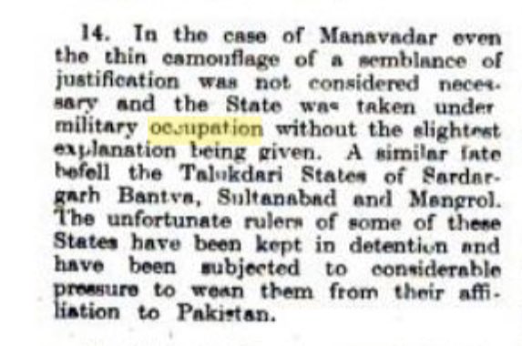
The same was the case with Manawadar, Pakistani acceded territory which was occupied.
Plebiscite was conducted in both regions and both regions were annexed by India.
Plebiscite was conducted in both regions and both regions were annexed by India.
Now for its implications, that map is only but a single step in the journey of a thousand miles. Though it is not insignificant. Pakistan will achieve multiple interests through the projection of this map.
Of a first, a forward policy in regards to Kashmir has been adopted.
Of a first, a forward policy in regards to Kashmir has been adopted.
Of a second, Pakistan can now very well juggle with multiple stances on the Kashmir dispute as it sees fit. Although it won’t be of much significance in normal day life, it is quite a significant tool in the Diplomatic world.
Of a third, this will create outcry in India which will very well once again internationalise the issue. The spark shall once again be ignited and much to the credit of our FO, it shall start from over our eastern border itself.
For Sir Creek and Junagadh/Manawadar, Pakistan is neither going to try to fully claim nor are they going to go to the extent of influencing the areas. It is a mere strategy to put to front a much more aggressive posture of Pakistan.
The most significant development is that Pakistan finally has a rhetoric which shall ease the annexation of GB and AJK. This shall be the first direct affect of this map and Pakistan’s new stance.
Though invariably, this map shall complicate the relations b/w Pakistan and India vis a vis Kashmir. ‘Undefined Frontiers’ still existing shows that there is room for much to more to take place in the events that follow.
To think I predicted all of this 4 months ago in an Op - Ed which was initially selected and then rejected at the last moment by a Geopolitical Magazine due to my age.

 Read on Twitter