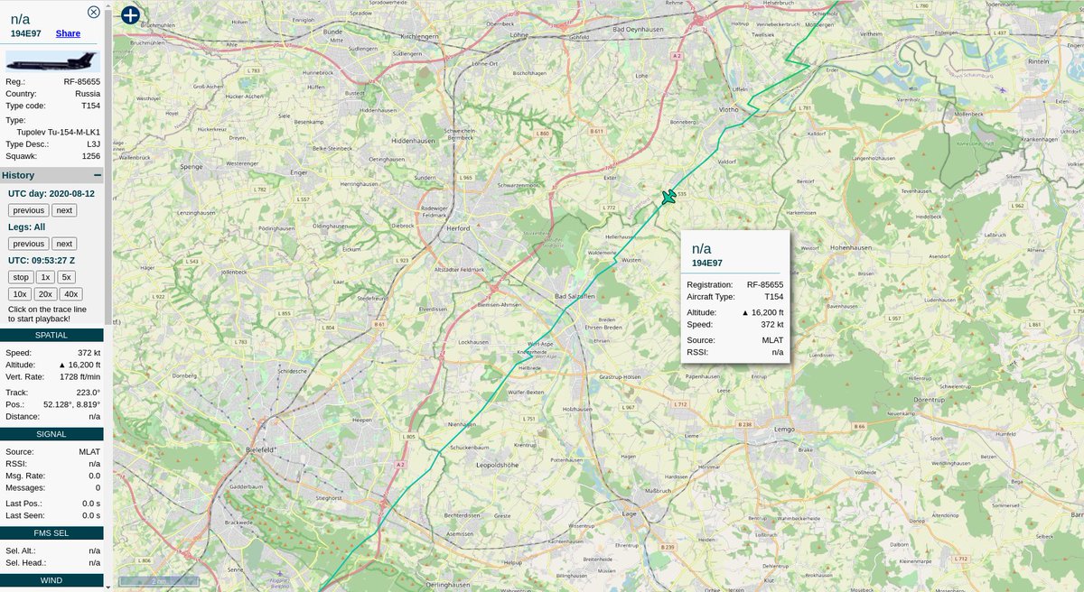
Corrections welcome!
https://tar1090.adsbexchange.com/?icao=194e97&showTrace=2020-08-04
#OpenSkiesTreaty
Now officially confirmed by Russia& #39;s military news network Krasnaya Zvezda. https://twitter.com/ilax200/status/1292673700773400577">https://twitter.com/ilax200/s...
...also coverage by @izvestia_ru
#OpenSkiesTreaty https://twitter.com/izvestia_ru/status/1292641882703564806">https://twitter.com/izvestia_...
#OpenSkiesTreaty https://twitter.com/izvestia_ru/status/1292641882703564806">https://twitter.com/izvestia_...
h/t to the Russian Air Force #RuAF for using their Tu-154M-LK-1 which uses Mode-S, rather than one of the An-30Bs, which do not have a transponder that we can follow using open source means. This allows the public to watch what they fly over in Germany, bypassing "officials".
https://tar1090.adsbexchange.com/?icao=194e97&showTrace=2020-08-10
Nice to have coverage from @flightradar24, who have been a great help tracking Open Skies Treaty flights over the years. https://twitter.com/flightradar24/status/1293475442603757568">https://twitter.com/flightrad...
...and coverage from @civmilair  https://abs.twimg.com/emoji/v2/... draggable="false" alt="👏" title="Applaus-Zeichen" aria-label="Emoji: Applaus-Zeichen">
https://twitter.com/CivMilAir/status/1293475900462424072?s=20">https://twitter.com/CivMilAir...
https://twitter.com/CivMilAir/status/1293475900462424072?s=20">https://twitter.com/CivMilAir...
Strangely still no American coverage of the German Foreign Minister& #39;s comments yesterday in support of the #OpenSkiesTreaty, which has been targeted for destruction by a faction of Republicans for years. https://twitter.com/steffanwatkins/status/1293248718024695808">https://twitter.com/steffanwa...
Germany and 32 other countries all support the #OpenSkiesTreaty, a faction of Republicans are the only ones in the United States government who are trying to destroy it. American news media fail to portray the Trump administration as the belligerent treaty-arsonists they are.
For some reason @starsandstripes wanted to quote anonymous officials over the official State Dept compliance report, spreading officials& #39; #disinformation, rather than facts. I have extremely low hopes any corrections will be made, but you never know.
https://twitter.com/starsandstripes/status/1293609818620604423?s=20.">https://twitter.com/starsands...
https://twitter.com/starsandstripes/status/1293609818620604423?s=20.">https://twitter.com/starsands...
Using a combination of @ADSBexchange& #39;s base layer of open street maps, Wikimapia, and Google maps sat imagery, you can pick out the depots and bases that the flight overflew; and I& #39;ll tell you tips to make sure you& #39;re making the right determinations by what we already know
In the treaty there are several stipulations about how pictures can be taken; the digital electro-optical sensor faces down, the plane must be level (not banking), the altitude is predetermined and must be maintained, and the speed is predetermined and at a constant rate.
Now you know that, look at the flight path again; where the plane banks, no pictures were taken. Where the plane was accelerating or decelerating rapidly there were no pictures taken. When the plane was descending or ascending, no pictures either.
link to flight path
https://tar1090.adsbexchange.com/?icao=194e97&lat=50.715&lon=10.745&zoom=7.6&showTrace=2020-08-12">https://tar1090.adsbexchange.com/...
https://tar1090.adsbexchange.com/?icao=194e97&lat=50.715&lon=10.745&zoom=7.6&showTrace=2020-08-12">https://tar1090.adsbexchange.com/...
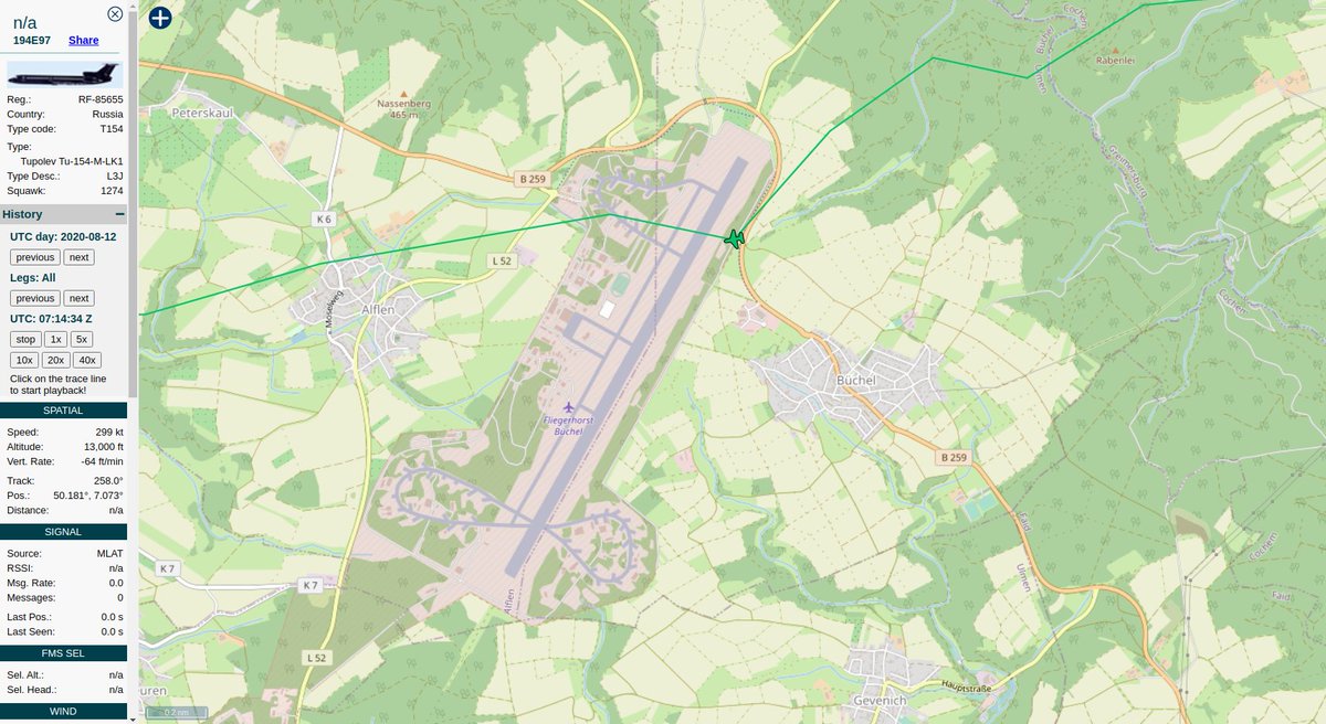
The magic speed number is ~300kt, the altitude should be flat around 13,000ft.
Oh, there& #39;s a likely subject; the Koblenz-Schmidtenhöhe training area.
The only headline you& #39;ll see today from any American news media will be how they flew over American military bases in Germany... yes, and the German bases in Germany too, eh. https://abs.twimg.com/emoji/v2/... draggable="false" alt="🤷♂️" title="Achselzuckender Mann" aria-label="Emoji: Achselzuckender Mann">
https://de.wikipedia.org/wiki/Standort%C3%BCbungsplatz_Koblenz-Schmidtenh%C3%B6he">https://de.wikipedia.org/wiki/Stan...
The only headline you& #39;ll see today from any American news media will be how they flew over American military bases in Germany... yes, and the German bases in Germany too, eh.
https://de.wikipedia.org/wiki/Standort%C3%BCbungsplatz_Koblenz-Schmidtenh%C3%B6he">https://de.wikipedia.org/wiki/Stan...
Can anyone name this American base in Germany?
No, this is Büchel Air Base, a Luftwaffe base in Germany, and that& #39;s what the Russians were doing flying over Germany; taking pictures of interesting things *in Germany*, with a military-facilities focus.
https://en.wikipedia.org/wiki/B%C3%BCchel_Air_Base">https://en.wikipedia.org/wiki/B%C3...
No, this is Büchel Air Base, a Luftwaffe base in Germany, and that& #39;s what the Russians were doing flying over Germany; taking pictures of interesting things *in Germany*, with a military-facilities focus.
https://en.wikipedia.org/wiki/B%C3%BCchel_Air_Base">https://en.wikipedia.org/wiki/B%C3...
So yes, there are American/NATO bases in Germany, but that& #39;s missing the point; saying them to the exclusion of German bases suggests their focus is exclusively to overfly American military bases, which is not true.
Spangdahlem Air Base:
https://en.wikipedia.org/wiki/Spangdahlem_Air_Base">https://en.wikipedia.org/wiki/Span...
https://en.wikipedia.org/wiki/Spangdahlem_Air_Base">https://en.wikipedia.org/wiki/Span...
Maybe this industrial park with an airstrip?
49.858°, 6.766° https://abs.twimg.com/emoji/v2/... draggable="false" alt="🤷♂️" title="Achselzuckender Mann" aria-label="Emoji: Achselzuckender Mann">
This is not an exact science.
You can, however, request the entire mission plan, and associated reports, from the German gov& #39;t in accordance with their FOIA laws. https://abs.twimg.com/emoji/v2/... draggable="false" alt="👍" title="Thumbs up" aria-label="Emoji: Thumbs up">
49.858°, 6.766°
This is not an exact science.
You can, however, request the entire mission plan, and associated reports, from the German gov& #39;t in accordance with their FOIA laws.
A gorgeous shot of United States Army Garrison Baumholder
49.622°, 7.328°
#USAGBaumholder #TheRock https://www.thebalanceeveryday.com/u-s-army-garrison-baumholder-3344648">https://www.thebalanceeveryday.com/u-s-army-...
49.622°, 7.328°
#USAGBaumholder #TheRock https://www.thebalanceeveryday.com/u-s-army-garrison-baumholder-3344648">https://www.thebalanceeveryday.com/u-s-army-...
Right over Ramstein Air Base and other presumably nearby training areas
https://en.wikipedia.org/wiki/Ramstein_Air_Base">https://en.wikipedia.org/wiki/Rams...
https://en.wikipedia.org/wiki/Ramstein_Air_Base">https://en.wikipedia.org/wiki/Rams...
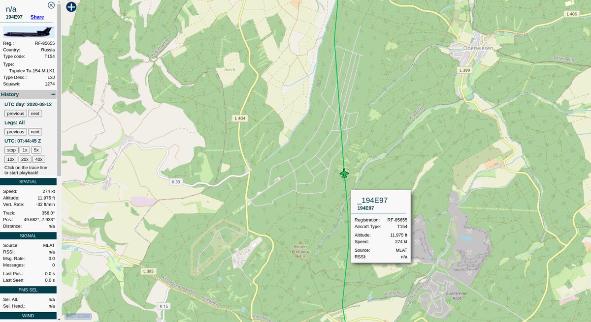
When you see unmarked roads in parallel lines in the woods, stop, and look on @wikimapia for 49.682°, 7.933°
Kriegsfeld Ammo Depot "Northpoint", a former nuclear weapons storage area that& #39;s supposed to be closed? Maybe they& #39;re seeing if it& #39;s still closed too.
Kriegsfeld Ammo Depot "Northpoint", a former nuclear weapons storage area that& #39;s supposed to be closed? Maybe they& #39;re seeing if it& #39;s still closed too.
Anderson Barracks (closed)
49.846°, 8.285°
Making sure it& #39;s closed?
https://de.wikipedia.org/wiki/Anderson_Barracks">https://de.wikipedia.org/wiki/Ande...
49.846°, 8.285°
Making sure it& #39;s closed?
https://de.wikipedia.org/wiki/Anderson_Barracks">https://de.wikipedia.org/wiki/Ande...
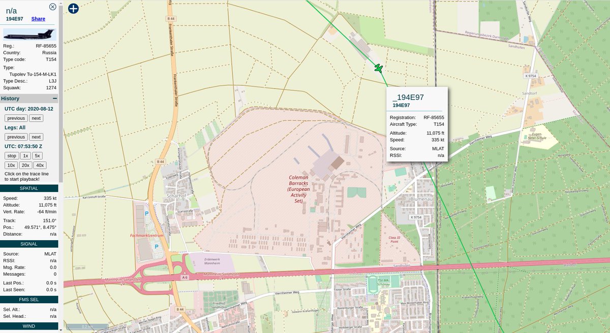
Coleman Barracks Army Prepositioned Stock Site
...and video thanks to DVIDS:
https://www.dvidshub.net/video/embed/666536">https://www.dvidshub.net/video/emb...
...and video thanks to DVIDS:
https://www.dvidshub.net/video/embed/666536">https://www.dvidshub.net/video/emb...
Who knew I would have needed to know Germany later in life; not this guy!
That& #39;s the German Bundeswehr Carl-Schurz-Kaserne Barracks in the bottom left (I hope), and a training area immediately north of the random data-point I picked.
That& #39;s the German Bundeswehr Carl-Schurz-Kaserne Barracks in the bottom left (I hope), and a training area immediately north of the random data-point I picked.
Storck Barracks
https://www.thebalanceeveryday.com/u-s-army-illesheim-storck-barracks-germany-3344676">https://www.thebalanceeveryday.com/u-s-army-...
https://www.thebalanceeveryday.com/u-s-army-illesheim-storck-barracks-germany-3344676">https://www.thebalanceeveryday.com/u-s-army-...
Katterbach Kaserne
https://en.wikipedia.org/wiki/Katterbach_Kaserne">https://en.wikipedia.org/wiki/Katt...
https://en.wikipedia.org/wiki/Katterbach_Kaserne">https://en.wikipedia.org/wiki/Katt...
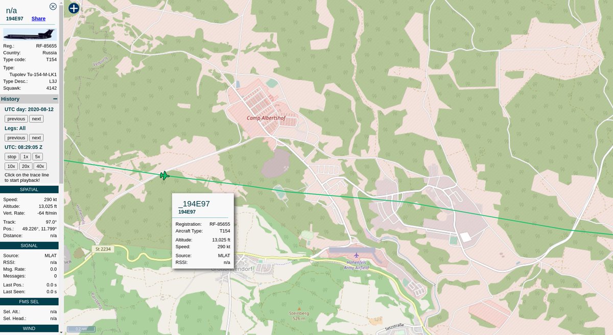
Camp Albertshof
https://currentops.com/installations/de/by/camp-albertshof
and/or
Hohenfels">https://currentops.com/installat... Army Airfield
https://www.mil-airfields.de/germany/hohenfels-army-airfield.html
Not">https://www.mil-airfields.de/germany/h... sure if they can get both in frame at the same time.
https://currentops.com/installations/de/by/camp-albertshof
and/or
Hohenfels">https://currentops.com/installat... Army Airfield
https://www.mil-airfields.de/germany/hohenfels-army-airfield.html
Not">https://www.mil-airfields.de/germany/h... sure if they can get both in frame at the same time.
Back North through the Hohenfels military training area
49.239°, 11.920°
https://www.thebalanceeveryday.com/u-s-army-garrison-hohenfels-training-area-3344673">https://www.thebalanceeveryday.com/u-s-army-...
49.239°, 11.920°
https://www.thebalanceeveryday.com/u-s-army-garrison-hohenfels-training-area-3344673">https://www.thebalanceeveryday.com/u-s-army-...
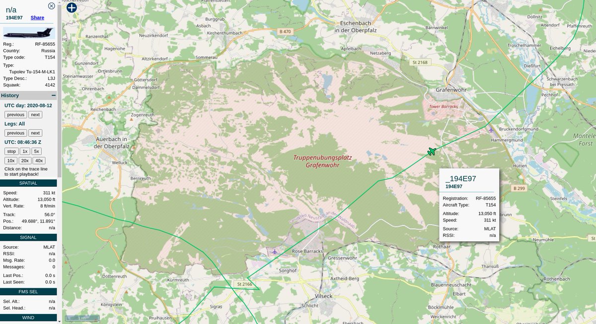
Grafenwöhr Training Area
49.688°, 11.891°
https://en.wikipedia.org/wiki/Grafenwoehr_Training_Area">https://en.wikipedia.org/wiki/Graf...
49.688°, 11.891°
https://en.wikipedia.org/wiki/Grafenwoehr_Training_Area">https://en.wikipedia.org/wiki/Graf...
https://tar1090.adsbexchange.com/?icao=194e97&showTrace=2020-08-13">https://tar1090.adsbexchange.com/...
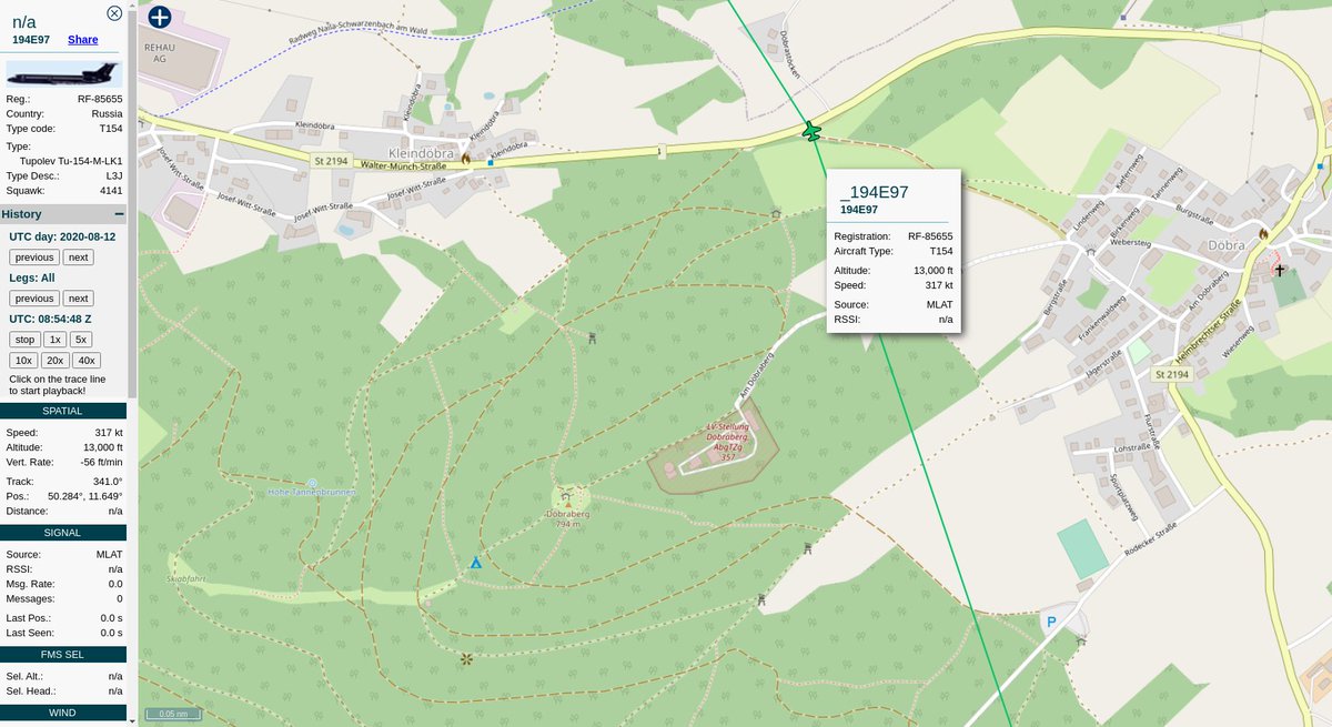
Yesterday, they flew right over the 355 Gleina radar station (or whatever the right term is)
https://de.wikipedia.org/wiki/Einsatzf%C3%BChrungsbereich_3">https://de.wikipedia.org/wiki/Eins...
https://de.wikipedia.org/wiki/Einsatzf%C3%BChrungsbereich_3">https://de.wikipedia.org/wiki/Eins...
https://www.mil-airfields.de/germany/holzdorf-air-base.html">https://www.mil-airfields.de/germany/h...
...and CRC Schönewalde.
http://www.ace-high-journal.eu/schoenewalde,-crc-bunker--harald-.html">https://www.ace-high-journal.eu/schoenewa...
http://www.ace-high-journal.eu/schoenewalde,-crc-bunker--harald-.html">https://www.ace-high-journal.eu/schoenewa...
Interested in what the  https://abs.twimg.com/emoji/v2/... draggable="false" alt="🇷🇺" title="Flagge von Russland" aria-label="Emoji: Flagge von Russland"> #RuAF was looking at when they overflew Canada, or the same for the
  https://abs.twimg.com/emoji/v2/... draggable="false" alt="🇨🇦" title="Flagge von Kanada" aria-label="Emoji: Flagge von Kanada"> #RCAF overflights of Russia? Well, here& #39;s a whole lot more information than you knew you could request from your government:
#ATIP #FOIA #OpenSkiesTreaty https://twitter.com/steffanwatkins/status/1283093085313011720?s=20">https://twitter.com/steffanwa...
#ATIP #FOIA #OpenSkiesTreaty https://twitter.com/steffanwatkins/status/1283093085313011720?s=20">https://twitter.com/steffanwa...
3300 asRWB
WGT Fliegerlager für Raketenbewaffnung und Munition
 https://abs.twimg.com/emoji/v2/... draggable="false" alt="🤷♂️" title="Achselzuckender Mann" aria-label="Emoji: Achselzuckender Mann">
http://wikimapia.org/11341075/de/3300-asRWB">https://wikimapia.org/11341075/...
WGT Fliegerlager für Raketenbewaffnung und Munition
http://wikimapia.org/11341075/de/3300-asRWB">https://wikimapia.org/11341075/...
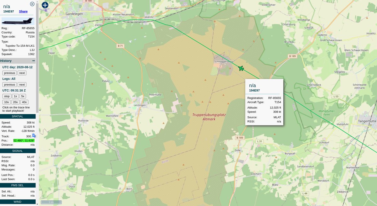
Over the Altmark training ground...
52.480°, 11.628°
https://www.rheinmetall-defence.com/en/rheinmetall_defence/company/divisions_and_subsidiaries/rheinmetall_dienstleistungszentrum_altmark_gmbh__/">https://www.rheinmetall-defence.com/en/rheinm...
52.480°, 11.628°
https://www.rheinmetall-defence.com/en/rheinmetall_defence/company/divisions_and_subsidiaries/rheinmetall_dienstleistungszentrum_altmark_gmbh__/">https://www.rheinmetall-defence.com/en/rheinm...
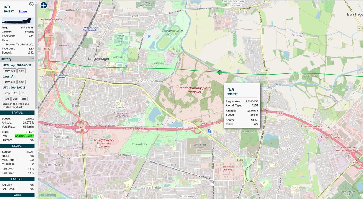
Hannover training area
52.440°, 9.784°
https://www.langenhagen.de/index.phtml?object=tx%7C1620.19.1&ModID=7&FID=1620.2826.1">https://www.langenhagen.de/index.pht...
52.440°, 9.784°
https://www.langenhagen.de/index.phtml?object=tx%7C1620.19.1&ModID=7&FID=1620.2826.1">https://www.langenhagen.de/index.pht...
https://en.wikipedia.org/wiki/Wunstorf_Air_Base">https://en.wikipedia.org/wiki/Wuns...
By this point in the trip, they& #39;re done. You know how I know, without asking "officials"? Check out the rate of climb and altitude; they& #39;re out of the envelope, unless they& #39;re going to level out again and take pictures at a higher altitude (they don& #39;t); they land back in Bonn.
Erica Vega, a USAF spokeswoman, told @starsandstripes "we do not know what bases they are most interested in".
The #USAF, State, and #DTRA have all the Open Skies Treaty flight plans, from all countries, ever flown, at their disposal. That statement is pretty thin wordplay.
The #USAF, State, and #DTRA have all the Open Skies Treaty flight plans, from all countries, ever flown, at their disposal. That statement is pretty thin wordplay.
This thread open-sources a partial list of military facilities in Germany of Russian interest, they& #39;re also interested in the industrial areas, rail yards, shipyards, etc to ensure no freshly produced little green trucks are being loaded onto trains. This is verification.

 Read on Twitter
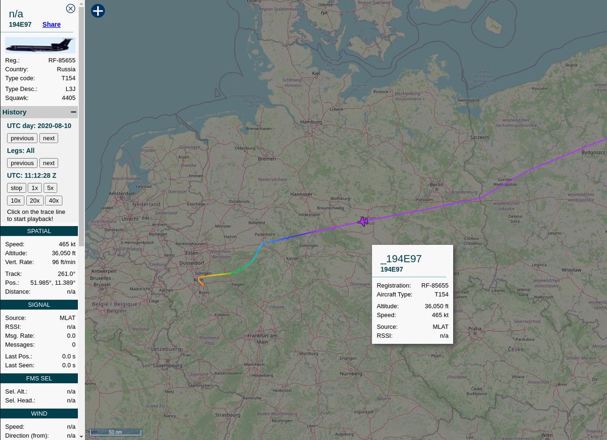 #Russia|n Air Force #RuAF Tupolev Tu-154M-LK1 Open Skies Treaty-certified observation plane RF-85655| #194E97 flew to #EDDK to conduct a scheduled Open Skies Treaty observation flight over Germany this week. https://tar1090.adsbexchange.com/... href="https://twtext.com//hashtag/RF85655"> #RF85655 #OpenSkiesTreaty" title="https://abs.twimg.com/emoji/v2/... draggable="false" alt="🇷🇺" title="Flagge von Russland" aria-label="Emoji: Flagge von Russland"> #Russia|n Air Force #RuAF Tupolev Tu-154M-LK1 Open Skies Treaty-certified observation plane RF-85655| #194E97 flew to #EDDK to conduct a scheduled Open Skies Treaty observation flight over Germany this week. https://tar1090.adsbexchange.com/... href="https://twtext.com//hashtag/RF85655"> #RF85655 #OpenSkiesTreaty" class="img-responsive" style="max-width:100%;"/>




 This is not an exact science.You can, however, request the entire mission plan, and associated reports, from the German gov& #39;t in accordance with their FOIA laws. https://abs.twimg.com/emoji/v2/... draggable="false" alt="👍" title="Thumbs up" aria-label="Emoji: Thumbs up">" title="Maybe this industrial park with an airstrip?49.858°, 6.766° https://abs.twimg.com/emoji/v2/... draggable="false" alt="🤷♂️" title="Achselzuckender Mann" aria-label="Emoji: Achselzuckender Mann">This is not an exact science.You can, however, request the entire mission plan, and associated reports, from the German gov& #39;t in accordance with their FOIA laws. https://abs.twimg.com/emoji/v2/... draggable="false" alt="👍" title="Thumbs up" aria-label="Emoji: Thumbs up">" class="img-responsive" style="max-width:100%;"/>






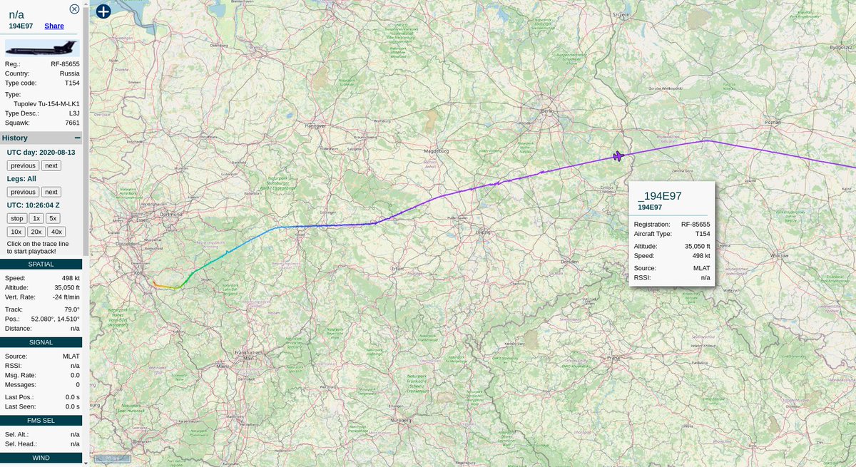 #Russia|n Air Force #RuAF Tupolev Tu-154M-LK1 RF-85655| #194E97 headed home this morning after one day of #OpenSkiesTreaty observation flights over Germany https://abs.twimg.com/emoji/v2/... draggable="false" alt="🇩🇪" title="Flagge von Deutschland" aria-label="Emoji: Flagge von Deutschland">. https://tar1090.adsbexchange.com/..." title="https://abs.twimg.com/emoji/v2/... draggable="false" alt="🇷🇺" title="Flagge von Russland" aria-label="Emoji: Flagge von Russland"> #Russia|n Air Force #RuAF Tupolev Tu-154M-LK1 RF-85655| #194E97 headed home this morning after one day of #OpenSkiesTreaty observation flights over Germany https://abs.twimg.com/emoji/v2/... draggable="false" alt="🇩🇪" title="Flagge von Deutschland" aria-label="Emoji: Flagge von Deutschland">. https://tar1090.adsbexchange.com/..." class="img-responsive" style="max-width:100%;"/>
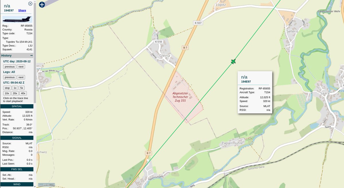
 Holzdorf Air Base (✠ Luftwaffe) https://www.mil-airfields.de/germany/h..." title="https://abs.twimg.com/emoji/v2/... draggable="false" alt="🇩🇪" title="Flagge von Deutschland" aria-label="Emoji: Flagge von Deutschland"> Holzdorf Air Base (✠ Luftwaffe) https://www.mil-airfields.de/germany/h..." class="img-responsive" style="max-width:100%;"/>

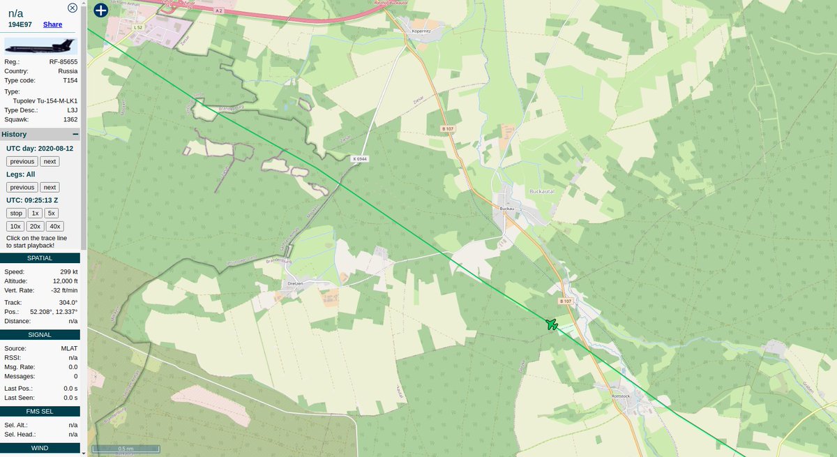 https://wikimapia.org/11341075/..." title="3300 asRWBWGT Fliegerlager für Raketenbewaffnung und Munitionhttps://abs.twimg.com/emoji/v2/... draggable="false" alt="🤷♂️" title="Achselzuckender Mann" aria-label="Emoji: Achselzuckender Mann"> https://wikimapia.org/11341075/..." class="img-responsive" style="max-width:100%;"/>

 Wunstorf Air Base (✠ Luftwaffe) https://en.wikipedia.org/wiki/Wuns..." title="https://abs.twimg.com/emoji/v2/... draggable="false" alt="🇩🇪" title="Flagge von Deutschland" aria-label="Emoji: Flagge von Deutschland"> Wunstorf Air Base (✠ Luftwaffe) https://en.wikipedia.org/wiki/Wuns..." class="img-responsive" style="max-width:100%;"/>
