𝗧𝗛𝗥𝗘𝗔𝗗 of Africa maps and its evolution through history.
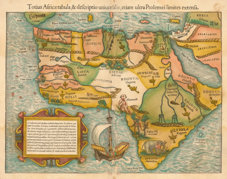
1. The earliest obtainable map of the whole continent of Africa: Sebastian Münster& #39;s Cosmographia (1545)
1. The earliest obtainable map of the whole continent of Africa: Sebastian Münster& #39;s Cosmographia (1545)
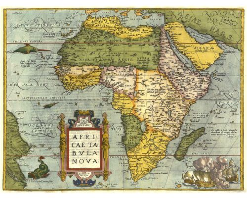
2. "Africae Tabula Nova" by Abraham Ortelius (1572).
It became the standard map of the continent until well into the seventeenth century.
It became the standard map of the continent until well into the seventeenth century.
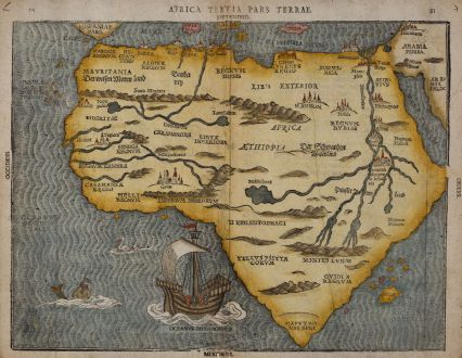
3. "Africa Tertia Pars Terrae" by Heinrich Bunting (1597)
The Nile finds its source in the mountains of the moon. Large sailing ship and sea creatures embellish the map.
The Nile finds its source in the mountains of the moon. Large sailing ship and sea creatures embellish the map.
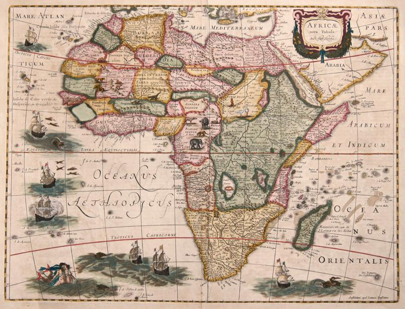
4. "Africae nova Tabula. Auct. Hen. Hondio." by Jodocus Hondius. (1631).
The map is decorated with an elaborate title cartouche and various sailing ships and sea monsters
The map is decorated with an elaborate title cartouche and various sailing ships and sea monsters
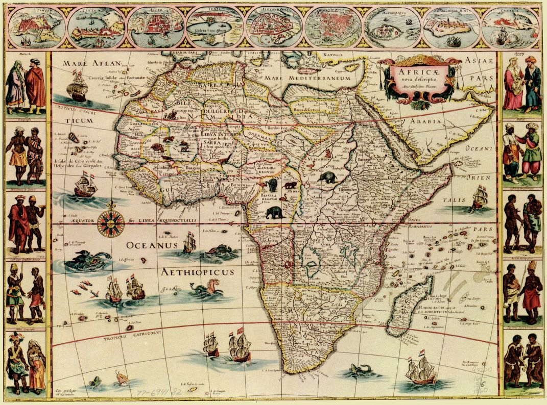
5. "Africae nova descriptio" by Willem Janszoon Blaeu (1633).
Large territories or kingdoms were outlined in color (e.g. Abyssinia and Monomotapa).
Large territories or kingdoms were outlined in color (e.g. Abyssinia and Monomotapa).
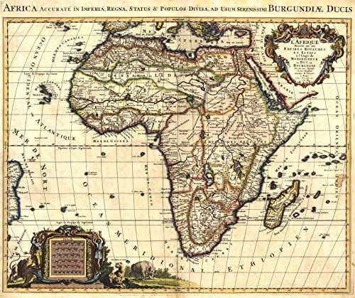
6. "Africa Accurate in Imperia, Regna, Status & Populos divisa, ad usum serenissimi Ludovici XV Galliarum Regis. - Carte D& #39;Afrique Dressée pour l& #39;usage du Roy" (1694)
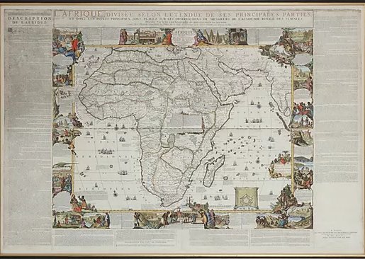
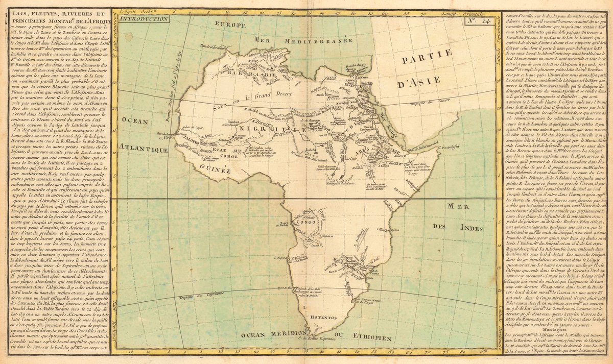
7. "L& #39;Afrique dressée selon les derniers relations et suivant les nouvelles decouvertes" by Nicolas de Fer (1705).
In the surrounding text you can read information about Africa& #39;s rivers, islands, mountains, kingdoms, peoples, etc.
In the surrounding text you can read information about Africa& #39;s rivers, islands, mountains, kingdoms, peoples, etc.
10. "Africa Secundum legitimas Projectionis stereographicae regulas" by Johann M. Hasse (1738).
A colorful cartouche shows Europeans, Africans, and various African animals with views of Cape Town.
A colorful cartouche shows Europeans, Africans, and various African animals with views of Cape Town.
13. "Afrique divisee en ses principaux Empires et Royaumes" by Robert G. de Vaugondy (1795).
The text on the right describes the lands, religions, colonies and other information.
The text on the right describes the lands, religions, colonies and other information.
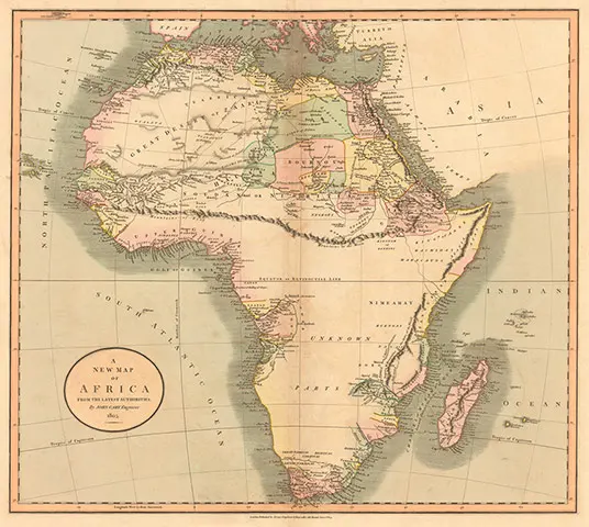
14. "A New Map of Africa, From the Latest Authorities" by John Cary (1805).
Shows a massive unexplored region south of the Mountains of Kong and the Mountains of the Moon.
Shows a massive unexplored region south of the Mountains of Kong and the Mountains of the Moon.
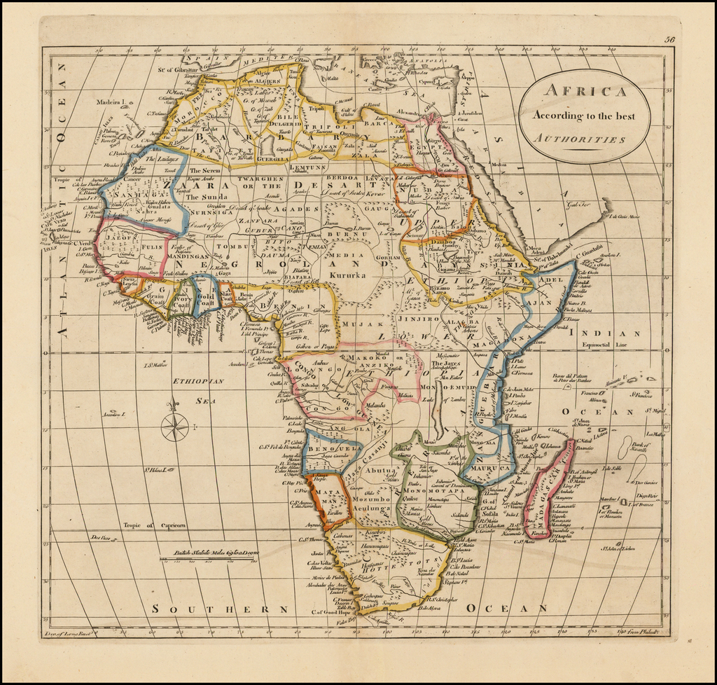
15. "Africa According to the best Authorities" by Mathew Carey (1814).
The map is divided by kingdoms and colonies, many of which are fictional.
The map is divided by kingdoms and colonies, many of which are fictional.
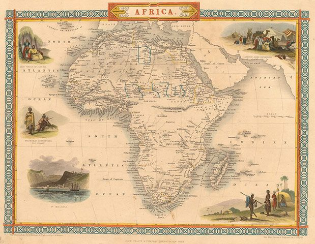
16. "Africa" by John Tallis (1851).
At the time the map was produced most of central Africa was still unknown to Europeans.
At the time the map was produced most of central Africa was still unknown to Europeans.
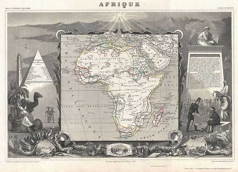
17. "Afrique" by Victor Levasseur (1852).
Much of the interior is still unknown to Europeans, with the exception of the Nile Valley, the French colonies (Senegal, Gambia, and Algeria), and the Dutch and English ones (South Africa).
Much of the interior is still unknown to Europeans, with the exception of the Nile Valley, the French colonies (Senegal, Gambia, and Algeria), and the Dutch and English ones (South Africa).
18. “Carte générale de l’Afrique, d’après les dernières découvertes” by J. Andriveau-Goujon (1856).
Coloring indicates the colonial land holdings of seven European nations.
Coloring indicates the colonial land holdings of seven European nations.
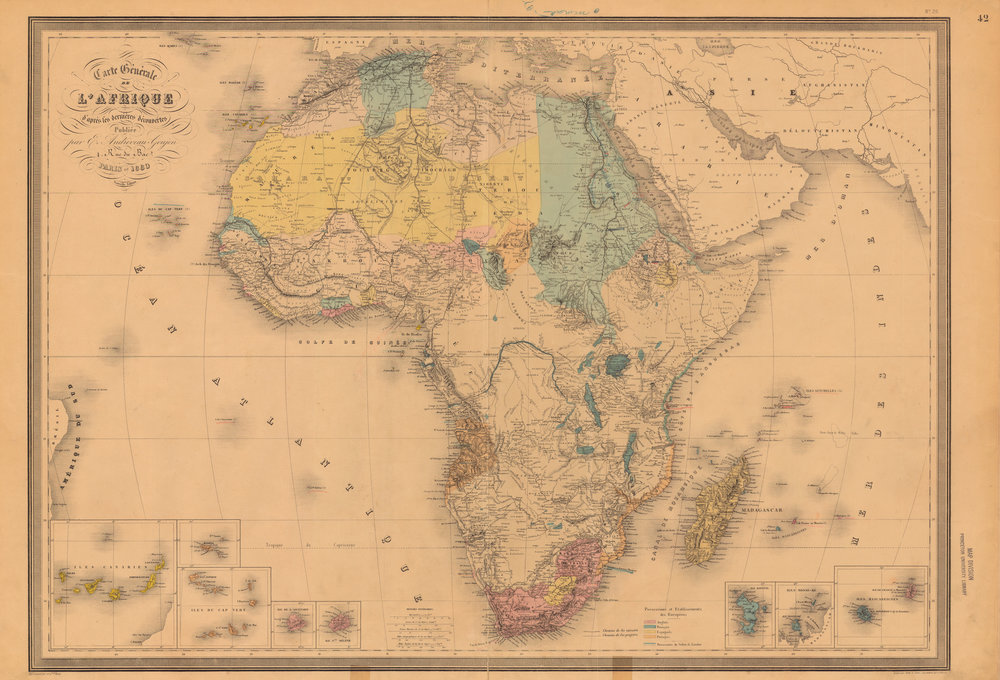
19. “Carte générale de l’Afrique, d’après les dernières découvertes” by Eugène Andriveau-Goujon (1880).
Coloring shows the advance of European influence in several territories.
Coloring shows the advance of European influence in several territories.
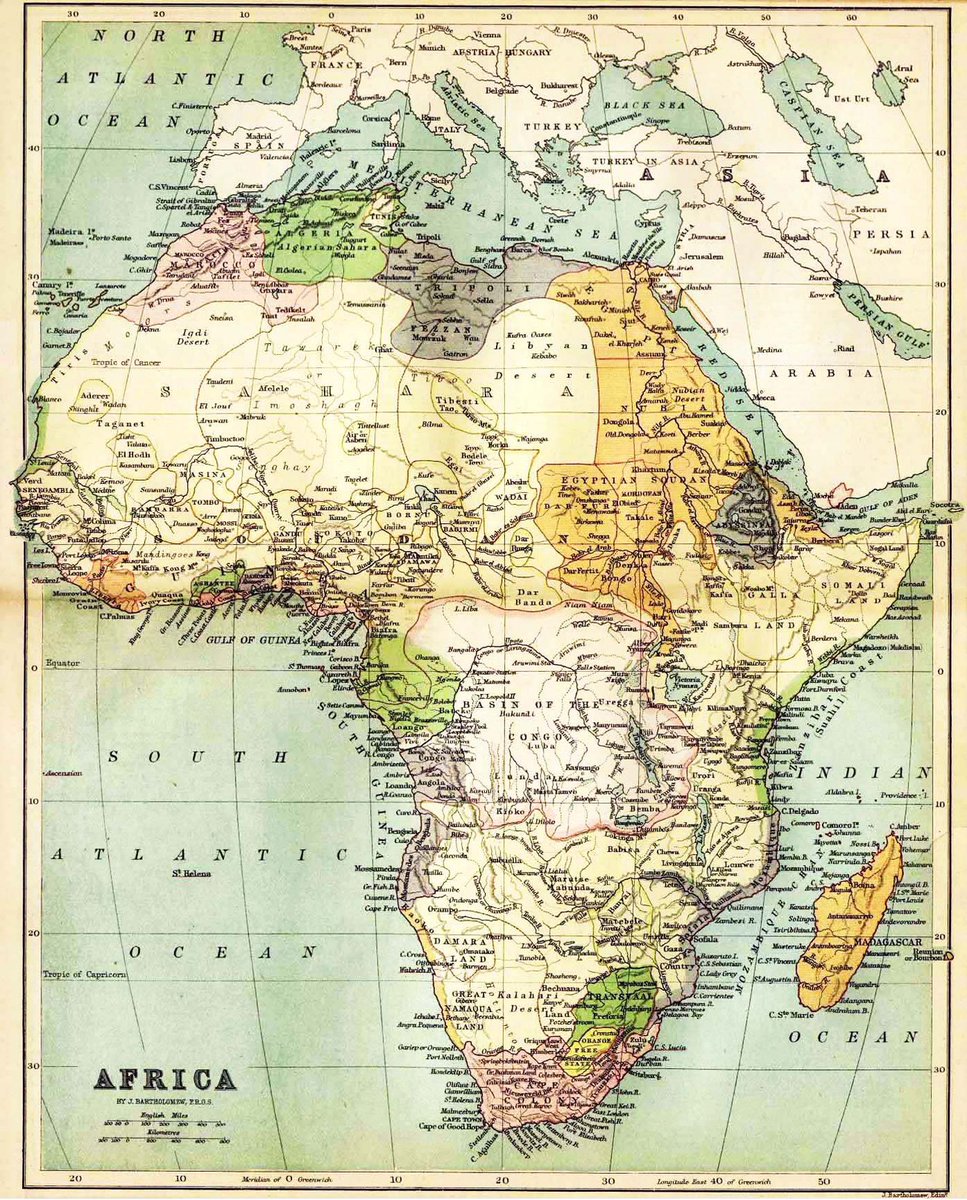
20. Africa by J. Bartholomew (1890).
The partitioning of Africa by the European powers has not yet really begun.
The partitioning of Africa by the European powers has not yet really begun.
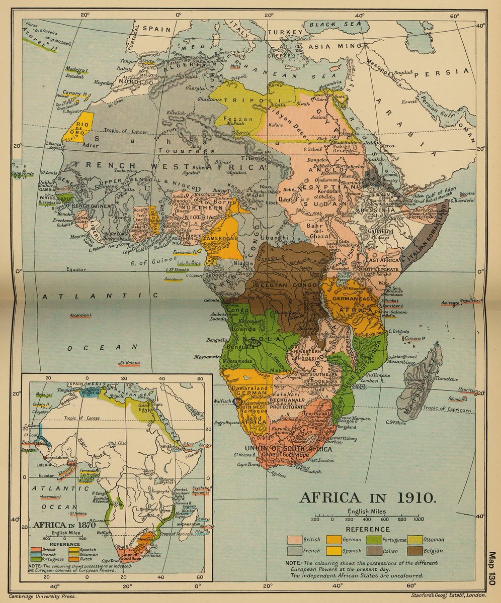
21. Map of Africa from the Cambridge Modern History Atlas (1912).
Coloring shows the possessions of the different European Powers in 1910. The independent African states are uncolored.
Coloring shows the possessions of the different European Powers in 1910. The independent African states are uncolored.
23. Map of Africa - Hammond& #39;s Handy Atlas of the World (1916).
Colour keyed to indicate the colonial possession of the world at that time.
Colour keyed to indicate the colonial possession of the world at that time.

 Read on Twitter