#trivia
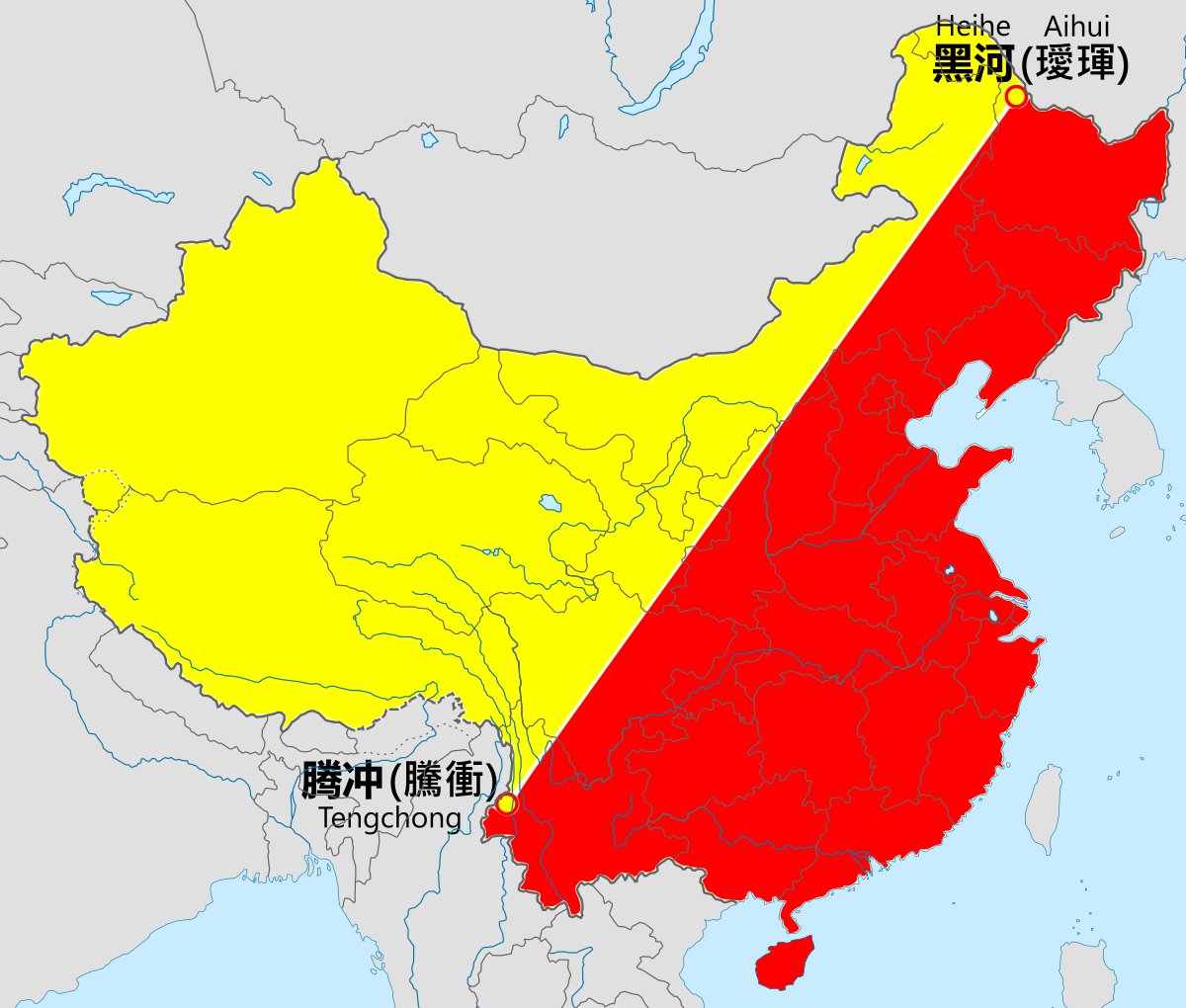
this is what every Chinese student learns in geography class at school: the heihe-tengchong line
Hu Huanyong first proposed this in 1935 (!)
94% of the population lives in the red area
the last image is QQ activity heatmap...
this is what every Chinese student learns in geography class at school: the heihe-tengchong line
Hu Huanyong first proposed this in 1935 (!)
94% of the population lives in the red area
the last image is QQ activity heatmap...
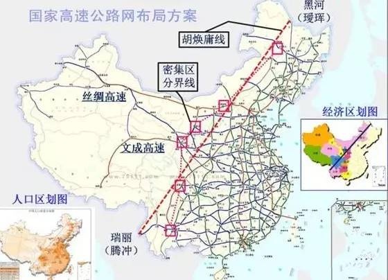
since people are loving these maps...
yes the Heihe-Tengchong line is related to the boundaries between the plain and highland regions
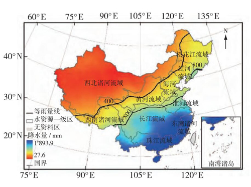
It& #39;s also related to the 15 inch isohyet (we use 400mm in China). But neither the isohyet nor the topographical line coincides with it entirely.
yes the Heihe-Tengchong line is related to the boundaries between the plain and highland regions
It& #39;s also related to the 15 inch isohyet (we use 400mm in China). But neither the isohyet nor the topographical line coincides with it entirely.

 Read on Twitter


