Thread https://abs.twimg.com/emoji/v2/... draggable="false" alt="👇" title="Rückhand Zeigefinger nach unten" aria-label="Emoji: Rückhand Zeigefinger nach unten">- Excited to publish this latest collaboration between @amnesty and @elementai - Using artificial intelligence to scale up human rights research: a case study on Darfur w/ @alkalait and @BuffyPrice https://citizenevidence.org/2020/07/06/using-artificial-intelligence-to-scale-up-human-rights-research-a-case-study-on-darfur/">https://citizenevidence.org/2020/07/0...
This work builds on early research by @JCornebise and @deworrall92 who in 2017 built a machine learning model which automatically detected “human presence,” as well as “destroyed” and “partially destroyed” villages in Darfur, Sudan.
https://aiforsocialgood.github.io/2018/pdfs/track1/80_aisg_neurips2018.pdf">https://aiforsocialgood.github.io/2018/pdfs...
https://aiforsocialgood.github.io/2018/pdfs/track1/80_aisg_neurips2018.pdf">https://aiforsocialgood.github.io/2018/pdfs...
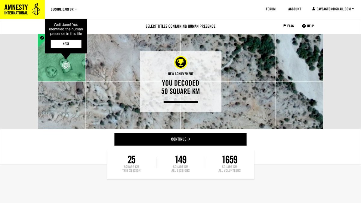
This research was possible thanks to thousands of digital volunteers who joined #AmnestyDecoders projects Decode Darfur and Decode the Difference, generating 13 million annotations of satellite images, covering 2.6 million satellite tiles.
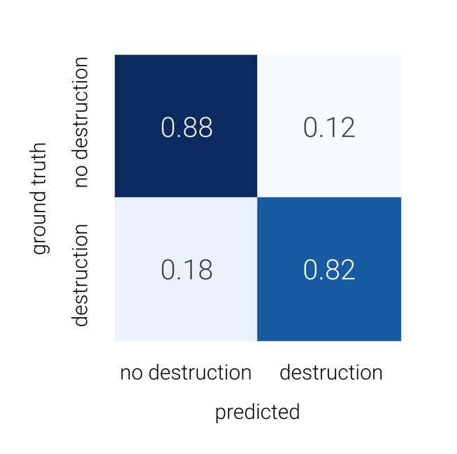
Human rights researchers at @amnesty teamed up with engineers at @elementai to automatically detect and quantify the destruction of homes in #Darfur. The new model achieved a precision of 85% and a recall of 81%. More technical details in the blog!
To visualize the predictions, we built a web app that superimposes the probability of human presence/destruction on a map. Given the risks involved of such data falling in the wrong hands, this is only available to @amnesty researchers.
Massive thanks to all those who made this happen including @JCornebise, @AI_Micah, @deworrall92, @alkalait, @laure_delisle, Alex Kuefler, Denis Kochetkov, @BuffyPrice, @sherifea and to @SatAppsCatapult and @Maxar for access to imagery.
Read all the context, risk assessment to even start this work, technical details, future work and some lessons learned in our post: https://citizenevidence.org/2020/07/06/using-artificial-intelligence-to-scale-up-human-rights-research-a-case-study-on-darfur/">https://citizenevidence.org/2020/07/0...

 Read on Twitter


