A short thread on China’s claims and maps in the Galwan Valley.
Bottom-line up-front: China has claimed most of the valley for decades, since before the 1962 war with India. However, the PRC MFA’s statement on June 19 suggests China’s claim may have expanded, as @ananthkrishnan and others have written.
The main area of uncertainty is whether China claims the entire Galwan river and the valley it creates, to where it meets the Shyok, or if China’s claim ends about ~5km before the Shyok, around what India calls “patrol point 14” on the LAC.
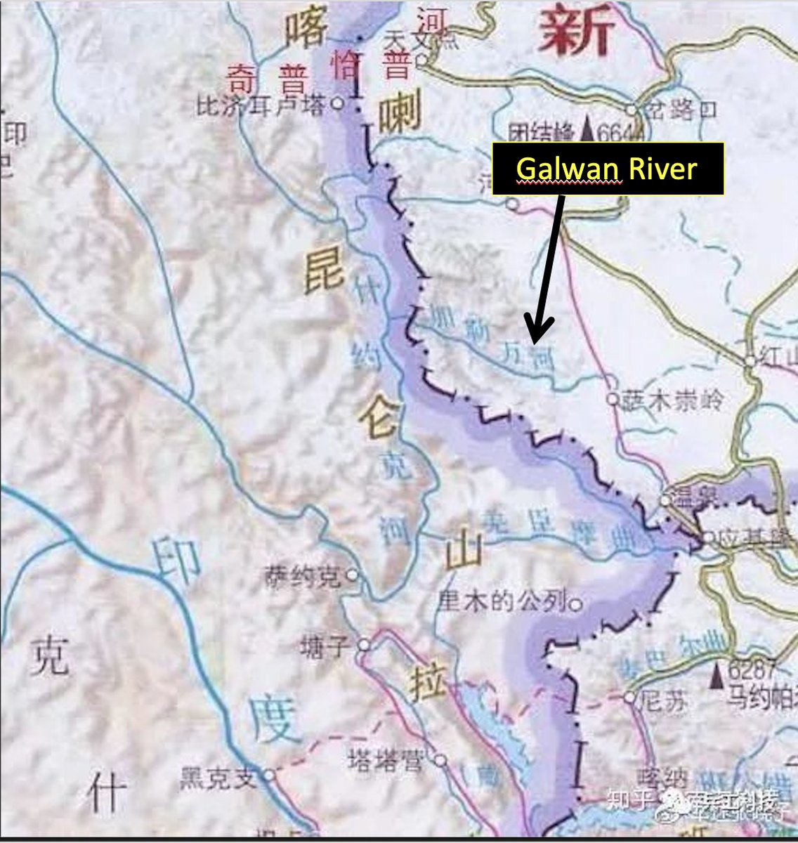
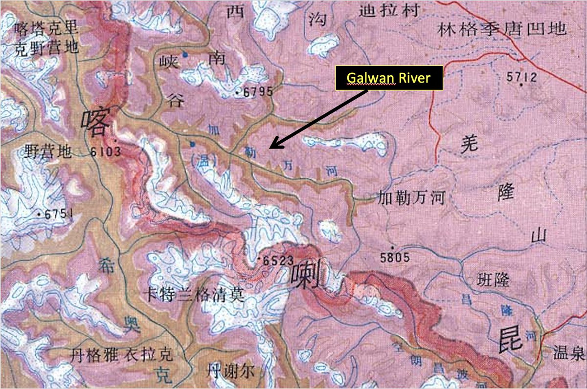
These maps show China claiming almost all of the Galwan Valley, ending where the Galwan begins to flow east to west, roughly where PP14 is located. Note: I do not know if these are official maps, but they are maps published in simplified Chinese and thus presumably in the PRC.
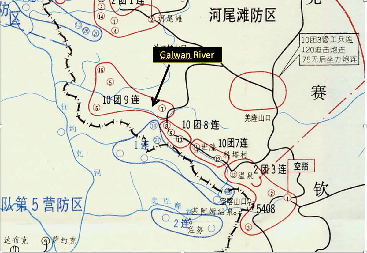
This map from a Chinese history of the 1962 war also shows China’s claim to the Galwan Valley ending shortly before the Galwan meets the Shyok. Here, blue denotes Indian positions and red Chinese positions.
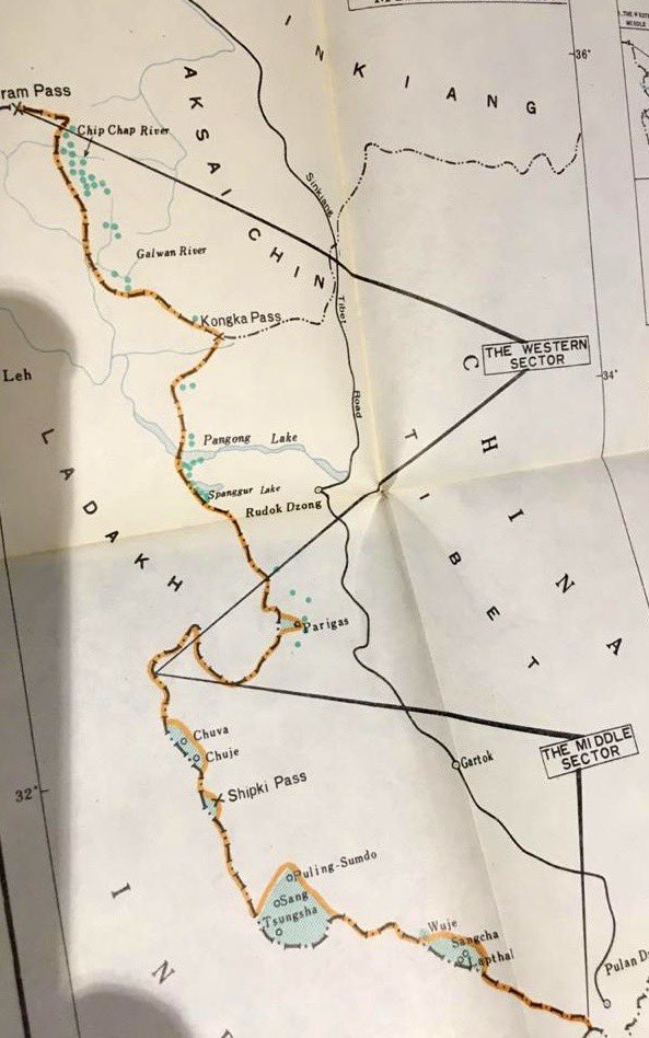
Only this map from November 1962 shows China’s claim extending all the way to the Shyok. (via @praveenswami, https://twitter.com/praveenswami/status/1264083001731735552)">https://twitter.com/praveensw...

 Read on Twitter


