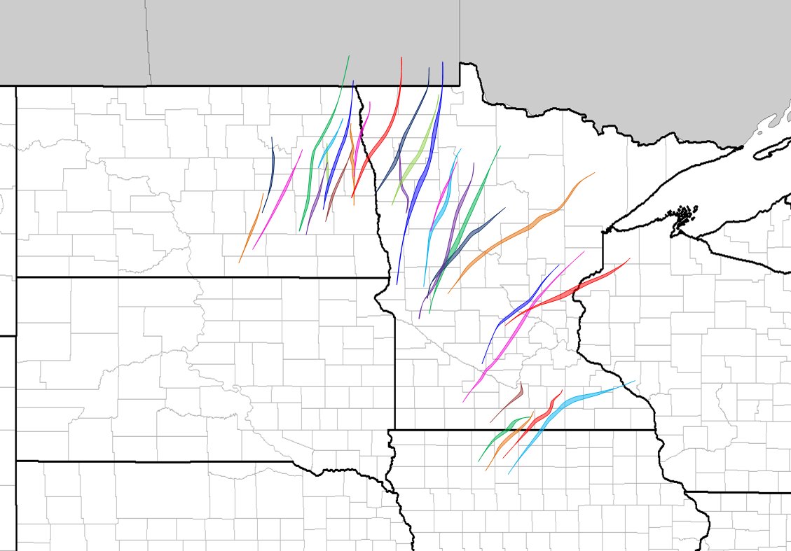
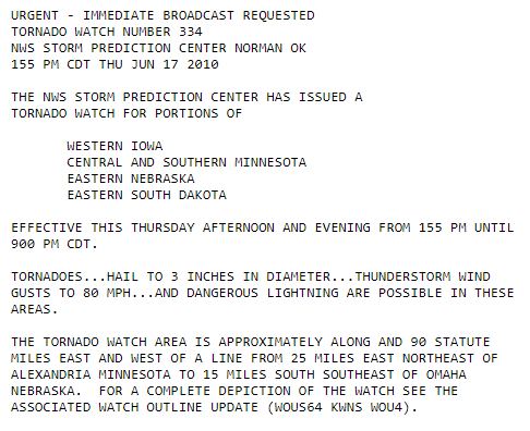
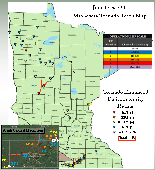
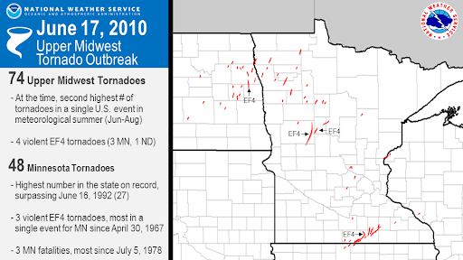
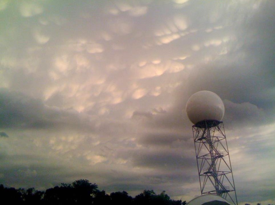
On this date in 2010, a historic tornado outbreak occurred, with 74 tornadoes across the Northern Plains. Of those tornadoes, 48 were in MN. 3 people were killed & 45 injured in MN. We will be re-enacting the events of this day as they unfolded. Stay tuned… #mnwx
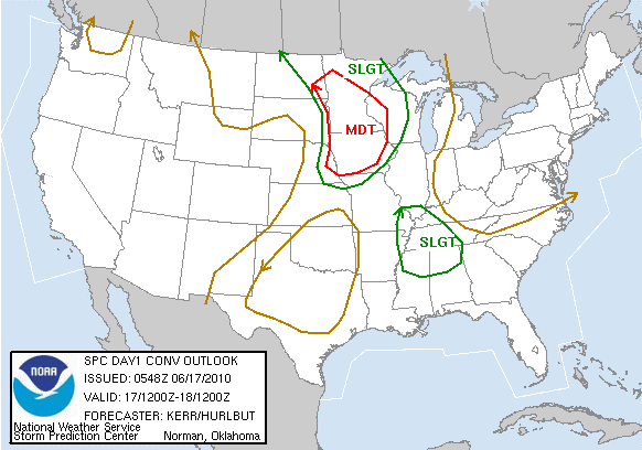
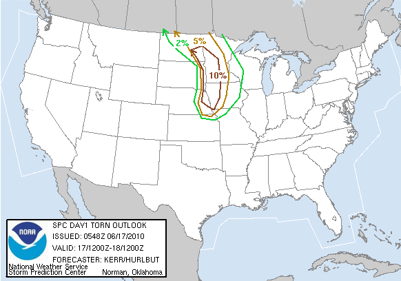
On this date in 2010: The Storm Prediction Center (SPC) upgrades the area to a Moderate Risk for severe thunderstorms on the overnight update, with a 10% probability of tornadoes. #mnwx
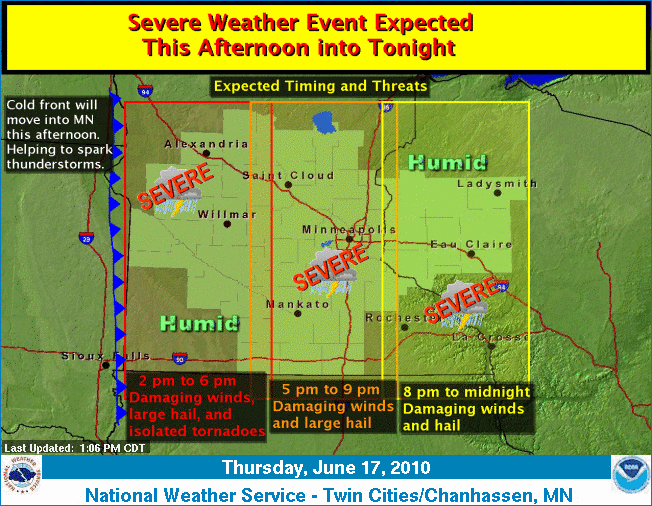
On this date in 2010: The morning weather graphic highlighting the threat for severe weather & tornadoes. Sidenote, our graphics have come a long ways in 10 years… ;) #mnwx
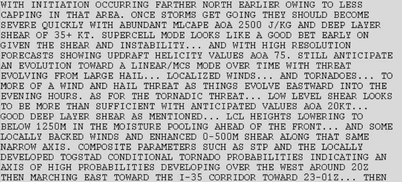
On this date in 2010: An updated Area Forecast Discussion (AFD) issued at 11:14 AM CDT. “...Tornado probabilities indicating an axis of high probabilities developing over the west around 20Z…” #mnwx
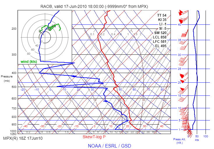
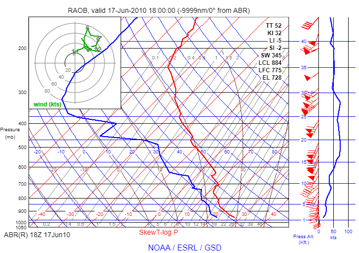
On this date in 2010: At 1 pm an extra balloon launch is conducted at our office in Chanhassen, as well as our neighboring office to the west in Aberdeen, which reveal the atmosphere is becoming more unstable and wind shear is increasing… #mnwx
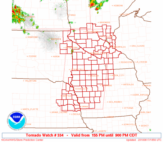
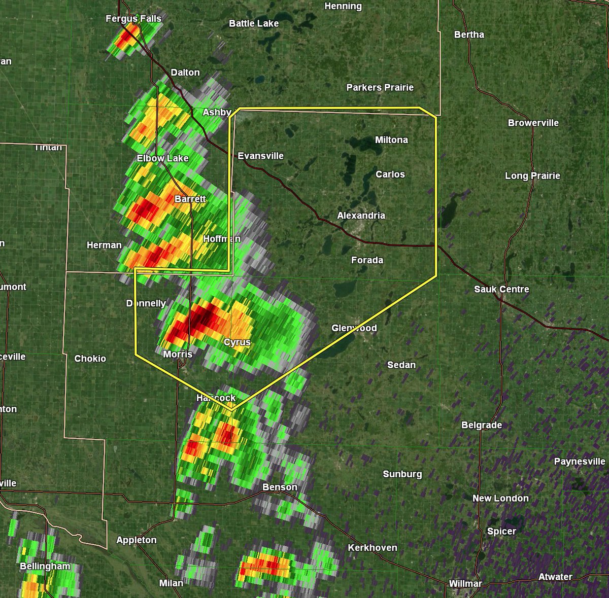
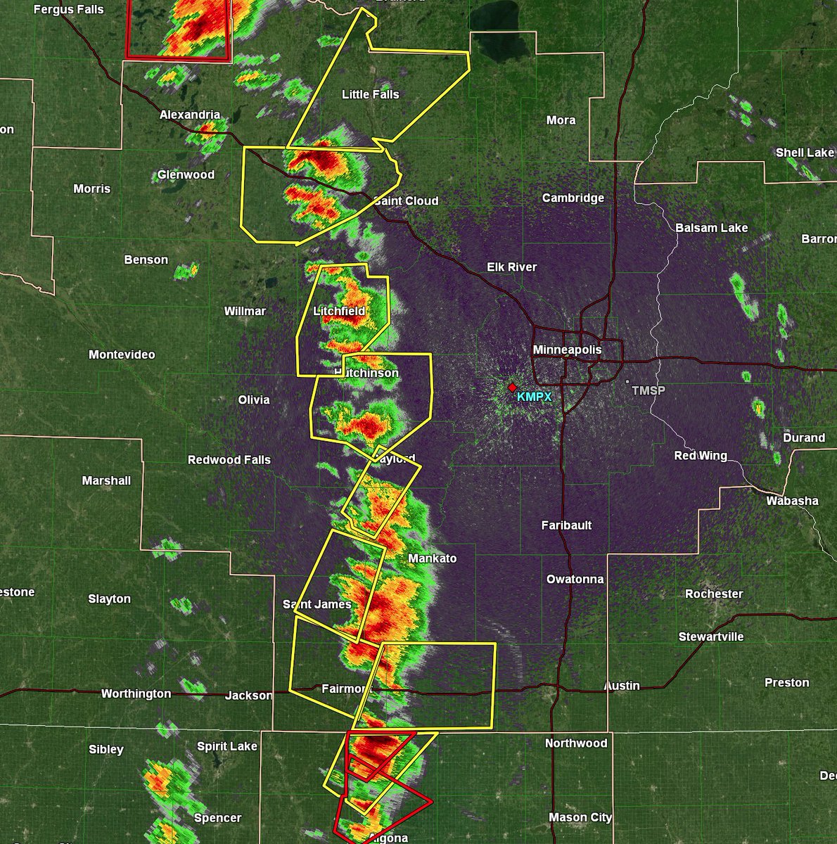
On This Date in 2010: First Warning of the day issued by @NWSTwinCities, a severe thunderstorm warning for Pope, Douglas, and Stevens County. We had severe thunderstorm and tornado warnings valid until 9pm as the event progressed. #mnwx
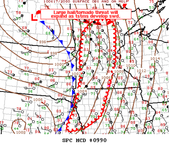
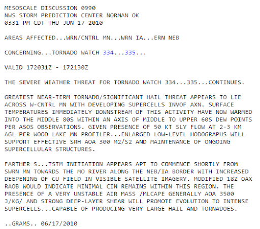
On this date in 2010: The Storm Prediction Center (SPC) issues a Mesoscale Convective Discussion at 3:30 PM CDT to reiterate the large hail and tornado threat. #mnwx
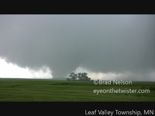
On This Date in 2010: The first tornado of the event in the @NWSTwinCities area of responsibility touches down in Leaf Valley Township in Douglas County. Previous reports from this storm include hail up to 4.25” in diameter. #mnwx
On This Date in 2010: By 4:30pm a line of severe storms was in progress throughout Minnesota. To the north, a tornado was just approaching the city of Wadena. Through central and southern Minnesota, storms were quickly strengthening as they moved to the east. #mnwx
On This Date in 2010: Just before 5pm an EF-4 tornado moves in to Wadena, MN doing significant damage to the town, hitting the high school and causing an anhydrous ammonia leak at an ag center. See more about this storm from @NWSGrandForks #mnwx https://www.weather.gov/fgf/20100617_tor_outbreak">https://www.weather.gov/fgf/20100...
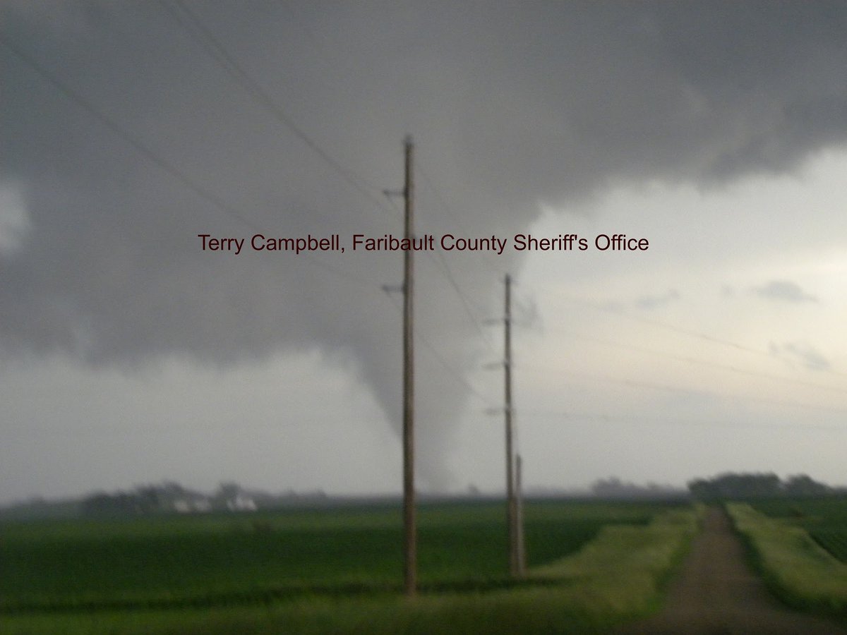
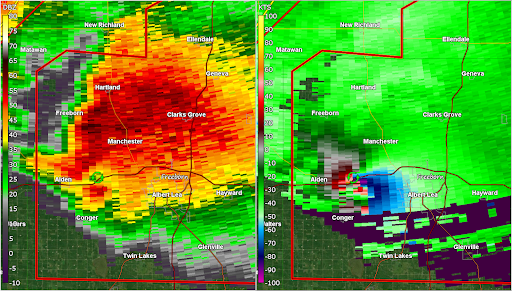
On This Date in 2010: Tornado warnings in central and southern Minnesota have been issued as supercell thunderstorms mature. The first funnel clouds have been reported along with a couple tornadoes in northern Iowa as storms move into Faribault County. #mnwx
On This Date in 2010: Following tornadoes near Lester Prairie and Winsted, an EF-1 tornado touched down north of Buffalo. Many reports came in via Amateur Radio. Additional funnel cloud and tornado producing storms moved in to Minnesota from Iowa at this time as well. #mnwx
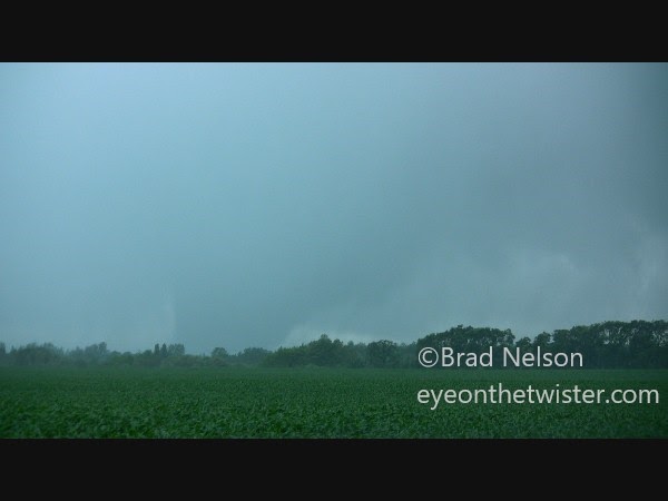
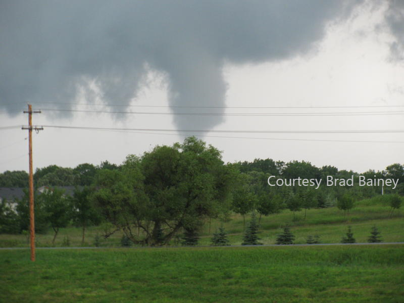
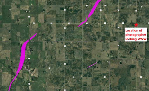
On this date in 2010: Afterward, there were many damage survey trips. Dozens of storm chaser pix/videos were viewed. Info was compared with terrain images on mapping programs to document the tornadoes. This tornado near Bricelyn was triangulated based on pix from others. #mnwx
On This Date in 2010: Around 6:20pm an EF-2 tornado went thru Kiester. There were a couple smaller tornadoes before one impacted the town. Immediately after the tornado passed through, it dissipated but not before a 2nd tornado formed, which would continue on for some time. #mnwx
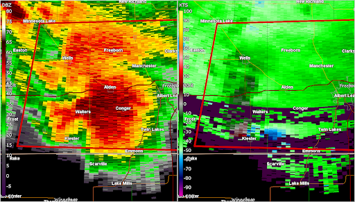
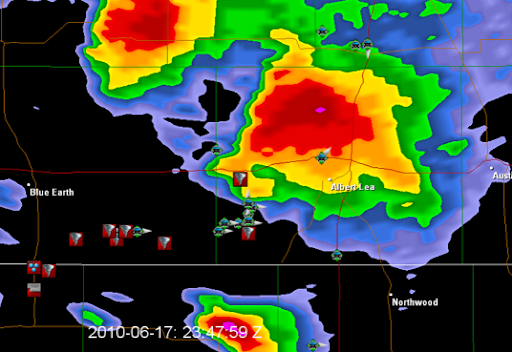
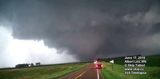
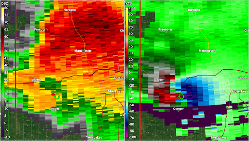
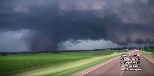
On This Date in 2010: The tornado that would be on the ground for 21 miles is now in progress just west of Conger, MN. The tornado is strengthening to EF-3 intensity at this time. Storm Chasers are reporting information to @NWSTwinCities via @SpotterNetwork. #mnwx
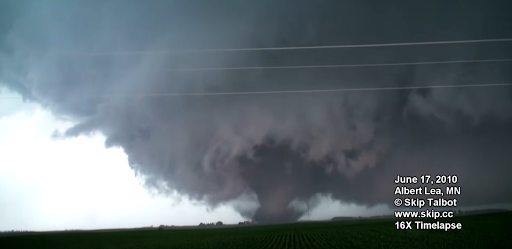
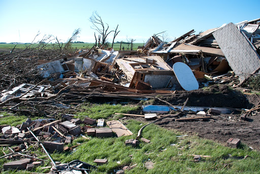
On This Date in 2010: The tornado that would be known as “The Mansfield to Hartland EF-4” is now reaching maximum intensity with approximately 175mph winds. Houses are swept from their foundations, trees are de-barked, soybean and corn fields are pulverized to bare dirt. #mnwx
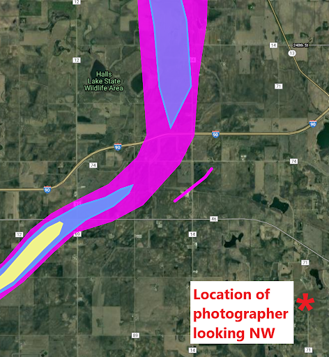
On This Date in 2010: As the tornado weakens slightly to EF-3 and then briefly EF-2 strength it turns to the N & re-intensities. An EF-1 strength satellite tornado has been rotating around the large tornado & causes damage in Armstrong. The tornado crosses I-90 moving due N #mnwx
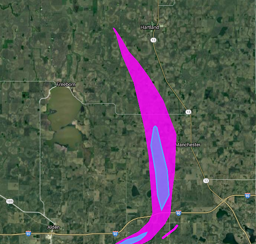
On This Date in 2010: The Mansfield to Hartland tornado moves north and then northwest, finally ending just west of the town of Hartland around 7:15 pm after traveling 20 miles. Unfortunately this tornado killed one person and injured 14, some with significant injuries. #mnwx
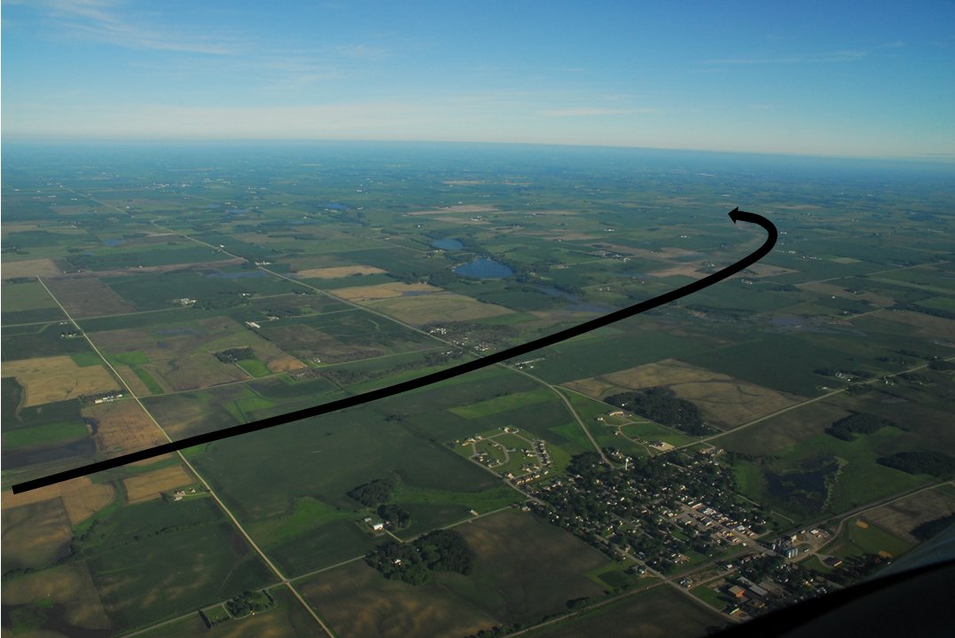
On this date in 2010: This EF3 tornado just missed Ellendale, in the foreground. The black line parallels its path. Looking NW. Steele County spotters near Ellendale did a great job, reporting one tornado west of town and another just east of town. Photo NOAA Corps. #mnwx
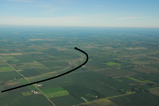
On this date in 2010: After missing Ellendale, the EF3 tornado continued its curving path & ended moving almost straight to the west. The black line parallels its path. We are looking NW. This type of path can happen when the parent storm is occluding. Photo NOAA Corps. #mnwx
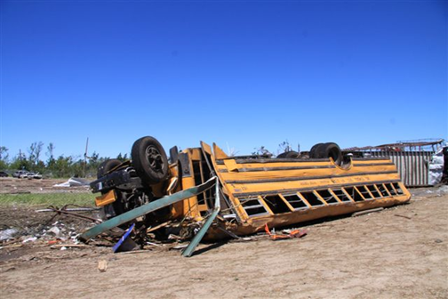
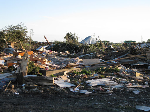
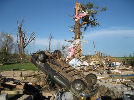
On this date in 2010: There could have been so many lives lost but great work by spotters, public safety, media, & chasers got the word out & people took shelter. An EF3 just missed Hollandale but hit this home. The family heard the warnings & sought shelter elsewhere. #mnwx
On this date in 2010: These sites near Blooming Prairie were only ½ mile apart, but hit by 2 tornadoes 15 minutes apart. Locals thought the first tornado had taken a right turn, but the detailed survey showed otherwise. A woman was badly injured & rescued by BP police. #mnwx
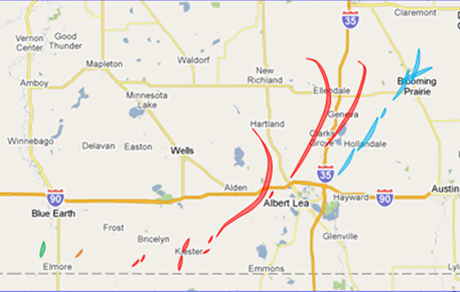
On this date in 2010: There were 18 tornadoes west and north of Albert Lea, including one rated EF4 and three EF3. The EF4 was the longest tornado and was on the ground for 20 miles when accounting for the curved path. The colors indicate the parent supercell. #mnwx
On this date in 2010: The last of the 48 MN tornadoes this day dissipates in the northwest part of Rochester. Six hours of tornadoes in MN, from the NW to SE corner. We are deeply grateful to everyone who helped save lives that day. #mnwx
On this date in 2010: In total, 519 non-routine products were issued by the 6 NWS offices serving MN in a 12 hour period, including 87 Tornado Warnings, 83 Severe Thunderstorm Warnings & 3 Flash Flood Warnings. For more info view our event summary at https://www.weather.gov/mpx/June172010Outbreak">https://www.weather.gov/mpx/June1... #mnwx
On this date in 2010: We remember those whose lives were lost - Margie Schulke of Almora, Wes Michaels of Mentor, and Kathy Woodside of rural Albert Lea. 45 others were injured across the state. #mnwx

 Read on Twitter